Cefn Feusydd Farm, Llwyngwril
- Bedrooms
- 4
- Bathrooms
- 1
Key Features
- Development Opportunity
- Excellent Business Opportunity
- Ring Fenced Holding
- Spectacular Countryside Views
- Stunning Views Over The Mawddach Estuary
- Traditional Welsh Farm
- 4 bedroom farmhouse
- Range of agricultural buildings and workshops
Description
SITUATION
Cefn Feusydd Farm is situated in a predominantly rural and agricultural setting on the outskirts of the coastal village of Llwyngwril, within the southern part of Gwynedd. The property enjoys a private position with attractive surrounding countryside and coastal influences, whilst remaining accessible to the A493 coastal route linking the nearby market and seaside towns of Tywyn and Barmouth. The locality is characterised by a mixture of traditional agricultural holdings, scattered residential properties and open grazing land, with the wider area benefiting from access to the Snowdonia National Park and the Cardigan Bay coastline. The area is known for its beautiful countryside and is a very popular area with walkers, mountain bikers and general holiday makers. The market town of Dolgellau and Tywyn provides all local amenities including shops, schools, doctor's surgeries and restaurants.
FARMHOUSE & GARDENS
The farmhouse occupies a private and elevated position at the centre of the holding, enjoying attractive views across the surrounding countryside. Constructed of traditional stone under a slate roof, the property features chimney stacks to both gable ends and retains a wealth of character features throughout, including exposed timber beams, slate flagged floors, deep window sills and traditional fireplaces Access is available via the front porch or from the attached stone building, incorporating the boot room, former dairy and attic, which lends itself to incorporation into the main farmhouse to create a larger dwelling or additional accommodation, subject to the necessary consents.
Whilst the internal accommodation requires refurbishment throughout, the property offers functional and versatile living space, presenting an excellent opportunity for a purchaser to create a bespoke Welsh farmhouse in a highly desirable rural setting. Externally, there is also a traditional outside water closet.
Please view brochure for accommodation list and floorplan.
BUILDINGS
The holding benefits from a range of traditional and modern agricultural buildings together with workshops, all centrally positioned within the holding and offering good access. All buildings are connected to electricity.
Please view brochure for buildings list.
LAND
The land is well presented as a ring-fenced holding extending to approximately 232.69 acres, bounded predominantly by traditional stone walls and stock-proof fencing. The land is divided into several manageable enclosures. The holding comprises a mix of cliff and mountain land, rough grazing and productive pastureland. The majority of the fields are accessed directly from the farmstead and interconnect with one another, providing practical internal access throughout the holding. The mountain land also benefits from direct access from the main road. The holding offers opportunities for commercial farming, environmental management and conservation initiatives, together with wider amenity and investment appeal.
TENURE
The holding is subject to a farm business tenancy. However a notice to quit has been served, and vacant possession is available after the 31st December 2026.
Council Tax Band: D (Cyngor Gwynedd Council)
Tenure: Freehold
The holding is subject to a farm business tenancy. However a notice to quit has been served, and vacant possession is available after the 31st December 2026.
Rights & easements: Public right of way
Map Location
Property details
- Tenure
- Freehold
- Council Tax Band
- D
- Date Posted
- 2026-06-05
Utilities & Restrictions
Utilities
- Electricity
- Mains
- Water
- Private Supply
- Heating
- Oil Heating
- Broadband
- Ask Agent
- Sewerage
- Septic Tank / Private
Rights & Restrictions
- Public Rights of Way
- Ask Agent
- Private Rights of Way
- Yes
- Listed Property
- Ask Agent
- Restrictions
- Ask Agent
Listed status, conservation areas and planning constraints for this location are in the full report.
Property Features
- Accessibility
- Ask Agent
- Parking
- Ask Agent
- Garden
- Garden
Beyond the particulars: planning activity, flood history, heritage and ground risks, checked for this exact spot.
Connectivity
Broadband
Fastest speed available at this postcode
1.8 Gbps
Gigabit full fibre
Suitable for
- 4K streaming on every screen
- Full-time home working
- Online gaming & big downloads
Mobile signal
Predicted 4G and 5G signal; indoor signal depends on building materials.
Ofcom Connected Nations postcode-level predictions. Speeds and signal are modelled, not measured, and vary between addresses and providers.
Signal is the easy part. Planning activity, flood history and protected designations here are in the full report.
Nearest Schools
Primary
- Ysgol y Traeth3.2 miles
- Pupils
- 185
- Type
- Nursery, Infants & Juniors
- Language
- Welsh medium school / provision (including transitional)
- Ysgol Craig y Deryn3.6 miles
- Pupils
- 95
- Type
- Nursery, Infants & Juniors
- Language
- Welsh medium school / provision (including transitional)
- Ysgol Gynradd Penybryn6.5 miles
- Pupils
- 240
- Type
- Infants & Juniors
- Language
- Welsh medium school / provision (including transitional)
- Ysgol Gynradd Dyffryn Ardudwy7.5 miles
- Pupils
- 68
- Type
- Infants & Juniors
- Language
- Welsh medium school / provision (including transitional)
- Ysgol Gynradd Pennal8.7 miles
- Pupils
- 34
- Type
- Nursery, Infants & Juniors
- Language
- Welsh medium school / provision (including transitional)
Secondary
- Ysgol Uwchradd Tywyn6.5 miles
- Pupils
- 376
- Type
- Secondary (ages 11-16)
- Language
- Dual language school / provision (Welsh and English) (including transitional)
- Bro Idris8.9 miles
- Pupils
- 541
- Type
- Middle (ages 3-16)
- Language
- Welsh medium school / provision (including transitional)
- Ysgol Bro Hyddgen11 miles
- Pupils
- 441
- Type
- Middle (ages 4-19)
- Language
- Welsh medium school / provision (including transitional)
- Ysgol Ardudwy13 miles
- Pupils
- 331
- Type
- Secondary (ages 11-16)
- Language
- Welsh medium school / provision (including transitional)
- Ysgol Eifionydd18 miles
- Pupils
- 373
- Type
- Secondary (ages 11-16)
- Language
- Welsh medium school / provision (including transitional)
Distances are straight-line from the advertised location. Source: the national school registers (DfE, Welsh Government, Scottish Government) and Ofsted.
Schools are just the start: sold prices nearby, planning activity and any flood history are in the full report.
Amenities
Supermarket
GP surgery
Pharmacy
Straight-line distances from the advertised location. Sources: NHS records, Geolytix supermarket locations, OS Open Greenspace and the national trails registers.
The area stacks up? Now check the location itself: planning nearby, protected designations and past flooding.
Getting Around
Nearest station
Nearest bus stop
Typical drive times
Straight-line distances from the advertised location; drive times are typical free-flow times over OpenStreetMap road data, so allow more at peak. Public transport locations from DfT NaPTAN.
Easy to reach matters. So do planning activity, flood history and ground risks: all in the full report.
Flood Risk
Natural Resources Wales open data, checked around the advertised map pin for the listed acreage. Long-term risk counts flood defences; the planning map's flood zones do not. Provided by LandSale, not the listing agent, and not part of the agent's particulars. Risk varies across a holding, so verify before committing.
Rivers and the sea
Planning map: Flood Zone 1.
Surface water
Not at the pin: mapped about 20 metres away.
These bandings are the summary. Where this location sits on the flood maps, plus planning activity, heritage and ground risks, is in the full report.
Important notice: Information, maps and tags on this page are drawn from the advertising agent's marketing materials or generated automatically. LandSale has not verified them. Relying on these details is at your own risk, always carry out independent checks before committing to a purchase.
LandSale full disclaimer
Marketing information only - not formal particulars. The details on this website are provided for general guidance and do not constitute an offer or contract. Neither LandSale nor the advertising estate/land agent accepts responsibility for any inaccuracy.
1. Source of information
- Listing content: Core description, asking price, tenure, measurements, photographs and planning history originate from the marketing materials of the advertising estate or land agent. LandSale does not author this content and cannot guarantee its accuracy.
- Automated tags & categorisation: Property type, land-use class, acreage bands and similar labels may be applied by machine-learning models. They are intended as a helpful guide only and may not reflect the property's legal status or permitted use.
- Third-party & enriched data layers: Maps, boundary outlines, planning designations, soil reports, broadband coverage and other environmental or location-based insights are licensed from external suppliers. Such data are supplied “as is", may be incomplete or out of date and are subject to change without notice.
2. Verification required
Prospective purchasers must verify critical matters, including but not limited to planning permission, title boundaries, public rights of way, environmental constraints, acreage, services, access and VAT status, through their own inspections, specialist surveys, legal advisers and the selling agent before relying on the information or entering into any contract.
3. No warranty or liability
LandSale gives no warranty, express or implied, as to the accuracy, completeness or fitness for any particular purpose of the information displayed. LandSale shall not be liable for any loss, damage, cost or expense arising directly or indirectly from any use of or reliance on such information, save where liability may not be excluded by law.
4. Updates & feedback
If you believe any detail on this listing is inaccurate, please let us know. We will investigate and, where appropriate, update the listing or notify the agent.
© LandSale | Version 1.3 - August 2026
Similar properties for sale
- Price
- £1,000,000
- Size
- 8.5 acres
Added on 25/07/2026Country Estate
- Price
- £950,000
- Size
- 4.75 acres
Troed y Rhiw Llanegryn Gwynedd LL36, Llanegryn, Gwynedd LL36 Wales
Added on 29/01/2026House with Land
- Price
- Offers in Region of£950,000
- Size
- 16 acres
Added on 14/10/2026Farmhouse
- Price
- £1,100,000
- Size
- 15 acres
Tyn y Coed Farm, Barmouth, LL42, Barmouth, Gwynedd LL42 Wales
Added on 29/07/2026Country Estate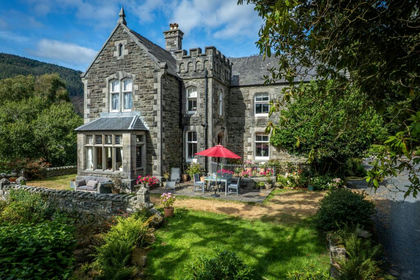
- Price
- Offers in Region of£1,100,000
- Size
- 3.4 acres
Farchynys Hall, Bontddu, LL42, Llanelltyd, Gwynedd LL42 Wales
Added on 12/07/2026Country Home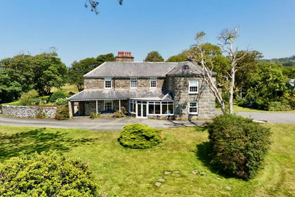
- Price
- Offers in Region of£1,350,000
- Size
- 1.48 acres
Bennar Fawr, Dyffryn Ardudwy, LL44, Dyffryn Ardudwy, Gwynedd LL44 Wales
Added on 16/10/2026House with Land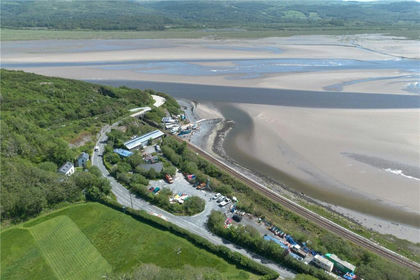
- Price
- £975,000
- Size
- 2.44 acres
Frongoch Boatyard, Aberdyfi, Gwynedd, LL35, Aberdovey, Gwynedd LL35 Wales
Added on 14/08/2026Holiday Let Property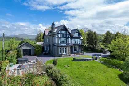
- Price
- Offers in Region of£1,300,000
- Size
- 1 acres
Plas Y Bryn Hall, Llanbedr, LL45, Llanbedr, Gwynedd LL45 Wales
Added on 29/01/2026Residential
- Price
- Offers in Region of£1,250,000
- Size
- 15 acres
Borth, Cardiganshire, Ceredigion, Mid Wales, SY24, Borth, Ceredigion SY24 Wales
Added on 29/01/2026Smallholding
- Price
- Guide Price£1,400,000
- Size
- 107 acres
Llandre, Bow Street, Aberystwyth, Ceulanamaesmawr, Ceredigion SY24 Wales
Added on 30/09/2026Farm