Coed Abergwynant Woodland, Penmaenpool, Dolgellau
- Land size
- 50 acres
Key Features
- Stunning Rural Setting
- 50 acres of Mixed Woodland
Description
Sold via Informal Tender-Tender Closing Date- Tuesday 14th of July at 12 noon.
The woodland at Abergwynant extends to approximately 50 acres of semi natural ancient woodland, offering an exceptional blend of mature native deciduous trees interwoven with stands of established evergreen conifers. Extensive areas of natural regeneration are visible throughout, creating a vibrant and evolving habitat that supports a wealth of wildlife and significantly enhances the long term biodiversity of the landscape.
Access is taken directly from a council maintained highway via a gated entrance, opening into a generous clearing from which a network of meandering woodland tracks radiates. These paths provide excellent access on foot and 4x4 vehicle in some areas, encouraging exploration of the woodland's varied terrain.
The boundaries are predominantly marked by traditional dry stone walls, complemented in places by sections of stock fencing. The land has remained ungrazed for several years, allowing the natural ground flora, birdlife, and woodland ecology to flourish undisturbed. The topography is attractively varied, with gentle undulations giving way to steeper pockets that add depth, interest, and character to the woodland.
This enchanting, Grade II Listed woodland presents a rare and compelling opportunity for those seeking a private slice of rural Eryri. Whether your interest lies in conservation, recreational enjoyment, or simply securing a peaceful natural retreat, Coed Abergwynant offers an exceptional setting immersed in tranquillity and framed by the breathtaking scenery of the surrounding National Park.
Directions
From the RG Jones Office in Dolgellau, head towards Cader Road and continue onwards for 0.9 miles. Then take a left turn onto the A493 towards the Penmaenpool. Continue along this road for 2.5 miles and the property will be on our right-hand side before the lodge.
What3words - commoners.surfaces.sunblock
Services
We are not aware of any services available at the property, or any which affect the property .
Council Tax / Business Rates
Not Applicable
Planning
We are not aware of any active planning applications in place in relation to the property.
Wayleaves Easements & Rights Of Way
The property will be sold subject to and with the benefit of all wayleaves, easements and rights of way whether mentioned in these
particulars or not.
Method of Sale
The property is to be offered for sale by Informal Tender.
Tenure & Possession
The freehold of the property is offered with Vacant Possession on completion of sale.
Local Authorities
Parc Cenedlaethol Eryri/Snowdonia National Park
Viewings
Strictly by confirmed appointment with the vendor's agents R G Jones -
Health & Safety
Given the potential hazards of property, we ask you to be as vigilant as possible when making your inspection for your own personal safety.
Survey & Condition
No formal survey has been made on the property in the last 12 months. The agents have not undertaken a full survey of the property.
DISCLAIMER
These particulars, whilst believed to be accurate, are set for guidance only and do not constitute any part of an offer or contract. Intending purchasers or purchasers should not rely on them as statements or representation of fact but must satisfy themselves by inspection or otherwise of their accuracy. No person in the employment of Farmers Marts (R G Jones) Ltd has the authority to make or give any representations or warranty in relation to the property.
Council Tax Band: Exempt (Parc Cenedlaethol Eryri)
Tenure: Freehold
Map Location
Property details
- Tenure
- Freehold
- Council Tax Band
- Ask Agent
- Date Posted
- 2026-06-05
Utilities & Restrictions
Utilities
- Electricity
- Ask Agent
- Water
- Ask Agent
- Heating
- Ask Agent
- Broadband
- Ask Agent
- Sewerage
- Ask Agent
Rights & Restrictions
- Public Rights of Way
- Ask Agent
- Private Rights of Way
- Ask Agent
- Listed Property
- Ask Agent
- Restrictions
- Ask Agent
Listed status, conservation areas and planning constraints for this location are in the full report.
Property Features
- Accessibility
- Ask Agent
- Parking
- Ask Agent
- Garden
- Ask Agent
Beyond the particulars: planning activity, flood history, heritage and ground risks, checked for this exact spot.
Connectivity
Broadband
Fastest speed available at this postcode
48 Mbps
Superfast · available to 33% of premises
Suitable for
- HD streaming
- Video calls
- Web & social
Mobile signal
Outdoor predictions; indoor signal depends on building materials.
Ofcom Connected Nations postcode-level predictions. Speeds and signal are modelled, not measured, and vary between addresses and providers.
Signal is the easy part. Planning activity, flood history and protected designations here are in the full report.
Nearest Schools
Primary
- Bro Idris3.1 miles
- Pupils
- 541
- Type
- Middle (ages 3-16)
- Language
- Welsh medium school / provision (including transitional)
- Ysgol y Traeth4.7 miles
- Pupils
- 185
- Type
- Nursery, Infants & Juniors
- Language
- Welsh medium school / provision (including transitional)
- Ysgol Gynradd Dyffryn Ardudwy6.6 miles
- Pupils
- 68
- Type
- Infants & Juniors
- Language
- Welsh medium school / provision (including transitional)
- Ysgol Gynradd Dyffryn Dulas7.8 miles
- Pupils
- 33
- Type
- Nursery, Infants & Juniors
- Language
- Welsh medium school / provision (including transitional)
- Ysgol Gynradd Llanbedr8.1 miles
- Pupils
- 43
- Type
- Infants & Juniors
- Language
- Welsh medium school / provision (including transitional)
Secondary
- Bro Idris3.1 miles
- Pupils
- 541
- Type
- Middle (ages 3-16)
- Language
- Welsh medium school / provision (including transitional)
- Ysgol Ardudwy11 miles
- Pupils
- 331
- Type
- Secondary (ages 11-16)
- Language
- Welsh medium school / provision (including transitional)
- Ysgol Bro Hyddgen11 miles
- Pupils
- 441
- Type
- Middle (ages 4-19)
- Language
- Welsh medium school / provision (including transitional)
- Ysgol Uwchradd Tywyn12 miles
- Pupils
- 376
- Type
- Secondary (ages 11-16)
- Language
- Dual language school / provision (Welsh and English) (including transitional)
- Ysgol Eifionydd15 miles
- Pupils
- 373
- Type
- Secondary (ages 11-16)
- Language
- Welsh medium school / provision (including transitional)
Distances are straight-line from the advertised location. Source: the national school registers (DfE, Welsh Government, Scottish Government) and Ofsted.
Schools are just the start: sold prices nearby, planning activity and any flood history are in the full report.
Amenities
Supermarket
GP surgery
Pharmacy
Straight-line distances from the advertised location. Sources: NHS records, Geolytix supermarket locations, OS Open Greenspace and the national trails registers.
The area stacks up? Now check the location itself: planning nearby, protected designations and past flooding.
Getting Around
Nearest station
Nearest bus stop
Typical drive times
Straight-line distances from the advertised location; drive times are typical free-flow times over OpenStreetMap road data, so allow more at peak. Public transport locations from DfT NaPTAN.
Easy to reach matters. So do planning activity, flood history and ground risks: all in the full report.
Flood Risk
From Natural Resources Wales flood map open data, checked around the advertised map pin and allowing for the listed acreage where known. This summary comes from LandSale, the advertising platform, not from the listing agent, and is not part of the agent's particulars. Risk can vary across a single holding, so verify anything critical through your own searches before committing.
Rivers and the sea
Surface water
Mapped within the area searched, not at the advertised map pin itself.
These bandings are the summary. Where this location sits on the flood maps, plus planning activity, heritage and ground risks, is in the full report.
Important notice: Information, maps and tags on this page are drawn from the advertising agent's marketing materials or generated automatically. LandSale has not verified them. Relying on these details is at your own risk, always carry out independent checks before committing to a purchase.
LandSale full disclaimer
Marketing information only - not formal particulars. The details on this website are provided for general guidance and do not constitute an offer or contract. Neither LandSale nor the advertising estate/land agent accepts responsibility for any inaccuracy.
1. Source of information
- Listing content: Core description, asking price, tenure, measurements, photographs and planning history originate from the marketing materials of the advertising estate or land agent. LandSale does not author this content and cannot guarantee its accuracy.
- Automated tags & categorisation: Property type, land-use class, acreage bands and similar labels may be applied by machine-learning models. They are intended as a helpful guide only and may not reflect the property's legal status or permitted use.
- Third-party & enriched data layers: Maps, boundary outlines, planning designations, soil reports, broadband coverage and other environmental or location-based insights are licensed from external suppliers. Such data are supplied “as is", may be incomplete or out of date and are subject to change without notice.
2. Verification required
Prospective purchasers must verify critical matters, including but not limited to planning permission, title boundaries, public rights of way, environmental constraints, acreage, services, access and VAT status, through their own inspections, specialist surveys, legal advisers and the selling agent before relying on the information or entering into any contract.
3. No warranty or liability
LandSale gives no warranty, express or implied, as to the accuracy, completeness or fitness for any particular purpose of the information displayed. LandSale shall not be liable for any loss, damage, cost or expense arising directly or indirectly from any use of or reliance on such information, save where liability may not be excluded by law.
4. Updates & feedback
If you believe any detail on this listing is inaccurate, please let us know. We will investigate and, where appropriate, update the listing or notify the agent.
© LandSale | Version 1.3 - August 2026
Listing agent
RG Jones, Bala
85 High Street, Bala, LL23 7AE
Similar properties for sale
- Price
- Sale by Tender
- Size
- 219.49 acres
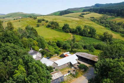
Land and Buildings At Nant Y Dugoed, Mallwyd, Machynlleth, Gwynedd, SY20, Banwy, Powys SY21 Wales
Added on 19/08/2026Farm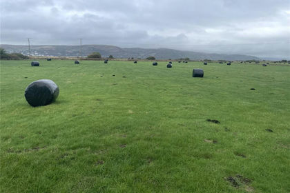
- Price
- Guide Price£760,000
- Size
- 95.87 acres
Ynyslas, Borth, Ceredigion, SY24, Llangynfelyn, Ceredigion SY24 Wales
Added on 29/01/2026Pasture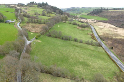
- Price
- Sale by Tender
- Size
- 96.19 acres
Land At Caerau, Sarnau, Bala, Gwynedd, LL23, Llandderfel, Gwynedd LL23 Wales
Added on 02/05/2026Farmland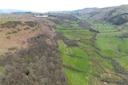
- Price
- £550,000
- Size
- 255 acres
Land At Cwm Main and Cefn Caer Euni, Llandderfel, Gwynedd, LL23, Llandderfel, Gwynedd LL21 Wales
Added on 02/05/2026Farmland
- Price
- Fixed Price£325,000
- Size
- 31 acres
Mynydd-Brith Wood West, Bronant, Aberystwyth, Ceredigionshire, SY23, Lledrod, Ceredigion SY23 Wales
Added on 10/09/2026Woodland
- Price
- Fixed Price£300,000
- Size
- 33 acres
Mynydd-Brith Wood East, Bronant, Aberystwyth, Ceredigionshire, SY23, Lledrod, Ceredigion SY23 Wales
Added on 10/09/2026Woodland
- Price
- Offers in Region of£250,000
- Size
- 48.66 acres
Added on 29/01/2026Amenity Land
- Price
- £6,500
- Size
- 50.34 acres
Mount Wood, Selattyn, Oswestry, SY10, Glyntraian, Wrexham SY10 Wales
Added on 22/06/2026Woodland