Spreyton, Crediton, EX17
- Land size
- 5.23 acres
- Bedrooms
- 6
- Bathrooms
- 3
Key Features
- 5 bedroom detached barn conversion
- 5.23 acres of ground including a paddock
- 1 bedroom substantial annexe
- Heated indoor swimming pool
- Large agricultural buildings
- Further barn with potential (STP)
- Garaging and plentiful parking
- Ringfenced with no rights of way
- Well maintained grounds & accommodation
- Rural quiet location
Description
A substantial barn conversion set within approximately 5.23 acres of ring-fenced grounds, combining extensive living space with a wide range of outbuildings, leisure facilities and flexible accommodation.
The property centres around a five-bedroom red brick barn conversion, offering generous rooms and a layout suited to both family life and entertaining. The main kitchen and dining area is arranged as an open-plan space, fitted with sage green shaker-style units and quartz worktops, creating a practical and sociable heart to the house. A utility room and ground floor WC add day-to-day convenience. The main lounge is notably spacious and centred around a wood-burning stove, bringing warmth and character to the room.
Upstairs are five double bedrooms, including a principal bedroom with en-suite. There is also access to a boarded attic, providing substantial additional storage.
A particularly valuable feature is the attached one-bedroom annexe, which is internally connected yet also benefits from its own separate entrance and outside space. The annexe includes a large lounge with patio doors, a kitchen fitted with dark grey shaker-style units, and a bathroom with both bath and separate shower. This arrangement lends itself well to multi-generational living, guest accommodation or potential income use.
Beyond the residential accommodation, the property includes an extensive leisure and entertainment area. An L-shaped building currently houses a games and party room complete with bar area and sink, alongside a heated indoor swimming pool with its own changing room, shower and WC facilities.
Outside, the grounds have been arranged to balance practical use with more relaxed outdoor areas. A newly built patio sits alongside a wildlife pond and productive vegetable garden with two polytunnels.
The outbuildings and agricultural structures are a major part of the property’s appeal. A large, enclosed barn offers space for workshop use, storage or vehicle housing, while a second open-style agricultural barn provides further flexibility. In addition, there are three garages with up-and-over doors along with further storage buildings, a red brick potting shed and a brick-built chicken shed with scope for repair or future use, subject to any necessary permissions.
The grounds extend to approximately 5.23 acres, fully enclosed and without public rights of way crossing the land. A large front yard provides parking for numerous vehicles and easy access to the outbuildings. Further practical features include 16 solar panels with a feed-in tariff and timber double-glazed windows throughout the main house.
Overall, this is a property with a broad range of possibilities, combining substantial living accommodation with leisure facilities, workshop and storage space, and land suited to a variety of lifestyles and long-term uses.
Please see the floorplan for room sizes.
Current Council Tax: Band F – West Devon 2026/27 - £3,722.70 Annexe Band A
Utilities: Mains electric, water, telephone & broadband
Broadband within this postcode: Ultrafast 1800Mbps
Drainage: Private drainage
Heating: Oil fired central heating, woodburning stove, Solar
Construction: Brick
Listed: No
Conservation Area: No
Tenure: Freehold
Buyers' Compliance Fee Notice: Please note that a compliance check fee of £25 (inc. VAT) per person is payable once your offer is accepted. This non-refundable fee covers essential ID verification and anti-money laundering checks, as required by law.
Boundaries, Access & Parking:
Boundary positions, access rights and parking arrangements have been provided by the seller, and any land plans shown are for identification purposes only. We have not seen the title deeds or other legal documents, and buyers should confirm exact details and ownership responsibilities with their conveyancer.
Virtual Staging:
Some images in this brochure may have been digitally enhanced or virtually staged, for example by adding lighting effects, twilight ambience, furniture or décor, to help illustrate how the property could look. These images are only illustrative and do not show the current fixtures, fittings or condition. Always rely on your viewing for an accurate understanding of the property.
Private Drainage:
We’re informed by the seller that the property has a private drainage system, which they advise is in working order. Buyers should satisfy themselves regarding its type, condition and regulatory compliance with their conveyancer.
SPREYTON is a hilltop village affording spectacular views across the surrounding countryside all the way to North Dartmoor. While the village enjoys a rural setting amid farmland, the A30 is within a short and easy drive making it a desirable location for those needing access to Exeter and the M5 or Okehampton and Cornwall. The first mention of Spreyton is in the Domesday Book of 1086 most likely starting as a single farming settlement. Since then, the village has grown and now thatched cottages have been joined by small and sensitively created newer developments. Residents are encouraged to join in with a dynamic community offering many diverse activities to keep them amused, there’s something for all ages and interests. The village has a community run shop, a pottery and The Tom Cobley Tavern – a family-run pub named for the legendary character Tom Cobley as it’s thought that his infamous trip to Widecombe Fair started here. There is also a small primary school which is rated OFSTED good and has early years provision.
DIRECTIONS : From the A377 in Bow, take Station Road towards Spreyton. On a sharp left bend, take a left turn toward Hillerton. Continue along and go straight across at Hillerton Cross and the property is the next on the left.
For Sat Nav: EX17 5AT
What3Words: ///fields.convinced.requests
Map Location
Property details
- Tenure
- Freehold
- Council Tax Band
- F
- Date Posted
- 2026-06-04
Market Value Analysis
Compared with 507 Homes with Land listings in South West England (5+ acres).
Utilities & Restrictions
Utilities
- Electricity
- Mains
- Water
- Mains
- Heating
- Solar Heating, Oil Heating, Wood Burner
- Broadband
- Ask Agent
- Sewerage
- Ask Agent
Rights & Restrictions
- Public Rights of Way
- Ask Agent
- Private Rights of Way
- Ask Agent
- Listed Property
- Ask Agent
- Restrictions
- Ask Agent
Listed status, conservation areas and planning constraints for this location are in the full report.
Property Features
- Accessibility
- Ask Agent
- Parking
- Parking Available
- Garden
- Private Garden
Beyond the particulars: planning activity, flood history, heritage and ground risks, checked for this exact spot.
Connectivity
Broadband
Fastest speed available at this postcode
1.8 Gbps
Gigabit full fibre · available to 67% of premises
Suitable for
- 4K streaming on every screen
- Full-time home working
- Online gaming & big downloads
Fixed wireless access may also be an option here.
Mobile signal
Outdoor predictions; indoor signal depends on building materials.
Ofcom Connected Nations postcode-level predictions. Speeds and signal are modelled, not measured, and vary between addresses and providers.
Signal is the easy part. Planning activity, flood history and protected designations here are in the full report.
Nearest Schools
Primary
- Spreyton School1.4 milesOfsted: Good *
- Ages
- 3 to 11
- Pupils
- 30
- Type
- Foundation school
- Bow Community Primary School2.2 milesOfsted: Good *
- Ages
- 4 to 11
- Pupils
- 133
- Type
- Community school
- Yeoford Community Primary School3.8 milesNo Ofsted rating
- Ages
- 4 to 11
- Pupils
- 56
- Type
- Academy converter
- North Tawton Community Primary School and Nursery4.1 milesNo Ofsted rating
- Ages
- 2 to 11
- Pupils
- 160
- Type
- Academy converter
- Cheriton Bishop Community Primary School4.2 milesOfsted report card · Feb 2026
- Ages
- 2 to 11
- Pupils
- 115
- Type
- Academy converter
Secondary
- Queen Elizabeth's6.8 milesOfsted report card · May 2026
- Ages
- 11 to 18
- Pupils
- 1,096
- Type
- Academy converter
- Okehampton College8.3 milesOfsted report card · Jan 2026
- Ages
- 11 to 18
- Pupils
- 1,066
- Type
- Academy converter
- Chulmleigh Community College11 milesNo Ofsted rating
- Ages
- 11 to 16
- Pupils
- 735
- Type
- Academy converter
- Thomas Hall School12 milesOfsted: Requires improvement
- Ages
- 4 to 16
- Pupils
- 438
- Type
- Free schools
- West Exe School13 milesOfsted report card · Jun 2026
- Ages
- 11 to 16
- Pupils
- 1,237
- Type
- Academy sponsor led
* Latest graded judgement covers quality of education only; no overall grade was issued under the 2024-25 inspection framework.
Distances are straight-line from the advertised location. Source: the national school registers (DfE, Welsh Government, Scottish Government) and Ofsted.
Schools are just the start: sold prices nearby, planning activity and any flood history are in the full report.
Amenities
Supermarket
GP surgery
Pharmacy
Hospital
Straight-line distances from the advertised location. Sources: NHS records, Geolytix supermarket locations, OS Open Greenspace and the national trails registers.
The area stacks up? Now check the location itself: planning nearby, protected designations and past flooding.
Getting Around
Nearest station
Nearest bus stop
Typical drive times
Straight-line distances from the advertised location; drive times are typical free-flow times over OpenStreetMap road data, so allow more at peak. Public transport locations from DfT NaPTAN.
Easy to reach matters. So do planning activity, flood history and ground risks: all in the full report.
Flood Risk
From Environment Agency flood map open data, checked around the advertised map pin and allowing for the listed acreage where known. This summary comes from LandSale, the advertising platform, not from the listing agent, and is not part of the agent's particulars. Risk can vary across a single holding, so verify anything critical through your own searches before committing.
Rivers and the sea
Surface water
Mapped within the area searched, not at the advertised map pin itself.
These bandings are the summary. Where this location sits on the flood maps, plus planning activity, heritage and ground risks, is in the full report.
Important notice: Information, maps and tags on this page are drawn from the advertising agent's marketing materials or generated automatically. LandSale has not verified them. Relying on these details is at your own risk, always carry out independent checks before committing to a purchase.
LandSale full disclaimer
Marketing information only - not formal particulars. The details on this website are provided for general guidance and do not constitute an offer or contract. Neither LandSale nor the advertising estate/land agent accepts responsibility for any inaccuracy.
1. Source of information
- Listing content: Core description, asking price, tenure, measurements, photographs and planning history originate from the marketing materials of the advertising estate or land agent. LandSale does not author this content and cannot guarantee its accuracy.
- Automated tags & categorisation: Property type, land-use class, acreage bands and similar labels may be applied by machine-learning models. They are intended as a helpful guide only and may not reflect the property's legal status or permitted use.
- Third-party & enriched data layers: Maps, boundary outlines, planning designations, soil reports, broadband coverage and other environmental or location-based insights are licensed from external suppliers. Such data are supplied “as is", may be incomplete or out of date and are subject to change without notice.
2. Verification required
Prospective purchasers must verify critical matters, including but not limited to planning permission, title boundaries, public rights of way, environmental constraints, acreage, services, access and VAT status, through their own inspections, specialist surveys, legal advisers and the selling agent before relying on the information or entering into any contract.
3. No warranty or liability
LandSale gives no warranty, express or implied, as to the accuracy, completeness or fitness for any particular purpose of the information displayed. LandSale shall not be liable for any loss, damage, cost or expense arising directly or indirectly from any use of or reliance on such information, save where liability may not be excluded by law.
4. Updates & feedback
If you believe any detail on this listing is inaccurate, please let us know. We will investigate and, where appropriate, update the listing or notify the agent.
© LandSale | Version 1.3 - August 2026
Similar properties for sale
- Price
- £725,000
- Size
- 7.65 acres
Wellsprings Lane, Sampford Courtenay, Okehampton, Sampford Courtenay, Devon EX20 England
Added on 22/07/2026House with Land
- Price
- Guide Price£975,000
- Size
- 2.4 acres
Added on 25/03/2026House with Land
- Price
- Guide Price£925,000
- Size
- 10.74 acres
Morchard Bishop, Crediton, EX17, Morchard Bishop, Devon EX17 England
Added on 28/04/2026Farm
- Price
- £750,000
- Size
- 3.5 acres
Tedburn St. Mary, Exeter, Tedburn St. Mary, Devon EX6 England
Added on 29/07/2026House with Land
- Price
- £780,000
- Size
- 6.7 acres
Added on 24/08/2026House with Land
- Price
- Guide Price£800,000
- Size
- 6 acres
Added on 15/05/2026Equestrian property
- Price
- £1,100,000
- Size
- 2.51 acres
Meldon Heights, Chagford, Devon, Chagford, Devon TQ13 England
Added on 29/01/2026House with Land
- Price
- Guide Price£895,000
- Size
- 4.96 acres
Added on 03/07/2026Farmhouse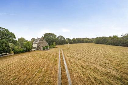
- Price
- £1,050,000
- Size
- 21 acres
Coxhall Mill Farm, Exbourne, Okehampton, Devon, EX20, Exbourne, Devon EX20 England
Added on 09/09/2026Country Home
- Price
- Guide Price£750,000
- Size
- 2 acres
Added on 11/03/2026Farmhouse