The Square, Thurnby, LE7
- Land size
- 4.13 acres
- Bedrooms
- 4
- Bathrooms
- 1
Description
A rare and highly individual opportunity to acquire an attractive period farmhouse positioned within the heart of Thurnby’s conservation area, offering approximately 4.13 acres of gardens and paddock land together with planning consent for an additional detached bungalow and annexe/garaging.
Firs Farm is a charming 18th century home that combines character, versatility and future potential in one of east Leicestershire’s most sought-after village settings. Occupying a prominent position within The Square, the property enjoys a quintessential village atmosphere whilst benefitting from substantial outside space extending far beyond the farmhouse itself.
Approached via gated frontage with the original “Firs Farm” plaque proudly displayed to the front elevation, the property presents an attractive first impression with traditional brick elevations and a wealth of period character throughout. The farmhouse offers approximately 1,840 sq ft of accommodation arranged over two floors and has been carefully maintained over the years, blending original features with tasteful modern improvements.
Internally, the accommodation is both versatile and well-balanced, ideally suited to family living whilst retaining the cosy and characterful feel expected from a home of this era. The entrance hallway leads through to a number of reception spaces including a formal dining room with feature fireplace and built-in storage, together with a dual aspect sitting room enjoying views to both the front and rear elevations.
Particular attention should be drawn to the recently refitted hand-painted Devol kitchen, undoubtedly one of the standout features of the home. Beautifully designed and fitted with quartz work surfaces, integrated appliances, Belfast sink and traditional quarry tiled flooring, the kitchen combines timeless styling with practical everyday use and forms a superb focal point to the property.
Beyond the kitchen is a breakfast room which in turn opens into the impressive family room extension. Featuring a vaulted ceiling with exposed timber trusses, exposed brickwork, log burning stove and French doors opening directly onto the rear gardens, this room creates a wonderful entertaining and living space with a far more open and contemporary feel whilst still complementing the character of the original farmhouse.
Further ground floor accommodation includes a useful office, utility/WC, work room and attached garage, providing excellent flexibility for those working from home or requiring additional storage and hobby space.
To the first floor are four bedrooms and a family bathroom fitted with a roll top bath and separate shower enclosure. The bedrooms continue the traditional feel of the property with original doors, fireplaces and pleasant views across the village and grounds beyond.
Externally, the property continues to impress with established front and rear gardens, gravelled driveway parking and vehicular access leading beyond the farmhouse towards the approved bungalow plot and paddock land. The rear gardens enjoy a desirable west-facing aspect and offer a pleasant mixture of lawned areas, patio seating and mature planting.
One of the most significant features of Firs Farm is the additional planning consent already secured within the grounds. Harborough District Council has granted planning permission under application number 20/02024/FUL for the erection of a detached bungalow together with detached annexe/garaging. CGI imagery and planning documents are available upon request.
The proposed bungalow has been thoughtfully designed with attractive traditional styling including a Swithland slate roof and decorative detailing intended to complement both the farmhouse and surrounding village setting. The detached annexe/garaging building sits separately from the bungalow itself and footings have already been installed, helping to reduce initial development work for any incoming purchaser. Services to the bungalow plot have also been considered, with a separate water meter already in place.
The approved scheme creates exciting possibilities for a wide variety of future purchasers, whether for multigenerational occupation, dependant relatives, guest accommodation, lifestyle use or further long-term flexibility.
Beyond the development plot lies approximately 3.75 acres of paddock and amenity land, divided into two principal enclosures and gently sloping towards Bushby Brook. The land is bordered by mature trees to the western boundary and offers excellent lifestyle or equestrian potential, further enhanced by the presence of a timber stable block currently utilised for storage. Whilst the brook itself sits towards the lower boundary, the land as a whole provides an increasingly rare opportunity to acquire meaningful acreage within such a well-regarded village setting.
Thurnby remains one of east Leicestershire’s most desirable villages, appreciated for its strong sense of community, attractive surroundings and excellent access to Leicester, Oadby and major road and rail links. Village amenities include a primary school, convenience store, doctors surgery, parish church and popular public house, whilst Leicester railway station offers direct services to London St Pancras, making the location particularly appealing for commuters seeking a more rural village lifestyle.
The property and grounds are currently offered for sale as a whole. However, it may be considered that the farmhouse, development plot and paddock land could be made available separately in the future. Further information can be discussed with the selling agent.
Properties combining period character, development potential and substantial land holdings within established village locations rarely become available and therefore early viewing is strongly advised.
EPC Rating: E
Parking - Driveway
Disclaimer
In accordance with current legal requirements, all prospective purchasers are required to undergo an Anti-Money Laundering (AML) check. An administration fee of £40 per property will apply. This fee is payable after an offer has been accepted and must be settled before a memorandum of sale can be issued.
Map Location
Property details
- Tenure
- Freehold
- Council Tax Band
- G
- Date Posted
- 2026-05-28
Market Value Analysis
Compared with 704 Homes with Land listings in East Midlands (1+ acres).
Utilities & Restrictions
Utilities
- Electricity
- Mains
- Water
- Mains
- Heating
- Gas Central Heating
- Broadband
- Fibre (FTTC)
- Sewerage
- Mains
Rights & Restrictions
- Public Rights of Way
- Ask Agent
- Private Rights of Way
- Ask Agent
- Listed Property
- Ask Agent
- Restrictions
- Ask Agent
Listed status, conservation areas and planning constraints for this location are in the full report.
Property Features
- Accessibility
- Ask Agent
- Parking
- Driveway
- Garden
- Private Garden
Beyond the particulars: planning activity, flood history, heritage and ground risks, checked for this exact spot.
Connectivity
Broadband
Fastest speed available at this postcode
5.5 Gbps
Gigabit full fibre
Suitable for
- 4K streaming on every screen
- Full-time home working
- Online gaming & big downloads
Mobile signal
Predicted 4G and 5G signal; indoor signal depends on building materials.
Ofcom Connected Nations postcode-level predictions. Speeds and signal are modelled, not measured, and vary between addresses and providers.
Signal is the easy part. Planning activity, flood history and protected designations here are in the full report.
Nearest Schools
Primary
- Thurnby, St Luke's Church of England Primary School182 metresOfsted report card · Apr 2026
- Ages
- 4 to 11
- Pupils
- 203
- Type
- Academy converter
- Faith
- Church of England
- Willowbrook Mead Primary Academy912 metresOfsted: Good
- Ages
- 3 to 11
- Pupils
- 436
- Type
- Academy converter
- Fernvale Primary School952 metresNo Ofsted rating
- Ages
- 4 to 11
- Pupils
- 331
- Type
- Academy converter
- Thurnby Mead Primary Academy0.9 milesNo Ofsted rating
- Ages
- 3 to 11
- Pupils
- 248
- Type
- Academy converter
- Krishna Avanti Primary School1 mileNo Ofsted rating
- Ages
- 4 to 11
- Pupils
- 414
- Type
- Free schools
- Faith
- Hindu
Secondary
- The City of Leicester College0.7 milesOfsted report card · May 2026
- Ages
- 11 to 19
- Pupils
- 1,499
- Type
- Academy converter
- St Paul's Catholic School, a Voluntary Academy0.9 milesNo Ofsted rating
- Ages
- 11 to 18
- Pupils
- 1,167
- Type
- Academy converter
- Faith
- Roman Catholic
- Judgemeadow Community College1 mileOfsted: Good
- Ages
- 11 to 16
- Pupils
- 975
- Type
- Academy sponsor led
- Orchard Mead Academy1.6 milesOfsted report card · Jun 2026
- Ages
- 11 to 16
- Pupils
- 1,007
- Type
- Academy sponsor led
- Crown Hills Community College1.8 milesOfsted: Outstanding *
- Ages
- 11 to 16
- Pupils
- 1,493
- Type
- Community school
* Latest graded judgement covers quality of education only; no overall grade was issued under the 2024-25 inspection framework.
Distances are straight-line from the advertised location. Source: the national school registers (DfE, Welsh Government, Scottish Government) and Ofsted.
Schools are just the start: sold prices nearby, planning activity and any flood history are in the full report.
Amenities
Supermarket
GP surgery
Pharmacy
Hospital
Green space
Straight-line distances from the advertised location. Sources: NHS records, Geolytix supermarket locations, OS Open Greenspace and the national trails registers.
The area stacks up? Now check the location itself: planning nearby, protected designations and past flooding.
Getting Around
Nearest station
Nearest bus stop
Typical drive times
Straight-line distances from the advertised location; drive times are typical free-flow times over OpenStreetMap road data, so allow more at peak. Public transport locations from DfT NaPTAN.
Easy to reach matters. So do planning activity, flood history and ground risks: all in the full report.
Flood Risk
Environment Agency open data, checked around the advertised map pin for the listed acreage. Long-term risk counts flood defences; the planning map's flood zones do not. The map pin for this listing marks the postcode area rather than the exact location, so these readings describe the surrounding area. Provided by LandSale, not the listing agent, and not part of the agent's particulars. Risk varies across a holding, so verify before committing.
Rivers and the sea
Planning map: Flood Zone 1.
Surface water
Not at the pin: mapped about 20 metres away.
These bandings are the summary. Where this location sits on the flood maps, plus planning activity, heritage and ground risks, is in the full report.
Important notice: Information, maps and tags on this page are drawn from the advertising agent's marketing materials or generated automatically. LandSale has not verified them. Relying on these details is at your own risk, always carry out independent checks before committing to a purchase.
LandSale full disclaimer
Marketing information only - not formal particulars. The details on this website are provided for general guidance and do not constitute an offer or contract. Neither LandSale nor the advertising estate/land agent accepts responsibility for any inaccuracy.
1. Source of information
- Listing content: Core description, asking price, tenure, measurements, photographs and planning history originate from the marketing materials of the advertising estate or land agent. LandSale does not author this content and cannot guarantee its accuracy.
- Automated tags & categorisation: Property type, land-use class, acreage bands and similar labels may be applied by machine-learning models. They are intended as a helpful guide only and may not reflect the property's legal status or permitted use.
- Third-party & enriched data layers: Maps, boundary outlines, planning designations, soil reports, broadband coverage and other environmental or location-based insights are licensed from external suppliers. Such data are supplied “as is", may be incomplete or out of date and are subject to change without notice.
2. Verification required
Prospective purchasers must verify critical matters, including but not limited to planning permission, title boundaries, public rights of way, environmental constraints, acreage, services, access and VAT status, through their own inspections, specialist surveys, legal advisers and the selling agent before relying on the information or entering into any contract.
3. No warranty or liability
LandSale gives no warranty, express or implied, as to the accuracy, completeness or fitness for any particular purpose of the information displayed. LandSale shall not be liable for any loss, damage, cost or expense arising directly or indirectly from any use of or reliance on such information, save where liability may not be excluded by law.
4. Updates & feedback
If you believe any detail on this listing is inaccurate, please let us know. We will investigate and, where appropriate, update the listing or notify the agent.
© LandSale | Version 1.3 - August 2026
Listing agent
Hortons, National
11 Brook Park Offices, Gaddesby Lane, Rearsby, LE7 4ZB
Similar properties for sale
- Price
- Offers Over£1,450,000
- Size
- 3.8 acres
Grange Park, Leicester, LE7, Thurnby and Bushby, Leicestershire LE7 England
Added on 06/10/2026House with Land
- Price
- Guide Price£1,495,000
- Size
- 3 acres
Queniborough LEICESTERSHIRE, Queniborough, Leicestershire LE7 England
Added on 08/10/2026Kennels Property
- Price
- Offers in Region of£1,550,000
- Size
- 3.03 acres
Added on 29/01/2026House with Land
- Price
- Offers Over£1,100,000
- Size
- 3.5 acres
Station Lane, Glenfield, LE3, Leicester, Leicestershire LE3 England
Added on 08/08/2026Development Land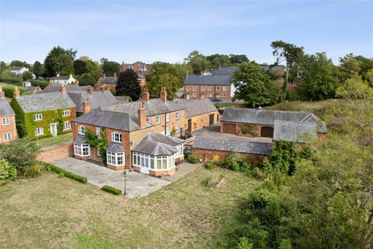
- Price
- Guide Price£1,350,000
- Size
- 4.5 acres
The Elms, Tur Langton, Tur Langton, Leicestershire LE8 England
Added on 28/09/2026Country Home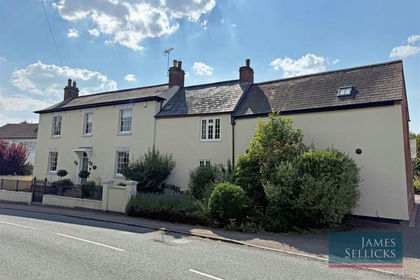
- Price
- Guide Price£1,250,000
- Size
- 4 acres
Brookhill Farmhouse, Main Street, Peatling Magna, Peatling Magna, Leicestershire LE8 England
Added on 26/03/2026Farmhouse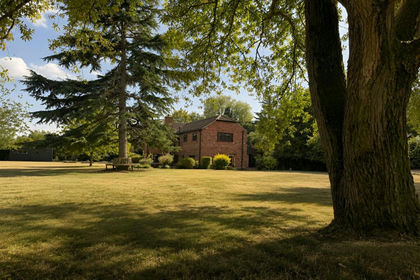
- Price
- Guide Price£1,250,000
- Size
- 2 acres
The Barn, Seagrave Road, Thrussington, Thrussington, Leicestershire LE7 England
Added on 08/08/2026Barn Conversion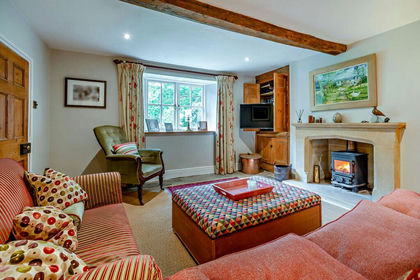
- Price
- £1,500,000
- Size
- 8.5 acres
Launde, Leicester, Leicestershire, Launde, Leicestershire LE7 England
Added on 29/04/2026Farmhouse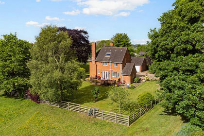
- Price
- £1,100,000
- Size
- 3.1 acres
Gilmorton Road, Ashby Magna, LE17, Ashby Magna, Leicestershire LE17 England
Added on 20/05/2026Country Home
- Price
- Guide Price£1,150,000
- Size
- 53.58 acres
Added on 22/06/2026Farm