Church Hill, Sutton, Deal, Kent, CT15
- Land size
- 208.19 acres
Key Features
- Productive arable
- Mainly Grade 2
- Edge of village
Description
A nice compact block of mainly Grade 2 East Kent arable land - James Hickman, Farms and Land
#TheGardenOfEngland
Lot 3 of 3 Lots
An excellent opportunity to purchase a productive East Kent arable farm situated on the edge of Sutton village and comprising a period Georgian fronted Grade II listed farmhouse, a popular holiday cottage, a good range of traditional and modern farm buildings, together with mainly Grade 2 arable land.
In all about 211.08 acres (85.423 hectares)
For sale as a whole or in 3 lots.
Freehold - Council Tax Bands G (Farmhouse) and C (Upper Farm Lodge)
Guide Prices:
Whole
Farmhouse, Upper Farm Lodge, Outbuildings, Farm buildings and Land (about 211.08 acres)
Guide Price £3,950,000 to £4,150,000
Lot 1
Farmhouse, Upper Farm Lodge and traditional outbuildings (about 1.93 acres)
Guide Price £1,400,000 to £1,450,000
Lot 2
Farm Buildings (about 0.96 acre)
Guide Price £350,000 to £400,000
Lot 3
Farmland (about 208.19 acres)
Guide Price £2,200,000 to £2,300,000
Situation
Upper Farm is situated in the small village and parish of Sutton which is located between the East Kent coastal towns of Deal and Dover. Both towns offer a good range of amenities including shops, schools, supermarkets, restaurants, and pubs. There is a wider choice of amenities at Canterbury which is an easy drive via the A2. The pretty Cinque Port town of Sandwich is also within easy reach to the north.
Method of Sale
The farm is offered for sale by Private Treaty with offers invited either for the whole or in 3 lots. In the event of competing offers, interested parties may be asked to submit their “best and final” offer or offers. In addition, the sellers’ reserve the right to offer the farm by informal tender or auction if the need arises.
Background
The farm was originally rented by part of the sellers’ family and in 1938 the sellers’ grandfather had the opportunity to purchase the farm. The farm has been in the family’s ownership ever since. The farm has been used for mixed arable and livestock farming over the years including cattle, dairy and pigs. More recently farmed as an arable farm.
Lot 1 - Upper Farmhouse and Buildings (edged red on plan)
Upper Farmhouse
An attractive farmhouse, which is Grade II listed, originally believed to have been a Yeomans House upon which a late Georgian front was added in about 1795. The property provides spacious accommodation with well proportioned rooms, good ceiling heights and a number of attractive period features.
Upper Farm Lodge
The Lodge is an attractive addition to the house. This was converted in about 2006/7 and is currently being let as a holiday cottage through Travel Chapter via Holiday Cottages (holidaycottages.co.uk) and Original Cottages (originalcottages.co.uk). The Lodge generates a useful additional income for the farm but could just as easily be used to provide ancillary accommodation or an annexe to the house.
The Lodge will be sold as a going concern with most of the furniture, white goods, and fixtures and fittings included.
Gardens
The farmhouse and Lodge sit within a large garden area which is mainly laid to lawn and planted with a good number of attractive trees to complement the borders and shrub areas. The garden includes a good sized double garage, two greenhouses, a small shed and a fruit cage.
Traditional Outbuildings
A number of mellow brick traditional buildings used recently as workshops, wood working, a shop/retail area, storage and rest rooms by the Sellers as part of their successful Stiles and Bates Woodturning Supplies business (now ceased trading).. These briefly comprise:
1) Workshops and Woodworking Room
2) Store, Workshop and WC
3) Workshop
4) Tractor Barn & Workshop and Store
5) Two Stores and Shop Area
6) Large Open Sided Barn
7) Barn with two Stores
8) Chemical Store
9) Office Building
A small number of these buildings are the subject of non-domestic/business rates.
Lot 2 - Upper Farm Buildings (blue on plan)
a) Grain Store, about 100'9 x 29'7, with attached Fan Store, about 17'10 x 24'6. The store has an on floor capacity of about 300 tonnes.
b) Former Silage Store, about 59'4 x 26'9 and 59'6 x 16'10. The larger part can store approx. 120 Tonnes on floor if required.
c) Open Sided General Purpose Barn (earth floor), about 90'0 x 25'6.
Lot 3 – Upper Farm (green on Plan)
A block of easy working arable land extending to about 208.19 acres (about 84.253 ha), which is accessed from Church Hill. The land lies in a rectangular block to the south west of the farmhouse and buildings and comprises a small number of easy working fields. There is good access to the land via a trackway that runs centrally through the land.
**Note: In the far north west of the land there was historically a pair of cottages that were accessed over a trackway from Homestead Lane to the south of East and West Studdal.
Soil Type and Land Classification
The land is shown as Soilscape 5 on the LandIS Map ( and is described as ‘’freely draining lime-rich loamy soils’’.
The land is classified as mainly Grade 2 on the Natural England Regional Agricultural Land Classification Map with a smaller area of Grade 3 along the northern edge of the land.
Tenure
The farm is freehold with vacant possession of all parts on completion.
Planning
All planning enquiries regarding any alternative uses, extensions or conversions must be directed to the Local Authority being Dover District Council (dover.gov.uk) planning department.
Services
Lot 1
Upper Farmhouse: Mains water and electricity, Klargester drainage, oil fired boiler for hot water and central heating.
Upper Farm Lodge: Mains water and electricity, Klargester drainage, oil fired boiler for hot water and central heating.
Farm and Outbuildings: Mains water and electricity, single with some 3 phase.
Lot 2
Farm Buildings: Mains water and Electricity (3 Phase)
Lot 3
Holdover
The sellers may need to reserve the right of holdover to use some of the farm buildings including the grain store for an agreed period of time after completion. The sellers may also require holdover to hold a farm dispersal sale on the farm.
Schemes
The land is not currently entered into any farm schemes.
The farm is registered for the Red Tractor Scheme.
Public Rights of Way, Wayleaves and Easements
There is a single footpath, No EE419, that runs along the edge of the far south west boundary of the farmland in Lot 3.
For further details go:
In general, the property is sold subject to and with the benefit of all existing easements and wayleaves and rights of way (if any) whether public or private.
Shooting, Hunting & Fishing Rights
These are all in hand.
Viewings
Viewing of ALL lots including the land and buildings are strictly by appointment only through our Ashford office on or our Tenterden office on .
Health and Safety
Prospective purchasers must have regard for their own safety during viewings. Neither the sellers nor Hobbs Parker Estate Agents accept any responsibility for any accident or injury as a result of viewing the property.
Acreage, Plans & Boundaries
The plan on these sales particulars and the acreages quoted are strictly for identification and guidance only. The boundaries shown on the plans in these particulars have been prepared by reference to digital Ordnance Survey data. The plans are published for illustrative purposes only and although they are believed to be correct their accuracy cannot be guaranteed.
Interested parties are reminded that the property is sold in accordance with the owners Land Registry Title plan/s, and they must satisfy themselves as to the boundaries and the quantity of land being purchased. Any error or mistake shall not annul the sale or entitle any party to compensation thereof.
Our Ref: AEA260013
Map Location
Property details
- Tenure
- Freehold
- Council Tax Band
- TBC
- Date Posted
- 2026-05-21
Market Value Analysis
Compared with 16 Farms & Smallholdings listings in South East England (100+ acres).
Utilities & Restrictions
Utilities
- Electricity
- Ask Agent
- Water
- Ask Agent
- Heating
- Ask Agent
- Broadband
- Ask Agent
- Sewerage
- Ask Agent
Rights & Restrictions
- Public Rights of Way
- Ask Agent
- Private Rights of Way
- Ask Agent
- Listed Property
- Ask Agent
- Restrictions
- Ask Agent
Listed status, conservation areas and planning constraints for this location are in the full report.
Property Features
- Accessibility
- Ask Agent
- Parking
- Parking Available
- Garden
- Garden
Beyond the particulars: planning activity, flood history, heritage and ground risks, checked for this exact spot.
Connectivity
Broadband
Fastest speed available at this postcode
27 Mbps
Standard (10-30 Mbps)
Suitable for
- Web & social
- Music streaming
- Standard video calls
Fixed wireless access may also be an option here.
Mobile signal
Outdoor predictions; indoor signal depends on building materials.
Ofcom Connected Nations postcode-level predictions. Speeds and signal are modelled, not measured, and vary between addresses and providers.
Signal is the easy part. Planning activity, flood history and protected designations here are in the full report.
Nearest Schools
Primary
- Northbourne Church of England Primary School1.6 milesNo Ofsted rating
- Ages
- 4 to 11
- Pupils
- 136
- Type
- Academy converter
- Faith
- Church of England
- Langdon Primary School1.9 milesNo Ofsted rating
- Ages
- 4 to 11
- Pupils
- 93
- Type
- Community school
- St Mary's Catholic Primary School2.1 milesOfsted: Good
- Ages
- 5 to 11
- Pupils
- 182
- Type
- Academy converter
- Faith
- Roman Catholic
- Hornbeam Primary School2.3 milesNo Ofsted rating
- Ages
- 4 to 11
- Pupils
- 207
- Type
- Academy converter
- Sholden Church of England Primary School2.4 milesOfsted: Good
- Ages
- 4 to 11
- Pupils
- 91
- Type
- Academy converter
- Faith
- Church of England
Secondary
- Goodwin Academy2.8 milesOfsted: Good *
- Ages
- 11 to 18
- Pupils
- 780
- Type
- Academy sponsor led
- Dover Christ Church Academy3.5 milesOfsted: Requires improvement
- Ages
- 11 to 18
- Pupils
- 761
- Type
- Academy sponsor led
- Duke of York's Royal Military School3.7 milesOfsted: Good
- Ages
- 11 to 18
- Pupils
- 470
- Type
- Academy sponsor led
- St Edmund's Catholic School4.3 milesOfsted: Good
- Ages
- 11 to 18
- Pupils
- 644
- Type
- Academy sponsor led
- Faith
- Roman Catholic
- Dover Grammar School for Girls4.5 milesOfsted: Good *
- Ages
- 11 to 18
- Pupils
- 847
- Type
- Community school
- Gender
- Girls
* Latest graded judgement covers quality of education only; no overall grade was issued under the 2024-25 inspection framework.
Distances are straight-line from the advertised location. Source: the national school registers (DfE, Welsh Government, Scottish Government) and Ofsted.
Schools are just the start: sold prices nearby, planning activity and any flood history are in the full report.
Amenities
Supermarket
GP surgery
Pharmacy
Hospital
Green space
Walking trail
Straight-line distances from the advertised location. Sources: NHS records, Geolytix supermarket locations, OS Open Greenspace and the national trails registers.
The area stacks up? Now check the location itself: planning nearby, protected designations and past flooding.
Getting Around
Nearest station
Nearest bus stop
Typical drive times
Straight-line distances from the advertised location; drive times are typical free-flow times over OpenStreetMap road data, so allow more at peak. Public transport locations from DfT NaPTAN.
Easy to reach matters. So do planning activity, flood history and ground risks: all in the full report.
Flood Risk
From Environment Agency flood map open data, checked around the advertised map pin and allowing for the listed acreage where known. This summary comes from LandSale, the advertising platform, not from the listing agent, and is not part of the agent's particulars. Risk can vary across a single holding, so verify anything critical through your own searches before committing.
Rivers and the sea
Surface water
Mapped within the area searched, not at the advertised map pin itself.
The detail behind these bandings
The full report pinpoints where this location sits on the flood maps, and runs the deeper checks that usually only surface after an offer.
- Exact flood zones & annual chances (included in the full report)
- Any recorded past flooding (included in the full report)
- Planning activity nearby (included in the full report)
- Heritage & conservation (included in the full report)
- Protected nature designations (included in the full report)
- Ground risks (included in the full report)
- Sold prices nearby (included in the full report)
£14.99 · one-off purchase
By LandSale, the platform. Not provided by the listing agent. Ready in about a minute.
Important notice: Information, maps and tags on this page are drawn from the advertising agent's marketing materials or generated automatically. LandSale has not verified them. Relying on these details is at your own risk, always carry out independent checks before committing to a purchase.
LandSale full disclaimer
Marketing information only - not formal particulars. The details on this website are provided for general guidance and do not constitute an offer or contract. Neither LandSale nor the advertising estate/land agent accepts responsibility for any inaccuracy.
1. Source of information
- Listing content: Core description, asking price, tenure, measurements, photographs and planning history originate from the marketing materials of the advertising estate or land agent. LandSale does not author this content and cannot guarantee its accuracy.
- Automated tags & categorisation: Property type, land-use class, acreage bands and similar labels may be applied by machine-learning models. They are intended as a helpful guide only and may not reflect the property's legal status or permitted use.
- Third-party & enriched data layers: Maps, boundary outlines, planning designations, soil reports, broadband coverage and other environmental or location-based insights are licensed from external suppliers. Such data are supplied “as is", may be incomplete or out of date and are subject to change without notice.
2. Verification required
Prospective purchasers must verify critical matters, including but not limited to planning permission, title boundaries, public rights of way, environmental constraints, acreage, services, access and VAT status, through their own inspections, specialist surveys, legal advisers and the selling agent before relying on the information or entering into any contract.
3. No warranty or liability
LandSale gives no warranty, express or implied, as to the accuracy, completeness or fitness for any particular purpose of the information displayed. LandSale shall not be liable for any loss, damage, cost or expense arising directly or indirectly from any use of or reliance on such information, save where liability may not be excluded by law.
4. Updates & feedback
If you believe any detail on this listing is inaccurate, please let us know. We will investigate and, where appropriate, update the listing or notify the agent.
© LandSale | Version 1.3 - August 2026
Listing agent
Hobbs Parker Estate Agents, Ashford
Romney House Monument Way, Orbital Park, Ashford, TN24 0HB
View agent profileSimilar properties for sale
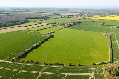
- Price
- Guide Price£1,950,000
- Size
- 121.16 acres
Little Cooting Farm, Adisham, Canterbury, Kent, Adisham, Kent CT3 England
Added on 18/06/2026Farmland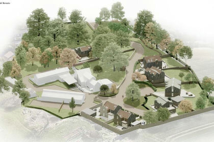
- Price
- Offers in Region of£1,950,000
- Size
- 3 acres
Shottendane Farm, Shottendane Road, Margate, Kent, CT9, East Thanet, Kent CT9 England
Added on 30/05/2026Development Land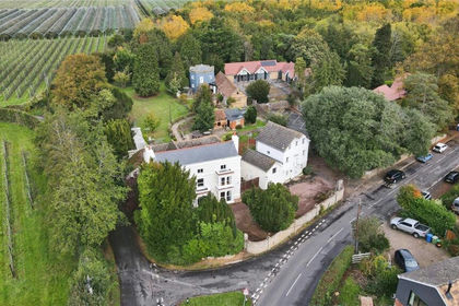
- Price
- £2,500,000
- Size
- 1.4 acres
Lynsted Lane, Lynsted, Sittingbourne, ME9, Lynsted with Kingsdown, Kent ME9 England
Added on 29/01/2026Development Land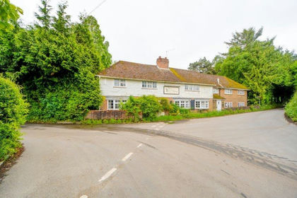
- Price
- £1,400,000
Added on 17/07/2026Development Land
- Price
- Guide Price£1,500,000
Boughton Monchelsea, Maidstone, Boughton Monchelsea, Kent ME17 England
Added on 09/06/2026Development Land
- Price
- Guide Price£2,250,000
Alexandra Street, Southend-On-Sea, Southend East and Rochford, Southend-on-Sea SS1 England
Added on 16/06/2026Development Land
- Price
- Guide Price£2,500,000
Added on 29/01/2026Development Land
- Price
- £2,500,000
- Size
- 3 acres
Added on 28/01/2026Development Land
- Price
- Guide Price£1,750,000
- Size
- 2.75 acres
Added on 12/03/2026Historic House
- Price
- From£1,454,000
Plot 3, Pankhurst Wood, Wateringbury, Kent, Wateringbury, Kent ME18 England
Added on 06/07/2026Development Land