Holme, Carnforth
- Land size
- 1 acres
- Bedrooms
- 5
- Bathrooms
- 2
Key Features
- Fully renovated and extended country home set amidst 1 acre (0.40 ha) with garaging and ample parking.
- Ideal for a smallholding or for those with equestrian interests.
- Additional land available by separate negotiation.
- Highly accessible position with excellent access to A6, A65 and M6.
Description
An extensively renovated country home, with an abundance of character features. Set in 1 acre of grounds including garden and paddock area. Highly accessible position with further land available by separate negotiation. Ideal for equestrian use or smallholdings.Occupying a beautiful rural setting, High House enjoys a quiet position with far reaching views across rolling countryside, towards Farleton Knott. Situated on the edge of the rural village of Holme, the location is popular amongst those looking to enjoy rural life, have excellent access to the Lake District National Park or make good use of the connectivity to the A6 and M6 with junction 36 being only a five minute drive away. Oxenholme Station is 7.5 miles away, positioned on the west coast mainline the service has direct links to London Euston.
The substantial farmhouse provides well-proportioned and flexible accommodation over two floors, which retain a wealth of original features and character. The property has been sympathetically and extensively restored, extended and refurbished during the current vendors ownership, creating a wonderful family home which takes full advantage of the stunning setting.
Outside the house is set in formal, well stocked gardens which extend to an acre and include a curved flagged patio area to the front of the house providing an ideal area to sit out and relax.. Beyond this, there is a lawn with a Hobbit House and BBQ grill set to one side, being the perfect garden room to be enjoyed year round with family and friends. A pedestrian gate leads from the garden to a paddock area which is accessed via a bridge, which crosses the stream. This space is an ideal extended garden space for those with children, and super area for dogs or great for those wishing to keep an eye on a pony.
Adjacent to the house is an impressive garage with storage to the second floor being ideal for garden equipment and bikes. The garage is equipped with power and water is available from the exterior. To the front of the garage is an extensive block paved driveway providing parking for several vehicles.
For those looking for additional land to make this the perfect smallholding property there is an additional 17 acres and a building available by separate negotiation.
The property is approached via an adopted meandering lane which splits, giving access to the subject property and its neighbour, which adds to the quiet, peaceful setting, with each property enjoying a private position.
Map Location
Property details
- Tenure
- Freehold
- Council Tax Band
- E
- Date Posted
- 2026-05-15
Market Value Analysis
Compared with 780 Homes with Land listings in North West England (1+ acres).
Utilities & Restrictions
Utilities
- Electricity
- Mains
- Water
- Mains
- Heating
- Ask Agent
- Broadband
- Ask Agent
- Sewerage
- Septic Tank / Private
Rights & Restrictions
- Public Rights of Way
- Ask Agent
- Private Rights of Way
- Ask Agent
- Listed Property
- Ask Agent
- Restrictions
- Ask Agent
Listed status, conservation areas and planning constraints for this location are in the full report.
Property Features
- Accessibility
- Ask Agent
- Parking
- Parking Available
- Garden
- Garden
Beyond the particulars: planning activity, flood history, heritage and ground risks, checked for this exact spot.
Connectivity
Broadband
Fastest speed available at this postcode
10 Mbps
Standard (10-30 Mbps)
Suitable for
- Web & social
- Music streaming
- Standard video calls
Fixed wireless access may also be an option here.
Mobile signal
Predicted 4G and 5G signal; indoor signal depends on building materials.
Ofcom Connected Nations postcode-level predictions. Speeds and signal are modelled, not measured, and vary between addresses and providers.
Signal is the easy part. Planning activity, flood history and protected designations here are in the full report.
Nearest Schools
Primary
- Holme Primary School1.3 milesNo Ofsted rating
- Ages
- 3 to 11
- Pupils
- 122
- Type
- Community school
- Milnthorpe Primary School1.5 milesNo Ofsted rating
- Ages
- 3 to 11
- Pupils
- 176
- Type
- Community school
- Beetham CofE Primary School1.9 milesNo Ofsted rating
- Ages
- 2 to 11
- Pupils
- 51
- Type
- Voluntary aided school
- Faith
- Church of England
- Burton Morewood CofE Primary School2.8 milesOfsted: Good
- Ages
- 2 to 11
- Pupils
- 165
- Type
- Academy converter
- Faith
- Church of England
- St Patrick's CofE School2.9 milesNo Ofsted rating
- Ages
- 2 to 11
- Pupils
- 92
- Type
- Voluntary aided school
- Faith
- Church of England
Secondary
- Dallam School1.5 milesOfsted report card · Apr 2026
- Ages
- 11 to 18
- Pupils
- 761
- Type
- Academy converter
- Queen Elizabeth School5.4 milesOfsted: Good
- Ages
- 11 to 18
- Pupils
- 1,155
- Type
- Academy converter
- Queen Elizabeth Studio School5.4 milesOfsted report card · Jun 2026
- Ages
- 14 to 19
- Pupils
- 329
- Type
- Studio schools
- Kirkbie Kendal School6.5 milesNo Ofsted rating
- Ages
- 11 to 18
- Pupils
- 1,029
- Type
- Academy converter
- Carnforth High School6.8 milesOfsted report card · Apr 2026
- Ages
- 11 to 16
- Pupils
- 657
- Type
- Academy converter
Distances are straight-line from the advertised location. Source: the national school registers (DfE, Welsh Government, Scottish Government) and Ofsted.
Schools are just the start: sold prices nearby, planning activity and any flood history are in the full report.
Amenities
Supermarket
GP surgery
Pharmacy
Hospital
Straight-line distances from the advertised location. Sources: NHS records, Geolytix supermarket locations, OS Open Greenspace and the national trails registers.
The area stacks up? Now check the location itself: planning nearby, protected designations and past flooding.
Getting Around
Nearest station
Nearest bus stop
Typical drive times
Straight-line distances from the advertised location; drive times are typical free-flow times over OpenStreetMap road data, so allow more at peak. Public transport locations from DfT NaPTAN.
Easy to reach matters. So do planning activity, flood history and ground risks: all in the full report.
Flood Risk
Environment Agency open data, checked around the advertised map pin for the listed acreage. Long-term risk counts flood defences; the planning map's flood zones do not. Provided by LandSale, not the listing agent, and not part of the agent's particulars. Risk varies across a holding, so verify before committing.
Rivers and the sea
Planning map: Flood Zone 3, about 30 metres away.
Surface water
Not at the pin: mapped about 30 metres away.
These bandings are the summary. Where this location sits on the flood maps, plus planning activity, heritage and ground risks, is in the full report.
Important notice: Information, maps and tags on this page are drawn from the advertising agent's marketing materials or generated automatically. LandSale has not verified them. Relying on these details is at your own risk, always carry out independent checks before committing to a purchase.
LandSale full disclaimer
Marketing information only - not formal particulars. The details on this website are provided for general guidance and do not constitute an offer or contract. Neither LandSale nor the advertising estate/land agent accepts responsibility for any inaccuracy.
1. Source of information
- Listing content: Core description, asking price, tenure, measurements, photographs and planning history originate from the marketing materials of the advertising estate or land agent. LandSale does not author this content and cannot guarantee its accuracy.
- Automated tags & categorisation: Property type, land-use class, acreage bands and similar labels may be applied by machine-learning models. They are intended as a helpful guide only and may not reflect the property's legal status or permitted use.
- Third-party & enriched data layers: Maps, boundary outlines, planning designations, soil reports, broadband coverage and other environmental or location-based insights are licensed from external suppliers. Such data are supplied “as is", may be incomplete or out of date and are subject to change without notice.
2. Verification required
Prospective purchasers must verify critical matters, including but not limited to planning permission, title boundaries, public rights of way, environmental constraints, acreage, services, access and VAT status, through their own inspections, specialist surveys, legal advisers and the selling agent before relying on the information or entering into any contract.
3. No warranty or liability
LandSale gives no warranty, express or implied, as to the accuracy, completeness or fitness for any particular purpose of the information displayed. LandSale shall not be liable for any loss, damage, cost or expense arising directly or indirectly from any use of or reliance on such information, save where liability may not be excluded by law.
4. Updates & feedback
If you believe any detail on this listing is inaccurate, please let us know. We will investigate and, where appropriate, update the listing or notify the agent.
© LandSale | Version 1.3 - August 2026
Listing agent
Armitstead Barnett, Cumbria
Lane Farm, Crooklands, LA7 7NH
Similar properties for sale
- Price
- £799,000
- Size
- 1.5 acres
Haverflatts Lane, Milnthorpe, LA7, Heversham, Westmorland and Furness LA7 England
Added on 28/02/2026Farmhouse
- Price
- £895,000
- Size
- 4 acres
Clawthorpe Lodge, Clawthorpe, LA6, Burton-in-Kendal, Westmorland and Furness LA6 England
Added on 14/05/2026House with Land
- Price
- £900,000
- Size
- 7 acres
Sellet Lodge, Stainton, Kendal, LA8, Stainton, Westmorland and Furness LA8 England
Added on 15/09/2026House with Land
- Price
- Guide Price£1,050,000
- Size
- 0.66 acres
Scout Hill Barn, Middle Row, Lupton, LA6, Lupton, Westmorland and Furness LA6 England
Added on 02/07/2026Barn Conversion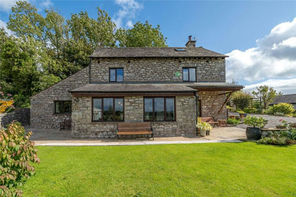
- Price
- £725,000
Carr Bank Road, Carr Bank, Milnthorpe, Cumbria, LA7, Beetham, Westmorland and Furness LA7 England
Added on 19/09/2026Barn Conversion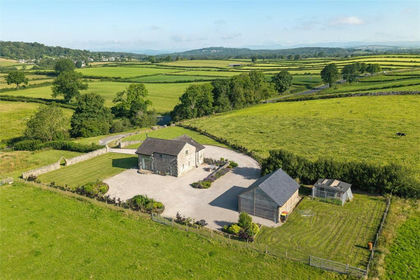
- Price
- Offers in Region of£850,000
- Size
- 3.88 acres
Milnthorpe Road, Yealand Conyers, Carnforth, Lancashire, The Yealands, Lancashire LA5 England
Added on 16/07/2026House with Land
- Price
- Guide Price£845,000
- Size
- 4.99 acres
Pells Yeat Farm, Kirkby Lonsdale, LA6, Kirkby Lonsdale, Westmorland and Furness LA6 England
Added on 10/03/2026Farmhouse
- Price
- Guide Price£795,000
- Size
- 1 acres
Orchard Barn, Priest Hutton, LA6, Priest Hutton, Lancashire LA6 England
Added on 29/01/2026Barn Conversion
- Price
- Offers in Region of£1,000,000
- Size
- 5.7 acres
Silverdale, Carnforth, Lancashire, Silverdale, Lancashire LA5 England
Added on 29/01/2026House with Land
- Price
- £800,000
- Size
- 1 acres
Corfe Farm, Sand Lane, Warton, Carnforth, LA5, Warton, Lancashire LA5 England
Added on 07/07/2026House with Land