Pinmore, Girvan
- Land size
- 6.41 acres
Key Features
- Approximately 6.41 acres of land in a lovely rural setting
- Picturesque riverside position along the Assel Water
- Previously granted planning permission for two dwellings (now lapsed)
- Mains water and electricity connections available
- Two access points from the A714, including a gated entrance
- Mixture of grazing land and woodland
- Easily accessible to Girvan, Ayr and Glasgow
- Ideal for a bespoke country residence (subject to planning)
Description
An exceptional opportunity to acquire a substantial parcel of land in an idyllic rural setting in the heart of the Stinchar Valley, South Ayrshire. Asselfoot enjoys a beautifully tranquil and highly scenic position, conveniently located near the charming villages of Pinmore and Pinwherry. Extending to approximately 6.42 acres, the land is superbly positioned along the banks of the Assel Water, offering a rare combination of privacy, natural beauty, and accessibility. The setting provides a truly outstanding backdrop for the creation of a bespoke country residence. The site presents an excellent opportunity for a discerning purchaser to realise their vision of a dream home, subject to obtaining the necessary planning consents from the local authority. It is worth noting that planning permission was previously granted for two dwellings, although this has now lapsed. The property further benefits from existing connections to water and electricity, enhancing its appeal as a ready-to-develop opportunity. A rare offering in a sought-after rural location, Asselfoot combines tranquillity, space, and considerable potential ideal for those seeking to create a distinctive home in one of South Ayrshire's most picturesque landscapes.
______________________________________
Location & Amenities
The nearby seaside town of Girvan offers a comprehensive range of local amenities, including shops, supermarkets, cafés, and a community hospital. The villages of Barr (approximately 5.5 miles) and Colmonell (approximately 6 miles) provide well-regarded primary schooling, with secondary education available in Girvan. The nearest independent schooling can be found in Ayr (approximately 27 miles).
Ayr provides a range of retail, leisure and cultural facilities, including supermarkets, restaurants, sports centres, a cinema, and art galleries. Girvan railway station offers regular services to Glasgow and Stranraer, while Glasgow is readily accessible via the A77 and M77. Glasgow Prestwick Airport (approximately 31 miles) provides a range of domestic and international flights. Ferry services to Ireland operate from Stranraer (approximately 28 miles).
______________________________________
Leisure & Recreation
Situated within the Stinchar Valley, the area is renowned for its natural beauty and is highly regarded for outdoor pursuits. There are numerous scenic walking routes and established cycle paths throughout the area, including Changue Forest, which offers an extensive network of approximately 20 miles of tracks and trails.
Stinchar is widely recognised as one of Scotland's notable salmon fisheries, particularly famed for its autumn runs.
To the north lies Trump Turnberry (approximately 12 miles), home to world-class golfing facilities and a luxury hotel and spa, alongside an excellent 18-hole golf course in Girvan itself.
________________________________________
The Land
The land at Asselfoot extends to approximately 6.41 acres and comprises a combination of grazing ground and areas of established woodland, creating a diverse and attractive landscape.
There are two access points from the A714, with the principal entrance formed by a substantial gated access leading directly into the site. The property benefits from mains water and electricity connections, further enhancing its appeal as a ready-to-develop opportunity.
According to the James Hutton Institute, the land is classified predominantly as Grade 5.3, with smaller areas of Grade 3.2 and 4.2.
____________________
Flood Risk
Flood risk maps for the area are available online and can be viewed via the appropriate environmental agencies.
________________________________________
Directions
From Girvan, take the A714 (signposted Newton Stewart) and proceed for approximately 6 miles. Pass beneath the viaduct and continue under it again, then travel a further 600 metres where the gated entrance to the site will be found on the left-hand side.
________________________________________
Postcode
KA26 0TN
________________________________________
What3Words
///pythons.crowns.amuses
________________________________________
Local Authority
South Ayrshire Council
County Buildings
Wellington Square
Ayr
KA7 1DR
________________________________________
Viewings
Strictly by appointment through the selling agent.
Map Location
Property details
- Tenure
- Freehold
- Council Tax Band
- Ask Agent
- Date Posted
- 2026-04-27
Market Value Analysis
Compared with 39 Bare & Undeveloped Land listings in Scotland (5+ acres).
Utilities & Restrictions
Utilities
- Electricity
- Ask Agent
- Water
- Ask Agent
- Heating
- Ask Agent
- Broadband
- Ask Agent
- Sewerage
- Ask Agent
Rights & Restrictions
- Public Rights of Way
- Ask Agent
- Private Rights of Way
- Ask Agent
- Listed Property
- Ask Agent
- Restrictions
- Ask Agent
Listed status, conservation areas and planning constraints for this location are in the full report.
Property Features
- Accessibility
- Ask Agent
- Parking
- Ask Agent
- Garden
- Ask Agent
Beyond the particulars: planning activity, flood history, heritage and ground risks, checked for this exact spot.
Connectivity
Broadband
Fastest speed available at this postcode
1.8 Gbps
Gigabit full fibre
Suitable for
- 4K streaming on every screen
- Full-time home working
- Online gaming & big downloads
Mobile signal
Predicted 4G and 5G signal; indoor signal depends on building materials.
Ofcom Connected Nations postcode-level predictions. Speeds and signal are modelled, not measured, and vary between addresses and providers.
Signal is the easy part. Planning activity, flood history and protected designations here are in the full report.
Nearest Schools
Primary
- Colmonell Primary School4.4 miles
- Pupils
- 38
- Type
- Non-denominational
- Girvan Primary School4.5 miles
- Pupils
- 305
- Type
- Non-denominational
- Sacred Heart Primary School4.7 miles
- Pupils
- 120
- Type
- Roman Catholic
- Barr Primary School5 miles
- Pupils
- 21
- Type
- Non-denominational
- Barrhill Primary School5.4 miles
- Pupils
- 20
- Type
- Non-denominational
Secondary
- Girvan Academy4.4 miles
- Pupils
- 542
- Type
- Non-denominational
- Carrick Academy13 miles
- Pupils
- 391
- Type
- Non-denominational
- Doon Academy19 miles
- Pupils
- 240
- Type
- Non-denominational
- Douglas Ewart High School20 miles
- Pupils
- 584
- Type
- Non-denominational
- Stranraer Academy20 miles
- Pupils
- 991
- Type
- Non-denominational
Distances are straight-line from the advertised location. Source: the national school registers (DfE, Welsh Government, Scottish Government) and Ofsted.
Schools are just the start: planning activity, heritage and any flood history here are in the full report.
Amenities
Supermarket
GP surgery
Pharmacy
Straight-line distances from the advertised location. Sources: NHS records, Geolytix supermarket locations, OS Open Greenspace and the national trails registers.
The area stacks up? Now check the location itself: planning nearby, protected designations and past flooding.
Getting Around
Nearest station
Nearest bus stop
Typical drive times
Straight-line distances from the advertised location; drive times are typical free-flow times over OpenStreetMap road data, so allow more at peak. Public transport locations from DfT NaPTAN.
Easy to reach matters. So do planning activity, flood history and ground risks: all in the full report.
Flood Risk
SEPA open data, checked around the advertised map pin for the listed acreage. Provided by LandSale, not the listing agent, and not part of the agent's particulars. Risk varies across a holding, so verify before committing.
Rivers and the sea
Not at the pin: mapped about 60 metres away.
Surface water
Not at the pin: mapped about 10 metres away.
These bandings are the summary. Where this location sits on the flood maps, plus planning activity, heritage and ground risks, is in the full report.
Important notice: Information, maps and tags on this page are drawn from the advertising agent's marketing materials or generated automatically. LandSale has not verified them. Relying on these details is at your own risk, always carry out independent checks before committing to a purchase.
LandSale full disclaimer
Marketing information only - not formal particulars. The details on this website are provided for general guidance and do not constitute an offer or contract. Neither LandSale nor the advertising estate/land agent accepts responsibility for any inaccuracy.
1. Source of information
- Listing content: Core description, asking price, tenure, measurements, photographs and planning history originate from the marketing materials of the advertising estate or land agent. LandSale does not author this content and cannot guarantee its accuracy.
- Automated tags & categorisation: Property type, land-use class, acreage bands and similar labels may be applied by machine-learning models. They are intended as a helpful guide only and may not reflect the property's legal status or permitted use.
- Third-party & enriched data layers: Maps, boundary outlines, planning designations, soil reports, broadband coverage and other environmental or location-based insights are licensed from external suppliers. Such data are supplied “as is", may be incomplete or out of date and are subject to change without notice.
2. Verification required
Prospective purchasers must verify critical matters, including but not limited to planning permission, title boundaries, public rights of way, environmental constraints, acreage, services, access and VAT status, through their own inspections, specialist surveys, legal advisers and the selling agent before relying on the information or entering into any contract.
3. No warranty or liability
LandSale gives no warranty, express or implied, as to the accuracy, completeness or fitness for any particular purpose of the information displayed. LandSale shall not be liable for any loss, damage, cost or expense arising directly or indirectly from any use of or reliance on such information, save where liability may not be excluded by law.
4. Updates & feedback
If you believe any detail on this listing is inaccurate, please let us know. We will investigate and, where appropriate, update the listing or notify the agent.
© LandSale | Version 1.3 - August 2026
Listing agent
Bruach Property, Girvan
31 Dalrymple Street, Girvan, South Ayrshire, KA26 9EU
View agent profileSimilar properties for sale
- Price
- Offers in Excess of£150,000
- Size
- 3.59 acres
Plot at Challoch & Allandoo, Dumfries and Galloway, Dumfries and Galloway DG9 Scotland
Added on 29/01/2026Building Plot
- Price
- Offers Over£115,000
- Size
- 1.23 acres
Added on 29/01/2026Development Land
- Price
- Offers in Excess of£150,000
- Size
- 1.9 acres
Royston Road, Glasgow, G21, Glasgow North East, Glasgow City G21 Scotland
Added on 28/09/2026Industrial Land
- Price
- Offers Over£150,000
- Size
- 24.3 acres
Added on 15/07/2026Development Land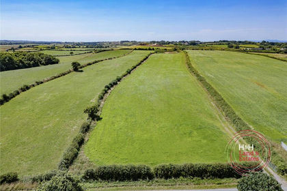
- Price
- £75,000
- Size
- 4.69 acres
Added on 20/08/2026Agricultural Land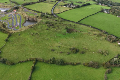
- Price
- Guide Price£120,000
- Size
- 17.88 acres
LAND AT LAMPLUGH, KIRKLAND, FRIZINGTON, CUMBRIA, CA26, Lamplugh, Cumberland CA26 England
Added on 02/10/2026Pasture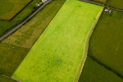
- Price
- £99,950
- Size
- 5.13 acres
Land at the Garth, Field number 321619, Crosby, undefined, undefined Isle of Man
Added on 29/01/2026Farmland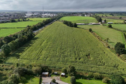
- Price
- £165,000
- Size
- 12.13 acres
Lot 2 - Land at Spittal Farm, Wigton, Cumberland, Wigton, Cumberland CA7 England
Added on 06/10/2026Agricultural Land
- Price
- Guide Price£80,000
- Size
- 5.26 acres
Lot 1 - Land at Spittal Farm, Wigton, CA7, Wigton, Cumberland CA7 England
Added on 07/10/2026Agricultural Land
- Price
- £149,950
- Size
- 7.54 acres
Land at the Garth, Field number 324067, Crosby, undefined, undefined Isle of Man
Added on 29/01/2026Farmland