The Orchards, Putley, Ledbury, HR8
- Land size
- 9.7 acres
- Bedrooms
- 5
- Bathrooms
- 4
Key Features
- Detached Period Property
- 5-8 Bedrooms
- 4-6 Bathrooms
- 5-8 Reception Rooms
- 9.7 Acres
- Standalone secondary accommodation
- Annexe secondary accommodation
- Rural Location
- Over 5000sqft in total
- EPC E (Main House)
Description
The Orchards is an historic farmstead comprising four listed buildings and a more modern garage building. It occupies an elevated position with fabulous, far-reaching views toward the Malvern Hills to the east and over the Wye Valley to the south.
Description
The charming brick farmhouse dates from 1835, although there was undoubtedly an older dwelling which was given a Georgian makeover.
The timber framed wing to the south west is probably early 18th century.
The main house extends to about 3,500 sq. ft. over two storeys plus a cellar, and incorporates a self-contained one bedroom annex.
A former wash house, now tack room, dating from the late 18th century and also listed (Grade II) in its own right, is located on the north east corner of the house.
Across the courtyard on the north side of the main house, Orchard House is a Grade II Listed, detached 2/3 bedroom, two-storey barn conversion of about 1580 sq. ft. It has its own private garden, vehicular access and parking. Currently let on an AST.
A detached Oak framed garage building has a a gardener's loo and a self-contained studio annexe above.
To the east of the house is a Grade II Listed five-bay timber framed and timber boarded barn. Planning Permission and Listed Building Consent for conversion to three dwellings was granted in 1990.
The house is set in beautifully landscaped grounds, with lawns and herbaceous borders at the front of the house and a kitchen garden and hard tennis court at the rear. There are terraces, mature hedges and some beautiful specimen trees.
The principal reception rooms have typically elegant Georgian proportions with well-preserved period features including large sash windows with garden views, ceiling coving, feature fireplaces, hardwood floors and a beautiful Oak staircase.
Location
The Orchards occupies a peaceful, elevated position overlooking the productive farmland and orchards of this beautiful part of East Herefordshire, between Ledbury and Hereford.
Ledbury is a thriving market town famous for its half-timbered buildings and medieval Market Hall. Local facilities include supermarkets and a wide range of independent retailers, primary and secondary schools, a library, a swimming pool, doctors' surgeries and a train station with direct service to London Paddington.
The Malvern Hills, an area of outstanding natural beauty, are the dominant feature of the landscape. Malvern is also a renowned cultural centre with an excellent theatre and cinema and good shopping facilities.
More comprehensive facilities can be found in the Cathedral cities of Hereford & Worcester. There are extensive shopping and recreational facilities, including Premiership rugby and County cricket at Worcester, racing at Hereford, Worcester and Cheltenham and plentiful opportunities for walking and riding out, especially in the Malvern Hills.
There is excellent schooling nearby from both the private and state sectors, including The Elms and The Downs preparatory schools in Colwall, Hereford's Cathedral School, The Royal Grammar School and The Kings School in Worcester as well as Malvern College and Malvern St James.
Trains run from Ledbury Station directly to London Paddington. Motorway access is via junction 2 of the M50, about 10 miles away.
Directions:
Post Code - HR8 2QR
What 3 words: denim.funny.pokes
Services:
Utilities – Mains electricity and water (metered supply). Private drainage via Bio-Disc treatment plant and soakaway field.
Oil fired central heating.
Council Tax
Council Tax: Band G (Herefordshire Council) (Main house)
Tenure
Freehold - We are advised (subject to legal verification) that the property is freehold.
General
Intending purchasers will be required to produce identification documentation and proof of funding in order to comply with The Money Laundering, Terrorist Financing and Transfer of Funds Regulations 2017. More information can be made available upon request. John Goodwin FRICS has made every effort to ensure that measurements and particulars are accurate however prospective purchasers/tenants must satisfy themselves by inspection or otherwise as to the accuracy of the information provided. No information with regard to planning use, structural integrity, tenure, availability/operation, business rates, services or appliances has been formerly verified and therefore prospective purchasers/tenants are requested to seek validation of all such matters prior to submitting a formal or informal intention to purchase/lease the property or enter into any contract.
Viewing
By appointment to be made through the Agent's Ledbury Office (Tel: )
EPC
The EPC rating for this property is E (main House).
Other
Flood risk – Very Low (Less than 0.1% chance of a flood each year)
Mobile phone coverage - 4G mobile signal is available in the area - we advise you to check with your provider.
Internet connection - Fibre to the premises (200 Mbps).
Not in a conservation area, National Park or AONB
There are a total of 4 Grade II Listed buildings at the property.
Map Location
Property details
- Tenure
- Freehold
- Council Tax Band
- G
- Date Posted
- 2026-04-15
Market Value Analysis
Compared with 280 Homes with Land listings in West Midlands (5+ acres).
Utilities & Restrictions
Utilities
- Electricity
- Mains
- Water
- Mains
- Heating
- Oil Heating
- Broadband
- Full Fibre (FTTP)
- Sewerage
- Septic Tank / Private
Rights & Restrictions
- Public Rights of Way
- Ask Agent
- Private Rights of Way
- Ask Agent
- Listed Property
- Yes
- Restrictions
- Ask Agent
Listed status, conservation areas and planning constraints for this location are in the full report.
Property Features
- Accessibility
- Ask Agent
- Parking
- Garage, Off-Street Parking
- Garden
- Private Garden
Beyond the particulars: planning activity, flood history, heritage and ground risks, checked for this exact spot.
Connectivity
Broadband
Fastest speed available at this postcode
900 Mbps
Gigabit full fibre · available to 83% of premises
Suitable for
- 4K streaming on every screen
- Full-time home working
- Online gaming & big downloads
Fixed wireless access may also be an option here.
Mobile signal
Predicted 4G and 5G signal; indoor signal depends on building materials.
Ofcom Connected Nations postcode-level predictions. Speeds and signal are modelled, not measured, and vary between addresses and providers.
Signal is the easy part. Planning activity, flood history and protected designations here are in the full report.
Nearest Schools
Primary
- Much Marcle CofE Primary School2.7 milesNo Ofsted rating
- Ages
- 3 to 11
- Pupils
- 90
- Type
- Academy converter
- Faith
- Church of England
- Ashperton Primary Academy2.8 milesOfsted: Good
- Ages
- 4 to 11
- Pupils
- 202
- Type
- Academy converter
- St Mary's CofE Primary School4 milesOfsted report card · May 2026
- Ages
- 2 to 11
- Pupils
- 84
- Type
- Voluntary aided school
- Faith
- Church of England
- Mordiford CofE Primary School4.2 milesOfsted: Good
- Ages
- 2 to 11
- Pupils
- 190
- Type
- Academy converter
- Faith
- Church of England
- Ledbury Primary School4.2 milesOfsted: Good
- Ages
- 2 to 11
- Pupils
- 420
- Type
- Community school
Secondary
- John Masefield High School4.5 milesNo Ofsted rating
- Ages
- 11 to 18
- Pupils
- 849
- Type
- Academy converter
- St Mary's RC High School6 milesNo Ofsted rating
- Ages
- 11 to 16
- Pupils
- 745
- Type
- Voluntary aided school
- Faith
- Roman Catholic
- The Bishop of Hereford's Bluecoat School6.9 milesOfsted report card · Feb 2026
- Ages
- 11 to 16
- Pupils
- 1,089
- Type
- Voluntary aided school
- Faith
- Church of England
- Aylestone School7.4 milesOfsted: Requires improvement
- Ages
- 11 to 16
- Pupils
- 443
- Type
- Community school
- John Kyrle High School and Sixth Form Centre Academy7.7 milesOfsted: Good *
- Ages
- 11 to 18
- Pupils
- 1,274
- Type
- Academy converter
* Latest graded judgement covers quality of education only; no overall grade was issued under the 2024-25 inspection framework.
Distances are straight-line from the advertised location. Source: the national school registers (DfE, Welsh Government, Scottish Government) and Ofsted.
Schools are just the start: sold prices nearby, planning activity and any flood history are in the full report.
Amenities
Supermarket
GP surgery
Pharmacy
Hospital
Straight-line distances from the advertised location. Sources: NHS records, Geolytix supermarket locations, OS Open Greenspace and the national trails registers.
The area stacks up? Now check the location itself: planning nearby, protected designations and past flooding.
Getting Around
Nearest station
Nearest bus stop
Typical drive times
Straight-line distances from the advertised location; drive times are typical free-flow times over OpenStreetMap road data, so allow more at peak. Public transport locations from DfT NaPTAN.
Easy to reach matters. So do planning activity, flood history and ground risks: all in the full report.
Flood Risk
Environment Agency open data, checked around the advertised map pin for the listed acreage. Long-term risk counts flood defences; the planning map's flood zones do not. The map pin for this listing marks the postcode area rather than the exact location, so these readings describe the surrounding area. Provided by LandSale, not the listing agent, and not part of the agent's particulars. Risk varies across a holding, so verify before committing.
Rivers and the sea
Planning map: Flood Zone 1.
Surface water
Not at the pin: mapped about 30 metres away.
These bandings are the summary. Where this location sits on the flood maps, plus planning activity, heritage and ground risks, is in the full report.
Important notice: Information, maps and tags on this page are drawn from the advertising agent's marketing materials or generated automatically. LandSale has not verified them. Relying on these details is at your own risk, always carry out independent checks before committing to a purchase.
LandSale full disclaimer
Marketing information only - not formal particulars. The details on this website are provided for general guidance and do not constitute an offer or contract. Neither LandSale nor the advertising estate/land agent accepts responsibility for any inaccuracy.
1. Source of information
- Listing content: Core description, asking price, tenure, measurements, photographs and planning history originate from the marketing materials of the advertising estate or land agent. LandSale does not author this content and cannot guarantee its accuracy.
- Automated tags & categorisation: Property type, land-use class, acreage bands and similar labels may be applied by machine-learning models. They are intended as a helpful guide only and may not reflect the property's legal status or permitted use.
- Third-party & enriched data layers: Maps, boundary outlines, planning designations, soil reports, broadband coverage and other environmental or location-based insights are licensed from external suppliers. Such data are supplied “as is", may be incomplete or out of date and are subject to change without notice.
2. Verification required
Prospective purchasers must verify critical matters, including but not limited to planning permission, title boundaries, public rights of way, environmental constraints, acreage, services, access and VAT status, through their own inspections, specialist surveys, legal advisers and the selling agent before relying on the information or entering into any contract.
3. No warranty or liability
LandSale gives no warranty, express or implied, as to the accuracy, completeness or fitness for any particular purpose of the information displayed. LandSale shall not be liable for any loss, damage, cost or expense arising directly or indirectly from any use of or reliance on such information, save where liability may not be excluded by law.
4. Updates & feedback
If you believe any detail on this listing is inaccurate, please let us know. We will investigate and, where appropriate, update the listing or notify the agent.
© LandSale | Version 1.3 - August 2026
Listing agent
John Goodwin FRICS, Ledbury
3 - 5, New Street, Ledbury, HR8 2DX
Similar properties for sale
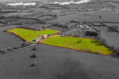
- Price
- £1,500,000
- Size
- 8 acres
Aylton, Ledbury, Herefordshire, Aylton, Herefordshire, County of HR8 England
Added on 31/08/2026House with Land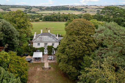
- Price
- Guide Price£2,350,000
- Size
- 8 acres
Bromsash, Ross-on-wye, HR9, Linton (Penyard Ward), Herefordshire, County of HR9 England
Added on 01/07/2026Country Estate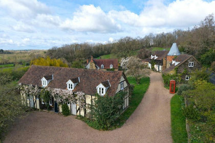
- Price
- £2,200,000
- Size
- 8.49 acres
Added on 24/06/2026Holiday Let Property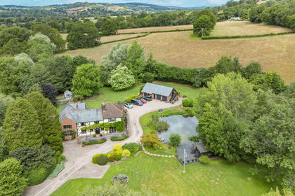
- Price
- Guide Price£1,600,000
- Size
- 4 acres
West Malvern Road, Mathon, Malvern, WR13, Mathon, Herefordshire, County of WR13 England
Added on 08/07/2026House with Land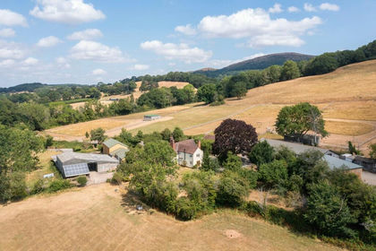
- Price
- Guide Price£1,975,000
- Size
- 28.04 acres
Colwall, Malvern, Herefordshire, Colwall, Herefordshire, County of WR13 England
Added on 11/09/2026House with Land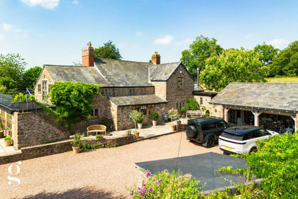
- Price
- Guide Price£1,950,000
- Size
- 10 acres
Little Birch, Hereford, Much Birch, Herefordshire, County of HR2 England
Added on 15/07/2026House with Land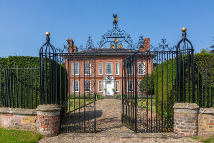
- Price
- Guide Price£1,800,000
- Size
- 12 acres
Hereford, Herefordshire, HR2, Haywood, Herefordshire, County of HR2 England
Added on 28/04/2026Country Home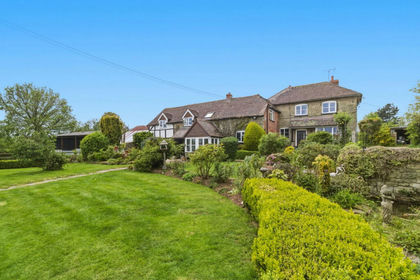
- Price
- Guide Price£2,200,000
- Size
- 130 acres
Added on 25/07/2026Farm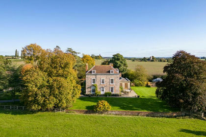
- Price
- Offers Over£1,750,000
- Size
- 14 acres
Nr Malvern, Worcestershire, Pendock, Worcestershire WR13 England
Added on 29/01/2026House with Land
- Price
- Guide Price£2,400,000
- Size
- 17.03 acres
Alfrick, Worcester, Worcestershire, Suckley, Worcestershire WR6 England
Added on 29/01/2026Country Home