Church Lane, East Lydford
- Land size
- 5 acres
- Bedrooms
- 4
- Bathrooms
- 2
Key Features
- Charming country cottage
- c. 5 acres of level land, and mixed woodland
- Fabulous views
- Edge of village location
- Bags of character
- Extensive stabling
- Easy access to Castle Cary railway station and the A303
- Set between Somerton and Castle Cary
- A great pub within walking distance
- Integral annexe
Description
CARY COTTAGE, CHURCH LANE, EAST LYDFORD, TA11 7HD
PRICE GUIDE £800,000 - £825,000
A fabulous country cottage with c. 5 acres of level land, pasture and woodland on the outskirts of this popular village between Glastonbury and Castle Cary.
The accommodation includes a porch, sitting room, kitchen & breakfast room, conservatory/dining room, second sitting room, cloakroom, ground floor bedroom with en-suite shower room and separate entrance, three further bedrooms and a family bathroom.
Outside there is a driveway, ample parking, a large lawn, a walled garden, stabling, c. 3 acres of paddock, a large orchard and a woodland area designated for wildlife with a large pond. Properties like this rarely come to the market so early viewing is strongly recommended.
Accommodation
Cary Cottage has stone elevations under a tiled roof and sits on the outskirts of the village down a quiet no through lane. The house has been improved and extended over the years and now provides a lovely home with plenty to offer for those who want a country lifestyle. The driveway, flanked by lawn, trees and a well, leads to a parking area in front of the cottage.
A porch with space to hang coats enters the kitchen & breakfast room. As with much of the rest of the house there are stone walls and quality oak doors giving a feel of character. The kitchen has a stone floor and ample storage space, with painted solid-timber units. There is easily enough room for a large dining table. The sitting room enjoys a fabulous stone inglenook fireplace with wood burner and a dual aspect allowing the light to flood in.
An inner hall leads to the second sitting room (with kitchenette at one end), which adjoins the ground floor bedroom with en-suite shower room: this part of the house has its own entrance and has served as an annexe. A door from the second sitting room leads to the rear walled garden. Also on the ground floor is a conservatory/dining room leading off the kitchen which makes the most of the stunning views across Cary Cottage's land. The triple aspect conservatory has a door leading outside and also houses the oil fired boiler.
Back into the inner hallway is a cloakroom with a w/c and plumbing for a washing machine. The stairs rise to the first floor from the inner hall. The master bedroom and second bedroom are of generous proportions and enjoy delightful views over the land towards the stables, pond and beyond. The third bedroom is a single in size and looks over the rear walled garden and onto the fields behind. Also on this floor is a bathroom with a shower unit...
Outside
This is where the property really comes into its own. The entire property totals c. 5 acres, which includes a 3-acre level grazing field, a large established orchard, a large pond and a large lawn. The level pasture would be ideal for equestrian purposes with outbuildings including three loose boxes, a hay store, a tack room and a second hay store. There is a separate gate to allow access for horse boxes and machinery, and it's worth noting the stables are in plain sight of the house for security purposes. There is an orchard of fruit trees including plum, apple, pear, quince and medlar. Behind the house is a walled garden with a grape vine and soft fruit bushes.
What makes this property truly unique is a wildlife area consisting of a large pond with a jetty and a substantial area of mixed woodland - the perfect place for wildlife and wildlife lovers alike. There is also a small hill with seating, which creates an ideal vantage point to take in the views.
About the area
East Lydford is a small Somerset village in beautiful countryside between the towns of Wells, Somerton, Glastonbury and Castle Cary. The villages of East and West Lydford are centred on the old Parish Churches and bridges over the River Brue and have a very active community with a good number of societies and organisations. Within a few minutes is a small local Budgens supermarket which also provides newspapers, off-licence etc. There are many good pubs and restaurants in the area, the closest being the highly regarded Cross Keys pub within walking distance.
The major towns of the area, being Bristol, Bath, Taunton and Yeovil, are all within commuting distance, and Castle Cary station (10 mins) has a main rail line to London. There are good state and independent schools close by, including Keinton Mandeville C of E primary, Strode College, Millfield, Sherborne, Wells Cathedral, the Bruton schools, Downside and Hazlegrove.
Services and other notes
Oil fired central heating. Mains sewerage, electricity and water supply.
There is a covenant over the stable block which stipulates against planning for conversion.
Directions
From Castle Cary, head towards Somerton on the B3153. Pass through Lovington and as you enter East Lydford, take the first right-hand turn onto Church Lane. Continue until the road bends round to the left, at which point head straight on down the no-through lane and Cary Cottage will be after a few yards on your right.
Important Notice
Roderick Thomas, their clients and any joint agents state that these details are for general guidance only and accuracy cannot be guaranteed. They do not constitute any part of any contract. All measurements are approximate and floor plans are to give a general indication only and are not measured accurate drawings. No guarantees are given with regard to planning permission or fitness for purpose. No apparatus, equipment, fixture or fitting has been tested. Items shown in photographs are not necessarily included. Purchasers must satisfy themselves on all matters by inspection or otherwise. VIEWINGS - interested parties are advised to check availability and current situation prior to travelling to see any property.
Map Location
Property details
- Tenure
- Freehold
- Council Tax Band
- E
- Date Posted
- 2026-03-27
Market Value Analysis
Compared with 462 Homes with Land listings in South West England (5+ acres).
Utilities & Restrictions
Utilities
- Electricity
- Ask Agent
- Water
- Ask Agent
- Heating
- Ask Agent
- Broadband
- Ask Agent
- Sewerage
- Ask Agent
Rights & Restrictions
- Public Rights of Way
- Ask Agent
- Private Rights of Way
- Ask Agent
- Listed Property
- Ask Agent
- Restrictions
- Ask Agent
Listed status, conservation areas and planning constraints for this location are in the full report.
Property Features
- Accessibility
- Ask Agent
- Parking
- Driveway
- Garden
- Private Garden
Beyond the particulars: planning activity, flood history, heritage and ground risks, checked for this exact spot.
Connectivity
Broadband
Fastest speed available at this postcode
1.8 Gbps
Gigabit full fibre
Suitable for
- 4K streaming on every screen
- Full-time home working
- Online gaming & big downloads
Mobile signal
Predicted 4G and 5G signal; indoor signal depends on building materials.
Ofcom Connected Nations postcode-level predictions. Speeds and signal are modelled, not measured, and vary between addresses and providers.
Signal is the easy part. Planning activity, flood history and protected designations here are in the full report.
Nearest Schools
Primary
- Lovington Church of England Primary School1.1 milesOfsted: Inadequate
- Ages
- 4 to 11
- Pupils
- 35
- Type
- Academy sponsor led
- Faith
- Church of England
- Keinton Mandeville Primary School1.7 milesOfsted: Good
- Ages
- 4 to 11
- Pupils
- 149
- Type
- Community school
- Baltonsborough Church of England VC Primary School2.9 milesOfsted: Requires improvement
- Ages
- 4 to 11
- Pupils
- 70
- Type
- Academy converter
- Faith
- Church of England
- Charlton Mackrell CofE Primary School3.4 milesOfsted: Good
- Ages
- 4 to 11
- Pupils
- 89
- Type
- Voluntary controlled school
- Faith
- Church of England
- Butleigh Church of England Primary School3.6 milesOfsted: Good
- Ages
- 2 to 11
- Pupils
- 98
- Type
- Academy converter
- Faith
- Church of England
Secondary
- Ansford Academy4.3 milesOfsted report card · Feb 2026
- Ages
- 11 to 16
- Pupils
- 469
- Type
- Academy converter
- Crispin School Academy6.4 milesNo Ofsted rating
- Ages
- 11 to 16
- Pupils
- 978
- Type
- Academy converter
- Sexey's School6.5 milesOfsted: Good
- Ages
- 11 to 18
- Pupils
- 633
- Type
- Academy converter
- Faith
- Church of England
- St Dunstan's School6.9 milesOfsted: Good
- Ages
- 11 to 16
- Pupils
- 529
- Type
- Academy converter
- Whitstone8 milesOfsted: Good
- Ages
- 11 to 16
- Pupils
- 545
- Type
- Academy converter
Distances are straight-line from the advertised location. Source: the national school registers (DfE, Welsh Government, Scottish Government) and Ofsted.
Schools are just the start: sold prices nearby, planning activity and any flood history are in the full report.
Amenities
Supermarket
GP surgery
Pharmacy
Hospital
Green space
Straight-line distances from the advertised location. Sources: NHS records, Geolytix supermarket locations, OS Open Greenspace and the national trails registers.
The area stacks up? Now check the location itself: planning nearby, protected designations and past flooding.
Getting Around
Nearest station
Nearest bus stop
Typical drive times
Straight-line distances from the advertised location; drive times are typical free-flow times over OpenStreetMap road data, so allow more at peak. Public transport locations from DfT NaPTAN.
Easy to reach matters. So do planning activity, flood history and ground risks: all in the full report.
Flood Risk
Environment Agency open data, checked around the advertised map pin for the listed acreage. Long-term risk counts flood defences; the planning map's flood zones do not. Provided by LandSale, not the listing agent, and not part of the agent's particulars. Risk varies across a holding, so verify before committing.
Rivers and the sea
Planning map: Flood Zone 3.
Surface water
Not at the pin: mapped about 30 metres away.
These bandings are the summary. Where this location sits on the flood maps, plus planning activity, heritage and ground risks, is in the full report.
Important notice: Information, maps and tags on this page are drawn from the advertising agent's marketing materials or generated automatically. LandSale has not verified them. Relying on these details is at your own risk, always carry out independent checks before committing to a purchase.
LandSale full disclaimer
Marketing information only - not formal particulars. The details on this website are provided for general guidance and do not constitute an offer or contract. Neither LandSale nor the advertising estate/land agent accepts responsibility for any inaccuracy.
1. Source of information
- Listing content: Core description, asking price, tenure, measurements, photographs and planning history originate from the marketing materials of the advertising estate or land agent. LandSale does not author this content and cannot guarantee its accuracy.
- Automated tags & categorisation: Property type, land-use class, acreage bands and similar labels may be applied by machine-learning models. They are intended as a helpful guide only and may not reflect the property's legal status or permitted use.
- Third-party & enriched data layers: Maps, boundary outlines, planning designations, soil reports, broadband coverage and other environmental or location-based insights are licensed from external suppliers. Such data are supplied “as is", may be incomplete or out of date and are subject to change without notice.
2. Verification required
Prospective purchasers must verify critical matters, including but not limited to planning permission, title boundaries, public rights of way, environmental constraints, acreage, services, access and VAT status, through their own inspections, specialist surveys, legal advisers and the selling agent before relying on the information or entering into any contract.
3. No warranty or liability
LandSale gives no warranty, express or implied, as to the accuracy, completeness or fitness for any particular purpose of the information displayed. LandSale shall not be liable for any loss, damage, cost or expense arising directly or indirectly from any use of or reliance on such information, save where liability may not be excluded by law.
4. Updates & feedback
If you believe any detail on this listing is inaccurate, please let us know. We will investigate and, where appropriate, update the listing or notify the agent.
© LandSale | Version 1.3 - August 2026
Listing agent
Roderick Thomas, Castle Cary
2 High Street Castle Cary BA7 7AW
Similar properties for sale
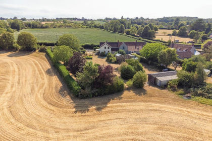
- Price
- Guide Price£650,000
- Size
- 4 acres
Barton Road, Butleigh, Glastonbury, Butleigh, Somerset BA6 England
Added on 12/09/2026House with Land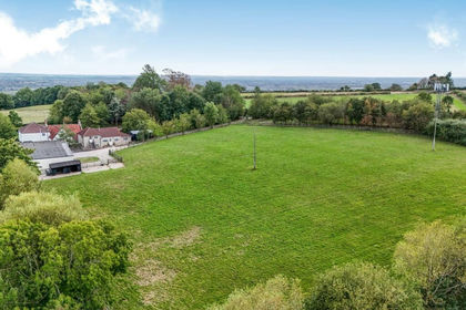
- Price
- Guide Price£825,000
- Size
- 7 acres
Ditcheat Hill, Ditcheat, BA4, Ditcheat, Somerset BA4 England
Added on 14/09/2026House with Land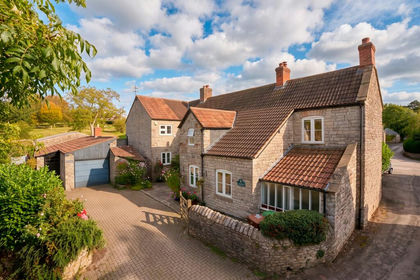
- Price
- Guide Price£900,000
- Size
- 2.4 acres
Added on 11/10/2026House with Land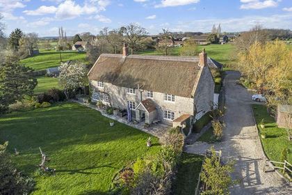
- Price
- Guide Price£895,000
- Size
- 4 acres
Added on 28/03/2026Cottage
- Price
- Guide Price£900,000
- Size
- 3 acres
Holton, Wincanton, Somerset, BA9, Holton, Somerset BA9 England
Added on 03/06/2026House with Land
- Price
- Guide Price£900,000
- Size
- 3 acres
Holton, Wincanton, Somerset, BA9, Holton, Somerset BA9 England
Added on 03/06/2026House with Land
- Price
- Guide Price£775,000
- Size
- 2 acres
North Cheriton SOMERSET, North Cheriton, Somerset BA8 England
Added on 08/10/2026Barn Conversion
- Price
- Guide Price£1,000,000
- Size
- 2.25 acres
Historic house close to Wells, Croscombe, Somerset BA5 England
Added on 24/09/2026House with Land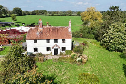
- Price
- Guide Price£700,000
- Size
- 17.34 acres
Charlton Musgrove, Wincanton, Charlton Musgrove, Somerset BA9 England
Added on 14/08/2026Farmhouse
- Price
- Guide Price£900,000
- Size
- 2 acres
Paradise Cottage, Paradise, Langport, Somerset, TA10, Huish Episcopi, Somerset TA10 England
Added on 04/06/2026Cottage