Rose Villa, Bowers Bent, Cotes Heath, Stafford
- Land size
- 1.23 acres
- Bedrooms
- 5
- Bathrooms
- 1
Key Features
- Characterful detached Staffordshire Cottage
- Set in 1.23 Acres
- Private rural location
- Range of outbuildings
- Small Paddock
- Private Driveway
- All enquires to Ashbourne
Description
Rose Villa is a characterful detached Staffordshire cottage set on 1.23 acres ( 0.495 hectares).
Located at Bowers bent on sandy Bank, it offers a private rural location, with minimal passing traffic.
Description - Rose Villa is a characterful detached Staffordshire cottage set in 1.23 acres (0.495 hectares). Located at Bowers Bent on Sandy Bank, it offers a private rural location, with minimal passing traffic.
The property includes a range of outbuildings, a small paddock and private drive. The traditional cottage features characterful living spaces, including a kitchen, three cosy reception rooms including a sitting room with a feature fireplace, large dining room and snug.
The first floor has five large bedrooms and a family bathroom.
The property retains a wealth of character with features including beams, parquet flooring and an imposing, spacious hallway. The grounds also boast mature trees, shrubs, and a lawned garden with outbuildings. This property is ideal for a country house lifestyle, or smallholding.
Ground Floor - Entrance Porch
3.90m (timber) x 1.27m
Timber framed porch with tiled floor.
Hallway
3.40m x 3.89m Max (11.15 ft x 12.76 ft)
With high ceilings complimented by a grand oak front door with panelling, Parquet flooring and a feature staircase with oak banister. There is also cloaks cupboard.
Kitchen
4.23m x 3.37m (13.88 ft x 11.06 ft) max
Range of fitted wooden units with stainless steel sink unit, integrated dishwasher, plumbing for washing machine and tiled vinyl floor. Stable door to outside. Wooden tongue and groove panelling to one wall.
Dining Room
An L shaped room measuring, 3.34m x 5.26m plus 4.50m x 2.15m (10.96 ft x 17.26 ft and 14.76 ft x 7.05 ft) A large entertaining space currently utilised as a L shaped dining area and sitting area with large windows and French doors overlooking the garden.
Snug
2.65 x 3.59m (8.69 ft x 11.78 ft)
A cosy snug with glazed double doors to dining room.
Sitting Room
3.55m x 3.94m Max (11.65 ft x 12.93 ft)
Sitting room with feature fireplace with brick surround, slate hearth. Beamed ceiling, spotlights and carpeted floor.
Cloakroom
1.39m x 1.56m with W.C. and hand wash basin.
Garage
4.83 Max x 5.30 Max (15.85 ft x 17.39 ft )
Large Garage with electric door.
First Floor - Bedroom 1
4.8m Max x 3.81 Max (15.75 ft x 12.50 ft) + Storage
Large front facing double bedroom with built-in storage cupboards and a stained glass window feature.
Bedroom 2
4.26m x 2.98m (13.98 ft x 9.78 ft)
Large double bedroom with dormer window overlooking the garden. Fitted storage cupboards and window seat with radiator to front. This room is currently utilised as a large office space and has access to airing cupboard.
Bedroom 3
3.40m x 2.86m Max (11.15 ft x 9.38 ft)
Small double bedroom with book shelves and dormer window which overlooks the garden. Main loft access is located outside this bedroom.
Bedroom 4
2.81m Min 3.64 Max x 3.68 Min 4.03 Max (12.07 ft x 13.22 ft)
Double bedroom which has a unique shower within false wardrobes along side a vanity unit with basin . There is also a built in wardrobe for storage.
Bedroom 5
3.65m Max x 2.64m (11.98 ft x 8.66 ft)
Small double bedroom with fitted wardrobe and dressing table.
Bathroom
1.57m x 3.03m (5.15 ft x 9.94 ft)
White suite comprising WC, bath with shower over, complimented by tiled walls , a heated towel rail and fitted storage cupboard.
Externally - The property enjoys a tranquil garden setting within a generous plot extending to approximately half an acre. The garden is predominantly laid to lawn with shrub borders and an ornamental pond.
Outbuildings comprising a brick-built barn beneath a tiled roof, WC and Utility. 8.80m x 2.22m (28.9 ft × 7.3 ft )
With a brick workshop formerly utilised as stabling, with original hay rack . Adjoining is a two-bay timber-framed open fronted store. 4.78m x 4.08m (15.7 ft × 13.4 ft)
The front driveway provides enough space to park three—four vehicles.
In addition , the property benefits from an adjoining paddock extending to approximately 0.76 acres (0.308 hectares). The paddock provides excellent amenity potential, ideally suited to equestrian use, or those simply seeking additional outdoor space. The land is gently undulating and offers a pleasant outlook over the surrounding countryside, enhancing the overall sense of privacy and rural setting of Rose Villa.
General Information -
Directions - From Stone, head North on the A51 to Meaford Roundabout taking the 1st exit on to the A51. Continue on the A51 for 3.6 miles and turn left opposite the former Pumping Sation following signs for Cranberry, Standon and Bowers. Follow the road for 0.8 miles and then turn right over the railway bridge onto Sandy Bank. Rose Villa is located 0.2 miles down the lane and is the first house on the left.
Location - Located on Sandy Bank at Bowers Bent between Bowers and the village of Cranberry. Approximately 0.9 miles from the A51 which connects Stone to Nantwich. Other Nearby Villages include Standon, Swynnerton and Eccleshall. The property is 5.4 miles from junction 15 of the M6.
Services - Mains water and electricity are connected to the Cottage. The property is heated by an oil fired central heating system which also provides hot water. There is also an electric immersion. The drainage is understood to be via a private septic tank system .
Fixtures And Fittings - Only those fixtures and fittings referred to in the sale particulars are included in the purchase price. Bagshaws have not tested any equipment, fixtures, fittings or services and no guarantee is given that they are in good working order.
Sporting, Timber And Mineral Rights - It is understood that these are included in the sale as far as they exist.
Tenure And Possession - The property is sold freehold with vacant possession.
Rights Of Way, Wayleaves And Easements - The paddock is crossed by public footpath which runs south off Sandy Bank through the paddock onto adjoining land. There is a Wayleave of overhead electric poles and cables in the paddock. We understand the vendor receives a payment from National Grid in relation to the Wayleave.
Local Authority - Staffordshire Borough Council.
Method Of Sale - Private Treaty
Viewing - Strictly by Appointment only. Please contact our Ashbourne office to book a viewing on .
Epc Rating - TBC
Council Tax Band - F
Money Laundering Regulations - Due to recent changes in legislation, all buyers must provide relevant documentation in order to provide proof of their identity and place of residence. The documentation collected is for this purpose only and will not be disclosed to any other party. This documentation must be provided at the time the offer is submitted.
Broadband Connectivity - It is understood that the property benefits from a satisfactory broadband service; however, due to the property's location, connection speeds may fluctuate. We recommend that prospective purchasers consult to obtain an estimated broadband speed for the area.
Mobile Network Coverage - Owing to the property's location, mobile network coverage may be limited. Prospective purchasers are advised to consult the website of Ofcom ( to obtain an estimate of the signal strength for this area.
Agents Notes - Bagshaws LLP have made every reasonable effort to ensure these details offer an accurate and fair description of the property. The particulars are produced in good faith, for guidance only and do not constitute or form an offer or part of the contract for sale. Bagshaws LLP and their employees are not authorised to give any warranties or representations in relation to the sale and give notice that all plans, measurements, distances, areas and any other details referred to are approximate and based on information available at the time of printing.
Map Location
Property details
- Tenure
- Freehold
- Council Tax Band
- F
- Date Posted
- 2026-02-28
Market Value Analysis
Compared with 1,044 Homes with Land listings in West Midlands (1+ acres).
Utilities & Restrictions
Utilities
- Electricity
- Ask Agent
- Water
- Ask Agent
- Heating
- Ask Agent
- Broadband
- Ask Agent
- Sewerage
- Ask Agent
Rights & Restrictions
- Public Rights of Way
- Ask Agent
- Private Rights of Way
- Ask Agent
- Listed Property
- Ask Agent
- Restrictions
- Ask Agent
Listed status, conservation areas and planning constraints for this location are in the full report.
Property Features
- Accessibility
- Ask Agent
- Parking
- Driveway
- Garden
- Garden
Beyond the particulars: planning activity, flood history, heritage and ground risks, checked for this exact spot.
Connectivity
Broadband
Fastest speed available at this postcode
80 Mbps
Superfast · available to 87% of premises
Suitable for
- HD streaming
- Video calls
- Web & social
Mobile signal
Outdoor predictions; indoor signal depends on building materials.
Ofcom Connected Nations postcode-level predictions. Speeds and signal are modelled, not measured, and vary between addresses and providers.
Signal is the easy part. Planning activity, flood history and protected designations here are in the full report.
Nearest Schools
Primary
- All Saints CofE (C) First School647 metresOfsted: Good
- Ages
- 5 to 9
- Pupils
- 41
- Type
- Voluntary controlled school
- Faith
- Church of England
- Springfields First School3.2 milesOfsted: Good
- Ages
- 3 to 9
- Pupils
- 138
- Type
- Community school
- Baldwins Gate CofE(VC) Primary School3.3 milesNo Ofsted rating
- Ages
- 3 to 11
- Pupils
- 188
- Type
- Voluntary controlled school
- Faith
- Church of England
- Tittensor CofE (C) First School3.4 milesOfsted: Good
- Ages
- 3 to 9
- Pupils
- 78
- Type
- Voluntary controlled school
- Faith
- Church of England
- Bishop Lonsdale Church of England Primary Academy4.3 milesOfsted: Good *
- Ages
- 3 to 11
- Pupils
- 287
- Type
- Academy converter
- Faith
- Church of England
Secondary
- Trentham Academy4.7 milesOfsted report card · Feb 2026
- Ages
- 11 to 16
- Pupils
- 794
- Type
- Academy converter
- Christ Church Academy4.9 milesOfsted report card · Apr 2026
- Ages
- 9 to 13
- Pupils
- 540
- Type
- Academy converter
- Faith
- Church of England
- Walton Priory Middle School5.1 milesOfsted: Good *
- Ages
- 9 to 13
- Pupils
- 542
- Type
- Community school
- Alleyne's Academy5.1 milesNo Ofsted rating
- Ages
- 13 to 18
- Pupils
- 846
- Type
- Academy converter
- Clayton Hall Academy5.2 milesOfsted: Good
- Ages
- 11 to 16
- Pupils
- 828
- Type
- Academy converter
* Latest graded judgement covers quality of education only; no overall grade was issued under the 2024-25 inspection framework.
Distances are straight-line from the advertised location. Source: the national school registers (DfE, Welsh Government, Scottish Government) and Ofsted.
Schools are just the start: sold prices nearby, planning activity and any flood history are in the full report.
Amenities
Supermarket
GP surgery
Pharmacy
Hospital
Green space
Straight-line distances from the advertised location. Sources: NHS records, Geolytix supermarket locations, OS Open Greenspace and the national trails registers.
The area stacks up? Now check the location itself: planning nearby, protected designations and past flooding.
Getting Around
Nearest station
Nearest bus stop
Typical drive times
Straight-line distances from the advertised location; drive times are typical free-flow times over OpenStreetMap road data, so allow more at peak. Public transport locations from DfT NaPTAN.
Easy to reach matters. So do planning activity, flood history and ground risks: all in the full report.
Flood Risk
From Environment Agency flood map open data, checked around the advertised map pin and allowing for the listed acreage where known. This summary comes from LandSale, the advertising platform, not from the listing agent, and is not part of the agent's particulars. Risk can vary across a single holding, so verify anything critical through your own searches before committing.
Rivers and the sea
Mapped within the area searched, not at the advertised map pin itself.
Surface water
These bandings are the summary. Where this location sits on the flood maps, plus planning activity, heritage and ground risks, is in the full report.
Important notice: Information, maps and tags on this page are drawn from the advertising agent's marketing materials or generated automatically. LandSale has not verified them. Relying on these details is at your own risk, always carry out independent checks before committing to a purchase.
LandSale full disclaimer
Marketing information only - not formal particulars. The details on this website are provided for general guidance and do not constitute an offer or contract. Neither LandSale nor the advertising estate/land agent accepts responsibility for any inaccuracy.
1. Source of information
- Listing content: Core description, asking price, tenure, measurements, photographs and planning history originate from the marketing materials of the advertising estate or land agent. LandSale does not author this content and cannot guarantee its accuracy.
- Automated tags & categorisation: Property type, land-use class, acreage bands and similar labels may be applied by machine-learning models. They are intended as a helpful guide only and may not reflect the property's legal status or permitted use.
- Third-party & enriched data layers: Maps, boundary outlines, planning designations, soil reports, broadband coverage and other environmental or location-based insights are licensed from external suppliers. Such data are supplied “as is", may be incomplete or out of date and are subject to change without notice.
2. Verification required
Prospective purchasers must verify critical matters, including but not limited to planning permission, title boundaries, public rights of way, environmental constraints, acreage, services, access and VAT status, through their own inspections, specialist surveys, legal advisers and the selling agent before relying on the information or entering into any contract.
3. No warranty or liability
LandSale gives no warranty, express or implied, as to the accuracy, completeness or fitness for any particular purpose of the information displayed. LandSale shall not be liable for any loss, damage, cost or expense arising directly or indirectly from any use of or reliance on such information, save where liability may not be excluded by law.
4. Updates & feedback
If you believe any detail on this listing is inaccurate, please let us know. We will investigate and, where appropriate, update the listing or notify the agent.
© LandSale | Version 1.3 - August 2026
Similar properties for sale
 Added on 26/06/2026Barn Conversion
 Added on 27/06/2026Barn Conversion
- Price
- £450,000
Added on 28/08/2026Development Land
- Price
- Offers Over£635,000
Clayalders Bank, Eccleshall, ST21, Eccleshall, Staffordshire ST21 England
Added on 22/06/2026Barn Conversion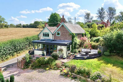
- Price
- £575,000
- Size
- 1.8 acres
Woodwall Green, Croxton, ST21, Eccleshall, Staffordshire ST21 England
Added on 29/07/2026House with Land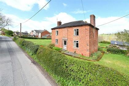
- Price
- Guide Price£475,000
- Size
- 2.92 acres
Cornes The Cottage, Offley Hay, Bishops Offley, Stafford, Eccleshall, Staffordshire ST21 England
Added on 01/08/2026House with Land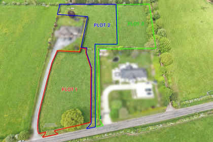
- Price
- Offers Over£400,000
Plot 1, Manor Road, Baldwins Gate, ST5, Whitmore, Staffordshire ST5 England
Added on 15/05/2026Building Plot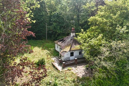
- Price
- Guide Price£500,000
- Size
- 2.95 acres
Station Road, Barlaston, ST12, Barlaston, Staffordshire ST12 England
Added on 15/09/2026Development Land Added on 01/06/2026Barn Conversion
- Price
- Offers Over£650,000
Cocknage Farm, Stoke-On-Trent, Barlaston, Staffordshire ST3 England
Added on 09/09/2026Barn Conversion