Self-build Plot, Crosombe
- Land size
- 0.4 acres
- Bedrooms
- 4
- Bathrooms
- 3
Key Features
- Building plot -Planning permission for a 'Grand Designs" style detached home in c. 0.4 acres
- Elevated position with fabulous views across the valley
- Located on a quiet lane on the edge of the village
- Planning for contemporary home with scope to design your own house, subject to additional planning approval
- 2023/0265/FUL - Sympathetic design following the contours of the valley - 366m2 (incl. garage)
- Circa 0.4 acre plot with timber storage shed
- Ample off road parking
- Village primary school & good local independent & secondary schools
- Thriving village with award winning pub, convenience shop, village hall, & community orchard
- 40 mins to Bristol Airport & 15 mins to Castle Cary Station with main line to London Paddington
Description
Property Description: Guide Price £300,000 - £350,000. Situated on the edge of the village, this contemporary and well designed self-build, three/four bedroom house with three bathrooms would be set within circa 0.4 acres of land. The views from the top of the site are are amazing with a vista over to the north of the village and beyond and views that stretch up the valley to the east.
The design of the house is well thought out with contemporary, light and bright accommodation including an open-plan style kitchen and a separate sitting room, both with bi-fold doors that open onto a covered terrace. There is a utility room, walk-in larder and plant room situated at the back of the house which are built into the hill. The bedrooms are on the first and second floor and all have large windows to take in the view. The principal suite has an ensuite bathroom and a dressing room and the design has incorporated plenty of storage.
.
The house has been designed with sustainability at the fore front and includes an air source heat pump for heating and hot water supply that would work in conjunction with Mechanical Ventilation with Heat Recovery (MVHR) to reduce the heating demand further. The MVHR would also filter the air that circulates throughout the property. The design also includes an array of photovoltaic panels which would supplement the electricity supply.
Outside: The garden falls down away from the proposed house and is bound on both side by hedges and trees making it very private. At the bottom of the garden is a wooden five-bar gate which leads to an old orchard with a timber shed. At the top of the site is an area of hard standing which will be the parking area for the house. There is ample space here for parking several cars and a carport (subject to planning).
Location: Located in the beautiful valley of the River Sheppey, Croscombe lies on the A371 to the east of Wells and the west of Shepton Mallet. Despite mentions in the Domesday Book, Croscombe first emerged in the 16th and 17th centuries with a boom in the wool trade. It is home to a beautiful medieval church and an award-winning pub, The George, which doubles up as the local shop. Croscombe has an active community and much to offer with classes from amateur dramatics to Tai Chi held in the village hall, as well as the Charter Market where villagers sell their local produce, a village orchestra, a village school, a playground and a sports field.
Just up the hill, the Rocky Mountain Nursery has an amazing fruit and vegetable stall every Thursday and Saturday and there are many countryside walks to enjoy in the area thanks to the village's many beautiful footpaths across the valley and beyond.
The historic city of Wells (approx. 3 miles) has a bustling High Street and provides a range of local amenities with four supermarkets (including Waitrose), a cinema, a leisure centre, numerous coffee shops, pubs and restaurants to choose from, several dentists and doctors and some fabulous independent shops. There are also famous historical landmarks such as the Cathedral and the Bishop Palace, as well as a twice weekly produce market.
Shepton Mallet (approx. 2 miles) is a vibrant and historic market town has a past dating back to Roman times and there is now a wealth of retail outlets including independent boutiques, cafes and bars as well as supermarkets and garden centres. The Charlton House Hotel & Spa is nearby with its award-winning restaurant in an elegant country house. Many cultural events are held throughout the year including the Lantern Festival, The Snowdrop Festival and the annual Carnival. Shepton Mallet has easy access to the Bath and West Show Ground with its various annual events and just a short drive away is the ever-increasing popular town of Bruton with its boutique shops, famous restaurants and world-renowned Hauser & Wirth Art Gallery.
There is an excellent range of both state and independent schools in the area including Croscombe C of E Primary School, The Blue School in Wells, Whitstone School in Shepton Mallet, Millfield, Wells Cathedral School, Strode College in Street, and numerous local primary schools.
Excellent transport links connect you to Bath, Bristol, and London, with Castle Cary station just 9 miles away and Bristol Airport within easy reach.
Planning Permission Ref. No: 2023/0265/FUL
Directions: SatNav = BA5 3RL
Council Tax: To be confirmed
Local Authority: Somerset Council -
Services: All services to be connected by the purchaser
Tenure: This property is freehold and is sold with vacant possession upon completion.
Disclaimer: Sandersons and their clients state that these details are for general guidance only and accuracy cannot be guaranteed. They do not form any part of any contract. All measurements are approximate, and floor plans are for general indication only and are not measured accurate drawings. No guarantees are given with any mentioned planning permission or fitness for purpose. No appliances, equipment, fixture or fitting has been tested by us and items shown in photographs are not necessarily included. Buyers must satisfy themselves on all matters by inspection or through the conveyancing process.
Additional Property Notes: Full planning granted for erection of a new dwelling. Planning Permission Ref. 2023/0265/FUL. A Community Infrastructure Levy may apply.
Identity Verification: Please note, Sandersons UK are obligated by law to undertake Anti Money Laundering (AML) Regulations checks on any purchaser who has an offer accepted on a property. We are required to use a specialist third party service to verify your identity. The cost of these checks is £60 inc. VAT per property and accepted offer. This is payable at the point an offer is accepted and our purchaser information form is completed, prior to issuing Memorandum of Sales to both parties respective conveyancing solicitors. This is a legal requirement and the charge is non-refundable.
Register for new listings before the portal launch:
Map Location
Property details
- Tenure
- Freehold
- Council Tax Band
- Ask Agent
- Date Posted
- 2026-02-20
Utilities & Restrictions
Utilities
- Electricity
- Ask Agent
- Water
- Ask Agent
- Heating
- Ask Agent
- Broadband
- Ask Agent
- Sewerage
- Ask Agent
Rights & Restrictions
- Public Rights of Way
- Ask Agent
- Private Rights of Way
- Ask Agent
- Listed Property
- Ask Agent
- Restrictions
- Ask Agent
Listed status, conservation areas and planning constraints for this location are in the full report.
Property Features
- Accessibility
- Ask Agent
- Parking
- Driveway
- Garden
- Garden
Beyond the particulars: planning activity, flood history, heritage and ground risks, checked for this exact spot.
Connectivity
Broadband
Fastest speed available at this postcode
1 Gbps
Gigabit full fibre
Suitable for
- 4K streaming on every screen
- Full-time home working
- Online gaming & big downloads
Mobile signal
Predicted 4G and 5G signal; indoor signal depends on building materials.
Ofcom Connected Nations postcode-level predictions. Speeds and signal are modelled, not measured, and vary between addresses and providers.
Signal is the easy part. Planning activity, flood history and protected designations here are in the full report.
Nearest Schools
Primary
- Croscombe Church of England Primary School463 metresOfsted: Requires improvement
- Ages
- 4 to 11
- Pupils
- 42
- Type
- Academy sponsor led
- Faith
- Church of England
- Bowlish Infant School1.5 milesNo Ofsted rating
- Ages
- 4 to 7
- Pupils
- 114
- Type
- Community school
- Horrington Primary School2 milesOfsted: Requires improvement
- Ages
- 4 to 11
- Pupils
- 100
- Type
- Academy converter
- Shepton Mallet Community Infants' School & Nursery2 milesNo Ofsted rating
- Ages
- 2 to 7
- Pupils
- 186
- Type
- Community school
- St Paul's Church of England VC Junior School2.1 milesOfsted: Good
- Ages
- 7 to 11
- Pupils
- 324
- Type
- Voluntary controlled school
- Faith
- Church of England
Secondary
- Whitstone2.2 milesOfsted: Good
- Ages
- 11 to 16
- Pupils
- 545
- Type
- Academy converter
- The Blue School2.9 milesNo Ofsted rating
- Ages
- 11 to 18
- Pupils
- 1,362
- Type
- Academy converter
- Faith
- Church of England
- St Dunstan's School6.2 milesOfsted: Good
- Ages
- 11 to 16
- Pupils
- 529
- Type
- Academy converter
- Crispin School Academy7.6 milesNo Ofsted rating
- Ages
- 11 to 16
- Pupils
- 978
- Type
- Academy converter
- Norton Hill Academy7.6 milesOfsted: Good *
- Ages
- 11 to 18
- Pupils
- 1,757
- Type
- Academy converter
* Latest graded judgement covers quality of education only; no overall grade was issued under the 2024-25 inspection framework.
Distances are straight-line from the advertised location. Source: the national school registers (DfE, Welsh Government, Scottish Government) and Ofsted.
Schools are just the start: sold prices nearby, planning activity and any flood history are in the full report.
Amenities
Supermarket
GP surgery
Pharmacy
Hospital
Green space
Straight-line distances from the advertised location. Sources: NHS records, Geolytix supermarket locations, OS Open Greenspace and the national trails registers.
The area stacks up? Now check the location itself: planning nearby, protected designations and past flooding.
Getting Around
Nearest station
Nearest bus stop
Typical drive times
Straight-line distances from the advertised location; drive times are typical free-flow times over OpenStreetMap road data, so allow more at peak. Public transport locations from DfT NaPTAN.
Easy to reach matters. So do planning activity, flood history and ground risks: all in the full report.
Flood Risk
Environment Agency open data, checked around the advertised map pin for the listed acreage. Long-term risk counts flood defences; the planning map's flood zones do not. Provided by LandSale, not the listing agent, and not part of the agent's particulars. Risk varies across a holding, so verify before committing.
Rivers and the sea
Planning map: Flood Zone 1.
Surface water
Not at the pin: mapped about 10 metres away.
These bandings are the summary. Where this location sits on the flood maps, plus planning activity, heritage and ground risks, is in the full report.
Important notice: Information, maps and tags on this page are drawn from the advertising agent's marketing materials or generated automatically. LandSale has not verified them. Relying on these details is at your own risk, always carry out independent checks before committing to a purchase.
LandSale full disclaimer
Marketing information only - not formal particulars. The details on this website are provided for general guidance and do not constitute an offer or contract. Neither LandSale nor the advertising estate/land agent accepts responsibility for any inaccuracy.
1. Source of information
- Listing content: Core description, asking price, tenure, measurements, photographs and planning history originate from the marketing materials of the advertising estate or land agent. LandSale does not author this content and cannot guarantee its accuracy.
- Automated tags & categorisation: Property type, land-use class, acreage bands and similar labels may be applied by machine-learning models. They are intended as a helpful guide only and may not reflect the property's legal status or permitted use.
- Third-party & enriched data layers: Maps, boundary outlines, planning designations, soil reports, broadband coverage and other environmental or location-based insights are licensed from external suppliers. Such data are supplied “as is", may be incomplete or out of date and are subject to change without notice.
2. Verification required
Prospective purchasers must verify critical matters, including but not limited to planning permission, title boundaries, public rights of way, environmental constraints, acreage, services, access and VAT status, through their own inspections, specialist surveys, legal advisers and the selling agent before relying on the information or entering into any contract.
3. No warranty or liability
LandSale gives no warranty, express or implied, as to the accuracy, completeness or fitness for any particular purpose of the information displayed. LandSale shall not be liable for any loss, damage, cost or expense arising directly or indirectly from any use of or reliance on such information, save where liability may not be excluded by law.
4. Updates & feedback
If you believe any detail on this listing is inaccurate, please let us know. We will investigate and, where appropriate, update the listing or notify the agent.
© LandSale | Version 1.3 - August 2026
Listing agent
Sandersons, Wells
1 The Guard House, Guard House Lane, Wells, BA5 1GD
Similar properties for sale
- Price
- Offers in Excess of£350,000
Leighton Lane, Evercreech, BA4, Evercreech, Somerset BA4 England
Added on 29/01/2026Barn
- Price
- Guide Price£300,000
- Size
- 1.29 acres
Land with Planning, Brangay Lane, Rodney Stoke, Cheddar, BS27, Rodney Stoke, Somerset BS27 England
Added on 28/07/2026Development Land
- Price
- £350,000
- Size
- 1.4 acres
Added on 08/07/2026Building Plot
- Price
- Guide Price£350,000
Development Site | Radstock | Planning Granted, Radstock, Bath and North East Somerset BA3 England
Added on 28/05/2026Development Land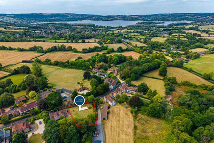
- Price
- Guide Price£280,000
- Size
- 0.27 acres
Building Plot | Stowey, Stowey-Sutton, Bath and North East Somerset BS39 England
Added on 09/09/2026Building Plot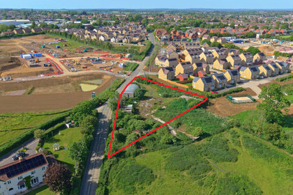
- Price
- Offers in Region of£300,000
- Size
- 0.65 acres
Land Off The B3092, Frome, Somerset, BA11, , Somerset BA11 England
Added on 22/07/2026Development Land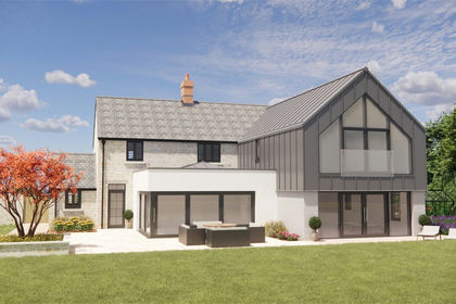
- Price
- Guide Price£280,000
- Size
- 1.31 acres
Land To The South Of South Street, West Camel, Yeovil, BA22, Yeovil, Somerset BA22 England
Added on 09/07/2026Building Plot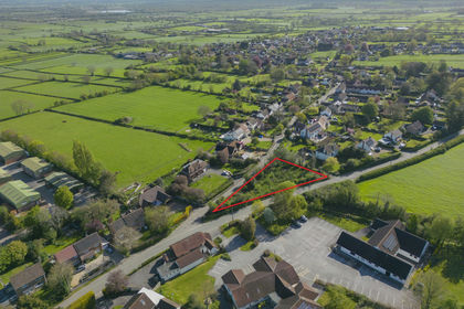
- Price
- Offers in Excess of£225,000
- Size
- 0.38 acres
Land At Corner Close, Edington, Nr. Bridgwater, TA7, Nr. Bridgwater, Somerset TA7 England
Added on 02/05/2026Building Plot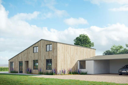
- Price
- Guide Price£350,000
- Size
- 5.4 acres
The Barn at Oldford with full planning, Oldford, Frome, BA11, Selwood, Somerset BA11 England
Added on 12/02/2026Conversion Land Added on 19/03/2026Barn