Millbrook, Torpoint, PL10
- Land size
- 6 acres
- Dwelling size
- 2116 sqft
- Bedrooms
- 3
- Bathrooms
- 1
Key Features
- Delightful opportunity to acquire a smallholding extending to 6 acres (2.42 ha) in all
- Three bedroom bungalow subject to an Agricultural Occupancy Condition
- Generous sized kitchen/diner
- Large sized garden wrapping around the property
- Double integral garage (extending to 37.60 square metres)
- Situated on the periphery of the village of Millbrook
- Offers great potential for modernisation in a rural yet accessible location
- Sale by Private Treaty
Description
DIRECTIONS
what3words location - sweetly.regretted.perfume
From Trerulefoot take the road signposted Torpoint. Having passed through Polbathic proceed for approximately 2 miles and then bear right as signposted ‘Millbrook’. Having driven through Crafthole proceed on the road towards Millbrook. On entering the village of Millbrook, the property will be the first bungalow on the right signposted Higher Hounster Farm.
SITUATION
Millbrook is a South East Cornwall village on the Rame Peninsula, around 4 miles south of Saltash and directly across the water from the naval city of Plymouth. Set at the head of a tidal creek framed by the Lynher and Tamar rivers and the sea, the area is designated as an Area of Outstanding Natural Beauty.
The village offers a good selection of everyday amenities, including a Spar with post office, a Co-op, primary school, village hall, newsagent and several independent shops. The nearby beaches at Whitsand Bay and Cawsand Bay provide opportunities for swimming, sailing and a variety of other watersports, while Mount Edgcumbe Country Park offers extensive coastal and countryside walking routes.
Plymouth, the main retail hub west of Exeter, lies roughly 8 miles away and provides a comprehensive range of shops, services and leisure facilities, as well as ferry links to France and Spain.
DESCRIPTION
Higher Hounster Farm features a detached three-bedroom bungalow (subject to an Agricultural Occupancy Condition) set on a generous plot in an elevated position on the edge of the attractive village of Millbrook. While the property would benefit from some modernisation internally, it presents an excellent opportunity for buyers and offers scope for extension, subject to obtaining the necessary planning consents. This unique property offers great potential for modernisation, making it an exciting opportunity for buyers.
The property extends internally to 2,116 square feet (196.6 square metres) to include the double garage, and comprises the following accommodation :-
Front entrance porch, entrance hallway, utility room, outside WC, kitchen, lounge, conservatory, airing cupboard, bedroom 1, bedroom 2, bedroom 3, separate WC, bathroom.
Outside
Approached via a gated tarmac driveway giving access to the front & rear of the property, including access to the agricultural land which leads off the council-maintained highway leading into the village of Millbrook. The property is positioned within a spacious, gently sloping garden wrapping around the east and south sides of the property, framed by mature shrub and flower borders. Former bird enclosures and a selection of old vegetable plots with raspberry canes offer scope for creative planting or a productive kitchen garden, while a greenhouse provides further growing space.
The agricultural land is situated on the west side of the property itself, extending to approximately 6 acres (2.42 hectares). There are two timber frame sheds as shown on the floorplan which are suitable for storage purposes.
Double Garage
Double doors, concrete floor, electric light and power points. Offering potential scope for conversion/ extension in the future (subject to obtaining the necessary planning consents).
The whole stands in mature gardens with small lawn area and close by there are small Poultry Houses with outdoor run. Also close by is an aluminium framed Greenhouse and two other Greenhouses of plastic construction.
Directly contiguous to the conservatory is a small patio with pond adjacent, close by is the domestic oil tank.
Services
Mains water and electricity. Private septic tank drainage. Oil fired Raeburn. Night storage heaters.
Verified Material Information
Council Tax band: B
Tenure: Freehold
Property type: Bungalow
Property construction: Standard construction
Energy Performance rating: E
Electricity supply: Mains electricity
Solar Panels: No
Other electricity sources: No
Water supply: Mains water supply
Sewerage: Septic tank
Heating: Night storage heaters. No central heating.
Heating features: Double glazing, Aga/Rayburn, and Open fire
Broadband: FTTP (Fibre to the Premises)
Mobile coverage: O2 - OK, Vodafone - Good, Three - OK, EE - OK
Parking: Garage, Driveway, Off Street, Rear, and Private
Building safety issues: No
Restrictions - Listed Building: No
Restrictions - Conservation Area: No
Restrictions - Tree Preservation Orders: None
Public right of way: No
Long-term area flood risk: No
Historical flooding: No
Flood defences: No
Coastal erosion risk: No
Planning permission issues: No
Accessibility and adaptations: None
Coal mining area: No
Non-coal mining area: Yes
All information is provided without warranty. Contains HM Land Registry data © Crown copyright and database right 2021. This data is licensed under the Open Government Licence v3.0.
The information contained is intended to help you decide whether the property is suitable for you. You should verify any answers which are important to you with your property lawyer or surveyor or ask for quotes from the appropriate trade experts: builder, plumber, electrician, damp, and timber expert.
To ensure legal compliance, we require our sellers to complete a Property Information Questionnaire or provide a Material Information Guide along with the title document. If available, please scan the QR code or access the additional online material information. Alternatively, you can contact our team for this information.
The information contained is intended to help you decide whether the property is suitable for you. You should verify any answers which are important to you with your property lawyer or surveyor or ask for quotes from the appropriate trade experts: builder, plumber, electrician, damp, and timber expert.
LOCAL AUTHORITY
Cornwall Council, Chy Trevail Beacon Technology Park Bodmin Cornwall PL31 2FR
Email: [email protected] Tel: 0300 1234151
LETTINGS
Luscombe Maye also offers an Award Winning Lettings service. If you are considering Letting your own property, or a buy to let purchase, please inform us and we can put you in contact with the Lettings team who would be delighted to discuss our range of bespoke services with you.
VIEWINGS
By appointment with Luscombe Maye Farms, Land & Smallholdings. Block viewing days will be offered for this property, so please ensure to telephone for details.
Map Location
Property details
- Tenure
- None
- Council Tax Band
- B
- Date Posted
- 2026-03-17
- Local Authority
- Cornwall Council
Price history
| Date | Change | Price |
|---|---|---|
| 13 Oct 2026 | Reduced 1.9% (−£10,000) | £515,000 |
| Until 13 Oct 2026 | Asking price | £525,000 |
Market Value Analysis
Compared with 121 Farms & Smallholdings listings in South West England (5+ acres).
Energy Performance Certificate
View the official EPC certificate for detailed energy efficiency information.
Running costs are one side. Planning activity, flood history and ground risks for this location are in the full report.
Property Brochure
Seen the details? The full report adds the independent checks: planning activity, flood history, heritage and ground.
Utilities & Restrictions
Utilities
- Electricity
- Ask Agent
- Water
- Ask Agent
- Heating
- Ask Agent
- Broadband
- Ask Agent
- Sewerage
- Ask Agent
Rights & Restrictions
- Public Rights of Way
- Ask Agent
- Private Rights of Way
- Ask Agent
- Listed Property
- Ask Agent
- Restrictions
- Ask Agent
Listed status, conservation areas and planning constraints for this location are in the full report.
Property Features
- Accessibility
- Level Access
- Parking
- Allocated Parking
- Garden
- Large Garden
Beyond the particulars: planning activity, flood history, heritage and ground risks, checked for this exact spot.
Connectivity
Broadband
Fastest speed available at this postcode
1.8 Gbps
Gigabit full fibre
Suitable for
- 4K streaming on every screen
- Full-time home working
- Online gaming & big downloads
Mobile signal
Predicted 4G and 5G signal; indoor signal depends on building materials.
Ofcom Connected Nations postcode-level predictions. Speeds and signal are modelled, not measured, and vary between addresses and providers.
Signal is the easy part. Planning activity, flood history and protected designations here are in the full report.
Nearest Schools
Primary
- Millbrook CofE Primary School734 metresNo Ofsted rating
- Ages
- 4 to 11
- Pupils
- 90
- Type
- Academy sponsor led
- Faith
- Church of England
- Fourlanesend Community Primary School0.9 milesOfsted: Good *
- Ages
- 4 to 11
- Pupils
- 58
- Type
- Community school
- Antony Church of England School1.9 milesOfsted report card · Jan 2026
- Ages
- 3 to 11
- Pupils
- 94
- Type
- Academy converter
- Faith
- Church of England
- Carbeile Junior School2.3 milesOfsted report card · Apr 2026
- Ages
- 7 to 11
- Pupils
- 268
- Type
- Community school
- Torpoint Nursery and Infant School2.5 milesOfsted: Good *
- Ages
- 3 to 7
- Pupils
- 204
- Type
- Community school
Secondary
- Torpoint Community College2.3 milesNo Ofsted rating
- Ages
- 11 to 18
- Pupils
- 668
- Type
- Foundation school
- UTC Plymouth3.1 milesOfsted: Good
- Ages
- 11 to 19
- Pupils
- 594
- Type
- University technical college
- Devonport High School for Boys3.4 milesOfsted: Good
- Ages
- 11 to 18
- Pupils
- 1,300
- Type
- Academy converter
- Gender
- Boys
- Millbay Academy3.6 milesOfsted: Good
- Ages
- 11 to 16
- Pupils
- 526
- Type
- Free schools
- Stoke Damerel Community College3.8 milesOfsted report card · Mar 2026
- Ages
- 11 to 18
- Pupils
- 1,292
- Type
- Academy converter
* Latest graded judgement covers quality of education only; no overall grade was issued under the 2024-25 inspection framework.
Distances are straight-line from the advertised location. Source: the national school registers (DfE, Welsh Government, Scottish Government) and Ofsted.
Schools are just the start: sold prices nearby, planning activity and any flood history are in the full report.
Amenities
Supermarket
GP surgery
Pharmacy
Hospital
Green space
Walking trail
Straight-line distances from the advertised location. Sources: NHS records, Geolytix supermarket locations, OS Open Greenspace and the national trails registers.
The area stacks up? Now check the location itself: planning nearby, protected designations and past flooding.
Getting Around
Nearest station
Nearest bus stop
Typical drive times
Straight-line distances from the advertised location; drive times are typical free-flow times over OpenStreetMap road data, so allow more at peak. Public transport locations from DfT NaPTAN.
Easy to reach matters. So do planning activity, flood history and ground risks: all in the full report.
Flood Risk
Environment Agency open data, checked around the advertised map pin for the listed acreage. Long-term risk counts flood defences; the planning map's flood zones do not. Provided by LandSale, not the listing agent, and not part of the agent's particulars. Risk varies across a holding, so verify before committing.
Rivers and the sea
Planning map: Flood Zone 1.
Surface water
Not at the pin: mapped about 60 metres away.
These bandings are the summary. Where this location sits on the flood maps, plus planning activity, heritage and ground risks, is in the full report.
Important notice: Information, maps and tags on this page are drawn from the advertising agent's marketing materials or generated automatically. LandSale has not verified them. Relying on these details is at your own risk, always carry out independent checks before committing to a purchase.
LandSale full disclaimer
Marketing information only - not formal particulars. The details on this website are provided for general guidance and do not constitute an offer or contract. Neither LandSale nor the advertising estate/land agent accepts responsibility for any inaccuracy.
1. Source of information
- Listing content: Core description, asking price, tenure, measurements, photographs and planning history originate from the marketing materials of the advertising estate or land agent. LandSale does not author this content and cannot guarantee its accuracy.
- Automated tags & categorisation: Property type, land-use class, acreage bands and similar labels may be applied by machine-learning models. They are intended as a helpful guide only and may not reflect the property's legal status or permitted use.
- Third-party & enriched data layers: Maps, boundary outlines, planning designations, soil reports, broadband coverage and other environmental or location-based insights are licensed from external suppliers. Such data are supplied “as is", may be incomplete or out of date and are subject to change without notice.
2. Verification required
Prospective purchasers must verify critical matters, including but not limited to planning permission, title boundaries, public rights of way, environmental constraints, acreage, services, access and VAT status, through their own inspections, specialist surveys, legal advisers and the selling agent before relying on the information or entering into any contract.
3. No warranty or liability
LandSale gives no warranty, express or implied, as to the accuracy, completeness or fitness for any particular purpose of the information displayed. LandSale shall not be liable for any loss, damage, cost or expense arising directly or indirectly from any use of or reliance on such information, save where liability may not be excluded by law.
4. Updates & feedback
If you believe any detail on this listing is inaccurate, please let us know. We will investigate and, where appropriate, update the listing or notify the agent.
© LandSale | Version 1.3 - August 2026
Listing agent
Luscombe Maye Farms & Land, Kingsbridge
62 Fore Street Kingsbridge TQ7 1PP
Call agent
01548800183Contact Luscombe Maye Farms & Land, Kingsbridge
62 Fore Street Kingsbridge TQ7 1PP
Call agent
01548800183Similar properties for sale
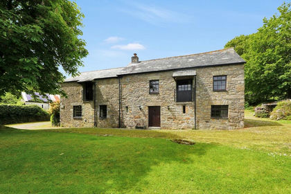
- Price
- Guide Price£575,000
- Size
- 4.31 acres
Crow's Nest, Liskeard, PL14, St. Cleer, Cornwall PL14 England
Added on 29/04/2026Smallholding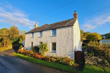
- Price
- £625,000
- Size
- 4.58 acres
Added on 07/10/2026House with Land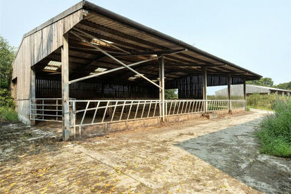
- Price
- Guide Price£425,000
- Size
- 33.11 acres
Added on 28/04/2026Small Farm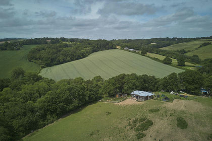
- Price
- Offers in Region of£400,000
- Size
- 11 acres
Added on 24/06/2026Smallholding