Old Mill Farmhouse, Trawsfynydd
- Land size
- 5 acres
- Bedrooms
- 10
- Bathrooms
- 8
Key Features
- 4 Bedroom Detached Property
- 7 Holiday Let Units
- Approximately 5 Acre Plot
- Fantastic Business Opportunity
- Abundance of Potential
- Ample Off-road Parking
- Outbuildings
- Solar Panels
- Spectacular Views of Llyn Trawsfynydd
- Beautiful Garden with G-Scale Model Railway
Description
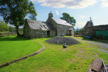
Discover Old Mill Farmhouse - a unique opportunity to own a spacious 4-bedroom detached home combined with seven self-contained holiday bedroom units with ensuites, perfect for a lucrative income stream! Set on approximately 5 acres of land, this charming property retains its original character, featuring stunning exposed timber beams throughout, offering the perfect canvas to modernise and personalise.
Enjoy the benefits of extensive grazing land, ample off-road parking and a beautiful enclosed garden. This exceptional garden features a bespoke G scale model railway, meticulously designed and seamlessly integrated into the landscape. The railway's charming locomotives navigate lush plantings and intricate cowboy western scenery, creating a captivating focal point for enthusiasts and guests alike. This unique blend of hobby and horticulture elevates the outdoor living experience to an extraordinary level. The property benefits from a range of versatile outbuildings - including a barn, a cozy lodge cabin, and a static caravan. Whether you are looking to create a thriving holiday let business or a private rural retreat with income potential, Old Mill Farmhouse offers endless possibilities in a stunning countryside setting.
The property is set in Trawsfynydd, a charming village located within the Snowdonia National Park. It is known for its stunning natural surroundings, including Llyn Trawsfynydd, a large man-made lake popular for fishing and water sports. The village has a rich history, with connections to the Welsh poet Hedd Wyn and the now-decommissioned Trawsfynydd nuclear power station. It offers a peaceful rural setting with easy access to outdoor activities such as hiking and cycling, while still being within reach of larger towns like Porthmadog and Dolgellau.
Accommodation:
Entrance Hall: (1.22m x 5.96m)
Lounge: (3.98m x 5.11m)
Kitchen: (2.16m x 4.71m)
Pantry: (1.49m x 4.13m)
Utility: (2.58m x 4.99m)
WC: (2.21m x 2.31m)
Dining Room: (3.16 x 7.28m)
Landing: (2.76m x 5.39m)
Bedroom 1: (3.64m x 3.13m)
Bedroom 2: (2.89m x 3.06m)
Bedroom 3: ( 2.91m x 2.69m)
Bedroom 4: (2.84m x 2.85m)
Bathroom: (1.93m x 1.96m)
Holiday Unit 1:
Bedroom 1: (3.67m 3.60m)
Shower Room: (2.39m x 1.25m)
Holiday Unit 2:
Bedroom 1: (2.62m x 3.22m)
Bedroom 2: (3.17m x 3.65m)
Shower Room: (2.43m x 1.64m)
Holiday Unit 3:
Bedroom 1: (5.10m x 2.74m)
Wet Room: (1.37m x 1.79m)
Holiday Unit 4:
Bedroom 1: (3.34m x 3.38m)
Shower Room: (1.87m x 1.75m)
Holiday Unit 5:
Bedroom 1: 2.54m x 2.89m)
Shower Room: (1.71m x 1.63m)
Holiday Unit 6:
Bedroom 1: (2.50m x 2.82m)
Shower Room: (1.62m x 1.69m)
Holiday Unit 7:
Bedroom 1: (4.35m x 3.08m)
Shower Room: (1.41m x 1.93m)
Services
The property benefits from mains electricity and water, a private septic tank, and solar panels installed on the main residence.
Heating
The main residence is heated via an oil-fired central heating system, while the holiday let units benefit from an Economy 7 electric heating system. The agent has tested no services, appliances or central heating system (if any).
Council Tax
Band A
Wayleaves, Easements & Rights Of Way
We are not aware of any wayleaves, easements, or rights of way affecting the property. The property will be sold subject to and with the benefit of all wayleaves, easements and rights of way whether mentioned in these particulars or not.
Planning
We are not aware of any active planning applications in place in relation to the property.
Article 4 Directive
If you own a residential dwelling (which is a main home) within the Eryri National Park area and wish to change the use to a second home, short term holiday let or specific mixed use, you will be required to obtain planning permission from Eryri's National Park Authority before undertaking the change of use. If you own a dwelling that is already in use as a second home, short term holiday let or specific mixed uses (before 1 June 2025) - the Article 4 Direction will not affect the current use.
Building Survey & Condition
No formal building survey has been made on the property in the last 12 months. The agents have not undertaken a full survey of the property.
Directions
From our office on Bala High Street, head northeast for approximately 0.2 miles and turn left onto Ffrydan Road, just before the bridge. Continue on this road for around 17 miles. As you enter Trawsfynydd, turn left onto the A470. After approximately 0.3 miles, take the first left just after crossing Afon Prysor. The property will be located on your right-hand side after about 110 yards.
What3Words: blasted.wheels.overt
Method of Sale
The property is to be offered for sale by private treaty.
Tenure & Possession
The freehold of the property is offered with vacant possession on completion of sale.
Local Authorities
Parc Cenedlaethol Eryri/Snowdonia National Park -
Viewings
Strictly by confirmed appointment with the vendor's agents R G Jones -
Health & Safety
Given the potential hazards of property, we ask you to be as vigilant as possible when making your inspection for your own personal safety.
DISCLAIMER
These particulars, whilst believed to be accurate, are set for guidance only and do not constitute any part of an offer or contract. Intending purchasers or purchasers should not rely on them as statements or representation of fact, but must satisfy themselves by inspection or otherwise of their accuracy. No person in the employment of Farmers Marts (R G Jones) Ltd has the authority to make or give any representations or warranty in relation to the property
Council Tax Band: A (Parc Cenedlaethol Eryri)
Tenure: Freehold
Map Location
Property details
- Tenure
- Freehold
- Council Tax Band
- A
- Date Posted
- 2026-01-29
Price history
| Date | Change | Price |
|---|---|---|
| 8 Oct 2026 | Reduced 7.7% (−£50,000) | £600,000 |
| Until 8 Oct 2026 | Asking price | £650,000 |
Market Value Analysis
Compared with 9 Holiday Lets listings in Wales (5+ acres).
Utilities & Restrictions
Utilities
- Electricity
- Mains, Solar Panels
- Water
- Mains
- Heating
- Electric Heating, Oil Heating
- Broadband
- Ask Agent
- Sewerage
- Septic Tank / Private
Rights & Restrictions
- Public Rights of Way
- Ask Agent
- Private Rights of Way
- Ask Agent
- Listed Property
- Ask Agent
- Restrictions
- Ask Agent
Listed status, conservation areas and planning constraints for this location are in the full report.
Property Features
- Accessibility
- Ask Agent
- Parking
- Driveway
- Garden
- Enclosed Garden
Beyond the particulars: planning activity, flood history, heritage and ground risks, checked for this exact spot.
Connectivity
Broadband
Fastest speed available at this postcode
80 Mbps
Superfast · available to 83% of premises
Suitable for
- HD streaming
- Video calls
- Web & social
Mobile signal
Predicted 4G and 5G signal; indoor signal depends on building materials.
Ofcom Connected Nations postcode-level predictions. Speeds and signal are modelled, not measured, and vary between addresses and providers.
Signal is the easy part. Planning activity, flood history and protected designations here are in the full report.
Nearest Schools
Primary
- Ysgol Bro Hedd Wyn669 metres
- Pupils
- 64
- Type
- Nursery, Infants & Juniors
- Language
- Welsh medium school / provision (including transitional)
- Ysgol Edmwnd Prys3.5 miles
- Pupils
- 18
- Type
- Nursery, Infants & Juniors
- Language
- Welsh medium school / provision (including transitional)
- Ysgol Bro Cynfal4.4 miles
- Pupils
- 40
- Type
- Nursery, Infants & Juniors
- Language
- Welsh medium school / provision (including transitional)
- Ysgol Manod6.1 miles
- Pupils
- 86
- Type
- Nursery, Infants & Juniors
- Language
- Welsh medium school / provision (including transitional)
- Ysgol Talsarnau6.3 miles
- Pupils
- 26
- Type
- Nursery, Infants & Juniors
- Language
- Welsh medium school / provision (including transitional)
Secondary
- Ysgol Y Moelwyn6.7 miles
- Pupils
- 355
- Type
- Secondary (ages 11-16)
- Language
- Welsh medium school / provision (including transitional)
- Ysgol Ardudwy8.4 miles
- Pupils
- 331
- Type
- Secondary (ages 11-16)
- Language
- Welsh medium school / provision (including transitional)
- Ysgol Eifionydd9.3 miles
- Pupils
- 373
- Type
- Secondary (ages 11-16)
- Language
- Welsh medium school / provision (including transitional)
- Bro Idris11 miles
- Pupils
- 541
- Type
- Middle (ages 3-16)
- Language
- Welsh medium school / provision (including transitional)
- YSGOL Godre'r Berwyn13 miles
- Pupils
- 571
- Type
- Middle (ages 3-19)
- Language
- Welsh medium school / provision (including transitional)
Distances are straight-line from the advertised location. Source: the national school registers (DfE, Welsh Government, Scottish Government) and Ofsted.
Schools are just the start: sold prices nearby, planning activity and any flood history are in the full report.
Amenities
Supermarket
GP surgery
Pharmacy
Green space
Straight-line distances from the advertised location. Sources: NHS records, Geolytix supermarket locations, OS Open Greenspace and the national trails registers.
The area stacks up? Now check the location itself: planning nearby, protected designations and past flooding.
Getting Around
Nearest station
Nearest bus stop
Typical drive times
Straight-line distances from the advertised location; drive times are typical free-flow times over OpenStreetMap road data, so allow more at peak. Public transport locations from DfT NaPTAN.
Easy to reach matters. So do planning activity, flood history and ground risks: all in the full report.
Flood Risk
Natural Resources Wales open data, checked around the advertised map pin for the listed acreage. Long-term risk counts flood defences; the planning map's flood zones do not. Provided by LandSale, not the listing agent, and not part of the agent's particulars. Risk varies across a holding, so verify before committing.
Rivers and the sea
Not at the pin: mapped about 70 metres away.
Planning map: Flood Zone 3, about 30 metres away.
Surface water
Not at the pin: mapped about 50 metres away.
These bandings are the summary. Where this location sits on the flood maps, plus planning activity, heritage and ground risks, is in the full report.
Important notice: Information, maps and tags on this page are drawn from the advertising agent's marketing materials or generated automatically. LandSale has not verified them. Relying on these details is at your own risk, always carry out independent checks before committing to a purchase.
LandSale full disclaimer
Marketing information only - not formal particulars. The details on this website are provided for general guidance and do not constitute an offer or contract. Neither LandSale nor the advertising estate/land agent accepts responsibility for any inaccuracy.
1. Source of information
- Listing content: Core description, asking price, tenure, measurements, photographs and planning history originate from the marketing materials of the advertising estate or land agent. LandSale does not author this content and cannot guarantee its accuracy.
- Automated tags & categorisation: Property type, land-use class, acreage bands and similar labels may be applied by machine-learning models. They are intended as a helpful guide only and may not reflect the property's legal status or permitted use.
- Third-party & enriched data layers: Maps, boundary outlines, planning designations, soil reports, broadband coverage and other environmental or location-based insights are licensed from external suppliers. Such data are supplied “as is", may be incomplete or out of date and are subject to change without notice.
2. Verification required
Prospective purchasers must verify critical matters, including but not limited to planning permission, title boundaries, public rights of way, environmental constraints, acreage, services, access and VAT status, through their own inspections, specialist surveys, legal advisers and the selling agent before relying on the information or entering into any contract.
3. No warranty or liability
LandSale gives no warranty, express or implied, as to the accuracy, completeness or fitness for any particular purpose of the information displayed. LandSale shall not be liable for any loss, damage, cost or expense arising directly or indirectly from any use of or reliance on such information, save where liability may not be excluded by law.
4. Updates & feedback
If you believe any detail on this listing is inaccurate, please let us know. We will investigate and, where appropriate, update the listing or notify the agent.
© LandSale | Version 1.3 - August 2026
Similar properties for sale
- Price
- Offers in Region of£485,000
- Size
- 10.71 acres
Tyddyn Sais House and Buildings, Trawsfynydd (Lot 1), Trawsfynydd, Gwynedd LL41 Wales
Added on 29/01/2026Farmhouse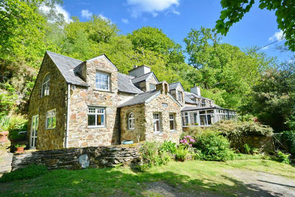
- Price
- £690,000
- Size
- 4 acres
Tan-Y-Bwlch, Blaenau Ffestiniog, Gwynedc, Maentwrog, Gwynedd LL41 Wales
Added on 17/03/2026House with Land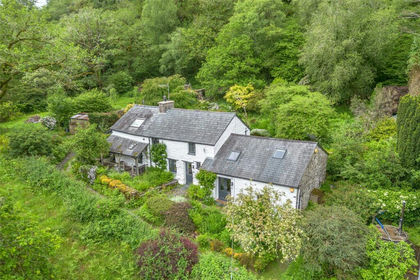
- Price
- £550,000
- Size
- 8.7 acres
Blaenau Ffestiniog, Gwynedd, LL41, Ffestiniog, Gwynedd LL41 Wales
Added on 26/06/2026House with Land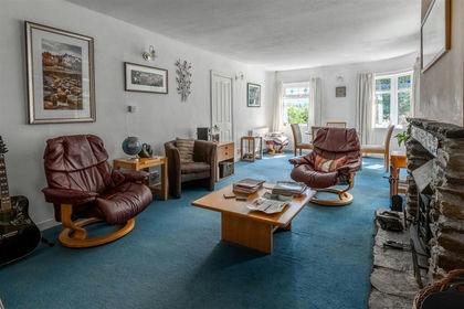
- Price
- £495,000
- Size
- 3 acres
Added on 03/09/2026House with Land
- Price
- £535,000
- Size
- 8.56 acres
Added on 28/07/2026House with Land
- Price
- £575,000
- Size
- 3.5 acres
Llanfrothen, Penrhyndeudraeth, Gwynedd, Beddgelert, Gwynedd LL48 Wales
Added on 01/07/2026House with Land
- Price
- Offers in Region of£649,500
- Size
- 6.2 acres
LLwyneinion Fechan, Dyffryn Ardudwy, Dyffryn Ardudwy, Gwynedd LL44 Wales
Added on 29/01/2026Farmhouse
- Price
- £695,000
- Size
- 73.12 acres
Added on 29/01/2026House with Land
- Price
- £595,000
- Size
- 13.34 acres
Added on 27/08/2026Multiple Dwelling Property
- Price
- £725,000
- Size
- 73.12 acres
Morfa Bychan, Porthmadog, Gwynedd, LL49, Porthmadog, Gwynedd LL49 Wales
Added on 21/05/2026House with Land