Manor Lodge, Pell Wall
- Land size
- 22.99 acres
- Bedrooms
- 5
- Bathrooms
- 3
Key Features
- 5-Bed detached property
- Bespoke open plan breakfast kitchen
- Drawing room, Snug, Morning room.
- Large utility/boot room with WC
- Principal suite with dressing area & ensuite bathroom
- 1-Bed annex with living room and bathroom
- Range of stables (6) with tack, feed room and kitchenette
- Additional buildings for storage.
- 30x50m Outdoor arena and 20m Lunge ring.
- In all approx 22.99 acres of paddocks, woodland and gallop.
Description
A WELL PRESENTED AND SPACIOUS, SIX BED DETACHED PROPERTY, WITH FANTASTIC EQUESTRIAN FACILITIES AND 22.99 ACRES.
Description - Manor Lodge is an exceptional detached property, offering large, light, and spacious family sized accommodation, with many period features and multiple equestrian business opportunities. This brick-built building is of steel construction under a slate roof and provides flexible living arranged over two floors, with a semi-annexed section of the house available for separate living accommodation.
The property is entered through a porch entrance and into the main reception hall which epitomises the history of this house. Off the hall is a galleried dining room with feature bay window and log burner. The dining room has access to the kitchen/breakfast room, which has an array of ground and wall mounted units with integrated appliances and AGA. Off the kitchen is a large utility and boot-room with downstairs WC and back entrance leading to the rear patio area.
The large drawing room is a great place to entertain with large windows and feature open fireplace. The drawing room, as well as the kitchen has access to the morning room which provides plenty of light and access onto the rear patio.
Completing the ground floor is a potential annex, which includes a sitting room, double bedroom and bathroom. This extension could easily be annexed to the main house and considered separate accommodation.
The first floor comprises a principle suite with an extensive range of fitted wardrobes, dressing room and access to a private balcony. The master has a contemporary en-suite with freestanding roll-top bath, tiled flooring and matching bespoke vanity unit. There are a further 3 double bedrooms, one with en-suite and a further family bathroom.
Gardens & Grounds - An impressive gated entrance leads to a private circular drive with central lawn, allows for plenty of parking and turning area for several cars. The drive continues to the double garage and equestrian facilities to one side. The land and equestrian facilities have another separate access from the main road with ample parking for multiple horseboxes, enabling the facilities to be separate from the house.
There is a third access from Sandy Lane which leads directly to a bridleway. This provides miles of outriding without the need to use a main road.
The entire property is surrounded and bordered by mature trees, which creates a very private oasis. The garden is a mixture of lawn with mature hedges, trees and shrubs. At one end of the garden is a large patio area, perfect for entertaining. The other is decked, with a timber framed gazebo over a hot tub.
Equestrian Facilities - The main stable building is built of steel construction and timber clad on a concrete pad. There are 5-6 stables depending on requirements. The main range has tack and feed rooms as well as a kitchenette with mains water and power connected.
Opposite the main range is another aluminum framed and timber clad building used for storage. This building could easily house more stabling if required. Adjacent is a further steel framed barn with lean-to. This barn is open sided to one elevation and is perfect for hay/straw and trailer storage.
The facilities have nearby grass paddocks all with automatic water troughs, lunge ring, a 30x 50 outdoor arena with a rubber surface and 2 further field shelters. Threading through the woodlands are multiple tracks that have fixed cross-country jumps of various sizes along with a oval ¾ mile canter track/gallop and is truly unique and an excellent facility.
Location - Pell Wall lies close to the popular market town of Market Drayton which is flanked by calm waterways and rolling farmland. Market Drayton is a buzzy North Shropshire town on the banks of the River Tern with – as the name suggests – a strong tradition of markets.
The Wednesday market dates to 1245, having originally been established by the Abbot of Combermere as a place to sell the abbey’s produce. Nowadays, the lively street and indoor market attract shoppers from all over the region. The town’s indoor Market Hall also hosts a weekly Saturday market, there is a monthly artisan market held around the historic Buttercross in Cheshire Street and even an annual “floating market” in summer at Talbot Wharf on the Shropshire Union Canal.
Additionally, larger towns such as Shrewsbury, Whitchurch and Newport are located within an easy drive, offering a wider array of amenities and several well-regarded schools in the state and private sector. The house offers very good road links, via the nearby A529, A41, the M54 and M6/M5, for commuting in any direction.
Train services are available at Prees, Stoke-on-Trent, Stafford, Telford, Shrewsbury and Crewe, with links to Chester, Wolverhampton and Birmingham. There are also direct trains to London Euston from Stoke-on-Trent or Stafford in under an hour and a half. Airports are at Manchester, Birmingham, Liverpool and East Midlands.
Distance In Approximate Miles - Market Drayton 1mile | Whitchurch 13 miles | Stoke on Trent 17 miles | Shrewsbury 21 miles | Stafford 20 miles
Property Information - Postcode: TF9 2AB
What three words: scales.brightens.juices
Tenure: Freehold
EPC: E
Services: Mains water, electricity, oil fired central heating, septic tank drainage.
Local Authority: Shropshire Local Authority
Council tax band: H amount payable for 2025 £4,707.28
Map Location
Property details
- Tenure
- Freehold
- Council Tax Band
- H
- Date Posted
- 2026-01-29
Price history
| Date | Change | Price |
|---|---|---|
| 29 Aug 2026 | Reduced 8.6% (−£150,000) | £1,600,000 |
| Until 29 Aug 2026 | Asking price | £1,750,000 |
Market Value Analysis
Compared with 18 Equestrian listings in West Midlands (10+ acres).
Energy Performance Certificate
Energy Efficiency Rating
Based on UK Energy Performance Certificate standards (EU Directive 2002/91/EC)
Running costs are one side. Planning activity, flood history and ground risks for this location are in the full report.
Utilities & Restrictions
Utilities
- Electricity
- Mains
- Water
- Mains
- Heating
- Oil Heating
- Broadband
- Ask Agent
- Sewerage
- Septic Tank / Private
Rights & Restrictions
- Public Rights of Way
- Ask Agent
- Private Rights of Way
- Ask Agent
- Listed Property
- Ask Agent
- Restrictions
- Ask Agent
Listed status, conservation areas and planning constraints for this location are in the full report.
Property Features
- Accessibility
- Ask Agent
- Parking
- Garage
- Garden
- Garden
Beyond the particulars: planning activity, flood history, heritage and ground risks, checked for this exact spot.
Connectivity
Broadband
Fastest speed available at this postcode
1.8 Gbps
Gigabit full fibre
Suitable for
- 4K streaming on every screen
- Full-time home working
- Online gaming & big downloads
Mobile signal
Predicted 4G and 5G signal; indoor signal depends on building materials.
Ofcom Connected Nations postcode-level predictions. Speeds and signal are modelled, not measured, and vary between addresses and providers.
Signal is the easy part. Planning activity, flood history and protected designations here are in the full report.
Nearest Schools
Primary
- Market Drayton Infant & Nursery School0.6 milesNo Ofsted rating
- Ages
- 2 to 7
- Pupils
- 346
- Type
- Academy converter
- Market Drayton Junior School0.7 milesNo Ofsted rating
- Ages
- 7 to 11
- Pupils
- 333
- Type
- Academy converter
- Longlands Primary School0.9 milesOfsted: Good
- Ages
- 2 to 11
- Pupils
- 201
- Type
- Academy sponsor led
- Buntingsdale Primary School and Nursery1.8 milesNo Ofsted rating
- Ages
- 3 to 11
- Pupils
- 76
- Type
- Community school
- Moreton Say CofE Primary School3 milesOfsted: Good
- Ages
- 2 to 11
- Pupils
- 111
- Type
- Voluntary controlled school
- Faith
- Church of England
Secondary
- The Grove School0.7 milesOfsted: Requires improvement
- Ages
- 11 to 18
- Pupils
- 856
- Type
- Academy converter
- Sir John Talbot's School9.2 milesOfsted: Good
- Ages
- 11 to 19
- Pupils
- 861
- Type
- Academy sponsor led
- Madeley High School9.4 milesNo Ofsted rating
- Ages
- 11 to 16
- Pupils
- 779
- Type
- Academy converter
- Haberdashers' Adams9.7 milesOfsted: Good
- Ages
- 11 to 18
- Pupils
- 1,090
- Type
- Academy converter
- Newport Girls' High School Academy10 milesOfsted: Outstanding
- Ages
- 11 to 18
- Pupils
- 884
- Type
- Academy converter
- Gender
- Girls
Distances are straight-line from the advertised location. Source: the national school registers (DfE, Welsh Government, Scottish Government) and Ofsted.
Schools are just the start: sold prices nearby, planning activity and any flood history are in the full report.
Amenities
Supermarket
GP surgery
Pharmacy
Hospital
Green space
Straight-line distances from the advertised location. Sources: NHS records, Geolytix supermarket locations, OS Open Greenspace and the national trails registers.
The area stacks up? Now check the location itself: planning nearby, protected designations and past flooding.
Getting Around
Nearest station
Nearest bus stop
Typical drive times
Straight-line distances from the advertised location; drive times are typical free-flow times over OpenStreetMap road data, so allow more at peak. Public transport locations from DfT NaPTAN.
Easy to reach matters. So do planning activity, flood history and ground risks: all in the full report.
Flood Risk
Environment Agency open data, checked around the advertised map pin for the listed acreage. Long-term risk counts flood defences; the planning map's flood zones do not. Provided by LandSale, not the listing agent, and not part of the agent's particulars. Risk varies across a holding, so verify before committing.
Rivers and the sea
Not at the pin: mapped about 140 metres away.
Planning map: Flood Zone 3, about 140 metres away.
Surface water
Not at the pin: mapped about 130 metres away.
These bandings are the summary. Where this location sits on the flood maps, plus planning activity, heritage and ground risks, is in the full report.
Important notice: Information, maps and tags on this page are drawn from the advertising agent's marketing materials or generated automatically. LandSale has not verified them. Relying on these details is at your own risk, always carry out independent checks before committing to a purchase.
LandSale full disclaimer
Marketing information only - not formal particulars. The details on this website are provided for general guidance and do not constitute an offer or contract. Neither LandSale nor the advertising estate/land agent accepts responsibility for any inaccuracy.
1. Source of information
- Listing content: Core description, asking price, tenure, measurements, photographs and planning history originate from the marketing materials of the advertising estate or land agent. LandSale does not author this content and cannot guarantee its accuracy.
- Automated tags & categorisation: Property type, land-use class, acreage bands and similar labels may be applied by machine-learning models. They are intended as a helpful guide only and may not reflect the property's legal status or permitted use.
- Third-party & enriched data layers: Maps, boundary outlines, planning designations, soil reports, broadband coverage and other environmental or location-based insights are licensed from external suppliers. Such data are supplied “as is", may be incomplete or out of date and are subject to change without notice.
2. Verification required
Prospective purchasers must verify critical matters, including but not limited to planning permission, title boundaries, public rights of way, environmental constraints, acreage, services, access and VAT status, through their own inspections, specialist surveys, legal advisers and the selling agent before relying on the information or entering into any contract.
3. No warranty or liability
LandSale gives no warranty, express or implied, as to the accuracy, completeness or fitness for any particular purpose of the information displayed. LandSale shall not be liable for any loss, damage, cost or expense arising directly or indirectly from any use of or reliance on such information, save where liability may not be excluded by law.
4. Updates & feedback
If you believe any detail on this listing is inaccurate, please let us know. We will investigate and, where appropriate, update the listing or notify the agent.
© LandSale | Version 1.3 - August 2026
Listing agent
Larch Property, Preston On Severn
Franks Barn, Preston On Severn, Uffington, SY4 4TB
Contact Larch Property, Preston On Severn
Franks Barn, Preston On Severn, Uffington, SY4 4TB
View agent profileSimilar properties for sale
- Price
- £1,350,000
- Size
- 56.6 acres
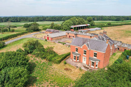
Fenns Wood House Lot 1, Fenns Lane, Whixall, Whitchurch, SY13, Bronington, Wrexham SY13 Wales
Added on 20/08/2026Farm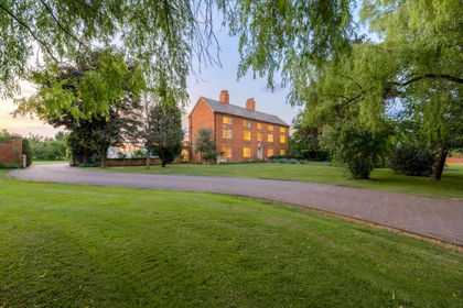
- Price
- Offers Over£2,000,000
- Size
- 15 acres
The Woodlands, Calveley Hall Lane, Tarporley, CW6, Alpraham and Calveley, Cheshire East CW6 England
Added on 28/01/2026House with Land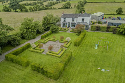
- Price
- Guide Price£1,250,000
- Size
- 16 acres
Dilhorne Road, Caverswall, Staffordshire, ST11, Caverswall, Staffordshire ST11 England
Added on 09/07/2026House with Land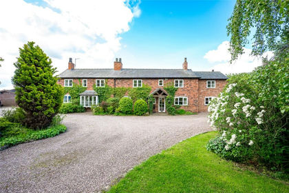
- Price
- Offers in Excess of£2,000,000
- Size
- 14.5 acres
Added on 16/06/2026House with Land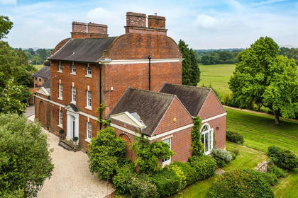
- Price
- Offers in Region of£1,995,000
- Size
- 15.5 acres
Added on 23/07/2026House with Land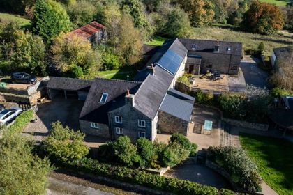
- Price
- Offers in Region of£1,500,000
- Size
- 13 acres
South Hillswood, Meerbrook, Leek, Leekfrith, Staffordshire ST13 England
Added on 28/01/2026House with Land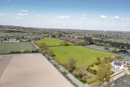
- Price
- Guide Price£1,395,000
- Size
- 14.39 acres
Forest Gate Farm, Delamere Road, Norley, Norley, Cheshire West and Chester WA6 England
Added on 25/04/2026Country Home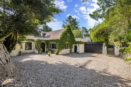
- Price
- Offers in Region of£1,250,000
- Size
- 42 acres
Nantyr, Glyn Ceiriog., Llansantffraid Glyn Ceiriog, Wrexham LL20 Wales
Added on 29/01/2026Country Estate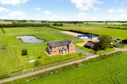
- Price
- Offers Over£2,000,000
- Size
- 13 acres
Antrobus, Northwich, Cheshire, Antrobus, Cheshire West and Chester CW9 England
Added on 05/06/2026Equestrian property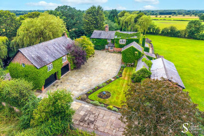
- Price
- Guide Price£1,550,000
- Size
- 11 acres
Hobbs Hill Lane, High Legh, WA16, High Legh, Cheshire East WA16 England
Added on 08/07/2026Farmhouse