Butter Bank Lane, Derrington
- Land size
- 5.3 acres
- Bedrooms
- 3
- Bathrooms
- 2
Key Features
- Picturesque detached thatched cottage
- Extended & tastefully presented
- Triple garage with loft above
- Games room
- Extensive grounds & paddocks, ext to approx. 5.3 acres
- Ideal equestrian facilities
- Elegant lounge with log burner
- EPC rating D. Council tax band F
- Charming dining room with log burner
- 360 virtual tour available
Description
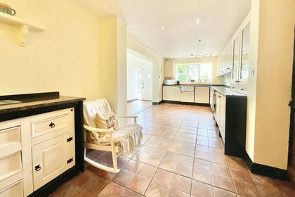
The reception hall has a cupboard and gives access to a charming dining room with a superb brick inglenook fireplace having a log burner. There is a parquet floor, beamed ceiling, dual aspect windows and a traditional radiator. On the opposite side of the hall, there is an elegant, extended lounge which has a stone fireplace incorporating a log burner. There is a parquet floor, beamed ceiling and feature wall covering to one wall. The spacious kitchen has a range of bespoke units with granite worksurfaces and drainer, recessed Belfast style sink, recess for a range style oven, tiled floor, exposed beams and a walk-in cupboard. From here, a rear lobby leads to a cloakroom with wash basin and WC, and separate boiler room.
The first floor has split level landing areas leading to three bedrooms. The principal bedroom has a dressing room off, which in turn leads to an en suite, incorporating a shower with drying area and both conventional waterfalls heads, wash basin with integrated cupboard beneath, WC, and contrasting tiling to wet areas. The beautifully appointed family bathroom features a roll top freestanding bath with chrome mixer tap, separate shower, WC, and wash basin set into an integrated unit with cupboards.
Outside, the house stands well back from the road beyond a long drive. There are paddocks to the side of the property, two stables, extensive parking area capable of parking numerous vehicles, and corrugated outbuildings. There is a personal Lychgate, in addition to wrought iron vehicle gates leading to an additional drive, again capable of parking numerous vehicles and giving access to the attractive thatched three car garage, which has an external spiral staircase leading to a useful loft space. The property also boasts a separate games room, which has a shower and WC off. To the front of the property, there are extensive lawns and a dwarf wall with steps to an abundantly stocked traditional garden incorporating beds and borders and a further garden area to the side. There are also extensive lawns to the rear.
Our clients have run a successful touring and camping business from the site, with pleasant pitches having mains hook up, plus an external shower/WC block. Please note, our clients are not selling the property as a business, but as a private home.
The property enjoys an idyllic position, but is also exceptionally convenient for commuters, being within approximately 10-minute drive from the county town of Stafford which has a mainline intercity railway station with regular services to London Euston, some of which take only approximately 1 hour 20 minutes. Junctions 13 and 14 of the M6 provide direct access into the national motorway network and M6 toll.
To view this property, please contact John German Stafford office.
Agents notes:
-There is a public footpath which runs through the grounds.
-There is no mains drainage or gas.
-There will be CCTV in operation.
-The property is registered on two Land Registry Titles which refer to rights. Copies of the documents are available upon request.
Tenure: Freehold (purchasers are advised to satisfy themselves as to the tenure via their legal representative).
Property construction: Traditional
Parking: Drive & three car garage
Electricity supply: Mains
Water supply: Mains
Sewerage: Septic tank
Heating: Oil fired central heating
(Purchasers are advised to satisfy themselves as to their suitability).
Broadband type: See Ofcom link for speed:
Mobile signal/coverage: See Ofcom link
Local Authority/Tax Band: Stafford Borough Council / Tax Band F
Useful Websites:
Our Ref: JGA/11092025
The property information provided by John German Estate Agents Ltd is based on enquiries made of the vendor and from information available in the public domain. If there is any point on which you require further clarification, please contact the office and we will be pleased to check the information for you, particularly if contemplating travelling some distance to view the property. Please note if your enquiry is of a legal or structural nature, we advise you to seek advice from a qualified professional in their relevant field.
We are required by law to comply fully with The Money Laundering Regulations 2017 and as such need to complete AML ID verification and proof / source of funds checks on all buyers and, where relevant, cash donors once an offer is accepted on a property. We use the Checkboard app to complete the necessary checks, this is not a credit check and therefore will have no effect on your credit history. With effect from 1st March 2025 a non-refundable compliance fee of £30.00 inc. VAT per buyer / donor will be required to be paid in advance when an offer is agreed and prior to a sales memorandum being issued.
Map Location
Property details
- Tenure
- Freehold
- Council Tax Band
- F
- Date Posted
- 2026-01-29
Price history
| Date | Change | Price |
|---|---|---|
| 26 Aug 2026 | Reduced 5.6% (−£50,000) | £850,000 |
| Until 26 Aug 2026 | Asking price | £900,000 |
Market Value Analysis
Compared with 281 Homes with Land listings in West Midlands (5+ acres).
Energy Performance Certificate
Energy Efficiency Rating
Based on UK Energy Performance Certificate standards (EU Directive 2002/91/EC)
Running costs are one side. Planning activity, flood history and ground risks for this location are in the full report.
Utilities & Restrictions
Utilities
- Electricity
- Mains
- Water
- Mains
- Heating
- Oil Heating
- Broadband
- Ask Agent
- Sewerage
- Septic Tank / Private
Rights & Restrictions
- Public Rights of Way
- Ask Agent
- Private Rights of Way
- Ask Agent
- Listed Property
- Ask Agent
- Restrictions
- Ask Agent
Listed status, conservation areas and planning constraints for this location are in the full report.
Property Features
- Accessibility
- Ask Agent
- Parking
- Garage, Off-Street Parking
- Garden
- Garden
Beyond the particulars: planning activity, flood history, heritage and ground risks, checked for this exact spot.
Connectivity
Broadband
Fastest speed available at this postcode
49 Mbps
Superfast
Suitable for
- HD streaming
- Video calls
- Web & social
Fixed wireless access may also be an option here.
Mobile signal
Predicted 4G and 5G signal; indoor signal depends on building materials.
Ofcom Connected Nations postcode-level predictions. Speeds and signal are modelled, not measured, and vary between addresses and providers.
Signal is the easy part. Planning activity, flood history and protected designations here are in the full report.
Nearest Schools
Primary
- Cooper Perry Primary School1.2 milesOfsted report card · Jan 2026
- Ages
- 3 to 11
- Pupils
- 206
- Type
- Community school
- Burleyfields Primary School1.7 milesNo Ofsted rating
- Ages
- 2 to 11
- Pupils
- 59
- Type
- Free schools
- Haughton St Giles CofE Primary Academy1.7 milesNo Ofsted rating
- Ages
- 3 to 11
- Pupils
- 111
- Type
- Academy converter
- Faith
- Church of England
- Doxey Academy1.8 milesOfsted: Requires improvement
- Ages
- 2 to 11
- Pupils
- 201
- Type
- Academy sponsor led
- All Saints Church of England Primary School and Nursery1.8 milesOfsted: Requires improvement
- Ages
- 3 to 11
- Pupils
- 72
- Type
- Academy sponsor led
- Faith
- Church of England
Secondary
- King Edward VI High School2.3 milesOfsted: Requires improvement *
- Ages
- 11 to 18
- Pupils
- 646
- Type
- Academy sponsor led
- Blessed William Howard Catholic School2.5 milesNo Ofsted rating
- Ages
- 11 to 18
- Pupils
- 950
- Type
- Academy converter
- Faith
- Roman Catholic
- Sir Graham Balfour High School2.9 milesNo Ofsted rating
- Ages
- 11 to 18
- Pupils
- 1,003
- Type
- Academy converter
- The Weston Road Academy4.6 milesNo Ofsted rating
- Ages
- 11 to 18
- Pupils
- 978
- Type
- Academy converter
- Walton High School4.9 milesNo Ofsted rating
- Ages
- 11 to 18
- Pupils
- 1,262
- Type
- Academy converter
* Latest graded judgement covers quality of education only; no overall grade was issued under the 2024-25 inspection framework.
Distances are straight-line from the advertised location. Source: the national school registers (DfE, Welsh Government, Scottish Government) and Ofsted.
Schools are just the start: sold prices nearby, planning activity and any flood history are in the full report.
Amenities
Supermarket
GP surgery
Pharmacy
Hospital
Straight-line distances from the advertised location. Sources: NHS records, Geolytix supermarket locations, OS Open Greenspace and the national trails registers.
The area stacks up? Now check the location itself: planning nearby, protected designations and past flooding.
Getting Around
Nearest station
Nearest bus stop
Typical drive times
Straight-line distances from the advertised location; drive times are typical free-flow times over OpenStreetMap road data, so allow more at peak. Public transport locations from DfT NaPTAN.
Easy to reach matters. So do planning activity, flood history and ground risks: all in the full report.
Flood Risk
Environment Agency open data, checked around the advertised map pin for the listed acreage. Long-term risk counts flood defences; the planning map's flood zones do not. Provided by LandSale, not the listing agent, and not part of the agent's particulars. Risk varies across a holding, so verify before committing.
Rivers and the sea
Not at the pin: mapped about 60 metres away.
Planning map: Flood Zone 3, about 40 metres away.
Surface water
Not at the pin: mapped about 60 metres away.
These bandings are the summary. Where this location sits on the flood maps, plus planning activity, heritage and ground risks, is in the full report.
Important notice: Information, maps and tags on this page are drawn from the advertising agent's marketing materials or generated automatically. LandSale has not verified them. Relying on these details is at your own risk, always carry out independent checks before committing to a purchase.
LandSale full disclaimer
Marketing information only - not formal particulars. The details on this website are provided for general guidance and do not constitute an offer or contract. Neither LandSale nor the advertising estate/land agent accepts responsibility for any inaccuracy.
1. Source of information
- Listing content: Core description, asking price, tenure, measurements, photographs and planning history originate from the marketing materials of the advertising estate or land agent. LandSale does not author this content and cannot guarantee its accuracy.
- Automated tags & categorisation: Property type, land-use class, acreage bands and similar labels may be applied by machine-learning models. They are intended as a helpful guide only and may not reflect the property's legal status or permitted use.
- Third-party & enriched data layers: Maps, boundary outlines, planning designations, soil reports, broadband coverage and other environmental or location-based insights are licensed from external suppliers. Such data are supplied “as is", may be incomplete or out of date and are subject to change without notice.
2. Verification required
Prospective purchasers must verify critical matters, including but not limited to planning permission, title boundaries, public rights of way, environmental constraints, acreage, services, access and VAT status, through their own inspections, specialist surveys, legal advisers and the selling agent before relying on the information or entering into any contract.
3. No warranty or liability
LandSale gives no warranty, express or implied, as to the accuracy, completeness or fitness for any particular purpose of the information displayed. LandSale shall not be liable for any loss, damage, cost or expense arising directly or indirectly from any use of or reliance on such information, save where liability may not be excluded by law.
4. Updates & feedback
If you believe any detail on this listing is inaccurate, please let us know. We will investigate and, where appropriate, update the listing or notify the agent.
© LandSale | Version 1.3 - August 2026
Listing agent
John German, Stafford
5 Pool Lane Brocton Stafford ST17 0TR
Similar properties for sale
- Price
- £995,000
- Size
- 5 acres
Church Eaton Road, Haughton, ST18, Haughton, Staffordshire ST18 England
Added on 13/05/2026House with Land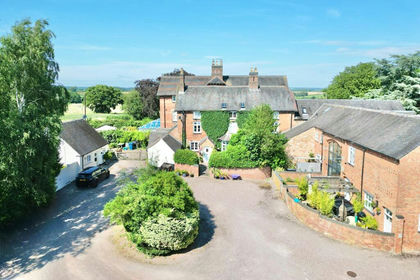
- Price
- £795,000
- Size
- 5 acres
Walton Bank, Eccleshall, ST21, Eccleshall, Staffordshire ST21 England
Added on 21/03/2026Farmhouse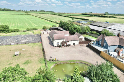
- Price
- Offers in Excess of£875,000
- Size
- 2 acres
Green Lane, Whitgreave, ST18, Whitgreave, Staffordshire ST18 England
Added on 28/01/2026Barn Conversion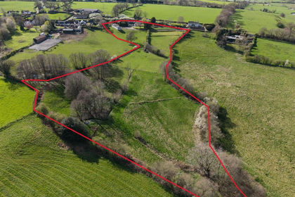
- Price
- Offers in Region of£750,000
- Size
- 5.36 acres
Cottage Farm, Sandon Bank, Stafford, Hopton and Coton, Staffordshire ST18 England
Added on 10/05/2026Farmhouse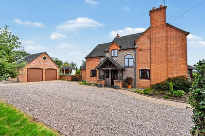
- Price
- £875,000
- Size
- 2.39 acres
Cash Lane, Eccleshall, ST21, Eccleshall, Staffordshire ST21 England
Added on 01/10/2026House with Land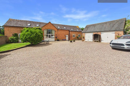
- Price
- £875,000
- Size
- 5.25 acres
Added on 08/07/2026Barn Conversion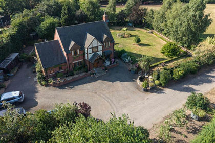
- Price
- Offers in Region of£900,000
- Size
- 2 acres
Pasture Fields, London Road, Weston, Stafford, Weston, Staffordshire ST18 England
Added on 30/07/2026House with Land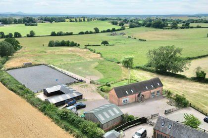
- Price
- £1,000,000
- Size
- 7 acres
Offley Marsh, Bishops Offley, ST21, Eccleshall, Staffordshire ST21 England
Added on 29/01/2026Equestrian property
- Price
- £1,000,000
- Size
- 2.1 acres
Watling Street, Brewood, Stafford, Brewood and Coven, Staffordshire ST19 England
Added on 05/08/2026House with Land
- Price
- £950,000
- Size
- 4.33 acres
Amerton, Dimmocks Farm, ST18, Stowe-by-Chartley, Staffordshire ST18 England
Added on 01/08/2026Barn Conversion