Aston Hill, Halton
- Land size
- 2.73 acres
- Bedrooms
- 5
- Bathrooms
- 3
Key Features
- Grounds of 2.73 acres
- Spectacular setting
- Useful outbuilding/annex
- Period features
- Fabulous kitchen/diner with bifold doors
- In The Chilterns Area Of Outstanding Natural Beauty
Description
Set against the breathtaking backdrop of the Chiltern Hills, Aston Hill Lodge is a distinguished period residence dating back to the late 1800s. Originally built by the Rothschild family as part of the iconic Halton House estate, the property has been sympathetically updated to offer a rare blend of historic charm and modern living. Tucked away along a quiet, tree-lined private drive, the property enjoys exceptional privacy within approximately 2.73 acres of landscaped gardens, open lawns, and mature woodland rich in wildlife. Despite its peaceful and secluded setting, Aston Hill Lodge offers superb connectivity. Nearby mainline stations at Tring and Wendover provide fast and direct rail services into London, while excellent road links offer convenient access to the M25 and M40. The property is also located within catchment for several highly regarded grammar schools, making it a superb option for families. Inside, the home is designed for both everyday living and entertaining. The central entrance hall leads to a generous living room with a wood-burning stove and a connected sitting room, ideal for cosy evenings or relaxed gatherings. At the heart of the home, the open-plan kitchen and dining room is both stylish and practical, featuring high-gloss units and bifold doors that open directly onto the gardens, creating a seamless indoor-outdoor flow. A spacious utility room and cloakroom complete the ground floor. Upstairs, the principal bedroom benefits from an en-suite shower room, while three additional bedrooms share a family shower room. The property also includes a highly versatile, detached self-contained annex/studio, currently used as a gym, comprising a reception room, kitchen, and shower room. This space is perfect for guests, home working, or multi-generational living. Aston Hill Lodge offers a unique opportunity to own a truly special home, combining period elegance, modern comfort, and a spectacular countryside setting with unbeatable convenience.
SITUATION
Nestled within the stunning landscape of the Chilterns Area of Outstanding Natural Beauty, Halton is a charming Buckinghamshire village that offers an exceptional blend of rural tranquillity and modern convenience. Surrounded by open countryside and ancient woodland, the village is ideally located close to the market towns of Wendover and Tring, both offering a range of amenities and services. Halton is perfectly positioned for commuters, with nearby Wendover and Tring railway stations providing fast and direct services to London Marylebone and London Euston. Road connections are equally strong, with the A41 offering swift access to the M25 and the wider motorway network. The village falls within the catchment area for Aylesbury`s highly regarded grammar schools, and is also conveniently located for several prestigious independent schools, including Berkhamsted School, Tring Park School for the Performing Arts, and St Columba`s College in St Albans. This sought-after location appeals to families, professionals, and nature lovers alike, offering access to miles of walking and cycling routes through the Chiltern Hills, while still being within easy reach of London and surrounding towns. Halton provides the perfect setting for those seeking a peaceful village lifestyle without sacrificing connectivity or educational excellence.
HISTORICAL CONTEXT
Believed to date from circa 1858, Aston Hill Lodge originally formed part of the Rothschild Estate and was occupied by the estate gamekeeper, giving the property a wonderful sense of provenance and an enduring connection to its woodland setting. Aston Hill itself also occupies a distinctive place in British motoring history, having been used for early hill-climb events associated with Lionel Martin; it was this connection with the hill that helped inspire the now legendary Aston Martin name. That heritage is still celebrated today, with classic Aston Martins continuing to make the pilgrimage to Aston Hill.
LOCAL AUTHORITY
Buckinghamshire Council
VIEWING
By appointment with Cesare & Co, 48 High Street, Tring, Hertfordshire, HP23 5AG.
IMPORTANT NOTICE
Although these particulars, together with any photographs and/or any floor plans, are intended to give a fair description of the property, they do not constitute any offer or any part of a Contract. The Vendors, his Agents, Cesare & Co and persons in the employment do not give any warranty whatever in relation to this property. All measurements are approximate. Any appliances and/or services mentioned within these particulars have not been tested or verified by the Agent. All negotiations should be conducted through Cesare & Co.
what3words /// null
Notice
Please note we have not tested any apparatus, fixtures, fittings, or services. Purchasers must undertake their own investigation into the working order of these items. All measurements are approximate and photographs provided for guidance only.
Map Location
Property details
- Tenure
- Freehold
- Council Tax Band
- G
- Date Posted
- 2026-01-28
Price history
| Date | Change | Price |
|---|---|---|
| 8 Oct 2026 | Reduced 3.6% (−£50,000) | £1,350,000 |
| Until 8 Oct 2026 | Asking price | £1,400,000 |
Market Value Analysis
Compared with 1,736 Homes with Land listings in South East England (1+ acres).
Energy Performance Certificate
Energy Efficiency Rating
Based on UK Energy Performance Certificate standards (EU Directive 2002/91/EC)
Running costs are one side. Planning activity, flood history and ground risks for this location are in the full report.
Utilities & Restrictions
Utilities
- Electricity
- Mains
- Water
- Mains
- Heating
- Ask Agent
- Broadband
- Fibre (FTTC)
- Sewerage
- Septic Tank / Private
Rights & Restrictions
- Public Rights of Way
- Ask Agent
- Private Rights of Way
- Ask Agent
- Listed Property
- Ask Agent
- Restrictions
- Ask Agent
Listed status, conservation areas and planning constraints for this location are in the full report.
Property Features
- Accessibility
- Ask Agent
- Parking
- Garage, Off-Street Parking
- Garden
- Private Garden
Beyond the particulars: planning activity, flood history, heritage and ground risks, checked for this exact spot.
Connectivity
Broadband
Fastest speed available at this postcode
1.8 Gbps
Gigabit full fibre · available to 75% of premises
Suitable for
- 4K streaming on every screen
- Full-time home working
- Online gaming & big downloads
Mobile signal
Predicted 4G and 5G signal; indoor signal depends on building materials.
Ofcom Connected Nations postcode-level predictions. Speeds and signal are modelled, not measured, and vary between addresses and providers.
Signal is the easy part. Planning activity, flood history and protected designations here are in the full report.
Nearest Schools
Primary
- Halton Community Combined School1.1 milesOfsted: Good
- Ages
- 4 to 11
- Pupils
- 204
- Type
- Community school
- Aston Clinton School1.4 milesOfsted: Good
- Ages
- 4 to 11
- Pupils
- 402
- Type
- Community school
- Wendover Church of England Junior School1.7 milesNo Ofsted rating
- Ages
- 7 to 11
- Pupils
- 336
- Type
- Voluntary controlled school
- Faith
- Church of England
- The John Hampden School1.7 milesNo Ofsted rating
- Ages
- 3 to 7
- Pupils
- 270
- Type
- Community school
- Goldfield Infants' and Nursery School1.9 milesOfsted: Good *
- Ages
- 3 to 7
- Pupils
- 222
- Type
- Community school
Secondary
- John Colet School1.7 milesNo Ofsted rating
- Ages
- 11 to 18
- Pupils
- 1,014
- Type
- Academy converter
- Tring School2.6 milesNo Ofsted rating
- Ages
- 11 to 18
- Pupils
- 1,599
- Type
- Academy converter
- Faith
- Church of England
- The Kingsbrook School4.2 milesOfsted: Good *
- Ages
- 11 to 18
- Pupils
- 759
- Type
- Free schools
- The Grange School4.2 milesOfsted: Good
- Ages
- 11 to 18
- Pupils
- 1,418
- Type
- Foundation school
- Aylesbury High School4.5 milesOfsted: Outstanding
- Ages
- 11 to 18
- Pupils
- 1,368
- Type
- Academy converter
- Gender
- Girls
* Latest graded judgement covers quality of education only; no overall grade was issued under the 2024-25 inspection framework.
Distances are straight-line from the advertised location. Source: the national school registers (DfE, Welsh Government, Scottish Government) and Ofsted.
Schools are just the start: sold prices nearby, planning activity and any flood history are in the full report.
Amenities
Supermarket
GP surgery
Pharmacy
Hospital
Green space
Straight-line distances from the advertised location. Sources: NHS records, Geolytix supermarket locations, OS Open Greenspace and the national trails registers.
The area stacks up? Now check the location itself: planning nearby, protected designations and past flooding.
Getting Around
Nearest station
Nearest bus stop
Typical drive times
Straight-line distances from the advertised location; drive times are typical free-flow times over OpenStreetMap road data, so allow more at peak. Public transport locations from DfT NaPTAN.
Easy to reach matters. So do planning activity, flood history and ground risks: all in the full report.
Flood Risk
Environment Agency open data, checked around the advertised map pin for the listed acreage. Long-term risk counts flood defences; the planning map's flood zones do not. Provided by LandSale, not the listing agent, and not part of the agent's particulars. Risk varies across a holding, so verify before committing.
Rivers and the sea
Planning map: Flood Zone 1.
Surface water
These bandings are the summary. Where this location sits on the flood maps, plus planning activity, heritage and ground risks, is in the full report.
Important notice: Information, maps and tags on this page are drawn from the advertising agent's marketing materials or generated automatically. LandSale has not verified them. Relying on these details is at your own risk, always carry out independent checks before committing to a purchase.
LandSale full disclaimer
Marketing information only - not formal particulars. The details on this website are provided for general guidance and do not constitute an offer or contract. Neither LandSale nor the advertising estate/land agent accepts responsibility for any inaccuracy.
1. Source of information
- Listing content: Core description, asking price, tenure, measurements, photographs and planning history originate from the marketing materials of the advertising estate or land agent. LandSale does not author this content and cannot guarantee its accuracy.
- Automated tags & categorisation: Property type, land-use class, acreage bands and similar labels may be applied by machine-learning models. They are intended as a helpful guide only and may not reflect the property's legal status or permitted use.
- Third-party & enriched data layers: Maps, boundary outlines, planning designations, soil reports, broadband coverage and other environmental or location-based insights are licensed from external suppliers. Such data are supplied “as is", may be incomplete or out of date and are subject to change without notice.
2. Verification required
Prospective purchasers must verify critical matters, including but not limited to planning permission, title boundaries, public rights of way, environmental constraints, acreage, services, access and VAT status, through their own inspections, specialist surveys, legal advisers and the selling agent before relying on the information or entering into any contract.
3. No warranty or liability
LandSale gives no warranty, express or implied, as to the accuracy, completeness or fitness for any particular purpose of the information displayed. LandSale shall not be liable for any loss, damage, cost or expense arising directly or indirectly from any use of or reliance on such information, save where liability may not be excluded by law.
4. Updates & feedback
If you believe any detail on this listing is inaccurate, please let us know. We will investigate and, where appropriate, update the listing or notify the agent.
© LandSale | Version 1.3 - August 2026
Listing agent
Cesare & Co, Tring
48/49 High Street, Tring, Hertfordshire, HP23 5AG
Similar properties for sale
- Price
- Offers in Excess of£1,350,000
- Size
- 2 acres
Added on 12/09/2026House with Land
- Price
- £1,650,000
- Size
- 6.5 acres
Little London, Wendover, Aylesbury, HP22, Wendover, Buckinghamshire HP22 England
Added on 16/07/2026Cottage
- Price
- Guide Price£1,595,000
- Size
- 1.5 acres
Terrick, Buckinghamshire, Ellesborough, Buckinghamshire HP17 England
Added on 28/01/2026House with Land
- Price
- Guide Price£1,400,000
- Size
- 2.3 acres
Long Marston, Tring, HP23, Tring Rural, Hertfordshire HP23 England
Added on 03/04/2026Barn Conversion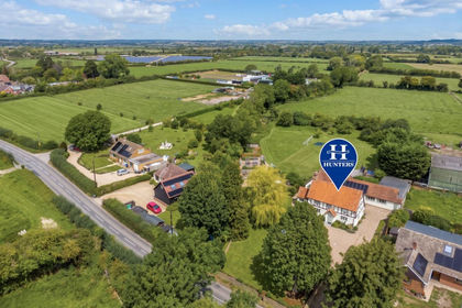
- Price
- Offers in Excess of£1,500,000
- Size
- 1.5 acres
Ford End, Ivinghoe, Leighton Buzzard, Ivinghoe, Buckinghamshire LU7 England
Added on 14/09/2026House with Land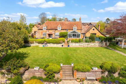
- Price
- Offers Over£1,500,000
- Size
- 3 acres
Lower End, Wingrave, Buckinghamshire, HP22, Wingrave with Rowsham, Buckinghamshire HP22 England
Added on 01/05/2026Farmhouse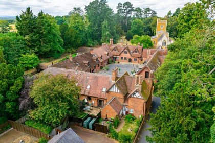
- Price
- £1,395,000
- Size
- 22 acres
Stable Yard, Mentmore, Buckinghamshire, LU7, Mentmore, Buckinghamshire LU7 England
Added on 14/08/2026Equestrian property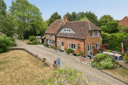
- Price
- Offers in Excess of£1,250,000
- Size
- 2.5 acres
Added on 20/08/2026House with Land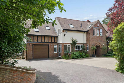
- Price
- Offers in Region of£1,675,000
- Size
- 2.5 acres
Ashley Green Road, Chesham, Buckinghamshire, HP5, Chesham, Buckinghamshire HP5 England
Added on 22/06/2026House with Land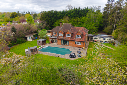
- Price
- Guide Price£1,500,000
- Size
- 2 acres
Added on 27/05/2026House with Land