1 Honeyborough Green, Neyland, SA73
- Land size
- 6 acres
- Bedrooms
- 3
- Bathrooms
- 3
Key Features
- Off Road Parking To The Fore And Rear Of The Residence
- Grade II Listed Smallholding
- Charming Detached Residence Set Within Approximately Half An Acre Of Grounds
- No Chain Sale
- Also Includes An Additional 5.5 Acres Of Level Pasture Land To The Rear
- Many Original Features Throughout
- Located In The Sought After Area Of Honeyborough Within The Town Of Neyland
- EPC Exempt
Description
Grade II Listed Smallholding
Charming Detached Residence Set Within Approximately Half An Acre Of Grounds
Also Includes An Additional 5.5 Acres Of Level Pasture Land To The Rear
Off Road Parking To The Fore And Rear Of The Residence
Many Original Features Throughout
Located In The Sought After Area Of Honeyborough Within The Town Of Neyland
No Chain Sale
EPC Exempt
Situation
The Old Dairy, located at 1 Honeyborough Grove, resides in the Honeyborough area, which has become an integral part of the quaint town of Neyland. Positioned on the northern shoreline of the Cleddau Estuary's tidal waters, Neyland offers a picturesque setting rich in history and community spirit.
Historically, Neyland was a modest fishing village within the parish of Llanstadwell. Its transformation began in 1856 when it was selected as the western terminus for Isambard Kingdom Brunel's Great Western Railway, establishing a transatlantic terminal for the era's largest ships. This development spurred rapid growth, with the Picton Castle and Lawrenny Estates granting numerous leases for house building. The town saw the addition of four new chapels, various shops, and enhanced services, elevating its status significantly.
Today, Neyland boasts a variety of local amenities, including a convenience store, a primary school, and a doctor's surgery. The town is also home to a popular river...
Description
The Old Dairy, is a Grade II listed smallholding featuring a substantial detached residence with solid stone walls and a rear extension that blend historical character with modern living. Set within approximately half an acre of grounds, the property also includes an additional 5.5 acres of level pasture land.
The residence retains many original features, notably a historically significant Flemish-style chimney. While the property exudes timeless appeal, certain areas are in need of upgrading, offering an excellent opportunity for restoration enthusiasts to enhance and personalize this historic home.
Please note: As a Grade II listed property, any renovations or alterations are subject to specific regulations to preserve its architectural and historical significance. Prospective buyers are advised to consult with local authorities regarding permissible changes.
Entrance Hallway
Property accessed via obscure wooden door, radiators wall lights, fitted storage shelving and bookcase, double glazed sash window to side, ceiling beams, wooden staircase with handrails leading up to first floor landing, doors leading off to:
Reception Room 1
Double glazed sash windows to fore and rear, exposed ceiling beams, inset open fireplace with feature stone wall and floating mantle beam, radiators, decorative stone alcove, wall lights.
Reception Room 2
Double glazed sash window to fore, exposed ceiling beams, wall lights, fitted shelving into alcove spaces, feature wooden fireplace and mantle with electric fore insert.
Kitchen/Breakfast Room
Wooden stable door to side, double glazed sash windows to side and rear, a range of high gloss wall and base units with marble effect worksurface and breakfast bar area over, stainless steel sink and drainer with mixer tap over, exposed ceiling beams, non-slip vinyl flooring, fitted shelving, extractor fan, radiators, free standing gas cooker, dishwasher and fridge., door leading through to utility room.
Utility Room
wooden stable door to side, double glazed sash window to rear, a range of high gloss wall and base units to include fitted pantry space, work surface over, stainless steel sink and drainer with mixer tap over, non-slip vinyl flooring, vinyl wall panels, storage cupboard housing wall mounted Vaillant boiler, sliding door leading through to shower room.
Shower Room
Obscure double glazed sash window to side, non-slip vinyl flooring, walk in double shower enclosure with electric shower, wash hand basin, low level w.c, vinyl wall panels, wall mounted chrome heated towel rail, extractor fan.
First Floor Landing
Large, fitted storage cupboard space housing shelving and hot water tank, radiators, double glazed sash window to side, doors leading off to:
Bedroom 1
Double glazed sash windows to fire and rear, fitted wardrobe space and vanity unit with shelving, radiators, wall lights, loft access.
Bedroom 2
Double glazed sash window to fore, radiator, large, fitted storage cupboard, fitted wardrobe space.
Bedroom 3
Double glazed sash window to fore, radiator.
Bathroom 1
Obscure double-glazed window to side, bath with shower attachment and glass screen over, wash hand basin, low level w.c, radiator, vinyl flooring, tiled splash back.
Bathroom 2
Obscure double-glazed window to fore, double wash hand basin vanity unit, low level w.c, single shower enclosure with electric shower, bath with tiled splash back, radiator, fitted storage cupboard space.
Externally
At the front of the property, there is a small forecourt providing off-road parking and a pathway leading to the residence's main entrance.
To the rear, close to the house, lies a collection of dilapidated former farm buildings. These structures lack roof coverings, and their visible walls are overgrown with vegetation. It is presumed that these buildings once served as cow sheds and a dairy. Additionally, there is a distinctive paved area offering off-road parking and vehicular access to the rear gardens and land.
The primary grounds immediately behind the residence are predominantly laid to lawn and include a timber-built storage shed.
A gated access from this garden area leads to the land of approximately three level, productive pasture fields.
The Land
The property encompasses approximately 6 acres. The main residence, along with the derelict outbuilding and surrounding grounds, covers just over half an acre. The remaining 5.5 acres consist of three contiguous, level pasture fields.
Access to these fields is available through a gateway located within the residence's rear garden or via a gate off West Lane, which terminates at the end of this adopted highway.
The land itself is level, productive pasture, well-fenced, and appears to have been recently used for grazing and cropping.
Overage Clause
The property is being sold subject to an overage clause.
The overage clause will be 25% of the uplift in value of the land above its apportioned sale price if planning consent for residential development is granted on the land for a period of 25 years from the date of completion of the sale with the cost of obtaining the planning consent being deducted from the uplift. The Overage will be secured by a restriction on the title.
Utilities & Services
Heating Source: Gas fired central heating
Services:
Electric: Mains
Water: Mains
Drainage: Mains
Tenure: Freehold and available with vacant possession upon completion.
Local Authority: Pembrokeshire County Council
Council Tax: Band E
Disclaimer
These particulars are provided for guidance only and do not constitute any part of an offer or contract. Whilst every effort has been made to ensure the accuracy of the information, descriptions, measurements, floor plans, and other details provided, they should not be relied upon as statements of fact. Prospective purchasers should satisfy themselves by inspection and other enquiries as to their accuracy.
Photographs, drone imagery, virtual tours, and other marketing images are for illustrative purposes only and may have been digitally enhanced, edited, or altered to improve presentation. Such images should not be relied upon as an exact representation of the property’s current condition, appearance, boundaries, or surroundings.
Services, appliances, and fittings have not been tested, and no warranty is given as to their condition or suitability. All measurements and distances are approximate. Purchasers should seek independent professional advice before proceeding with any trans...
Map Location
Property details
- Tenure
- Freehold
- Council Tax Band
- E
- Date Posted
- 2026-01-29
Market Value Analysis
Compared with 365 Homes with Land listings in Wales (5+ acres).
Utilities & Restrictions
Utilities
- Electricity
- Ask Agent
- Water
- Ask Agent
- Heating
- Ask Agent
- Broadband
- Ask Agent
- Sewerage
- Ask Agent
Rights & Restrictions
- Public Rights of Way
- Ask Agent
- Private Rights of Way
- Ask Agent
- Listed Property
- Ask Agent
- Restrictions
- Ask Agent
Listed status, conservation areas and planning constraints for this location are in the full report.
Property Features
- Accessibility
- Ask Agent
- Parking
- Parking Available
- Garden
- Garden
Beyond the particulars: planning activity, flood history, heritage and ground risks, checked for this exact spot.
Connectivity
Broadband
Fastest speed available at this postcode
1 Gbps
Gigabit full fibre · available to 12% of premises
Suitable for
- 4K streaming on every screen
- Full-time home working
- Online gaming & big downloads
Mobile signal
Predicted 4G and 5G signal; indoor signal depends on building materials.
Ofcom Connected Nations postcode-level predictions. Speeds and signal are modelled, not measured, and vary between addresses and providers.
Signal is the easy part. Planning activity, flood history and protected designations here are in the full report.
Nearest Schools
Primary
- Neyland Community School588 metres
- Pupils
- 291
- Type
- Nursery, Infants & Juniors
- Language
- English medium school / provision
- Pembroke Dock Community School1.9 miles
- Pupils
- 607
- Type
- Nursery, Infants & Juniors
- Language
- English medium school / provision
- Pennar CP2 miles
- Pupils
- 214
- Type
- Nursery, Infants & Juniors
- Language
- English medium school / provision
- Ysgol Bro Penfro2.6 miles
- Pupils
- 149
- Type
- Nursery, Infants & Juniors
- Language
- Welsh medium school / provision (including transitional)
- Cosheston VC School2.9 miles
- Pupils
- 63
- Type
- Nursery, Infants & Juniors
- Language
- English medium school / provision
Secondary
- Ysgol Harri Tudur / Henry Tudor School2.5 miles
- Pupils
- 1,152
- Type
- Secondary (ages 11-19)
- Language
- English medium school / provision
- Milford Haven School3 miles
- Pupils
- 1,045
- Type
- Secondary (ages 11-16)
- Language
- English medium school / provision
- Haverfordwest High VC School5.8 miles
- Pupils
- 1,699
- Type
- Secondary (ages 11-19)
- Language
- English medium school / provision
- Ysgol Caer Elen7.1 miles
- Pupils
- 907
- Type
- Middle (ages 3-16)
- Language
- Welsh medium school / provision (including transitional)
- Ysgol Greenhill School11 miles
- Pupils
- 877
- Type
- Secondary (ages 11-19)
- Language
- English medium school / provision
Distances are straight-line from the advertised location. Source: the national school registers (DfE, Welsh Government, Scottish Government) and Ofsted.
Schools are just the start: sold prices nearby, planning activity and any flood history are in the full report.
Amenities
Supermarket
GP surgery
Pharmacy
Green space
Walking trail
Straight-line distances from the advertised location. Sources: NHS records, Geolytix supermarket locations, OS Open Greenspace and the national trails registers.
The area stacks up? Now check the location itself: planning nearby, protected designations and past flooding.
Getting Around
Nearest station
Nearest bus stop
Typical drive times
Straight-line distances from the advertised location; drive times are typical free-flow times over OpenStreetMap road data, so allow more at peak. Public transport locations from DfT NaPTAN.
Easy to reach matters. So do planning activity, flood history and ground risks: all in the full report.
Flood Risk
Natural Resources Wales open data, checked around the advertised map pin for the listed acreage. Long-term risk counts flood defences; the planning map's flood zones do not. Provided by LandSale, not the listing agent, and not part of the agent's particulars. Risk varies across a holding, so verify before committing.
Rivers and the sea
Planning map: Flood Zone 1.
Surface water
These bandings are the summary. Where this location sits on the flood maps, plus planning activity, heritage and ground risks, is in the full report.
Important notice: Information, maps and tags on this page are drawn from the advertising agent's marketing materials or generated automatically. LandSale has not verified them. Relying on these details is at your own risk, always carry out independent checks before committing to a purchase.
LandSale full disclaimer
Marketing information only - not formal particulars. The details on this website are provided for general guidance and do not constitute an offer or contract. Neither LandSale nor the advertising estate/land agent accepts responsibility for any inaccuracy.
1. Source of information
- Listing content: Core description, asking price, tenure, measurements, photographs and planning history originate from the marketing materials of the advertising estate or land agent. LandSale does not author this content and cannot guarantee its accuracy.
- Automated tags & categorisation: Property type, land-use class, acreage bands and similar labels may be applied by machine-learning models. They are intended as a helpful guide only and may not reflect the property's legal status or permitted use.
- Third-party & enriched data layers: Maps, boundary outlines, planning designations, soil reports, broadband coverage and other environmental or location-based insights are licensed from external suppliers. Such data are supplied “as is", may be incomplete or out of date and are subject to change without notice.
2. Verification required
Prospective purchasers must verify critical matters, including but not limited to planning permission, title boundaries, public rights of way, environmental constraints, acreage, services, access and VAT status, through their own inspections, specialist surveys, legal advisers and the selling agent before relying on the information or entering into any contract.
3. No warranty or liability
LandSale gives no warranty, express or implied, as to the accuracy, completeness or fitness for any particular purpose of the information displayed. LandSale shall not be liable for any loss, damage, cost or expense arising directly or indirectly from any use of or reliance on such information, save where liability may not be excluded by law.
4. Updates & feedback
If you believe any detail on this listing is inaccurate, please let us know. We will investigate and, where appropriate, update the listing or notify the agent.
© LandSale | Version 1.3 - August 2026
Similar properties for sale
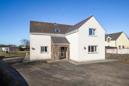
- Price
- Fixed Price£499,950
- Size
- 10 acres
Llangwm, Haverfordwest, SA62, Freystrop, Pembrokeshire SA62 Wales
Added on 23/07/2026House with Land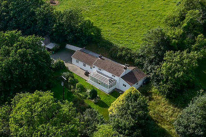
- Price
- £520,000
- Size
- 5 acres
Camrose, Haverfordwest, SA62, Haverfordwest, Pembrokeshire SA62 Wales
Added on 13/07/2026Smallholding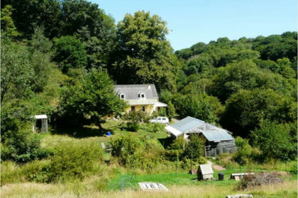
- Price
- Offers in Region of£530,000
- Size
- 6 acres
Hafod Y Dail, Clynderwen, SA66, New Moat, Pembrokeshire SA66 Wales
Added on 26/09/2026Smallholding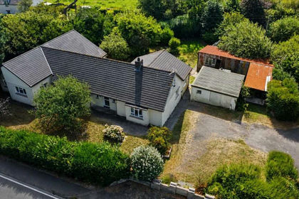
- Price
- Guide Price£450,000
- Size
- 4.51 acres
Added on 24/08/2026House with Land
- Price
- Offers in Region of£525,000
- Size
- 7 acres
Plas Y Mabws, Mabws Fawr Mathry Haverfordwest, Mathry, Pembrokeshire SA62 Wales
Added on 14/08/2026House with Land
- Price
- Offers in Region of£499,950
- Size
- 4 acres
Added on 08/09/2026Smallholding
- Price
- £395,000
- Size
- 5 acres
Rhosfach, Clunderwen, SA66, Maenclochog, Pembrokeshire SA66 Wales
Added on 09/10/2026Smallholding
- Price
- Offers in Excess of£525,000
- Size
- 5 acres
Added on 11/02/2026Barn Conversion
- Price
- Guide Price£495,000
- Size
- 24.32 acres
Dwrbach, Fishguard, SA65, Fishguard, Pembrokeshire SA65 Wales
Added on 12/10/2026Smallholding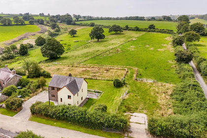
- Price
- Guide Price£425,000
- Size
- 13 acres
Llanboidy CARMARTHENSHIRE, Llanboidy, Carmarthenshire SA34 Wales
Added on 08/10/2026Smallholding