East Street, Kimbolton, Cambridgeshire
- Land size
- 0.7 acres
- Bedrooms
- 5
- Bathrooms
- 2
Key Features
- Period 5 Bedroom House
- Central Kimbolton Location
- Garage
- Large Hidden Garden
- Available With No Onward Chain
Description
Oliver Russell Property Consultants are delighted to bring to the market this substantial 5 bedroom Grade II Listed home, situated in the Conservation area of Kimbolton, on East Street.
KIMBOLTON
Kimbolton provides an eclectic mixture of homes and businesses with numerous independent retail operators, a Grade I Listed Church, a Public House with restaurant, an Indian restaurant a dentist, butchers, hardware store and chemist. The retail coverage has been improved with a small Budgens Supermarket opening on Thrapston Road, the village also has its own Doctors surgery and Medical Centre.
At one end of the village is Kimbolton Castle an imposing building of national historic importance with links to King Harrold, Henry VIII and Katherine of Aragon. The former seat of the Dukes of Manchester the Castle since 1951 has been a school.
EDUCATION:
Kimbolton hosts the leading independent Kimbolton School, providing pre prep, prep and senior schooling. The town also provides the Kimbolton Primary School State primary school.
Alternative independent schools are available at Bedford (14 miles) including Bedford School, Bedford Girls School, Bedford Modern School, & Bedford Greenacre School. Oundle School is approximately 18 miles to the North West. State secondary schools, Longsands and Hinchingbrook are situated in St Neots ( 9 miles) and Huntingdon (7 miles) respectively.
LOCATION:
The property is situated off East Street in the centre of the small market town of Kimbolton and is approximately 8 miles to the larger market town of St Neots, where extensive retail and leisure facilities are available with the addition of a mainline railway station, providing regular direct access services to London Kings Cross in approximately 45 minutes.
The property benefits from a 26ft long lounge, separate dining room, kitchen-breakfast room with hand built units, separate utility room, 5 bedrooms, including master bedroom with en-suite bathroom. To the outside, the house has a small terrace to the rear of the breakfast room and lawn areas of approx 0.7 of an acre,. The property also has the benefit of a garage located on St Andrew's Lane.
THE PROPERTY:
ENTRANCE:
Period door, access to lounge and dining room, stairs.
LOUNGE: 8.1 M X 4.1 M
Substantial lounge with dual aspects to East Street and St Andrews Church. The room provides oak flooring, fireplace, with flagstone hearth, two radiators, exposed period beams in part.
DINING ROOM: 4.35 M X 3.5 M
Sash window with views to St Andrews Church to the front aspect, exposed beams and uprights in part, inglenook fire place, radiator, stairs to master bedroom, steps down to kitchen and breakfast room.
KITCHEN: 4.30 M X 3.75 M
Kitchen with views to St Andrews Church from window to front aspect, hand built kitchen units with granite and hard wood work surfaces. Belfast sink, tiled floor, Redfyre cooking range ( also controls heating and hot water),exposed beams in part, pantry, opening to the breakfast room.
BREAKFAST ROOM: 3.0 M X 2.45 M
French windows to private walled courtyard, tiled flooring.
UTILITY ROOM: 4.0 M X 3.0 M
Range of base units and work tops with inset single bowl sink. Plumbing for washing machine and space for appliances, radiator, storage cupboard, stable door to pathway leading to side garden.
GROUND FLOOR CLOAKROOM:
Low level WC and wash hand basin.
FIRST FLOOR LANDING:
Window to rear aspect, overlooking East Street, doors to bedrooms and bathroom, stairs to Bedroom 2, airing cupboard.
BEDROOM 2: 5.30 M X 4.40 M
Double bedroom with double aspect windows to front and rear, part vaulted ceiling, range of fitted wardrobes, radiator, loft access.
BEDROOM 3: 4.0 M X 3.33 M
Window to rear aspect, period cast iron fireplace, fitted cupboards, radiator.
FAMILY BATHROOM:
Fully fitted bathroom, comprising panel bath, with hand mixer shower, tiled shower cubicle with glazed screen, wash hand basin, low level WC, radiator, tiling and timber paneling to half height, window to front aspect.
BEDROOM 5: 3.38 M X 2.92 M
Bedroom with vaulted ceiling, window to front aspect over looking St Andrews Church, shelving.
BEDROOM 4: 3.53 M X 3.38 M
Window to front aspect, period fireplace, cupboard, radiator.
BEDROOM 1: 5.40 M X 3.50 M
Double room with dual aspect windows to front elevation, wardrobes, radiator, door to:
EN-SUITE BATHROOM:
Spectacular recently refitted bathroom with vaulted ceiling. Tiled flooring with under floor heating. Large free standing oval bath, over sized circular shower cubicle, twin basins and WC with concealed cistern, dormer window to front aspect.
GARAGE
Single garage accessed off St Andrew's Lane
GARDEN:
To the side of the property is a walled and fenced garden mainly laid to lawn, following a path leads to a larger secluded lawn area, onto the banks of the River Kym.
Map Location
Property details
- Tenure
- Ask Agent
- Council Tax Band
- Ask Agent
- Date Posted
- 2026-11-16
Utilities & Restrictions
Utilities
- Electricity
- Ask Agent
- Water
- Ask Agent
- Heating
- Oil Heating
- Broadband
- Ask Agent
- Sewerage
- Ask Agent
Rights & Restrictions
- Public Rights of Way
- Ask Agent
- Private Rights of Way
- Ask Agent
- Listed Property
- Ask Agent
- Restrictions
- Ask Agent
Listed status, conservation areas and planning constraints for this location are in the full report.
Property Features
- Accessibility
- Ask Agent
- Parking
- Parking Available
- Garden
- Garden
Beyond the particulars: planning activity, flood history, heritage and ground risks, checked for this exact spot.
Connectivity
Broadband
Fastest speed available at this postcode
1 Gbps
Gigabit full fibre · available to 80% of premises
Suitable for
- 4K streaming on every screen
- Full-time home working
- Online gaming & big downloads
Mobile signal
Predicted 4G and 5G signal; indoor signal depends on building materials.
Ofcom Connected Nations postcode-level predictions. Speeds and signal are modelled, not measured, and vary between addresses and providers.
Signal is the easy part. Planning activity, flood history and protected designations here are in the full report.
Nearest Schools
Primary
- Kimbolton Primary Academy378 metresNo Ofsted rating
- Ages
- 2 to 11
- Pupils
- 59
- Type
- Academy sponsor led
- Great Staughton Primary Academy2.7 milesOfsted report card · Jan 2026
- Ages
- 2 to 11
- Pupils
- 80
- Type
- Academy converter
- Eileen Wade Primary School3.3 milesOfsted report card · Dec 2025
- Ages
- 4 to 11
- Pupils
- 70
- Type
- Foundation school
- Spaldwick Primary School3.3 milesOfsted: Good *
- Ages
- 4 to 11
- Pupils
- 104
- Type
- Academy converter
- Riseley CofE Primary School4.3 milesOfsted: Good
- Ages
- 3 to 11
- Pupils
- 121
- Type
- Voluntary aided school
- Faith
- Church of England
Secondary
- Manor School6.8 milesOfsted: Inadequate
- Ages
- 11 to 19
- Pupils
- 851
- Type
- Academy converter
- Longsands Academy7.4 milesOfsted: Good
- Ages
- 11 to 18
- Pupils
- 1,412
- Type
- Academy converter
- Ernulf Academy7.6 milesOfsted: Good *
- Ages
- 11 to 16
- Pupils
- 720
- Type
- Academy sponsor led
- Hinchingbrooke School8.2 milesOfsted report card · May 2026
- Ages
- 11 to 18
- Pupils
- 2,173
- Type
- Academy converter
- The Ferrers School8.4 milesOfsted report card · Mar 2026
- Ages
- 11 to 18
- Pupils
- 937
- Type
- Academy converter
* Latest graded judgement covers quality of education only; no overall grade was issued under the 2024-25 inspection framework.
Distances are straight-line from the advertised location. Source: the national school registers (DfE, Welsh Government, Scottish Government) and Ofsted.
Schools are just the start: sold prices nearby, planning activity and any flood history are in the full report.
Amenities
Supermarket
GP surgery
Pharmacy
Hospital
Green space
Straight-line distances from the advertised location. Sources: NHS records, Geolytix supermarket locations, OS Open Greenspace and the national trails registers.
The area stacks up? Now check the location itself: planning nearby, protected designations and past flooding.
Getting Around
Nearest station
Nearest bus stop
Typical drive times
Straight-line distances from the advertised location; drive times are typical free-flow times over OpenStreetMap road data, so allow more at peak. Public transport locations from DfT NaPTAN.
Easy to reach matters. So do planning activity, flood history and ground risks: all in the full report.
Flood Risk
Environment Agency open data, checked around the advertised map pin for the listed acreage. Long-term risk counts flood defences; the planning map's flood zones do not. Provided by LandSale, not the listing agent, and not part of the agent's particulars. Risk varies across a holding, so verify before committing.
Rivers and the sea
Not at the pin: mapped about 20 metres away.
Planning map: Flood Zone 3, about 30 metres away.
Surface water
Not at the pin: mapped about 20 metres away.
These bandings are the summary. Where this location sits on the flood maps, plus planning activity, heritage and ground risks, is in the full report.
Important notice: Information, maps and tags on this page are drawn from the advertising agent's marketing materials or generated automatically. LandSale has not verified them. Relying on these details is at your own risk, always carry out independent checks before committing to a purchase.
LandSale full disclaimer
Marketing information only - not formal particulars. The details on this website are provided for general guidance and do not constitute an offer or contract. Neither LandSale nor the advertising estate/land agent accepts responsibility for any inaccuracy.
1. Source of information
- Listing content: Core description, asking price, tenure, measurements, photographs and planning history originate from the marketing materials of the advertising estate or land agent. LandSale does not author this content and cannot guarantee its accuracy.
- Automated tags & categorisation: Property type, land-use class, acreage bands and similar labels may be applied by machine-learning models. They are intended as a helpful guide only and may not reflect the property's legal status or permitted use.
- Third-party & enriched data layers: Maps, boundary outlines, planning designations, soil reports, broadband coverage and other environmental or location-based insights are licensed from external suppliers. Such data are supplied “as is", may be incomplete or out of date and are subject to change without notice.
2. Verification required
Prospective purchasers must verify critical matters, including but not limited to planning permission, title boundaries, public rights of way, environmental constraints, acreage, services, access and VAT status, through their own inspections, specialist surveys, legal advisers and the selling agent before relying on the information or entering into any contract.
3. No warranty or liability
LandSale gives no warranty, express or implied, as to the accuracy, completeness or fitness for any particular purpose of the information displayed. LandSale shall not be liable for any loss, damage, cost or expense arising directly or indirectly from any use of or reliance on such information, save where liability may not be excluded by law.
4. Updates & feedback
If you believe any detail on this listing is inaccurate, please let us know. We will investigate and, where appropriate, update the listing or notify the agent.
© LandSale | Version 1.3 - August 2026
Similar properties for sale
- Price
- Guide Price£900,000
- Size
- 1 acres
Added on 30/10/2026House with Land
- Price
- Guide Price£800,000
- Size
- 13.77 acres
Little Catworth, Huntingdon, Cambridgeshire, PE28, Catworth, Cambridgeshire PE28 England
Added on 09/09/2026Farmhouse
- Price
- Guide Price£575,000
Howard Barn, Upper Dean, Dean and Shelton, Bedford PE28 England
Added on 16/07/2026Barn Conversion
- Price
- Guide Price£825,000
- Size
- 3 acres
Wychtree Farm, Keysoe, MK44, Bolnhurst and Keysoe, Bedford MK44 England
Added on 29/01/2026Barn Conversion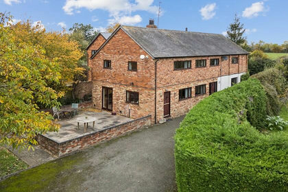
- Price
- Offers in Excess of£825,000
- Size
- 0.5 acres
Added on 12/11/2026Barn Conversion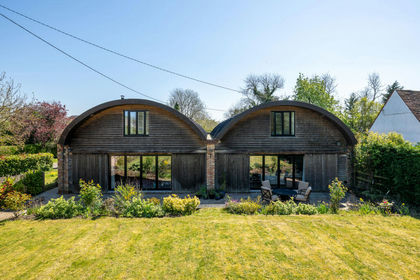
- Price
- £900,000
- Size
- 0.4 acres
Honeydon Road, Colmworth, MK44, Colmworth, Bedford MK44 England
Added on 30/04/2026Barn Conversion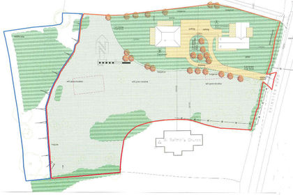
- Price
- Guide Price£850,000
- Size
- 3 acres
Brington Road, Old Weston. PE28, Old Weston, Cambridgeshire PE28 England
Added on 18/07/2026Development Land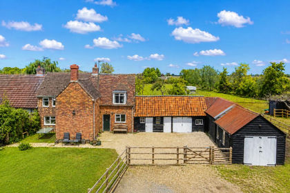
- Price
- Guide Price£650,000
- Size
- 2.5 acres
Cross End, Thurleigh, Bedford, Bedfordshire, MK44, Thurleigh, Bedford MK44 England
Added on 23/07/2026House with Land
- Price
- Offers Over£900,000
- Size
- 1.19 acres
Mill Road, Buckden, PE19, Buckden, Cambridgeshire PE19 England
Added on 11/06/2026House with Land
- Price
- Offers Over£795,000
Home Close, Sharnbrook, Bedfordfordshire, MK44, Sharnbrook, Bedford MK44 England
Added on 30/07/2026Barn Conversion