Maryfield House, Mains Loan, Dundee
- Land size
- 2.71 acres
Description
**CLOSING DATE: 12 noon on Friday 13th November 2026**
The site is rectangular in shape and accessed from Mains Loan. NHS Tayside have declared Maryfield House and the site surplus and are offering the site for sale. The site extends to 1.1 hectares (2.71 acres). Whilst the site has no official allocation within the Dundee City local Plan, Dundee City Council has prepared a development brief for the site. A copy is available to interested parties.
LOCATION:
The site is located to the west of Mains Loan and to the east of Arklay Terrace, set within the Maryfield area of the city. The site is surrounded by a mix of established housing including private and local authority housing, Dundee International Sports Centre, Clepington Primary School, Morgan Academy and both Dundee United and Dundee football stadiums.
Dundee is a thriving and increasingly popular city on Scotland's east coast, offering an excellent combination of urban convenience, natural beauty and strong transport links. Set along the River Tay, the city boasts an attractive waterfront, historic architecture and a growing selection of shops, restaurants, cafés and leisure facilities.
The city is home to the renowned V&A Dundee, Discovery Point and a vibrant cultural scene, while Dundee's universities and excellent educational facilities make the area particularly appealing to students, professionals and families alike.
Dundee provides convenient road and rail connections to surrounding towns and cities, including Perth, St Andrews and Edinburgh, making it an attractive location for commuters. The nearby Angus countryside and coastline also offer plenty of opportunities for walking, cycling and outdoor activities.
With ongoing investment and regeneration across the city, Dundee continues to develop as an exciting place to live, work and invest. Its combination of amenities, transport connections, waterfront attractions and comparatively accessible property prices makes Dundee an appealing choice for a wide range of buyers.
BIDDING PROCESS
Ballantynes will administer the sale of the site and all enquiries should be made to Ballantynes in the first instance. The heritable Interest (freehold) is offered for sale as a whole, with vacant possession.
Parties should register their interest in order to be kept advised of any Closing date being set. Please note that agents acting on behalf of potential bidders must advise Ballantynes for whom they are acting .
Bidders should note the following information will be required:
1. Bidding Parties Name
2. Headline price and method of payment
3. Development layout - identifying potential numbers, layouts and proposed house/flat types.
4. Details of proposed scheme including development coverage
5. Clawback and overage provisions
6. Conditions of purchase
7. Timetable of purchase
8. Evidence of Board approval
9. Legal representative details.
Please note that the client seeks clean offers and a greater weighting will be given to clean offers.
The owner reserves the right to sell the property without any reference to any other party.
Interviews may be held after the closing date. The client shall not be bound to accept the highest or indeed any offer.
CLAWBACK:
The seller, the Scottish Ministers per NHS Tayside reserve the right to impose a clawback/overage provision as a condition of the sale.
SERVICES:
The property is served by mains electricity, mains water and mains drainage.
RATEABLE VALUE:
The property is currently assessed for rates as a Hospital and the rateable value as assessed on 1st April 2026 was £147,000.
VIEWING:
Viewing is strictly by appointment only, by contacting the sole selling agents, Ballantynes, Perth Office.
Tenure: Freehold
Map Location
Property details
- Tenure
- Freehold
- Council Tax Band
- Ask Agent
- Date Posted
- 2026-11-10
Utilities & Restrictions
Utilities
- Electricity
- Ask Agent
- Water
- Ask Agent
- Heating
- Ask Agent
- Broadband
- Ask Agent
- Sewerage
- Ask Agent
Rights & Restrictions
- Public Rights of Way
- Ask Agent
- Private Rights of Way
- Ask Agent
- Listed Property
- Ask Agent
- Restrictions
- Ask Agent
Listed status, conservation areas and planning constraints for this location are in the full report.
Property Features
- Accessibility
- Ask Agent
- Parking
- Ask Agent
- Garden
- Ask Agent
Beyond the particulars: planning activity, flood history, heritage and ground risks, checked for this exact spot.
Connectivity
Broadband
Fastest speed available at this postcode
5.5 Gbps
Gigabit full fibre
Suitable for
- 4K streaming on every screen
- Full-time home working
- Online gaming & big downloads
Mobile signal
Predicted 4G and 5G signal; indoor signal depends on building materials.
Ofcom Connected Nations postcode-level predictions. Speeds and signal are modelled, not measured, and vary between addresses and providers.
Signal is the easy part. Planning activity, flood history and protected designations here are in the full report.
Nearest Schools
Primary
- Clepington Primary School377 metres
- Pupils
- 401
- Type
- Non-denominational
- Dens Road Primary School787 metres
- Pupils
- 239
- Type
- Non-denominational
- Glebelands Primary School962 metres
- Pupils
- 356
- Type
- Non-denominational
- Rosebank Primary School0.7 miles
- Pupils
- 295
- Type
- Non-denominational
- Our Lady's RC Primary School0.7 miles
- Pupils
- 239
- Type
- Roman Catholic
Secondary
- Morgan Academy338 metres
- Pupils
- 942
- Type
- Non-denominational
- St Paul's RC Academy1 mile
- Pupils
- 997
- Type
- Roman Catholic
- Craigie High School1.4 miles
- Pupils
- 725
- Type
- Non-denominational
- St John's RC High School1.4 miles
- Pupils
- 1,279
- Type
- Roman Catholic
- Baldragon Academy1.7 miles
- Pupils
- 881
- Type
- Non-denominational
Distances are straight-line from the advertised location. Source: the national school registers (DfE, Welsh Government, Scottish Government) and Ofsted.
Schools are just the start: planning activity, heritage and any flood history here are in the full report.
Amenities
Supermarket
GP surgery
Pharmacy
Green space
Walking trail
Straight-line distances from the advertised location. Sources: NHS records, Geolytix supermarket locations, OS Open Greenspace and the national trails registers.
The area stacks up? Now check the location itself: planning nearby, protected designations and past flooding.
Getting Around
Nearest station
Nearest bus stop
Typical drive times
Straight-line distances from the advertised location; drive times are typical free-flow times over OpenStreetMap road data, so allow more at peak. Public transport locations from DfT NaPTAN.
Easy to reach matters. So do planning activity, flood history and ground risks: all in the full report.
Flood Risk
SEPA open data, checked around the advertised map pin for the listed acreage. Provided by LandSale, not the listing agent, and not part of the agent's particulars. Risk varies across a holding, so verify before committing.
Rivers and the sea
Surface water
Not at the pin: mapped about 30 metres away.
These bandings are the summary. Where this location sits on the flood maps, plus planning activity, heritage and ground risks, is in the full report.
Important notice: Information, maps and tags on this page are drawn from the advertising agent's marketing materials or generated automatically. LandSale has not verified them. Relying on these details is at your own risk, always carry out independent checks before committing to a purchase.
LandSale full disclaimer
Marketing information only - not formal particulars. The details on this website are provided for general guidance and do not constitute an offer or contract. Neither LandSale nor the advertising estate/land agent accepts responsibility for any inaccuracy.
1. Source of information
- Listing content: Core description, asking price, tenure, measurements, photographs and planning history originate from the marketing materials of the advertising estate or land agent. LandSale does not author this content and cannot guarantee its accuracy.
- Automated tags & categorisation: Property type, land-use class, acreage bands and similar labels may be applied by machine-learning models. They are intended as a helpful guide only and may not reflect the property's legal status or permitted use.
- Third-party & enriched data layers: Maps, boundary outlines, planning designations, soil reports, broadband coverage and other environmental or location-based insights are licensed from external suppliers. Such data are supplied “as is", may be incomplete or out of date and are subject to change without notice.
2. Verification required
Prospective purchasers must verify critical matters, including but not limited to planning permission, title boundaries, public rights of way, environmental constraints, acreage, services, access and VAT status, through their own inspections, specialist surveys, legal advisers and the selling agent before relying on the information or entering into any contract.
3. No warranty or liability
LandSale gives no warranty, express or implied, as to the accuracy, completeness or fitness for any particular purpose of the information displayed. LandSale shall not be liable for any loss, damage, cost or expense arising directly or indirectly from any use of or reliance on such information, save where liability may not be excluded by law.
4. Updates & feedback
If you believe any detail on this listing is inaccurate, please let us know. We will investigate and, where appropriate, update the listing or notify the agent.
© LandSale | Version 1.3 - August 2026
Similar properties for sale
- Price
- POA
- Size
- 1.68 acres
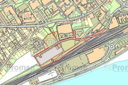
Land at Seabraes, Greenmarket, Dundee, DD1, Dundee Central, Dundee City DD1 Scotland
Added on 29/01/2026Redevelopment Land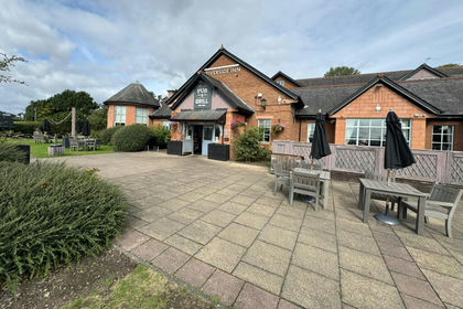
- Price
- POA
- Size
- 3.05 acres
Riverside Inn, Riverside Drive, Dundee, DD2, Dundee Central, Dundee City DD2 Scotland
Added on 08/09/2026Pub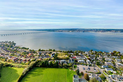
- Price
- POA
- Size
- 1.7 acres
Netherlea, West Road, Newport-On-Tay, DD6, North East Fife, Fife DD6 Scotland
Added on 29/01/2026Development Land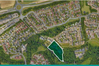
- Price
- POA
- Size
- 1.16 acres
Added on 29/01/2026Development Land
- Price
- Offers Over£598,000
- Size
- 10 acres
Kirkbuddo, Forfar, DD8, Arbroath and Broughty Ferry, Angus DD8 Scotland
Added on 29/01/2026Redevelopment Land
- Price
- Offers Over£325,000
- Size
- 4.56 acres
Added on 28/01/2026Development Land
- Price
- POA
- Size
- 2.73 acres
Land, Lour Road, Forfar, DD8, Angus and Perthshire Glens, Angus DD8 Scotland
Added on 28/01/2026Undeveloped Land
- Price
- Guide Price£275,000
- Size
- 4.6 acres
Added on 14/10/2026Development Land
- Price
- POA
- Size
- 1.68 acres
Added on 29/01/2026Development Land
- Price
- Offers Over£150,000
- Size
- 2.59 acres
Added on 23/10/2026Building Plot