
Roepark Holdings, Little Brechin, DD9
- Land size
- 4.32 acres
- Bedrooms
- 3
- Bathrooms
- 1
Key Features
- Attractive semi-rural location
- Deatched 3 bedroom home
- Rennovation potential
- Number of outbuildings
- 1.46 Ha (3.61 Ac) of land
Description
Roepark is an attractive small holding located within the sought after hamlet of Little Brechin, in rural North Angus. Extending to approximately 4.32 acres, the property includes a useful range of buildings.
CLOSING DATE SET - TUESDAY 19 MAY 12 NOON
Roepark Holdings is an attractive small holding located within the sought after hamlet of Little Brechin, in rural North Angus. Set in a peaceful semi-rural setting and extending to approximately 3.6 acres, the property includes a useful range of buildings and offers an excellent lifestyle opportunity with potential to create a bespoke rural home.
The accommodation extends to approximately 148.73 sq.m and is arranged over two floors. At ground floor level, there are two well-proportioned reception rooms, one featuring an open fireplace, together with a kitchen fitted with wall and base units, a versatile office or potential ground-floor bedroom, and a generous family bathroom. A particular highlight is the impressive sun room, which extends along the southern elevation and provides a bright and spacious additional living area. The first floor comprises two double bedrooms, both with built-in storage and enjoying attractive outlooks over the surrounding countryside.
The house benefits from oil-fired central heating, mains electricity and water, septic tank drainage, and predominantly double-glazed windows.
The farm buildings at Roepark Holdings are situated to the west of the house and comprise a compact and practical range of predominantly modern agricultural buildings. Well laid out and easily accessible, the buildings are suitable for a variety of uses including livestock housing, machinery storage, fodder storage or equestrian purposes. The buildings are served by mains water and electricity.
Cattle Court
A fivebay steel portal frame building with box profile sheeting to the west and north elevations and an earth floor. An adjoining small cattle court and storage shed lies to the east. Approximately 30.0m x 12.5m (375 sq.m)
Small Cattle Court
Of concrete block construction under a pitched fibre cement roof. The building includes central feed barriers, a secure workshop area clad in box profile sheeting, and is accessed via a sliding metal door. Approximately 13.0m x 10.5m (136.5 sq.m)
Machinery Shed / Extension
Constructed with a combination of concrete blockwork, tin sheeting and ventilated cladding beneath a fibre cement roof. Sliding metal door access provides ease of use for machinery and general storage. Approximately 10.5m x 8.57m and 10.5m x 7.4m (169.76 sq.m)
Leanto Store
Of part concrete block and part ventilated sheet cladding construction under a fibre cement roof with a concrete floor. Currently used for general storage and accessed via a swinging metal door. Approximately 10.77m x 7.5m (80.77 sq.m)
Modern Workshop
Located adjacent to the farmhouse, this modern steel portal frame building is clad in box profile sheeting to the roof and walls, with roller shutter doors on the east and south elevations and a concrete floor, providing excellent workshop or storage accommodation. Approximately 6.0m x 9.0m (54 sq.m)
The land at Roepark Holdings extends to approximately 1.46 hectares (3.61 acres) of Grade 2 permanent pasture, divided into three field parcels. The land is well suited to livestock grazing or equestrian use and is enclosed by stockproof fencing comprising a mix of rabbit netting, rylock and plain wire. A mature, wellestablished hedge provides shelter, privacy and clearly defines the boundary of the holding.
To the front of the property, the garden is partially laid to lawn, bordered by hedging and complemented by a large patio accessed directly from the sun room. A large summerhouse is positioned within the eastern corner of the garden, creating a pleasant and private setting ideal for outdoor dining and relaxation.
An outhouse adjoins the farmhouse on the west elevation and is of traditional stone construction beneath a slate roof with a concrete floor, providing useful additional storage. Externally, the property benefits from a generous gravel parking area to the north and west of the house, together with a traditional single garage.
Roepark Holdings is located in the peaceful village of Little Brechin, near Brechin, within the county of Angus. This semi-rural setting combines the charm of countryside living with practical access to nearby towns and transport links, making it ideal for families, retirees, or anyone seeking a quieter lifestyle within reach of essential services.
The property is located just 2 miles from the city of Brechin, which provides a range of local amenities including shops, schools, healthcare services, and leisure facilities. Local schooling includes Maisondieu Primary School (approximately 2 miles away) and Brechin High School (around 2.3 miles). The city of Dundee lies 28 miles to the south and offers all the services expected of a city including renowned cultural facilities such as the V&A museum and two universities. There is a mainline railway stations at Dundee, including a sleeper service. There are daily flights from Dundee Airport to Heathrow. The surrounding countryside provides for all tastes in outdoor activities, including hill walking in the Angus Glens, golf, curling, fishing, water sports and skiing.
Directions
Heading north on the A90 dual carriageway, take the exit signposted for Brechin. At the roundabout, take the first exit and continue for approximately 1.6 miles, passing through Castle Street, St Mary’s Street, St David’s Street and Swan Street. Turn right onto Panmure Street and at the next roundabout turn left onto Southesk Street. After approximately 0.1 miles, continue straight ahead at the following roundabout onto Distillery Road, before bearing slightly right onto Cookston Road. Continue for around 1.6 miles, where Roepark will be found on the left-hand side.
For viewers using the ‘what3words’ app, ///shredding.arrive.pine
Mains water and electricity. Drainage to a septic tank. Oil fired central heating.
All fitted blinds and curtains are included in the sale. All other items of furniture, freestanding appliances, and decorative pieces may be available by separate negotiation. The CCTV system is not included in the sale.
Map Location
Property details
- Tenure
- Ask Agent
- Council Tax Band
- E
- Date Posted
- 2026-11-09
Market Value Analysis
Compared with 106 Farms & Smallholdings listings in Scotland (1+ acres).
Energy Performance Certificate
Energy Efficiency Rating
Based on UK Energy Performance Certificate standards (EU Directive 2002/91/EC)
Running costs are one side. Planning activity, flood history and ground risks for this location are in the full report.
Property Brochure
Seen the details? The full report adds the independent checks: planning activity, flood history, heritage and ground.
Utilities & Restrictions
Utilities
- Electricity
- Ask Agent
- Water
- Ask Agent
- Heating
- Ask Agent
- Broadband
- Ask Agent
- Sewerage
- Ask Agent
Rights & Restrictions
- Public Rights of Way
- Ask Agent
- Private Rights of Way
- Ask Agent
- Listed Property
- Ask Agent
- Restrictions
- Ask Agent
Listed status, conservation areas and planning constraints for this location are in the full report.
Property Features
- Accessibility
- Ask Agent
- Parking
- Ask Agent
- Garden
- Ask Agent
Beyond the particulars: planning activity, flood history, heritage and ground risks, checked for this exact spot.
Connectivity
Broadband
Fastest speed available at this postcode
1.8 Gbps
Gigabit full fibre
Suitable for
- 4K streaming on every screen
- Full-time home working
- Online gaming & big downloads
Mobile signal
Predicted 4G and 5G signal; indoor signal depends on building materials.
Ofcom Connected Nations postcode-level predictions. Speeds and signal are modelled, not measured, and vary between addresses and providers.
Signal is the easy part. Planning activity, flood history and protected designations here are in the full report.
Nearest Schools
Primary
- Maisondieu Primary School1.7 miles
- Pupils
- 367
- Type
- Non-denominational
- Andover Primary School2.2 miles
- Pupils
- 241
- Type
- Non-denominational
- Stracathro Primary School2.5 miles
- Pupils
- 22
- Type
- Non-denominational
- Edzell Primary School4.2 miles
- Pupils
- 102
- Type
- Non-denominational
- Aberlemno Primary School5.7 miles
- Pupils
- 11
- Type
- Non-denominational
Secondary
- Brechin High School1.3 miles
- Pupils
- 562
- Type
- Non-denominational
- Montrose Academy8.9 miles
- Pupils
- 859
- Type
- Non-denominational
- Mearns Academy10 miles
- Pupils
- 687
- Type
- Non-denominational
- Forfar Academy11 miles
- Pupils
- 1,107
- Type
- Non-denominational
- Arbroath Academy13 miles
- Pupils
- 683
- Type
- Non-denominational
Distances are straight-line from the advertised location. Source: the national school registers (DfE, Welsh Government, Scottish Government) and Ofsted.
Schools are just the start: planning activity, heritage and any flood history here are in the full report.
Amenities
Supermarket
GP surgery
Pharmacy
Walking trail
Straight-line distances from the advertised location. Sources: NHS records, Geolytix supermarket locations, OS Open Greenspace and the national trails registers.
The area stacks up? Now check the location itself: planning nearby, protected designations and past flooding.
Getting Around
Nearest station
Nearest bus stop
Typical drive times
Straight-line distances from the advertised location; drive times are typical free-flow times over OpenStreetMap road data, so allow more at peak. Public transport locations from DfT NaPTAN.
Easy to reach matters. So do planning activity, flood history and ground risks: all in the full report.
Flood Risk
SEPA open data, checked around the advertised map pin for the listed acreage. Provided by LandSale, not the listing agent, and not part of the agent's particulars. Risk varies across a holding, so verify before committing.
Rivers and the sea
Surface water
These bandings are the summary. Where this location sits on the flood maps, plus planning activity, heritage and ground risks, is in the full report.
Important notice: Information, maps and tags on this page are drawn from the advertising agent's marketing materials or generated automatically. LandSale has not verified them. Relying on these details is at your own risk, always carry out independent checks before committing to a purchase.
LandSale full disclaimer
Marketing information only - not formal particulars. The details on this website are provided for general guidance and do not constitute an offer or contract. Neither LandSale nor the advertising estate/land agent accepts responsibility for any inaccuracy.
1. Source of information
- Listing content: Core description, asking price, tenure, measurements, photographs and planning history originate from the marketing materials of the advertising estate or land agent. LandSale does not author this content and cannot guarantee its accuracy.
- Automated tags & categorisation: Property type, land-use class, acreage bands and similar labels may be applied by machine-learning models. They are intended as a helpful guide only and may not reflect the property's legal status or permitted use.
- Third-party & enriched data layers: Maps, boundary outlines, planning designations, soil reports, broadband coverage and other environmental or location-based insights are licensed from external suppliers. Such data are supplied “as is", may be incomplete or out of date and are subject to change without notice.
2. Verification required
Prospective purchasers must verify critical matters, including but not limited to planning permission, title boundaries, public rights of way, environmental constraints, acreage, services, access and VAT status, through their own inspections, specialist surveys, legal advisers and the selling agent before relying on the information or entering into any contract.
3. No warranty or liability
LandSale gives no warranty, express or implied, as to the accuracy, completeness or fitness for any particular purpose of the information displayed. LandSale shall not be liable for any loss, damage, cost or expense arising directly or indirectly from any use of or reliance on such information, save where liability may not be excluded by law.
4. Updates & feedback
If you believe any detail on this listing is inaccurate, please let us know. We will investigate and, where appropriate, update the listing or notify the agent.
© LandSale | Version 1.3 - August 2026
Similar properties for sale
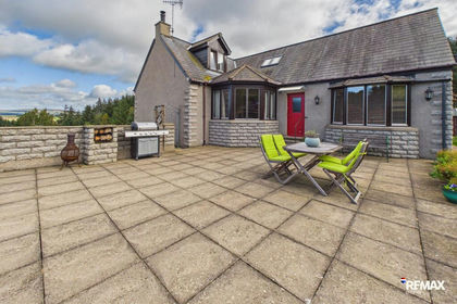
- Price
- Offers Over£390,000
- Size
- 4 acres
Clatt, Huntly, AB54, Gordon and Buchan, Aberdeenshire AB54 Scotland
Added on 29/09/2026Smallholding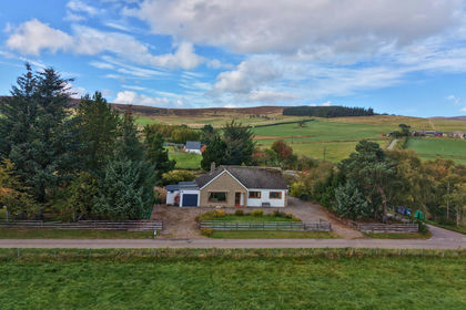
- Price
- Offers Over£325,000
- Size
- 2 acres
Glenlivet, Ballindalloch, Moray West, Nairn and Strathspey, Moray AB37 Scotland
Added on 08/10/2026House with Land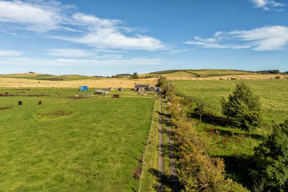
- Price
- Offers Over£390,000
- Size
- 33.3 acres
2 Hayhillock Cottage, Ellon, Aberdeenshire, AB41, Gordon and Buchan, Aberdeenshire AB41 Scotland
Added on 13/10/2026Smallholding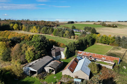
- Price
- Offers Over£400,000
- Size
- 20 acres
Sessnie Croft, Ellon, AB41, Gordon and Buchan, Aberdeenshire AB41 Scotland
Added on 25/10/2026Smallholding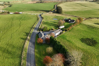
- Price
- Offers Over£365,000
- Size
- 5 acres
Aberchirder, Huntly, AB54, Aberdeenshire North and Moray East, Aberdeenshire AB54 Scotland
Added on 07/11/2026Smallholding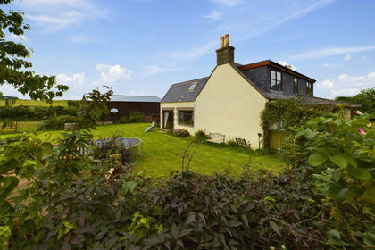
- Price
- Offers Over£349,500
- Size
- 2 acres
Gordonstown, Banff, AB45, Aberdeenshire North and Moray East, Aberdeenshire AB45 Scotland
Added on 25/08/2026House with Land