
Craigview House, Usan, Montrose, DD10
- Land size
- 1.9 acres
- Dwelling size
- 5,069 sq ft
Key Features
- Entrance vestibule
- 3 public rooms
- Garden room
- Dining size kitchen
- 5 bedrooms
- Shower room
- Separate studio with swimming pool
- Attic room
- Garage
Description
B listed former Manse close to the coast, with stunning uninterrupted views over farmland to South Montrose Cove. Within easy reach of the amenities in Montrose.
Craigview House is a most attractive B listed, late Georgian former manse, believed to date from the late 18th century and shown on a map from 1792. It is a lovely symmetrical, bow-fronted house overlooking its own enclosed gardens. A fine stone-built and harled house, a previous owner created a studio in the former dairy building, attached to the house by an arched entrance onto a courtyard. This studio was later extended in the 1980s to include an attached garage, and an indoor swimming pool was added. Internally much of the original character and features of the house remain, with moulded cornicings, including in all the reception rooms and bedrooms, together with some panelled doors, window shutters and some decorative arched doorways.
The house is of local historical interest as it belonged to the late James Morrison, a celebrated landscape painter who exhibited at The Scottish Gallery in Edinburgh and was renowned for his dramatic skies. His life and works were made into the film Eye of the Storm by Anthony Baxter. A conservatory was added in the mid-1980s.
Additional garden ground and the paddock were acquired over the years to enhance the property. To further protect the house, a strip of ground was acquired to the west.
Accommodation
A partially glazed front door opens to an entrance vestibule with a tiled floor and inner stained glass door to the hallway, which features a period staircase, along with an original James Morrison painted door to an understair WC. The main reception rooms off the hallway all overlook the garden. The living room has a marble fireplace; the dining room is bay fronted with glazed doors to the garden, shutters and shelving; and the sitting room includes a low marble fireplace, display cupboard and doors to the conservatory which has a mature vine and access to the garden.
From the reception hall to the right is the dining kitchen with base units, a stainless steel sink and an integrated oven and hob. To the left of the staircase is a WC with wash basin. A short internal corridor opens through to a large rear porch and the adjacent boiler room, which then gives access to the courtyard.
Upstairs, the staircase with cast iron balustrades leads to a landing with storage cupboards and a shower room with large shower cubicle, WC and washbasin and a window overlooking the garden. Bedroom one has windows on two sides; bedroom two is bay fronted with shutters; bedroom three overlooks the rear garden; and two further bedrooms complete the accommodation.
From the courtyard, access leads to the studio, which has a large garden-facing window, storage and steps to an attic room. A door connects to the pool room with a swimming pool and filtration system, together with a shower room and garden access. To the rear is a double garage with electric and roller doors, storage space and housing boilers, pool equipment and flooring to cover over the swimming pool if required.
Listing
Designated by Historic Environment Scotland, Craigview House is a Category B listed building, recognising its architectural and historic significance. Please note that the hand-painted feature door to the ground floor WC may be replaced.
The gardens are beautifully arranged into a series of distinct, sheltered areas. A south-facing wall shelters two greenhouses and a garden store, while the main garden features lawns, colourful borders, spring bulbs and fruit trees.
Further areas include a tree-lined section with road access, a productive vegetable garden, and a paddock beyond, also with its own gated access.
Craigview House lies just south of Montrose and north of Lunan Bay in Angus, close to the coast. Montrose is an historic port, while Montrose Basin is a tidal basin and renowned wildlife reserve, home to a wide variety of migrating birds including ducks and geese. The River South Esk flows into the basin and out to the North Sea, and the basin is famed for its ever-changing tidal scenery and spectacular sunsets. This stretch of coast features red sandstone cliffs, rock formations and sandy bays. Lunan Bay itself is a well-known sandy beach extending for around 3 miles, with rolling fertile farmland inland.
Ferryden offers a primary school, pub and local shop, while Montrose provides primary and secondary schooling, a wide range of shopping and leisure facilities including a modern sports centre and swimming pool. Independent schooling is available at Lathallan, the High School of Dundee and schools in Aberdeen, with rail links from Montrose supporting commuting pupils. Local golf courses include Montrose, Edzell and Carnoustie. Fishing is available on the nearby North and South Esk rivers as well as along the coast.
The A92 runs from Stonehaven to Dundee via Montrose and Arbroath, while the A90 provides a fast inland route between Dundee and Aberdeen. Journey times to Aberdeen and its airport have improved with the Western Peripheral Route. Both Aberdeen and Dundee offer extensive city amenities, with Dundee home to attractions such as the V&A museum. Montrose sits on the East Coast railway line, providing direct services north and south, including a sleeper to London. Aberdeen Airport offers domestic and European flights, Dundee Airport connects to London City, and Edinburgh Airport is also accessible.
Directions
From Arbroath on the A92, head north for approximately 8.5 miles. Turn right, signposted Craig (opposite the turning for Rossie). After 1 mile, continue straight over a crossroads, then straight over a second crossroads after 0.2 miles. After a further 0.5 miles, turn right at the T-junction. Craigview House is on the right after 0.1 miles.
From Montrose, take the A92 south. Just south of the town, turn left (opposite the A934 to Forfar), signposted Balgove. Continue uphill for 0.7 miles and turn left at the T-junction. Go straight over two crossroads, then turn right at the next T-junction. Continue as above to reach the property.
For viewers using the ‘what3words’ app, the location of Craigview House is ///puzzles.requests.niece
Mains water and electricity, private drainage to a septic tank and oil fired central heating. There is a separate boiler to service the swimming pool.
Map Location
Property details
- Tenure
- Freehold
- Council Tax Band
- G
- Date Posted
- 2026-11-09
Market Value Analysis
Compared with 428 Homes with Land listings in Scotland (1+ acres).
Energy Performance Certificate
Energy Efficiency Rating
Based on UK Energy Performance Certificate standards (EU Directive 2002/91/EC)
Running costs are one side. Planning activity, flood history and ground risks for this location are in the full report.
Property Brochure
Seen the details? The full report adds the independent checks: planning activity, flood history, heritage and ground.
Utilities & Restrictions
Utilities
- Electricity
- Ask Agent
- Water
- Ask Agent
- Heating
- Ask Agent
- Broadband
- Ask Agent
- Sewerage
- Ask Agent
Rights & Restrictions
- Public Rights of Way
- Ask Agent
- Private Rights of Way
- Ask Agent
- Listed Property
- Ask Agent
- Restrictions
- Ask Agent
Listed status, conservation areas and planning constraints for this location are in the full report.
Property Features
- Accessibility
- Ask Agent
- Parking
- Ask Agent
- Garden
- Ask Agent
Beyond the particulars: planning activity, flood history, heritage and ground risks, checked for this exact spot.
Connectivity
Broadband
Fastest speed available at this postcode
1.8 Gbps
Gigabit full fibre
Suitable for
- 4K streaming on every screen
- Full-time home working
- Online gaming & big downloads
Mobile signal
Predicted 4G and 5G signal; indoor signal depends on building materials.
Ofcom Connected Nations postcode-level predictions. Speeds and signal are modelled, not measured, and vary between addresses and providers.
Signal is the easy part. Planning activity, flood history and protected designations here are in the full report.
Nearest Schools
Primary
- Ferryden Primary School0.7 miles
- Pupils
- 150
- Type
- Non-denominational
- Southesk Primary School0.9 miles
- Pupils
- 212
- Type
- Non-denominational
- St Margaret's RC Primary School1.5 miles
- Pupils
- 21
- Type
- Roman Catholic
- Lochside Primary School1.8 miles
- Pupils
- 351
- Type
- Non-denominational
- Borrowfield Primary School2.4 miles
- Pupils
- 214
- Type
- Non-denominational
Secondary
- Montrose Academy1 mile
- Pupils
- 859
- Type
- Non-denominational
- Brechin High School8.6 miles
- Pupils
- 562
- Type
- Non-denominational
- Arbroath Academy9.7 miles
- Pupils
- 683
- Type
- Non-denominational
- Mearns Academy9.9 miles
- Pupils
- 687
- Type
- Non-denominational
- Arbroath High School11 miles
- Pupils
- 889
- Type
- Non-denominational
Distances are straight-line from the advertised location. Source: the national school registers (DfE, Welsh Government, Scottish Government) and Ofsted.
Schools are just the start: planning activity, heritage and any flood history here are in the full report.
Amenities
Supermarket
GP surgery
Pharmacy
Green space
Walking trail
Straight-line distances from the advertised location. Sources: NHS records, Geolytix supermarket locations, OS Open Greenspace and the national trails registers.
The area stacks up? Now check the location itself: planning nearby, protected designations and past flooding.
Getting Around
Nearest station
Nearest bus stop
Typical drive times
Straight-line distances from the advertised location; drive times are typical free-flow times over OpenStreetMap road data, so allow more at peak. Public transport locations from DfT NaPTAN.
Easy to reach matters. So do planning activity, flood history and ground risks: all in the full report.
Flood Risk
SEPA open data, checked around the advertised map pin for the listed acreage. Provided by LandSale, not the listing agent, and not part of the agent's particulars. Risk varies across a holding, so verify before committing.
Rivers and the sea
Surface water
These bandings are the summary. Where this location sits on the flood maps, plus planning activity, heritage and ground risks, is in the full report.
Important notice: Information, maps and tags on this page are drawn from the advertising agent's marketing materials or generated automatically. LandSale has not verified them. Relying on these details is at your own risk, always carry out independent checks before committing to a purchase.
LandSale full disclaimer
Marketing information only - not formal particulars. The details on this website are provided for general guidance and do not constitute an offer or contract. Neither LandSale nor the advertising estate/land agent accepts responsibility for any inaccuracy.
1. Source of information
- Listing content: Core description, asking price, tenure, measurements, photographs and planning history originate from the marketing materials of the advertising estate or land agent. LandSale does not author this content and cannot guarantee its accuracy.
- Automated tags & categorisation: Property type, land-use class, acreage bands and similar labels may be applied by machine-learning models. They are intended as a helpful guide only and may not reflect the property's legal status or permitted use.
- Third-party & enriched data layers: Maps, boundary outlines, planning designations, soil reports, broadband coverage and other environmental or location-based insights are licensed from external suppliers. Such data are supplied “as is", may be incomplete or out of date and are subject to change without notice.
2. Verification required
Prospective purchasers must verify critical matters, including but not limited to planning permission, title boundaries, public rights of way, environmental constraints, acreage, services, access and VAT status, through their own inspections, specialist surveys, legal advisers and the selling agent before relying on the information or entering into any contract.
3. No warranty or liability
LandSale gives no warranty, express or implied, as to the accuracy, completeness or fitness for any particular purpose of the information displayed. LandSale shall not be liable for any loss, damage, cost or expense arising directly or indirectly from any use of or reliance on such information, save where liability may not be excluded by law.
4. Updates & feedback
If you believe any detail on this listing is inaccurate, please let us know. We will investigate and, where appropriate, update the listing or notify the agent.
© LandSale | Version 1.3 - August 2026
Similar properties for sale
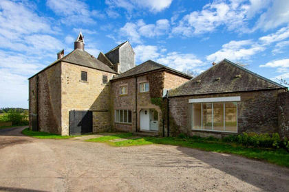
- Price
- Guide Price£520,000
- Size
- 1.59 acres
Balbirnie Mill, Brechin, DD9, Angus and Perthshire Glens, Angus DD9 Scotland
Added on 29/01/2026House with Land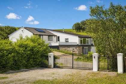
- Price
- Offers Over£440,000
- Size
- 1.68 acres
Kinneff, Montrose, DD10, West Aberdeenshire and Kincardine, Aberdeenshire DD10 Scotland
Added on 29/01/2026Equestrian property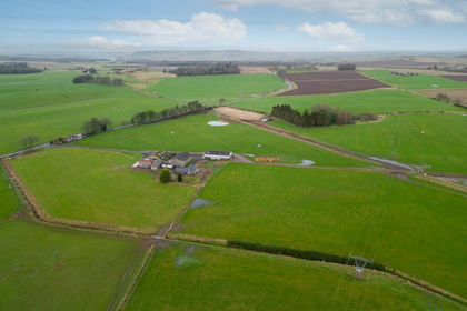
- Price
- Offers Over£598,000
- Size
- 10 acres
Kirkbuddo, Forfar, DD8, Arbroath and Broughty Ferry, Angus DD8 Scotland
Added on 29/01/2026Redevelopment Land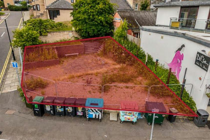
- Price
- Offers Over£425,000
Perth Road, Dundee, Dundee, DD2, Dundee Central, Dundee City DD1 Scotland
Added on 16/07/2026Development Land
- Price
- Offers Over£595,000
- Size
- 12 acres
St.Michaels, Leuchars, St Andrews, Fife, KY16, North East Fife, Fife KY16 Scotland
Added on 01/10/2026House with Land
- Price
- Offers Over£525,000
- Size
- 1.92 acres
Tillyneuk, Aberdeen, AB31, West Aberdeenshire and Kincardine, Aberdeenshire AB31 Scotland
Added on 20/07/2026House with Land
- Price
- Offers Over£495,000
- Size
- 3 acres
Losset Farm, Losset Road, Alyth, PH11, Angus and Perthshire Glens, Perth and Kinross PH11 Scotland
Added on 29/01/2026Redevelopment Land
- Price
- Offers Over£595,000
- Size
- 1.2 acres
Kirkside House, Kirkton of Glenisla. PH11, Angus and Perthshire Glens, Angus PH11 Scotland
Added on 13/05/2026House with Land
- Price
- Offers Over£425,000
- Size
- 6 acres
Added on 29/01/2026House with Land
- Price
- Offers Over£545,000
Added on 22/07/2026Barn Conversion