Land at Milden Road, Brent Eleigh, Nr Sudbury, Suffolk
- Land size
- 237.37 acres
Description
SUMMARY
The land at Milden Road, Brent Eleigh offers a purchaser a unique opportunity to purchase a ring-fenced block of gently undulating predominantly productive arable land in south Suffolk close to the market town of Sudbury.
In all about 237.37 acres (96.06 ha).
• 196.12 acres of productive arable land
• 30.10 acres of woodland (Camps Wood)
• 8.23 acres of permanent grassland
For sale by private treaty.
• Sudbury 7 miles
• Bury St Edmunds 14 miles
• Ipswich 15 miles
• Colchester 16 miles
These particulars are only a guide and must not be relied on as a statement of fact. Your attention is drawn to the important notice on the last page of text.
THE LAND
The land at Milden Road, Brent Eleigh is a high yielding block of arable land and woodland with good sized fields suitable for modern farming machinery.
The land type is shown as Grade 3 on the 1:250,000 Series Land Classification Plan. The soil is shown, in part, as being of the 411d (Hanslope Association) which is described in detail as ‘chalky till’. 'Slowly permeable calcareous clayed soil. Some slowly permeable non-calcareous clayey soils. Slight of wind erosion.'
In total, the farm extends to some 237.31 acres (96.06 hectares) and the typical cropping across the farm includes winter wheat, oil seed , barley and more recently some legume fallow. The land is gently undulating in topography and in addition to the arable land, includes a field permanent grassland and an attractive block of mature woodland. The land benefits from a comprehensive drainage system across the farm. There is a central grass track through the farm, providing a good level of access and connectivity for all farming activities. The are a number of mature trees along the boundaries and in small copse across the farm.
Camps Wood comprises 30.03 acres (12.15 hectares) of diverse mature woodland, open rides and wide-ranging habitat. Camps Wood provides a peaceful remote setting and is enclosed with deer fencing around the perimeter. Access is taken from the adjoining arable land.
GENERAL REMARKS AND STIPULATIONS
Method of Sale
The property is being offered for sale by private treaty as a whole.
Vendors Solicitors
Greene and Greene, 80 Guildhall Street, Bury St Edmunds, Suffolk IP33 1QB, attn James Southward, , , .
Exchange of Contracts and Completion
A deposit of 10% of the purchase price will be payable on exchange of contracts and if early entry is required then the purchaser will be asked to pay an additional 10% at that stage. Upon agreeing heads of terms, the purchaser will be obligated to sign an exclusivity agreement with a 5% exclusivity payment being paid to and held by the Vendors Solicitors. This will form part of the purchase price if the purchaser proceeds, but it is not refundable if the purchaser withdraws, unless withdrawal is due to a defect revealed in the title, surveys or searches.
A copy of the Exclusivity Agreement is available from the Agent. Completion will take place no later than four weeks from exchange of contracts.
Lotting & Cross Rights
The intention is to sell the property as a whole, however, if the farm is sold in lots, there will be reserved rights agreed to benefit each lot and to ensure the continued access, maintenance and supply of services across the farm.
Tenure and Possession
The property is to be sold freehold with vacant possession. The land is let on a Farm Business Tenancy with vacant possession to be provided at the end of harvest 2027 or sooner by agreement.
Front of Cottages Field is occupied by a local grazier on an informal basis with permission granted to store baled silage.
The owners of Marls Hall have the benefit of an informal licence to occupy The Dell as a garden extension. Vacant possession for the grassland and The Dell will be provided at completion.
Boundaries, Plans, Areas, Schedules & Disputes
The boundaries are based on the Ordnance Survey and are for reference only. The Purchaser(s) will be deemed to have full knowledge of the boundaries, and any error or mistake shall not annul the sale or entitle any party to compensation in respect thereof. Should any dispute arise as to the boundaries or any points arise on the general remarks and stipulations, particulars, schedules, plan or the interpretation of any of them, such questions shall be referred to the Agent whose decisions acting as expert shall be final. The property is registered with the Land Registry under part title number SK299394 and SK685.
Rights of Way, Wayleaves, Easements etc
The property is sold subject to and with the benefit of all rights of way, wayleaves and easements, quasi easements, rights of way, covenants and restrictions whether mentioned in these particulars or not.
The Vendors own the track which is the main entrance to Marls Hall as shown on the sale plan. The owners of Marls Hall have an unrestricted right of way at all times for all purposes and an obligation to contribute to maintenance.
There is a water pipe running from Milden Road to Marls Hall for the benefit of Marls Hall, the pipe runs through the centre of Marls Hall Drive field. The farm benefits from a water supply with a water meter located in the eastern corner of Marls Hall garden.
A footpath runs through the land in an east-west direction starting opposite Wells Hall and heading to Marls Hall and then south onto the B1115.
Overhead electricity wires and 3 electricity poles cross part of the land on Valley and Camps Field and clip the corner of Stone Hill West.
Sporting, Minerals & Timber Rights
Insofar as they are owned, all rights of sporting, minerals and timber are included in the sale of the freehold but are not currently exercised. An informal agreement is in place for the control of deer within Camps Wood.
Holdover
If required, the Vendor reserves the right for the Tenant to holdover to harvest growing crops.
Town & Country Planning
The property is sold subject to any development plans, tree preservation orders, ancient monument orders and Town and Country schedules or other similar matters that may be or come into force.
Overage
No overage or restrictive covenants will be applied to the sale.
Outgoings
The property is sold subject to any drainage rates and other outgoings that may be relevant.
Viewing
Strictly by prior arrangement with the Agent.
Ingoing Valuation
If applicable, in addition to the purchase price, the Purchaser will take over and pay for all cultivations and growing crops upon completion. Payment is to be made at the figure assessed by the Agent based upon CAAV rates or contractors’ rates where applicable and invoiced costs of seed, fertiliser and sprays applied plus enhancement value.
Environmental Scheme
The land is in a Countryside Stewardship Mid-Tier environmental scheme which commenced in 2015. The scheme will terminate on 31st December 2026. The options include grass margins, pollen and nectar mix, legume fallow and flower rich margins. The land is not entered in a replacement Sustainable Farming Incentive (SFI) scheme. A copy of the agreement is available on request from the Agent.
VAT
Any guide price quoted or discussed is exclusive of VAT. In the event that a sale of the property or any part thereof or any right attached to it becomes a chargeable supply for the purposes of VAT, such tax will be payable in addition.
Local Authority
Babergh Mid Suffolk Council, Endeavour House, 8 Russell Road, Ipswich, IP1 2BX. Tel. .
Data Room
Additional information about the land can be requested by interest parties. Please contact the Agent for more details.
Important Notice
1. Clarke & Simpson and their client give notice that every care has been taken with the preparation of these particulars, but complete accuracy cannot be guaranteed. If there is any point, which is of particular importance to you, please obtain professional confirmation. Alternatively, we will be pleased to check the information for you. These Particulars do not constitute a contract or part of a contract. All measurements and areas quoted are approximate. The Fixtures, Fittings & Appliances have not been tested and therefore no guarantee can be given that they are in working order. Photographs are reproduced for general information, and it cannot be inferred that any item shown is included. No guarantee can be given that any planning permission or listed building consent or building regulations have been applied for or approved. The agents have not been made aware of any covenants or restrictions that may impact the property, unless stated otherwise. Any site plans used in the particulars are indicative only and buyers should rely on the Land Registry/transfer plan.
2. The Money Laundering, Terrorist Financing and Transfer of Funds (Information on the Payer) Regulations 2017 require all Estate Agents to obtain sellers’ and buyers’ identity.
Particulars prepared November 2026
Map Location
Property details
- Tenure
- Ask Agent
- Council Tax Band
- Ask Agent
- Date Posted
- 2026-11-06
Market Value Analysis
Compared with 27 Farmland & Pasture listings in East Anglia (100+ acres).
Utilities & Restrictions
Utilities
- Electricity
- Ask Agent
- Water
- Ask Agent
- Heating
- Ask Agent
- Broadband
- Ask Agent
- Sewerage
- Ask Agent
Rights & Restrictions
- Public Rights of Way
- Ask Agent
- Private Rights of Way
- Ask Agent
- Listed Property
- Ask Agent
- Restrictions
- Ask Agent
Listed status, conservation areas and planning constraints for this location are in the full report.
Property Features
- Accessibility
- Ask Agent
- Parking
- Parking Available
- Garden
- Garden
Beyond the particulars: planning activity, flood history, heritage and ground risks, checked for this exact spot.
Connectivity
Broadband
Fastest speed available at this postcode
80 Mbps
Superfast · available to 92% of premises
Suitable for
- HD streaming
- Video calls
- Web & social
Mobile signal
Predicted 4G and 5G signal; indoor signal depends on building materials.
Ofcom Connected Nations postcode-level predictions. Speeds and signal are modelled, not measured, and vary between addresses and providers.
Signal is the easy part. Planning activity, flood history and protected designations here are in the full report.
Nearest Schools
Primary
- Lavenham Community Primary School1.9 milesNo Ofsted rating
- Ages
- 4 to 11
- Pupils
- 114
- Type
- Community school
- Bildeston Primary School3.3 milesOfsted: Good
- Ages
- 4 to 11
- Pupils
- 117
- Type
- Community school
- Acton Church of England Voluntary Controlled Primary School3.4 milesNo Ofsted rating
- Ages
- 4 to 11
- Pupils
- 196
- Type
- Voluntary controlled school
- Faith
- Church of England
- Great Waldingfield Church of England Voluntary Controlled Primary School3.5 milesOfsted: Good
- Ages
- 4 to 11
- Pupils
- 203
- Type
- Voluntary controlled school
- Faith
- Church of England
- Kersey Church of England Primary School4.4 milesOfsted: Good
- Ages
- 4 to 11
- Pupils
- 40
- Type
- Academy converter
- Faith
- Church of England
Secondary
- Ormiston Sudbury Academy5.3 milesOfsted report card · Feb 2026
- Ages
- 11 to 19
- Pupils
- 710
- Type
- Academy sponsor led
- Thomas Gainsborough School5.8 milesOfsted: Good *
- Ages
- 11 to 18
- Pupils
- 1,603
- Type
- Academy converter
- Hadleigh High School6.6 milesNo Ofsted rating
- Ages
- 11 to 16
- Pupils
- 712
- Type
- Academy converter
- Stowmarket High School9.2 milesOfsted: Good *
- Ages
- 11 to 16
- Pupils
- 901
- Type
- Academy sponsor led
- Stour Valley Community School10 milesOfsted: Good
- Ages
- 11 to 16
- Pupils
- 569
- Type
- Free schools
* Latest graded judgement covers quality of education only; no overall grade was issued under the 2024-25 inspection framework.
Distances are straight-line from the advertised location. Source: the national school registers (DfE, Welsh Government, Scottish Government) and Ofsted.
Schools are just the start: sold prices nearby, planning activity and any flood history are in the full report.
Amenities
Supermarket
GP surgery
Pharmacy
Hospital
Straight-line distances from the advertised location. Sources: NHS records, Geolytix supermarket locations, OS Open Greenspace and the national trails registers.
The area stacks up? Now check the location itself: planning nearby, protected designations and past flooding.
Getting Around
Nearest station
Nearest bus stop
Typical drive times
Straight-line distances from the advertised location; drive times are typical free-flow times over OpenStreetMap road data, so allow more at peak. Public transport locations from DfT NaPTAN.
Easy to reach matters. So do planning activity, flood history and ground risks: all in the full report.
Flood Risk
Environment Agency open data, checked around the advertised map pin for the listed acreage. Long-term risk counts flood defences; the planning map's flood zones do not. Provided by LandSale, not the listing agent, and not part of the agent's particulars. Risk varies across a holding, so verify before committing.
Rivers and the sea
Not at the pin: mapped about 210 metres away.
Planning map: Flood Zone 3, about 170 metres away.
Surface water
Not at the pin: mapped about 230 metres away.
These bandings are the summary. Where this location sits on the flood maps, plus planning activity, heritage and ground risks, is in the full report.
Important notice: Information, maps and tags on this page are drawn from the advertising agent's marketing materials or generated automatically. LandSale has not verified them. Relying on these details is at your own risk, always carry out independent checks before committing to a purchase.
LandSale full disclaimer
Marketing information only - not formal particulars. The details on this website are provided for general guidance and do not constitute an offer or contract. Neither LandSale nor the advertising estate/land agent accepts responsibility for any inaccuracy.
1. Source of information
- Listing content: Core description, asking price, tenure, measurements, photographs and planning history originate from the marketing materials of the advertising estate or land agent. LandSale does not author this content and cannot guarantee its accuracy.
- Automated tags & categorisation: Property type, land-use class, acreage bands and similar labels may be applied by machine-learning models. They are intended as a helpful guide only and may not reflect the property's legal status or permitted use.
- Third-party & enriched data layers: Maps, boundary outlines, planning designations, soil reports, broadband coverage and other environmental or location-based insights are licensed from external suppliers. Such data are supplied “as is", may be incomplete or out of date and are subject to change without notice.
2. Verification required
Prospective purchasers must verify critical matters, including but not limited to planning permission, title boundaries, public rights of way, environmental constraints, acreage, services, access and VAT status, through their own inspections, specialist surveys, legal advisers and the selling agent before relying on the information or entering into any contract.
3. No warranty or liability
LandSale gives no warranty, express or implied, as to the accuracy, completeness or fitness for any particular purpose of the information displayed. LandSale shall not be liable for any loss, damage, cost or expense arising directly or indirectly from any use of or reliance on such information, save where liability may not be excluded by law.
4. Updates & feedback
If you believe any detail on this listing is inaccurate, please let us know. We will investigate and, where appropriate, update the listing or notify the agent.
© LandSale | Version 1.3 - August 2026
Similar properties for sale
- Price
- Guide Price£2,400,000
- Size
- 138.46 acres
Hollesley, Nr Woodbridge, Suffolk, Hollesley, Suffolk IP12 England
Added on 09/10/2026Equestrian property
- Price
- Guide Price£2,400,000
- Size
- 138.46 acres
Hollesley, Nr Woodbridge, Suffolk, Hollesley, Suffolk IP12 England
Added on 09/10/2026Farm
- Price
- Guide Price£1,895,000
- Size
- 209.24 acres
Land North Of Ramsey Road, Warboys, PE28, Warboys, Cambridgeshire PE28 England
Added on 12/10/2026Farmland
- Price
- Guide Price£2,375,000
- Size
- 220 acres
Willington, Bedford, Bedfordshire, Willington, Bedford MK44 England
Added on 15/07/2026Farm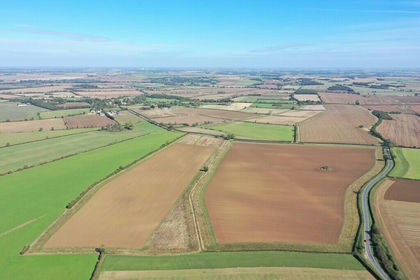
- Price
- Guide Price£2,155,000
- Size
- 212.16 acres
Land and Buildings at Mount Pleasant Farm, Winwick, Winwick, Cambridgeshire PE28 England
Added on 24/09/2026Farmland
- Price
- Guide Price£1,915,000
- Size
- 210.07 acres
Added on 31/05/2026Farmland
- Price
- Guide Price£1,950,000
- Size
- 121.16 acres
Little Cooting Farm, Adisham, Canterbury, Kent, Adisham, Kent CT3 England
Added on 18/06/2026Farmland