Auction: Thursday 17 December 2026 at 12 noon
Wilderness Drove, Sharpham, Nr Street, BA16
- Land size
- 15.91 acres
Key Features
- For sale by auction
- 12 midday on Thursday 17th December 2026
- The Theatre, The Royal Bath and West Showground, Shepton Mallet
- Bidding available in person, by livestream or by proxy
- Former Peat Working with Conservation and Leisure Potential
- 15.91 Acres
- Situated within an attractive wildlife area
- Planning permission has been obtained for the restoration of the site
- Short distance from renowned RSPB Nature Reserves
- Guide Price: �120,000 to �150,000
Description
For Sale by Auction on Thursday 17th December 2026 at 12 midday at The Royal Bath and West Showground and via Livestream - Former Peat Working with Conservation and Leisure Potential
A former peat working situated within an attractive wildlife area, extending in total to approximately 15.91 acres (6.44 hectares).
Planning permission has been obtained for the restoration of the site to create a lake suitable for leisure use, with planning items passed as follows -- fishing, paddleboarding, kayaking, wild swimming, Bird watching, photography, ecological appreciation and a parking area. Further details can be obtained from Somerset Council planning portal under planning reference 085460/001/COND28/MK
Situated a short distance from the renowned Ham Wall and Shapwick Heath RSPB Nature Reserves, the property would be ideally suited to those with an interest in conservation and habitat creation who are looking to undertake their own leisure or environmental project. Alternatively, there may be potential for other uses, subject to the necessary consents. Prospective purchasers are advised to make their own enquiries in this regard.
Access
Access to the property is taken via a right of way over adjoining land from the Wilderness Drove. The ROW is highlighted green on the insert sale plan. Further information regarding the rights of access are contained within the Auction Legal Pack.
Stewardship Schemes
The land is not subject to any environmental or countryside stewardship schemes.
Designations
The land is not situated within AONB or SSSI. Part situated within the Brue Nitrate Vulnerable Zone.
Uplift Clause
None.
Planning
Situated within the area covered by Somerset Council – Telephone:
Tenure
Freehold with vacant possession upon completion.
Services
We understand mains electricity is on site and currently disconnected. Electric drainage pump on site (not connected). Potential purchasers are advised to make their own enquiries into the adequacy and availability of any services.
VAT
We are advised the property is not elected for VAT.
Disclaimer
Important Notice: These particulars are set out as a general outline only for the guidance of intended purchasers and do not constitute, nor constitute part of, an offer or contract. All descriptions, dimensions, reference to condition and necessary permissions for use and occupation, warranties and other details are given without responsibility, and any intending purchasers should not rely on them as statements or representations of fact but must satisfy themselves by inspection or otherwise as to the correctness of each of them.
Other Schemes
The land is not subject to any environmental or countryside stewardship schemes.
Drainage Rates
None payable.
Footpaths and Rights of Way
Further details of any other rights of way (if applicable) will be contained within the auction legal pack.
Flood Risk
Completion
Completion has been set for 14th January 2027 or earlier by arrangement.
Viewing
At any reasonable time, on foot only and with a set of the sale details.
Closest Postcode: BA16 9SQ
What3words – decorator.pinks.towers
Fees
Potential buyers should be aware that there may be additional fees payable to the Vendor’s solicitor on completion of the sale, details of which will be contained within the auction pack for each lot. At the launch of the property onto the market this information is not always available and so interested parties must refer to the auction pack and satisfy their own enquiries.
Registering to bid and Administration fee
Cooper and Tanner require all bidders who wish to bid at our Auction to register beforehand, whether you are intending on bidding in the room, by proxy or online. As part of the registration process, you will be asked to provide card details in order that the Buyer’s Administration Fee of £1395 inc VAT can be paid if you are successful. A week before the auction a hold will be placed on your account for this sum, which will then be released if you are unsuccessful. This fee will only be taken if you are the successful buyer. The fee is retained by Cooper and Tanner and does not form part of your deposit or completion settlement. Please also be aware that the Buyer’s Administration fee is payable per lot purchased and applicable to all pre-auction sales. If you are successful in purchasing more than one lot, we will contact you following the auction to take subsequent payments for additional lots bought. All checks required by current anti-money laundering legislation must be satisfactorily completed, as part of the registration process before prior approval to bid will be granted; this will include providing proof of funds.
Deposit
Successful bidders will be required to pay to the Cooper and Tanner Client Account the deposit of 10% of the purchase price within 24 hours of the auction. The account details will be provided to the successful bidder on conclusion of the auction. Once funds are cleared, they will be transferred on to the account of the solicitor acting for the seller. Please ensure that funds are in an account suitable to be able to make an Electronic Transfer from.
Solicitors:
Mogers Drewett
Telephone:
Tracy Neal acting
Website tags: auction-property, december-auction, land-property
Map Location
Property details
- Tenure
- Freehold
- Council Tax Band
- Ask Agent
- Date Posted
- 2026-11-06
Market Value Analysis
Compared with 31 Development Land listings in South West England (10+ acres).
Utilities & Restrictions
Utilities
- Electricity
- Ask Agent
- Water
- Ask Agent
- Heating
- Ask Agent
- Broadband
- Ask Agent
- Sewerage
- Ask Agent
Rights & Restrictions
- Public Rights of Way
- Ask Agent
- Private Rights of Way
- Ask Agent
- Listed Property
- Ask Agent
- Restrictions
- Ask Agent
Listed status, conservation areas and planning constraints for this location are in the full report.
Property Features
- Accessibility
- Ask Agent
- Parking
- Parking Available
- Garden
- Ask Agent
Beyond the particulars: planning activity, flood history, heritage and ground risks, checked for this exact spot.
Connectivity
Broadband
Fastest speed available at this postcode
7 Mbps
Under 10 Mbps here
Suitable for
- Basic browsing & email
Mobile signal
Predicted 4G and 5G signal; indoor signal depends on building materials.
Ofcom Connected Nations postcode-level predictions. Speeds and signal are modelled, not measured, and vary between addresses and providers.
Signal is the easy part. Planning activity, flood history and protected designations here are in the full report.
Nearest Schools
Primary
- St Benedict's Church of England Voluntary Aided Junior School1.5 milesNo Ofsted rating
- Ages
- 7 to 11
- Pupils
- 236
- Type
- Voluntary aided school
- Faith
- Church of England
- Meare Village Primary School1.6 milesOfsted: Good
- Ages
- 4 to 11
- Pupils
- 100
- Type
- Community school
- St John's Church of England Voluntary Controlled Infants School1.7 milesOfsted: Good *
- Ages
- 2 to 7
- Pupils
- 184
- Type
- Voluntary controlled school
- Faith
- Church of England
- Elmhurst Junior School2.2 milesOfsted: Good
- Ages
- 7 to 11
- Pupils
- 210
- Type
- Academy converter
- Walton Church of England Voluntary Controlled Primary School2.2 milesOfsted: Good
- Ages
- 4 to 11
- Pupils
- 129
- Type
- Voluntary controlled school
- Faith
- Church of England
Secondary
- St Dunstan's School1.6 milesOfsted: Good
- Ages
- 11 to 16
- Pupils
- 529
- Type
- Academy converter
- Crispin School Academy1.9 milesNo Ofsted rating
- Ages
- 11 to 16
- Pupils
- 978
- Type
- Academy converter
- The Blue School5.9 milesNo Ofsted rating
- Ages
- 11 to 18
- Pupils
- 1,362
- Type
- Academy converter
- Faith
- Church of England
- Hugh Sexey Church of England Middle School6.1 milesOfsted: Good
- Ages
- 9 to 13
- Pupils
- 595
- Type
- Academy converter
- Faith
- Church of England
- The Kings of Wessex Academy8.4 milesNo Ofsted rating
- Ages
- 13 to 18
- Pupils
- 1,043
- Type
- Academy converter
- Faith
- Church of England
* Latest graded judgement covers quality of education only; no overall grade was issued under the 2024-25 inspection framework.
Distances are straight-line from the advertised location. Source: the national school registers (DfE, Welsh Government, Scottish Government) and Ofsted.
Schools are just the start: sold prices nearby, planning activity and any flood history are in the full report.
Amenities
Supermarket
GP surgery
Pharmacy
Hospital
Straight-line distances from the advertised location. Sources: NHS records, Geolytix supermarket locations, OS Open Greenspace and the national trails registers.
The area stacks up? Now check the location itself: planning nearby, protected designations and past flooding.
Getting Around
Nearest station
Nearest bus stop
Typical drive times
Straight-line distances from the advertised location; drive times are typical free-flow times over OpenStreetMap road data, so allow more at peak. Public transport locations from DfT NaPTAN.
Easy to reach matters. So do planning activity, flood history and ground risks: all in the full report.
Flood Risk
Environment Agency open data, checked around the advertised map pin for the listed acreage. Long-term risk counts flood defences; the planning map's flood zones do not. Provided by LandSale, not the listing agent, and not part of the agent's particulars. Risk varies across a holding, so verify before committing.
Rivers and the sea
Not at the pin: mapped about 70 metres away.
Planning map: Flood Zone 3, about 20 metres away.
Surface water
Not at the pin: mapped about 10 metres away.
These bandings are the summary. Where this location sits on the flood maps, plus planning activity, heritage and ground risks, is in the full report.
Important notice: Information, maps and tags on this page are drawn from the advertising agent's marketing materials or generated automatically. LandSale has not verified them. Relying on these details is at your own risk, always carry out independent checks before committing to a purchase.
LandSale full disclaimer
Marketing information only - not formal particulars. The details on this website are provided for general guidance and do not constitute an offer or contract. Neither LandSale nor the advertising estate/land agent accepts responsibility for any inaccuracy.
1. Source of information
- Listing content: Core description, asking price, tenure, measurements, photographs and planning history originate from the marketing materials of the advertising estate or land agent. LandSale does not author this content and cannot guarantee its accuracy.
- Automated tags & categorisation: Property type, land-use class, acreage bands and similar labels may be applied by machine-learning models. They are intended as a helpful guide only and may not reflect the property's legal status or permitted use.
- Third-party & enriched data layers: Maps, boundary outlines, planning designations, soil reports, broadband coverage and other environmental or location-based insights are licensed from external suppliers. Such data are supplied “as is", may be incomplete or out of date and are subject to change without notice.
2. Verification required
Prospective purchasers must verify critical matters, including but not limited to planning permission, title boundaries, public rights of way, environmental constraints, acreage, services, access and VAT status, through their own inspections, specialist surveys, legal advisers and the selling agent before relying on the information or entering into any contract.
3. No warranty or liability
LandSale gives no warranty, express or implied, as to the accuracy, completeness or fitness for any particular purpose of the information displayed. LandSale shall not be liable for any loss, damage, cost or expense arising directly or indirectly from any use of or reliance on such information, save where liability may not be excluded by law.
4. Updates & feedback
If you believe any detail on this listing is inaccurate, please let us know. We will investigate and, where appropriate, update the listing or notify the agent.
© LandSale | Version 1.3 - August 2026
Similar properties for sale
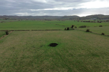
- Price
- Guide Price£150,000
- Size
- 26.58 acres
Land At North Rhyne, Ivythorn Lane, Walton, Street, BA16, Street, Somerset BA16 England
Added on 02/11/2026Agricultural Land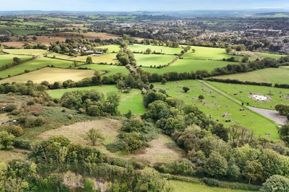
- Price
- Guide Price£100,000
- Size
- 7.05 acres
Land At Windsor Hill, Shepton Mallet, Somerset, BA4, Shepton Mallet, Somerset BA4 England
Added on 20/10/2026Pasture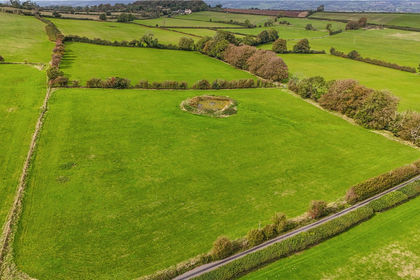
- Price
- Guide Price£100,000
- Size
- 10.17 acres
10.17 Acres (Lot B) of Land, Paywell Lane, Blagdon, Bristol, BS40, Bristol, Somerset BS40 England
Added on 30/10/2026Agricultural Land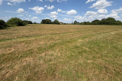
- Price
- Guide Price£95,000
- Size
- 7.98 acres
Limington Road, Yeovil, Yeovilton and District, Somerset BA22 England
Added on 28/09/2026Agricultural Land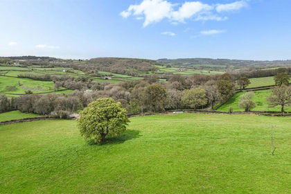
- Price
- Guide Price£110,000
- Size
- 11.12 acres
Whitestaunton, Chard, Somerset, Whitestaunton, Somerset TA20 England
Added on 22/06/2026Pasture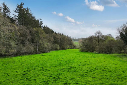
- Price
- Guide Price£150,000
- Size
- 11.63 acres
Whitestaunton, Chard, Somerset, Whitestaunton, Somerset TA20 England
Added on 22/06/2026Grazing Land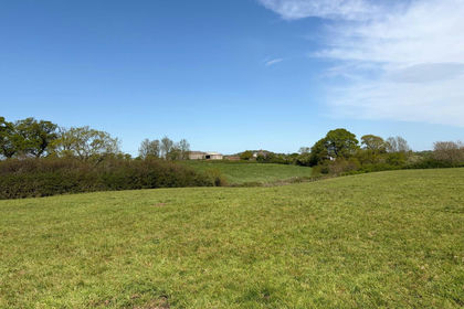
- Price
- Guide Price£140,000
- Size
- 13.97 acres
Lot 2 - Land Higher Woolcombe Farm, Melbury Bubb, Dorchester, DT2, Dorchester, Dorset DT2 England
Added on 16/06/2026Pasture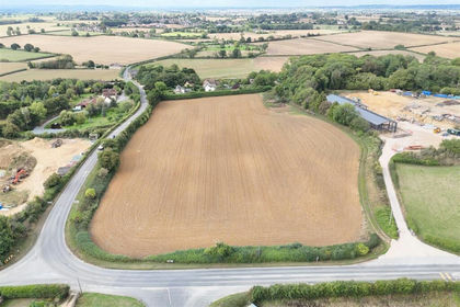
- Price
- Guide Price£100,000
- Size
- 7.56 acres
Gannetts, Todber, Sturminster Newton, Todber, Dorset DT10 England
Added on 30/09/2026Farmland
- Price
- Guide Price£130,000
- Size
- 13.9 acres
Okeford Fitzpaine, Blandford Forum, Okeford Fitzpaine, Dorset DT11 England
Added on 30/10/2026Pasture
- Price
- Guide Price£120,000
- Size
- 8 acres
Land at West Farm, Knook, Warminster BA12, Knook, Wiltshire BA12 England
Added on 26/10/2026Agricultural Land