
Barmore Steading, Tarbert, Argyll and Bute
- Dwelling size
- 4,047 sq ft
- Bedrooms
- 9
- Bathrooms
- 7
Key Features
- Truly excellent lifestyle opportunity
- Long established business
- Stunning Victorian steading
- 6 self-catering apartments
- Planning permission for 4 dwelling houses
- Great potential for further development
- Excellent reviews
- Offers over £895,000
Description
Resurrected from a ruinous state in the 1980s, Barmore Steading is a truly wonderful piece of Victorian architecture designed by the eminent architect, Sir William Playfair, who was responsible for some of the most prestigious buildings in Scotland, including much of Edinburgh’s New Town.
Barmore Steading is in the most beautiful of surroundings at the top end of Glenralloch which leads from West Loch Tarbert to the famous Loch Fyne. Barmore Steading is made up of 6 self-catering cottages and a substantial area of land. There is currently planning permission for the erection of 4 dwelling houses on the land; however, the land would be suitable to take great advantage of the location and the boom in tourism by creating, among other ideas, a chalet, glamping or camping site.
Barmore Steading has been in operation with the same owners for over 40 years, firstly as a restaurant and bar and latterly as a holiday let operation. The sale of Barmore Steading is a truly unique opportunity to acquire a truly wonderful lifestyle business with great potential on the West Coast of Scotland. Its versatile layout and flexible accommodation will provide new owners with great expansion potential.
Location
Barmore Steading is located a short distance from the charming and picturesque village of Tarbert, which is considered to be the gateway to the peninsula of Kintyre. Surrounded by rugged hills and a natural harbour Tarbert is host to Scotland’s largest sailing regatta, the Scottish Series. There are lots of independent shops, cafés and restaurants overlooking the harbour in addition to a supermarket and banking services.
Tarbert offers local schooling at nursery, primary and secondary level. There is a short 9-hole golf course and two major golf courses at Machrihanish, including the Machrihanish Links, which is conserved by many to be one of the best in the country. There are also a great many outdoor activities for enthusiasts including fishing, stalking, and shooting.
Tarbert is popular with overnight visitors as it is the last stop before the ferry service to Islay, famed around the world for its whisky. Campbeltown, approx. 40 miles to the south, also offers regular flights to and from Glasgow Airport, which has a great range of national and international flights including many destinations in North America, the Middle East and Mainland Europe.
The main local hub is that of Lochgilphead, a town approximately 14 miles to the north and the administrative centre of Argyll and Bute. Facilities include a swimming pool, a sports centre, a hospital, supermarkets and a nine-hole golf course. The town is approximately 100 miles north of Glasgow, a road journey that takes in some of the most breath-taking scenery that Scotland has to offer.
Business
Barmore Steading currently operates as a lifestyle business to suit the needs of the owners. With three 2-bedroom cottages and three 1-bedoom cottages it operates from Easter through to the end of October. Prices range from £140 to £200 per night. The accommodation is exceptionally popular with tourists exploring the Kintyre Peninsula and Barmore Steading benefits greatly from its excellent reviews, reputation and much repeat business. The business is run with the assistance of 2 part time members of staff as and when required.
There is a great opportunity for new owners to significantly increase revenues or change the direction of the business, such as the introduction of café, farm shop, artisan studio or retreat. Barmore Steading has previously successfully been run as a bar and restaurant and it would be relatively straightforward to re-establish a restaurant with rooms, which is proving to be a very popular and successful business model. The carpark and entrance have been created to cater for a substantial hospitality venue.
Barmore Steading would also make a great events venue with its large lawns suitable for the erection of a marquee.
At the rear of the property is a substantial area of land which currently has planning permission for the erection of 4 dwelling houses. The site would be suitable for a camping/caravan site; development of bespoke glamping pods or chalets to enhance the hospitality business. There are endless opportunities for Barmore Steading.
Property
Shepherd’s Cottage: Once home to Barmore’ Steadings last resident, Shepherd’s Cottage is now a comfortable, tastefully refurbished retreat. Its blend of modern and traditional décor and open fire make it ideal for relaxing after exploring the Kintyre Peninsula or nearby islands. Guests can unwind in the courtyard, watch for wildlife, or enjoy walks to Barmore Island and Loch Fyne, where seals and otters are often seen.
The Cartshed: Formerly housing farm equipment and Clydesdale horses, The Cartshed is now a spacious, light-filled cottage. Original arched windows brighten the open-plan living and kitchen area. The master bedroom has an en-suite, while the twin room features a modern shower room. Guests can relax by the log stove or dine on the private patio.
The Bothy: Located in the oldest part of the steading, The Bothy is a cosy, refurbished one-bedroom apartment with open-plan living and kitchen. Natural materials nod to its history. The bedroom offers fitted wardrobes, and the bathroom has modern fittings and ample storage for outdoor gear.
The Hayloft: This bright, one-bedroom loft conversion features an open lounge and kitchen with an oak breakfast bar. Roof lights and west-facing windows create a modern, airy feel. Storage includes a built-in wardrobe and space for bikes. A log-burning stove adds warmth, and a private patio offers garden views.
Dairymaid’s Cottage: Recently refurbished, Dairymaid’s Cottage is a spacious, light-filled one-bedroom retreat. Glass walls face the courtyard and evening sun, while the living area features leather sofas and a fireplace. The kitchen includes a handmade breakfast bar, and the bedroom has a super-king bed and seating area. The bathroom offers a walk-in shower and bath.
A sixth, two-bedroom cottage, is for private use.
External
The steading has a large area of lawn to the front and carpark to the side that can easily accommodate 20 vehicles. The driveway and road access are suitable for a substantial hospitality business.
The land with planning permission is accessed via a road running past the carpark. It benefits from an elevated position with some outstanding views over the surrounding countryside.
Map Location
Property details
- Tenure
- Freehold
- Council Tax Band
- Ask Agent
- Date Posted
- 2026-11-06
Property Brochure
Seen the details? The full report adds the independent checks: planning activity, flood history, heritage and ground.
Utilities & Restrictions
Utilities
- Electricity
- Ask Agent
- Water
- Ask Agent
- Heating
- Ask Agent
- Broadband
- Ask Agent
- Sewerage
- Ask Agent
Rights & Restrictions
- Public Rights of Way
- Ask Agent
- Private Rights of Way
- Ask Agent
- Listed Property
- Ask Agent
- Restrictions
- Ask Agent
Listed status, conservation areas and planning constraints for this location are in the full report.
Property Features
- Accessibility
- Ask Agent
- Parking
- Ask Agent
- Garden
- Ask Agent
Beyond the particulars: planning activity, flood history, heritage and ground risks, checked for this exact spot.
Connectivity
Broadband
Fastest speed available at this postcode
30 Mbps
Standard (10-30 Mbps)
Suitable for
- HD streaming
- Video calls
- Web & social
Mobile signal
Predicted 4G and 5G signal; indoor signal depends on building materials.
Ofcom Connected Nations postcode-level predictions. Speeds and signal are modelled, not measured, and vary between addresses and providers.
Signal is the easy part. Planning activity, flood history and protected designations here are in the full report.
Nearest Schools
Primary
- Tarbert Academy1.6 miles
- Pupils
- 106
- Type
- Non-denominational
- Achahoish Primary School6.8 miles
- Pupils
- 6
- Type
- Non-denominational
- Tighnabruaich Primary School7.1 miles
- Pupils
- 67
- Type
- Non-denominational
- Ardrishaig Primary School9.5 miles
- Pupils
- 90
- Type
- Non-denominational
- Lochgilphead High School10 miles
- Pupils
- 201
- Type
- Non-denominational
Secondary
- Tarbert Academy1.6 miles
- Pupils
- 120
- Type
- Non-denominational
- Lochgilphead High School10 miles
- Pupils
- 408
- Type
- Non-denominational
- Rothesay Academy15 miles
- Pupils
- 277
- Type
- Non-denominational
- Dunoon Grammar School20 miles
- Pupils
- 745
- Type
- Non-denominational
- Largs Academy23 miles
- Pupils
- 994
- Type
- Non-denominational
Distances are straight-line from the advertised location. Source: the national school registers (DfE, Welsh Government, Scottish Government) and Ofsted.
Schools are just the start: planning activity, heritage and any flood history here are in the full report.
Amenities
Supermarket
GP surgery
Pharmacy
Walking trail
Straight-line distances from the advertised location. Sources: NHS records, Geolytix supermarket locations, OS Open Greenspace and the national trails registers.
The area stacks up? Now check the location itself: planning nearby, protected designations and past flooding.
Getting Around
Nearest station
Nearest bus stop
Typical drive times
Straight-line distances from the advertised location; drive times are typical free-flow times over OpenStreetMap road data, so allow more at peak. Public transport locations from DfT NaPTAN.
Easy to reach matters. So do planning activity, flood history and ground risks: all in the full report.
Flood Risk
SEPA open data, checked around the advertised map pin for the listed acreage. The map pin for this listing is approximate, so these readings describe the surrounding area. Provided by LandSale, not the listing agent, and not part of the agent's particulars. Risk varies across a holding, so verify before committing.
Rivers and the sea
Not at the pin: mapped about 10 metres away.
Surface water
Not at the pin: mapped about 10 metres away.
These bandings are the summary. Where this location sits on the flood maps, plus planning activity, heritage and ground risks, is in the full report.
Important notice: Information, maps and tags on this page are drawn from the advertising agent's marketing materials or generated automatically. LandSale has not verified them. Relying on these details is at your own risk, always carry out independent checks before committing to a purchase.
LandSale full disclaimer
Marketing information only - not formal particulars. The details on this website are provided for general guidance and do not constitute an offer or contract. Neither LandSale nor the advertising estate/land agent accepts responsibility for any inaccuracy.
1. Source of information
- Listing content: Core description, asking price, tenure, measurements, photographs and planning history originate from the marketing materials of the advertising estate or land agent. LandSale does not author this content and cannot guarantee its accuracy.
- Automated tags & categorisation: Property type, land-use class, acreage bands and similar labels may be applied by machine-learning models. They are intended as a helpful guide only and may not reflect the property's legal status or permitted use.
- Third-party & enriched data layers: Maps, boundary outlines, planning designations, soil reports, broadband coverage and other environmental or location-based insights are licensed from external suppliers. Such data are supplied “as is", may be incomplete or out of date and are subject to change without notice.
2. Verification required
Prospective purchasers must verify critical matters, including but not limited to planning permission, title boundaries, public rights of way, environmental constraints, acreage, services, access and VAT status, through their own inspections, specialist surveys, legal advisers and the selling agent before relying on the information or entering into any contract.
3. No warranty or liability
LandSale gives no warranty, express or implied, as to the accuracy, completeness or fitness for any particular purpose of the information displayed. LandSale shall not be liable for any loss, damage, cost or expense arising directly or indirectly from any use of or reliance on such information, save where liability may not be excluded by law.
4. Updates & feedback
If you believe any detail on this listing is inaccurate, please let us know. We will investigate and, where appropriate, update the listing or notify the agent.
© LandSale | Version 1.3 - August 2026
Similar properties for sale
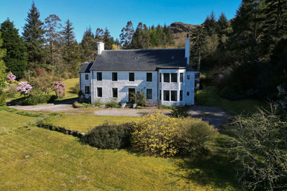
- Price
- £800,000
- Size
- 2.3 acres
Kinlochruel House, Colintraive, Argyll, Bute and South Lochaber, Argyll and Bute PA22 Scotland
Added on 01/10/2026Country Home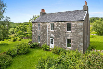
- Price
- Offers Over£950,000
- Size
- 22.5 acres
By Achnabreck, Lochgilphead, Argyll, Bute and South Lochaber, Argyll and Bute PA31 Scotland
Added on 02/07/2026Country Home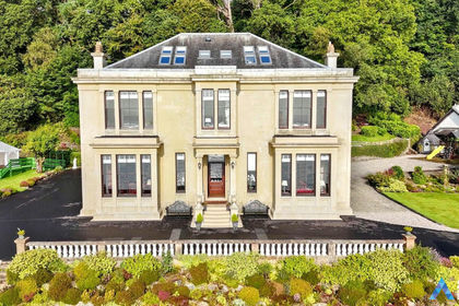
- Price
- Offers Over£975,000
- Size
- 1.5 acres
Strone, Strone, PA23, Argyll, Bute and South Lochaber, Argyll and Bute PA23 Scotland
Added on 09/10/2026House with Land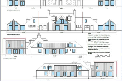
- Price
- Offers Over£890,000
- Size
- 1 acres
Bowfield Road, Howwood, PA9, Paisley and Renfrewshire South, Renfrewshire PA9 Scotland
Added on 08/07/2026Development Land
- Price
- Offers Over£875,000
- Size
- 1.32 acres
Tullycross, Croftamie, Glasgow, G63, Stirling and Strathallan, Stirling G63 Scotland
Added on 07/09/2026Country Home
- Price
- Offers Over£700,000
- Size
- 4.3 acres
1 Monktonhead House, Monkton, Central Ayrshire, South Ayrshire KA9 Scotland
Added on 07/09/2026House with Land
- Price
- Offers Over£995,000
- Size
- 3 acres
Killearn, Glasgow, Stirlingshire, G63, Stirling and Strathallan, Stirling G63 Scotland
Added on 24/08/2026Country Home
- Price
- Offers in Excess of£695,000
- Size
- 10 acres
Raggithill, Mossblown, Ayr, KA6, Central Ayrshire, South Ayrshire KA6 Scotland
Added on 22/10/2026Kennels Property
- Price
- Offers Over£950,000
- Size
- 10.03 acres
Culbowie Road, Buchlyvie, Stirling, Stirlingshire, Stirling and Strathallan, Stirling FK8 Scotland
Added on 02/08/2026Country Home
- Price
- Offers in Excess of£850,000
- Size
- 16.12 acres
Greyfriars Monastery, Uddingston, G71, Rutherglen, South Lanarkshire G71 Scotland
Added on 04/11/2026Redevelopment Land