Wark, Hexham, NE48
- Land size
- 1.25 acres
- Bedrooms
- 4
- Bathrooms
- 2
Key Features
- Attractive detached Victorian country house set in own grounds
- Elevated position just outside the picturesque Tyne Valley village of Wark
- Four generously proportioned bedrooms
- A wealth of original period features, including Victorian cornicing, shutters, fireplaces and plasterwork
- Large double garage with lights and power sockets
- Planning permission granted for a substantial rear extension
- Gardens,woodland and paddock extending to approximately 1.25 acres
- Additional land of up to approximately nine acres available by separate negotiation
Description
A handsome Victorian country house, rich in original character set in an elevated position within private grounds overlooking the beautiful Tyne Valley, with four bedrooms, a paddock, double garage and exciting potential to extend
Deneburn House is a distinctive detached Victorian country house, originally built in 1855 as a hunting lodge for a doctor from Newcastle. Occupying an elevated position on the outskirts of Wark, the property combines considerable period charm with generous family accommodation, attractive gardens and scope for further enhancement.
The house retains a wealth of original features, providing a glimpse into its Victorian heritage. These include decorative cornicing, original shutters, traditional fireplaces, original plasterwork and oak flooring, all of which contribute to the property's individual character.
Accommodation
The property is approached through a substantial Victorian front door, complete with its original lock, key and doorbell.The entrance hallways feature oak flooring and original plasterwork, including distinctive decorative deer heads which reflect the property's former use as a hunting lodge. The Hallway provides access to the main ground floor accommodation.
The LivingRoom is a particularly appealing, south-facing reception room with original Victorian cornicing, traditional shutters and a large marble fireplace. Oak flooring completes the room, while the southerly aspect provides an attractive sense of light. The Drawing Room is a second generous reception room with alcoves, featuring original shutters, a substantial original fireplace and oak flooring. This versatile room provides an elegant setting for formal entertaining or everyday family living.
The light filled spacious Dining Kitchen has an excellent range of floor and wall units with granite work surfaces built in cooker and a separateelectric Aga with surround, original window shutters and patio doors opening directly onto the rear garden. The generous proportions provide ample space for cooking, dining and informal gatherings. An adjoining pantry offers useful additional storage, with fitted shelving.
The Utility / Downstairs Shower room incorporates a double shower, wash basin and WC, together with space beneath the work surface for a washing machine and tumble dryer. A separate cloak cupboard at the bottom of the stairs providing ample storage whilst still retaining an original deer-hanging hook, another charming reminder of the house's history.
There is a side entrance porch with tiled floor that provides access into the side entrance hallway as well as offering access to a sheltered stone-walled‘suntrap’ courtyard, where a hot tub creates an inviting space for relaxation.
A spacious first-floor landing is illuminated by a striking feature window incorporating an original decorative stained-glass window. A spacious, south-facing Principal Bedroom with original marble fireplace and attractive original Victorian cornicing provides views across the Dene Burn and surrounding countryside. The second Bedroom, is also a large south-facing double bedroom, retaining its original stone fireplace.
A generous third double Bedroom has fitted wardrobes and panoramic views across open fields towards Wark. A fourth Bedroom with side window and also featuring a skylight which provides natural light and flexibility for use as a fourth bedroom, study or hobby room.
A large family bathroom fitted with a bath and shower over, double wash basin unit, WC and a bidet. A boiler cupboard houses the hot water system, with a new boiler installed in 2021. There is further attic storage which is accessed via a loft ladder.
External
Deneburn House occupies an attractive and private setting behind mature hedges. The grounds are entered through substantial feature sandstone entrance gateposts, built to support electric gates with intercom recessed from the lane allowing ample space to turn into the gravelled driveway with a generous turning area and substantial parking within a leafy setting
The grounds extend to approximately one and a quarter acres, incorporating established gardens, mature trees and shrubs, a paddock and a small area of mixed woodland. The private front garden features planted borders with a pedestrian gate leading up stone steps towards the house. To the rear, a large garden enjoys open views across the valley and is complemented by mature trees. A stone-walled courtyard provides a sheltered outdoor retreat, with a hot tub, creating an appealing suntrap and outdoor dining space to enjoy the evening sunset.
A substantial timber double garage provides useful vehicle storage and benefits from lighting and power sockets. A decorative weathervane adds further character.
Planning Permission
The property also benefits from live planning permission for a substantial rear extension, offering an exciting opportunity to enhance the existing accommodation, subject to the approved plans and any relevant conditions. (Planning Ref No. 23/01481/FUL)
Additional Land
For those seeking additional space, up to approximately 8 acres of land may be available by separate negotiation in two separate paddocks.
Overage Clause
There will be an Overage Clause equal to 30% of the net uplift in land value triggered by the grant of planning permission within a 25-year term, there is also a historic overage clause already on the land. Further details are available from the Agent.
Location
Wark is a charming rural village set alongside the River North Tyne, in an area renowned for its beautiful scenery, peaceful surroundings and opportunities for outdoor pursuits. Riverside walks, salmon fishing, countryside trails and cycling routes can all be enjoyed nearby.
Despite its rural setting, the village offers a useful range of everyday amenities, including a convenience store and post office, a village hall, public house, church and coffee shop/eatery. The award-winning Battlesteads Hotel and Restaurant provides a popular local destination for dining and hospitality.
Families are served by a village primary school, with a school bus service to Queen Elizabeth High School in Hexham. A local doctor's surgery also provides a useful healthcare facility. Hexham provides a wide range of larger local facilities.
The combination of village amenities, attractive countryside and access to regional centres makes Deneburn House an appealing proposition for those seeking a characterful country home in a picturesque Northumberland setting.
Please note that one of the vendors is an employee of Anton Estates.
Mileages
Wark 0.1 mile | Bellingham 5.5 miles | Hexham 11 miles | Newcastle Airport 27.1 miles
Services | Mains Water, Electricity and Drainage (TBC), Oil-fired heating
Council Tax | Band E
Tenure | Freehold
EPC Rating | TBC
Agents Note
These particulars do not form any part of any offer or contract. They are intended to provide a fair description of the property but neither Anton Estates nor the Vendor accept any responsibility for any error they may contain, however caused. Any intending purchaser must therefore satisfy themselves by inspection or otherwise as to their correctness. Neither Anton Estates nor any of their employees has any authority to make or give any further representations or warranty in relation to this property.
Map Location
Property details
- Tenure
- Freehold
- Council Tax Band
- E
- Date Posted
- 2026-11-06
Market Value Analysis
Compared with 183 Homes with Land listings in North East England (1+ acres).
Energy Performance Certificate
Energy Efficiency Rating
Based on UK Energy Performance Certificate standards (EU Directive 2002/91/EC)
Running costs are one side. Planning activity, flood history and ground risks for this location are in the full report.
Utilities & Restrictions
Utilities
- Electricity
- Mains
- Water
- Mains
- Heating
- Oil Heating
- Broadband
- Ask Agent
- Sewerage
- Mains
Rights & Restrictions
- Public Rights of Way
- Ask Agent
- Private Rights of Way
- Ask Agent
- Listed Property
- Ask Agent
- Restrictions
- Ask Agent
Listed status, conservation areas and planning constraints for this location are in the full report.
Property Features
- Accessibility
- Ask Agent
- Parking
- Garage, Driveway, Gated Parking
- Garden
- Garden
Beyond the particulars: planning activity, flood history, heritage and ground risks, checked for this exact spot.
Connectivity
Broadband
Fastest speed available at this postcode
1.8 Gbps
Gigabit full fibre · available to 43% of premises
Suitable for
- 4K streaming on every screen
- Full-time home working
- Online gaming & big downloads
Mobile signal
Predicted 4G and 5G signal; indoor signal depends on building materials.
Ofcom Connected Nations postcode-level predictions. Speeds and signal are modelled, not measured, and vary between addresses and providers.
Signal is the easy part. Planning activity, flood history and protected designations here are in the full report.
Nearest Schools
Primary
- Wark Church of England Primary School566 metresOfsted report card · Jun 2026
- Ages
- 3 to 11
- Pupils
- 69
- Type
- Academy converter
- Faith
- Church of England
- Bellingham Primary School3.8 milesOfsted: Good *
- Ages
- 4 to 8
- Pupils
- 64
- Type
- Foundation school
- Chollerton Church of England Aided First School4.4 milesOfsted: Good
- Ages
- 2 to 9
- Pupils
- 31
- Type
- Voluntary aided school
- Faith
- Church of England
- Humshaugh Church of England First School5.5 milesNo Ofsted rating
- Ages
- 2 to 9
- Pupils
- 42
- Type
- Voluntary aided school
- Faith
- Church of England
- Newbrough Church of England Primary School6 milesOfsted report card · Mar 2026
- Ages
- 2 to 11
- Pupils
- 65
- Type
- Academy converter
- Faith
- Church of England
Secondary
- Bellingham Middle School and Sports College3.8 milesOfsted: Good
- Ages
- 9 to 13
- Pupils
- 46
- Type
- Foundation school
- Haydon Bridge High School7.9 milesOfsted report card · Jan 2026
- Ages
- 11 to 18
- Pupils
- 392
- Type
- Foundation school
- Queen Elizabeth High School9.3 milesOfsted: Good
- Ages
- 13 to 18
- Pupils
- 1,299
- Type
- Academy converter
- St Joseph's Catholic Middle School, Hexham9.4 milesNo Ofsted rating
- Ages
- 9 to 13
- Pupils
- 168
- Type
- Academy converter
- Faith
- Roman Catholic
- Hexham Middle School9.7 milesNo Ofsted rating
- Ages
- 9 to 13
- Pupils
- 619
- Type
- Academy converter
* Latest graded judgement covers quality of education only; no overall grade was issued under the 2024-25 inspection framework.
Distances are straight-line from the advertised location. Source: the national school registers (DfE, Welsh Government, Scottish Government) and Ofsted.
Schools are just the start: sold prices nearby, planning activity and any flood history are in the full report.
Amenities
Supermarket
GP surgery
Pharmacy
Hospital
Green space
Straight-line distances from the advertised location. Sources: NHS records, Geolytix supermarket locations, OS Open Greenspace and the national trails registers.
The area stacks up? Now check the location itself: planning nearby, protected designations and past flooding.
Getting Around
Nearest station
Nearest bus stop
Typical drive times
Straight-line distances from the advertised location; drive times are typical free-flow times over OpenStreetMap road data, so allow more at peak. Public transport locations from DfT NaPTAN.
Easy to reach matters. So do planning activity, flood history and ground risks: all in the full report.
Flood Risk
Environment Agency open data, checked around the advertised map pin for the listed acreage. Long-term risk counts flood defences; the planning map's flood zones do not. Provided by LandSale, not the listing agent, and not part of the agent's particulars. Risk varies across a holding, so verify before committing.
Rivers and the sea
Not at the pin: mapped about 30 metres away.
Planning map: Flood Zone 3, about 30 metres away.
Surface water
These bandings are the summary. Where this location sits on the flood maps, plus planning activity, heritage and ground risks, is in the full report.
Important notice: Information, maps and tags on this page are drawn from the advertising agent's marketing materials or generated automatically. LandSale has not verified them. Relying on these details is at your own risk, always carry out independent checks before committing to a purchase.
LandSale full disclaimer
Marketing information only - not formal particulars. The details on this website are provided for general guidance and do not constitute an offer or contract. Neither LandSale nor the advertising estate/land agent accepts responsibility for any inaccuracy.
1. Source of information
- Listing content: Core description, asking price, tenure, measurements, photographs and planning history originate from the marketing materials of the advertising estate or land agent. LandSale does not author this content and cannot guarantee its accuracy.
- Automated tags & categorisation: Property type, land-use class, acreage bands and similar labels may be applied by machine-learning models. They are intended as a helpful guide only and may not reflect the property's legal status or permitted use.
- Third-party & enriched data layers: Maps, boundary outlines, planning designations, soil reports, broadband coverage and other environmental or location-based insights are licensed from external suppliers. Such data are supplied “as is", may be incomplete or out of date and are subject to change without notice.
2. Verification required
Prospective purchasers must verify critical matters, including but not limited to planning permission, title boundaries, public rights of way, environmental constraints, acreage, services, access and VAT status, through their own inspections, specialist surveys, legal advisers and the selling agent before relying on the information or entering into any contract.
3. No warranty or liability
LandSale gives no warranty, express or implied, as to the accuracy, completeness or fitness for any particular purpose of the information displayed. LandSale shall not be liable for any loss, damage, cost or expense arising directly or indirectly from any use of or reliance on such information, save where liability may not be excluded by law.
4. Updates & feedback
If you believe any detail on this listing is inaccurate, please let us know. We will investigate and, where appropriate, update the listing or notify the agent.
© LandSale | Version 1.3 - August 2026
Similar properties for sale
- Price
- Offers Over£650,000
- Size
- 3 acres
Boat Road, Bellingham, Hexham, NE48, Bellingham, Northumberland NE48 England
Added on 24/06/2026House with Land
- Price
- Guide Price£745,000
Walwick Cottage, Humshaugh, Hexham, Northumberland, Humshaugh, Northumberland NE46 England
Added on 16/04/2026Cottage
- Price
- Offers Over£550,000
- Size
- 5 acres
West Woodburn, Hexham, Northumberland, NE48, Corsenside, Northumberland NE48 England
Added on 20/08/2026Equestrian property
- Price
- Offers in Region of£695,000
Low Warden, Hexham, Northumberland, NE46, Warden, Northumberland NE46 England
Added on 03/09/2026Barn Conversion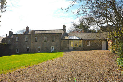
- Price
- £750,000
- Size
- 1 acres
Carr House Great Bavington, Newcastle Upon Tyne NE19, Bavington, Northumberland NE19 England
Added on 28/04/2026Country Home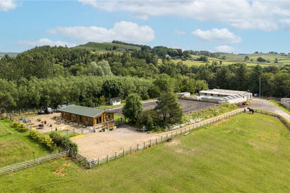
- Price
- Offers Over£700,000
- Size
- 28.51 acres
Bardon Mill, Hexham, Northumberland, NE47, Henshaw, Northumberland NE47 England
Added on 23/07/2026Equestrian property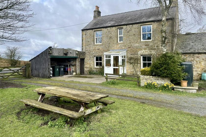
- Price
- Offers in Region of£595,000
- Size
- 2 acres
Bardon Mill, Northumberland, NE47, Henshaw, Northumberland NE47 England
Added on 10/05/2026Farmhouse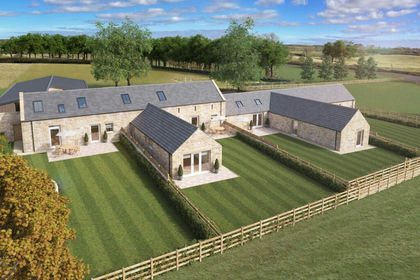
- Price
- Guide Price£625,000
Added on 04/09/2026Barn Conversion
- Price
- Offers Over£695,000
Added on 18/09/2026Barn Conversion
- Price
- Guide Price£795,000
- Size
- 11 acres
Hallpeat Moss, Melkridge, Haltwhistle, Northumberland, Melkridge, Northumberland NE49 England
Added on 23/09/2026House with Land