Land adjoining Brookhouse Farm, Hyssington, Churchstoke, Montgomery
- Land size
- 65.75 acres
Description
A rare opportunity to acquire a ring-fenced block of productive, south-facing grassland, known as Land adjoining Brookhouse Farm, Hyssington. Extending to approximately 65.75 acres (26.61 ha) or thereabouts, the land is suitable for grassland and arable production. The land is accessed via a gateway directly from a council-maintained highway to the north of the village of Hyssington, and is encompassed by mature hedgerows and secure stock-proof fencing boundaries. In addition to the land benefiting from a natural water supply, there are mains water and elecricity lines in close facility to connect to, lending the land to alternative options such as tourism, subject to the relevant planning consents.
Description - A rare opportunity to acquire a ring-fenced block of productive, south-facing grassland, known as Land adjoining Brookhouse Farm, Hyssington. Extending to approximately 65.75 acres (26.61 ha) or thereabouts, the land is suitable for both grassland and arable production. The land is split into a number of useful enclosures, bordered by mature hedgerows and secure stock-proof fencing to both internal and external boundaries. Access is via a gateway directly from a council-maintained highway to the north to the village of Hyssington, and the property benefits from a natural water supply.
Situation - The land is situated to the north of the village of Hyssington, in close proximity to the larger village of Churchstoke. The towns of Welshpool and Newtown are also in accessible reach.
Services - Natural water supply
Method Of Sale - Private Treaty
Boundaries - Any purchaser shall be deemed to have full knowledge of all boundaries and neither the Vendor nor the vendors are responsible for defining the boundaries or ownership thereof.
Local Authority - Powys County Council
Wayleave, Easements And Rights Of Way - The property is sold subject to and with the benefit of all rights including rights of way, whether public or private, light, drainage, water and electricity supplies and any other rights and obligations, easements and proposed wayleaves for masts, pylons, stays, cables, drains and water, gas and other pipes, whether referred to in the Sale details or not.
Plans, Areas And Schedules - Plans are for identification and reference purposes only. The purchaser(s) shall be deemed to have satisfied themselves of the description of the property. Any error or mis-statement shall not annul a sale or entitle any party to compensation.
Map Location
Property details
- Tenure
- Freehold
- Council Tax Band
- Ask Agent
- Date Posted
- 2026-11-04
Market Value Analysis
Compared with 55 Farmland & Pasture listings in Wales (50+ acres).
Utilities & Restrictions
Utilities
- Electricity
- Ask Agent
- Water
- Ask Agent
- Heating
- Ask Agent
- Broadband
- Ask Agent
- Sewerage
- Ask Agent
Rights & Restrictions
- Public Rights of Way
- Ask Agent
- Private Rights of Way
- Ask Agent
- Listed Property
- Ask Agent
- Restrictions
- Ask Agent
Listed status, conservation areas and planning constraints for this location are in the full report.
Property Features
- Accessibility
- Ask Agent
- Parking
- Ask Agent
- Garden
- Ask Agent
Beyond the particulars: planning activity, flood history, heritage and ground risks, checked for this exact spot.
Connectivity
Broadband
Fastest speed available at this postcode
1.8 Gbps
Gigabit full fibre · available to 60% of premises
Suitable for
- 4K streaming on every screen
- Full-time home working
- Online gaming & big downloads
Fixed wireless access may also be an option here.
Mobile signal
Predicted 4G and 5G signal; indoor signal depends on building materials.
Ofcom Connected Nations postcode-level predictions. Speeds and signal are modelled, not measured, and vary between addresses and providers.
Signal is the easy part. Planning activity, flood history and protected designations here are in the full report.
Nearest Schools
Primary
- Churchstoke C.P. School2.5 miles
- Pupils
- 38
- Type
- Nursery, Infants & Juniors
- Language
- English medium school / provision
- Montgomery C.I.W. School5.5 miles
- Pupils
- 108
- Type
- Nursery, Infants & Juniors
- Language
- English medium school / provision
- Forden C.I.W. School6.4 miles
- Pupils
- 56
- Type
- Nursery, Infants & Juniors
- Language
- English medium school / provision
- Leighton C.P. School8.3 miles
- Pupils
- 50
- Type
- Nursery, Infants & Juniors
- Language
- English medium school / provision
- Berriew C.P. School8.8 miles
- Pupils
- 105
- Type
- Nursery, Infants & Juniors
- Language
- English medium school / provision
Secondary
- Welshpool High School9.7 miles
- Pupils
- 816
- Type
- Secondary (ages 11-19)
- Language
- English medium school / provision
- Newtown High School13 miles
- Pupils
- 896
- Type
- Secondary (ages 11-19)
- Language
- English medium school / provision
- Ysgol Bro Caereinion15 miles
- Pupils
- 494
- Type
- Middle (ages 4-19)
- Language
- Welsh medium school / provision (including transitional)
- Ysgol Llanfyllin18 miles
- Pupils
- 775
- Type
- Middle (ages 4-19)
- Language
- Dual language school / provision (Welsh and English) (including transitional)
- Llanidloes High School23 miles
- Pupils
- 703
- Type
- Secondary (ages 11-19)
- Language
- Dual language school / provision (Welsh and English) (including transitional)
Distances are straight-line from the advertised location. Source: the national school registers (DfE, Welsh Government, Scottish Government) and Ofsted.
Schools are just the start: sold prices nearby, planning activity and any flood history are in the full report.
Amenities
Supermarket
GP surgery
Pharmacy
Green space
Straight-line distances from the advertised location. Sources: NHS records, Geolytix supermarket locations, OS Open Greenspace and the national trails registers.
The area stacks up? Now check the location itself: planning nearby, protected designations and past flooding.
Getting Around
Nearest station
Nearest bus stop
Typical drive times
Straight-line distances from the advertised location; drive times are typical free-flow times over OpenStreetMap road data, so allow more at peak. Public transport locations from DfT NaPTAN.
Easy to reach matters. So do planning activity, flood history and ground risks: all in the full report.
Flood Risk
Natural Resources Wales open data, checked around the advertised map pin for the listed acreage. Long-term risk counts flood defences; the planning map's flood zones do not. The map pin for this listing is approximate, so these readings describe the surrounding area. Provided by LandSale, not the listing agent, and not part of the agent's particulars. Risk varies across a holding, so verify before committing.
Rivers and the sea
Planning map: Flood Zone 1.
Surface water
Not at the pin: mapped about 30 metres away.
These bandings are the summary. Where this location sits on the flood maps, plus planning activity, heritage and ground risks, is in the full report.
Important notice: Information, maps and tags on this page are drawn from the advertising agent's marketing materials or generated automatically. LandSale has not verified them. Relying on these details is at your own risk, always carry out independent checks before committing to a purchase.
LandSale full disclaimer
Marketing information only - not formal particulars. The details on this website are provided for general guidance and do not constitute an offer or contract. Neither LandSale nor the advertising estate/land agent accepts responsibility for any inaccuracy.
1. Source of information
- Listing content: Core description, asking price, tenure, measurements, photographs and planning history originate from the marketing materials of the advertising estate or land agent. LandSale does not author this content and cannot guarantee its accuracy.
- Automated tags & categorisation: Property type, land-use class, acreage bands and similar labels may be applied by machine-learning models. They are intended as a helpful guide only and may not reflect the property's legal status or permitted use.
- Third-party & enriched data layers: Maps, boundary outlines, planning designations, soil reports, broadband coverage and other environmental or location-based insights are licensed from external suppliers. Such data are supplied “as is", may be incomplete or out of date and are subject to change without notice.
2. Verification required
Prospective purchasers must verify critical matters, including but not limited to planning permission, title boundaries, public rights of way, environmental constraints, acreage, services, access and VAT status, through their own inspections, specialist surveys, legal advisers and the selling agent before relying on the information or entering into any contract.
3. No warranty or liability
LandSale gives no warranty, express or implied, as to the accuracy, completeness or fitness for any particular purpose of the information displayed. LandSale shall not be liable for any loss, damage, cost or expense arising directly or indirectly from any use of or reliance on such information, save where liability may not be excluded by law.
4. Updates & feedback
If you believe any detail on this listing is inaccurate, please let us know. We will investigate and, where appropriate, update the listing or notify the agent.
© LandSale | Version 1.3 - August 2026
Similar properties for sale
- Price
- Guide Price£680,000
- Size
- 67.78 acres
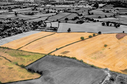
Land at Tetchill (Lot 2), Ellesmere, SY12, Ellesmere Rural, Shropshire SY12 England
Added on 29/01/2026Farmland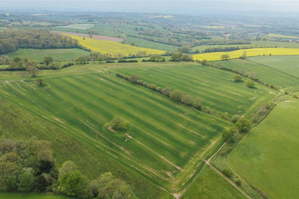
- Price
- £560,000
- Size
- 56.44 acres
Lot 5, Parsonage Farm, Kyre, Tenbury Wells, Worcestershire, Kyre, Worcestershire WR15 England
Added on 16/05/2026Farm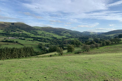
- Price
- Offers in Excess of£700,000
- Size
- 143 acres
Land at Tycanol Farm, Tafolwern, Llanbrynmair, Powys, Llanbrynmair, Powys SY19 Wales
Added on 26/08/2026Farmland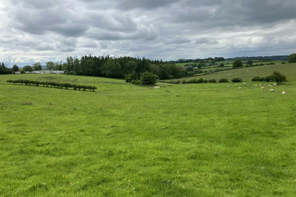
- Price
- £500,000
- Size
- 44.06 acres
Tedstone Wafre, Bromyard, Edvin Loach and Saltmarshe, Herefordshire, County of HR7 England
Added on 29/01/2026Farmland
- Price
- £550,000
- Size
- 255 acres
Land At Cwm Main and Cefn Caer Euni, Llandderfel, Gwynedd, LL23, Llandderfel, Gwynedd LL21 Wales
Added on 02/05/2026Farmland
- Price
- Guide Price£600,000
- Size
- 227 acres
Rhandirmwyn, Llandovery, SA20, Llandovery, Carmarthenshire SA20 Wales
Added on 29/01/2026Farmland
- Price
- Offers in Region of£650,000
- Size
- 68.36 acres
Added on 15/10/2026Farmland
- Price
- £475,000
- Size
- 99 acres
Added on 15/04/2026Vacant Land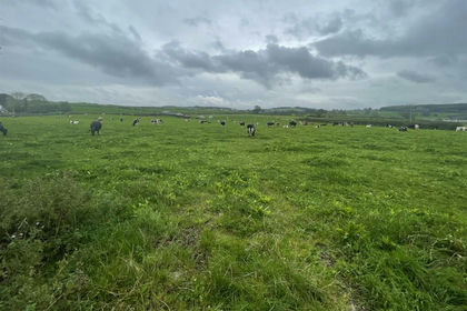
- Price
- Guide Price£650,000
- Size
- 36.2 acres
Added on 29/01/2026Agricultural Land
- Price
- Fixed Price£600,000
- Size
- 60 acres
Bamford Wood, Abergele, Denbighshire, Wales, LL22, Abergele, Conwy LL22 Wales
Added on 10/09/2026Woodland