Farleaze, near Sherston
- Land size
- 1 acres
- Bedrooms
- 3
- Bathrooms
- 1
Key Features
- Contemporary barn conversion
- Rural setting 3 miles from Sherston
- 3 bedrooms and mezzanine floor
- Stunning open plan kitchen/dining/living room
- Air source heat pump and underfloor heating
- 1 acre of garden and paddocks
- Private gated parking
- Westerly countryside views
Description
Hidden away in a private rural setting some 3 miles outside of the desirable Cotswold village of Sherston, 1 Grain Store Barn is a stunning contemporary home accompanied by 1 acre of garden and paddocks. Converted in 2022 alongside just three other homes, the property enjoys far-reaching, uninterrupted countryside 180-degree views with the principal living area positioned at the rear to enjoy a westerly aspect and in particular command some outstanding sunsets.
An impressive home to be proud of, the barn is superbly designed and completed to an exceptional high-quality finish boasting air source pump heating and underfloor heating beneath polished concrete flooring. The layout offers a lovely balance of open plan living as well as cosy comfortable spaces, plus the recent addition of a mezzanine first floor offering a study/occasional fourth bedroom. The stylish accommodation extends to 1,346 sq.ft. The superb specification allows for low running costs benefitting from a high EPC rating B
A particular feature of the layout is the stunning open plan kitchen/reception which has been designed to take full advantage of the setting, views and grounds through large windows and three sets of patio doors. This light and bright room comprises a kitchen, dining, and living area with the mezzanine gallery above. The kitchen is extensively fitted with integrated appliances and has a utility room adjoining. The living area has a contemporary style wood-burning stove. The bedroom accommodation is located on the ground floor making it an excellent home for those with mobility issues or looking for a 'future proof' home. This light and airy three-bedroom accommodation is accentuated by high ceilings and large windows. There is a family ‘Jack & Jill’ style bathroom and a further WC off the entrance hall.
This idyllic country home is accompanied by a generous amount of external grounds comprising of a formal garden and two fenced paddocks beyond which total 0.9 acres. The paddock is currently a wonderful meadow enhancing the picturesque outlook but has the potential for a range of uses from those wanting the 'good life' with orchards and chickens, a family seeking a private secure place for their children to play, or the equestrian requiring a pony paddock. The whole site is secured by shared electric front gates complete with video intercom and the property has an intruder alarm system. There is allocated parking in front of the property.
In June 2023, planning permission was granted to construct a garage/workshop and home office. (Planning Reference Number: PL/2023/02803).
Our clients have provided some dialogue in relation to Lime Down Solar and the potential effect on its location. Please refer to attached documents or refer to the agents for further detail and information.
Situation
The property is positioned within an idyllic rural setting on the edge of the Cotswold Area of Outstanding Natural Beauty. 3 miles to the north is the much sought after village of Sherston with its broad High Street and thriving community offering many facilities, including a church, popular primary school, doctors surgery, Co-op shop and post office, coffee shops, hairdresser, Indian restaurant, garden centre and the highly regarded 16th century Rattlebone Inn, with its excellent food and friendly atmosphere. Some further 3 miles south lies the village of Grittleton with amenities including The Neeld Arms public house, Church, tennis and cricket clubs. The village of Hullavington is also within easy reach with additional amenities. A more comprehensive range of facilities are found at the market towns of Malmesbury, Tetbury and Chippenham which are all within 10 miles. Schooling locally is second to none, with very good state and independent schools including Ofsted rated Outstanding Malmesbury secondary school and Westonbirt prep school. The cultural cities of Bath and Bristol are about 30 minutes by car and for those needing to travel further afield there are frequent inter-city train services at Chippenham with London Paddington just over an hour away. The M4 is 5-10 minutes' drive away to Junction 17 and 18 respectively providing access to London, the south and the Midlands. The local area is rich with activities and attractions including Westonbirt Arboretum which hosts music concerts, horse racing at Bath and Cheltenham, golf at Castle Combe, and for the keen equestrian, there is the world famous Badminton Horse Trials and the Beaufort polo and hunt.
Additional Information
The property is Freehold with air source heat pump central heating, private sewage treatment plant drainage, private water, and mains electricity. There is a service charge of approximately £624 p/a payable to Grain Store Barn Management Company Limited which contributes to maintenance and a small sinking fund. Broadband is available. Information taken from the Ofcom mobile and broadband checker, please see the website for more information and mobile phone coverage. Wiltshire Council Tax Band E.
Please note: To comply with Anti-Money Laundering (AML) regulations, all purchasers must complete identity verification and source of funds checks once their offer has been accepted. A non-refundable fee of £25 (including VAT) per person will be charged to cover the cost of these mandatory AML checks.
Map Location
Property details
- Tenure
- Freehold
- Council Tax Band
- E
- Date Posted
- 2026-11-02
Market Value Analysis
Compared with 1,547 Homes with Land listings in South West England (1+ acres).
Energy Performance Certificate
Energy Efficiency Rating
Based on UK Energy Performance Certificate standards (EU Directive 2002/91/EC)
Running costs are one side. Planning activity, flood history and ground risks for this location are in the full report.
Utilities & Restrictions
Utilities
- Electricity
- Mains
- Water
- Private Supply
- Heating
- Air Source Heat Pump, Underfloor Heating
- Broadband
- Ask Agent
- Sewerage
- Septic Tank / Private
Rights & Restrictions
- Public Rights of Way
- Ask Agent
- Private Rights of Way
- Ask Agent
- Listed Property
- Ask Agent
- Restrictions
- Ask Agent
Listed status, conservation areas and planning constraints for this location are in the full report.
Property Features
- Accessibility
- Lateral Living, Level Access
- Parking
- Off-Street Parking
- Garden
- Private Garden
Beyond the particulars: planning activity, flood history, heritage and ground risks, checked for this exact spot.
Connectivity
Broadband
Fastest speed available at this postcode
1 Mbps
Under 10 Mbps here
Suitable for
- Basic browsing & email
Mobile signal
Predicted 4G and 5G signal; indoor signal depends on building materials.
Ofcom Connected Nations postcode-level predictions. Speeds and signal are modelled, not measured, and vary between addresses and providers.
Signal is the easy part. Planning activity, flood history and protected designations here are in the full report.
Nearest Schools
Primary
- Hullavington CofE Primary and Nursery School1.5 milesNo Ofsted rating
- Ages
- 2 to 11
- Pupils
- 131
- Type
- Voluntary controlled school
- Faith
- Church of England
- Sherston CofE Primary School2.5 milesOfsted report card · Feb 2026
- Ages
- 4 to 11
- Pupils
- 127
- Type
- Voluntary controlled school
- Faith
- Church of England
- Stanton St Quintin Primary and Nursery School2.7 milesNo Ofsted rating
- Ages
- 4 to 11
- Pupils
- 72
- Type
- Community school
- Luckington Community School2.7 milesNo Ofsted rating
- Ages
- 4 to 11
- Pupils
- 43
- Type
- Community school
- Kington St Michael Church of England Primary School3.6 milesOfsted: Good *
- Ages
- 5 to 11
- Pupils
- 127
- Type
- Voluntary controlled school
- Faith
- Church of England
Secondary
- Malmesbury School4.3 milesOfsted: Outstanding
- Ages
- 11 to 18
- Pupils
- 1,438
- Type
- Academy converter
- Hardenhuish School5.5 milesNo Ofsted rating
- Ages
- 11 to 18
- Pupils
- 1,519
- Type
- Academy converter
- Sheldon School5.7 milesOfsted: Good
- Ages
- 11 to 18
- Pupils
- 1,467
- Type
- Academy converter
- Sir William Romney's School7.2 milesNo Ofsted rating
- Ages
- 11 to 16
- Pupils
- 495
- Type
- Academy converter
- Abbeyfield School7.4 milesOfsted: Good
- Ages
- 11 to 19
- Pupils
- 902
- Type
- Academy converter
* Latest graded judgement covers quality of education only; no overall grade was issued under the 2024-25 inspection framework.
Distances are straight-line from the advertised location. Source: the national school registers (DfE, Welsh Government, Scottish Government) and Ofsted.
Schools are just the start: sold prices nearby, planning activity and any flood history are in the full report.
Amenities
Supermarket
GP surgery
Pharmacy
Hospital
Straight-line distances from the advertised location. Sources: NHS records, Geolytix supermarket locations, OS Open Greenspace and the national trails registers.
The area stacks up? Now check the location itself: planning nearby, protected designations and past flooding.
Getting Around
Nearest station
Nearest bus stop
Typical drive times
Straight-line distances from the advertised location; drive times are typical free-flow times over OpenStreetMap road data, so allow more at peak. Public transport locations from DfT NaPTAN.
Easy to reach matters. So do planning activity, flood history and ground risks: all in the full report.
Flood Risk
Environment Agency open data, checked around the advertised map pin for the listed acreage. Long-term risk counts flood defences; the planning map's flood zones do not. Provided by LandSale, not the listing agent, and not part of the agent's particulars. Risk varies across a holding, so verify before committing.
Rivers and the sea
Planning map: Flood Zone 1.
Surface water
Not at the pin: mapped about 30 metres away.
These bandings are the summary. Where this location sits on the flood maps, plus planning activity, heritage and ground risks, is in the full report.
Important notice: Information, maps and tags on this page are drawn from the advertising agent's marketing materials or generated automatically. LandSale has not verified them. Relying on these details is at your own risk, always carry out independent checks before committing to a purchase.
LandSale full disclaimer
Marketing information only - not formal particulars. The details on this website are provided for general guidance and do not constitute an offer or contract. Neither LandSale nor the advertising estate/land agent accepts responsibility for any inaccuracy.
1. Source of information
- Listing content: Core description, asking price, tenure, measurements, photographs and planning history originate from the marketing materials of the advertising estate or land agent. LandSale does not author this content and cannot guarantee its accuracy.
- Automated tags & categorisation: Property type, land-use class, acreage bands and similar labels may be applied by machine-learning models. They are intended as a helpful guide only and may not reflect the property's legal status or permitted use.
- Third-party & enriched data layers: Maps, boundary outlines, planning designations, soil reports, broadband coverage and other environmental or location-based insights are licensed from external suppliers. Such data are supplied “as is", may be incomplete or out of date and are subject to change without notice.
2. Verification required
Prospective purchasers must verify critical matters, including but not limited to planning permission, title boundaries, public rights of way, environmental constraints, acreage, services, access and VAT status, through their own inspections, specialist surveys, legal advisers and the selling agent before relying on the information or entering into any contract.
3. No warranty or liability
LandSale gives no warranty, express or implied, as to the accuracy, completeness or fitness for any particular purpose of the information displayed. LandSale shall not be liable for any loss, damage, cost or expense arising directly or indirectly from any use of or reliance on such information, save where liability may not be excluded by law.
4. Updates & feedback
If you believe any detail on this listing is inaccurate, please let us know. We will investigate and, where appropriate, update the listing or notify the agent.
© LandSale | Version 1.3 - August 2026
Contact James Pyle & Co, Cotswolds
The Barn Swan Barton Sherston Malmesbury Wiltshire SN16 0LJ
View agent profileSimilar properties for sale
- Price
- Offers Over£800,000
- Size
- 1.3 acres
Lanhill, Chippenham, SN14, Chippenham Without, Wiltshire SN14 England
Added on 04/09/2026House with Land
- Price
- Guide Price£795,000
- Size
- 1.02 acres
Cross Keys, Corsham, Wiltshire, SN13, Corsham, Wiltshire SN13 England
Added on 24/06/2026House with Land
- Price
- Guide Price£850,000
- Size
- 6.5 acres
Added on 15/04/2026Cottage
- Price
- £875,000
- Size
- 1.43 acres
Added on 18/09/2026House with Land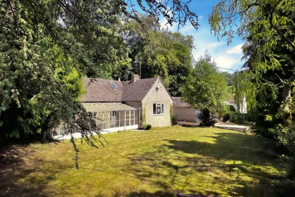
- Price
- Offers Over£600,000
- Size
- 1.31 acres
Woodstock Lane, Avening, GL8, Avening, Gloucestershire GL8 England
Added on 25/05/2026House with Land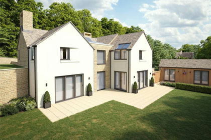
- Price
- Offers Over£600,000
- Size
- 1.31 acres
Woodstock Lane, Avening, Tetbury, Gloucestershire, GL8, Avening, Gloucestershire GL8 England
Added on 27/08/2026Development Land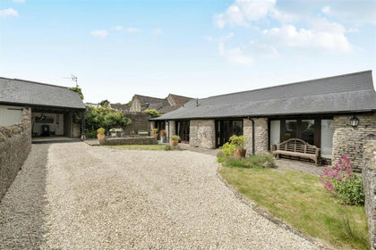 Added on 22/05/2026Barn Conversion

- Price
- £825,000
- Size
- 4.83 acres
Added on 11/06/2026House with Land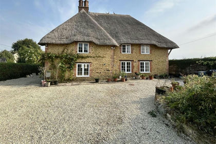
- Price
- Offers in Excess of£795,000
Sandy Lane, Chippenham, Derry Hill & Studley, Wiltshire SN15 England
Added on 14/05/2026Cottage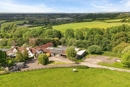
- Price
- £875,000
- Size
- 1.8 acres
Parkfield, Pucklechurch, BS16, Pucklechurch, South Gloucestershire BS16 England
Added on 12/09/2026House with Land