Detached Bungalow with Approx. 2.5 Acre Plot (STMS) with Private Woodland in Bradenham
- Land size
- 2.5 acres
- Bedrooms
- 3
- Bathrooms
- 2
Key Features
- Guide Price £600,000 - £650,000
- Approx. 2.5 Acre Plot, with Private Woodland Walk Area (STMS)
- Three Double Bedrooms
- Principal En-Suite Bedroom with Two Further Bedrooms Sharing a Bathroom
- Potential To Extend and Convert Loft Space, Subject to Relevant Planning
- Two Spacious Reception Rooms and Modernised Throughout with Feature Multi-Fuel Burner at the Heart of the Home
- Double Garage with Adjoining Storage Rooms, Potential for Annexe Conversion, Subject to Relevant Planning
- Front Garden with Private Driveway and Carport
- Popular Village Location, Conveniently Located for Market Towns of Dereham, Swaffham, and Watton
- Short Walk To Bradenham Village Green
Description
Situated in the popular Norfolk village of Bradenham, Rosecroft is an attractive, modernised three-bedroom home set within approximately 2.5 acres (STMS). Offering generous accommodation, versatile outbuildings and private grounds, the property presents an appealing opportunity for those seeking a village lifestyle with space and future potential.
The accommodation includes two reception rooms, three double bedrooms, an en-suite principal bedroom and a shared bathroom serving the two remaining bedrooms. A separate sitting room provides a comfortable space to relax, while the family/dining room offers an inviting setting for everyday living and entertaining. The kitchen, utility room and additional WC provide further practicality, with the home having been modernised throughout.
There is also potential to extend the existing accommodation or explore a loft conversion, subject to the necessary planning permissions and building regulations, offering flexibility as requirements change.
A particular feature of Rosecroft is its substantial double garage with adjoining storage rooms, providing versatile space for vehicles, hobbies, workshops or general storage. These buildings may also offer potential for conversion into an annexe or ancillary accommodation, subject to the necessary consents, making them particularly appealing for those seeking additional living or working space.
The impressive grounds provide privacy and plenty of room to enjoy the outdoors, including a private woodland walk. Whether for gardening, recreation or simply relaxing in the natural surroundings, the setting offers considerable scope to make the most of the land. The bungalow also benefits from an adjoining carport, with a door leading directly into the utility room, a practical feature the current owner has particularly appreciated when arriving home on rainy days.
Despite its generous plot, Rosecroft remains conveniently positioned within Bradenham, with the village green just a short walk away. The nearby market towns of Dereham, Watton and Swaffham provide a wider range of shops, services and everyday amenities.
Combining modernised accommodation, substantial outbuildings and extensive grounds, Rosecroft offers a versatile home with exciting potential for future enhancement, all within an established Norfolk village setting.
BRADENHAM
Bradenham is a charming Norfolk village centred around an attractive village green, complete with a children’s play area and an active cricket club. The village is also home to a bowls club, football club and village hall, creating a welcoming community atmosphere for residents of all ages.
Surrounded by picturesque countryside, Bradenham lies close to the sources of two Norfolk rivers. The River Yare rises near Shipdham and flows eastwards, while the River Wissey flows westwards through Bradenham towards the Fens.
Approximately six miles away, in the heart of Norfolk, Dereham is a traditional market town with an appealing mix of Georgian architecture, historic buildings and more recent developments.
The town’s history dates back to AD 654, when St Withburga is said to have founded a religious settlement. Today, its twice-weekly markets, held on Tuesdays and Fridays, together with independent shops, cafés and free public parking, make Dereham an inviting place to explore.
Among its historic attractions are the Mid-Norfolk Railway, offering heritage train journeys between Dereham and Wymondham, the Grade II listed Dereham Windmill and Bishop Bonner’s Cottage, dating back to 1502 and believed to be the oldest surviving building in the town.
With local schools, leisure facilities, a golf course and convenient access to Norwich and the North Norfolk coast, Dereham and its surrounding villages offer an appealing balance of countryside living and everyday convenience.
SERVICES CONNECTED
Mains water, electricity and drainage. Heating via LPG.
COUNCIL TAX
Band D.
ENERGY EFFICIENCY RATING
E. Ref:- 0319-3064-4203-0226-2200
To retrieve the Energy Performance Certificate for this property please visit and enter in the reference number above. Alternatively, the full certificate can be obtained through Sowerbys.
TENURE
Freehold.
LOCATION
What3words: ///permanent.avocado.squabbles
WEBSITE TAGS
perfect-views
village-spirit
bloom-blossom
room-to-roam
family-life
work-and-grow
project-homes
EPC Rating: E
Parking - Car port
Parking - Garage
Parking - Driveway
Parking - EV charging
Disclaimer
These particulars are provided as a guide only and do not form part of any offer or contract. Sowerbys and its representatives have no authority to make or give representations or warranties. All descriptions, measurements, photographs and plans are for guidance only and should not be relied upon as statements of fact. Buyers should satisfy themselves as to the accuracy of the information through inspection or professional advice. Services, appliances and equipment have not been tested and no warranty can be given as to their condition. Planning permissions, building regulations and other consents should be verified by the buyer’s legal adviser. In accordance with Anti-Money Laundering regulations, proceeding buyers must complete a digital ID check through our compliance partner. A charge of £48 including VAT per sale or purchase applies. Leasehold buyers should confirm ground rent, service charges and lease details with their legal adviser.
Map Location
Property details
- Tenure
- Freehold
- Council Tax Band
- D
- Date Posted
- 2026-11-02
Market Value Analysis
Compared with 1,120 Homes with Land listings in East Anglia (1+ acres).
Energy Performance Certificate
Energy Efficiency Rating
Based on UK Energy Performance Certificate standards (EU Directive 2002/91/EC)
Running costs are one side. Planning activity, flood history and ground risks for this location are in the full report.
Utilities & Restrictions
Utilities
- Electricity
- Mains
- Water
- Mains
- Heating
- Gas Central Heating
- Broadband
- Fibre (FTTC)
- Sewerage
- Mains
Rights & Restrictions
- Public Rights of Way
- Ask Agent
- Private Rights of Way
- Ask Agent
- Listed Property
- Ask Agent
- Restrictions
- Ask Agent
Listed status, conservation areas and planning constraints for this location are in the full report.
Property Features
- Accessibility
- Ask Agent
- Parking
- Garage, Covered Parking, Driveway, EV Charger
- Garden
- Front Garden, Rear Garden
Beyond the particulars: planning activity, flood history, heritage and ground risks, checked for this exact spot.
Connectivity
Broadband
Fastest speed available at this postcode
80 Mbps
Superfast
Suitable for
- HD streaming
- Video calls
- Web & social
Mobile signal
Predicted 4G and 5G signal; indoor signal depends on building materials.
Ofcom Connected Nations postcode-level predictions. Speeds and signal are modelled, not measured, and vary between addresses and providers.
Signal is the easy part. Planning activity, flood history and protected designations here are in the full report.
Nearest Schools
Primary
- Necton VA Primary School2.7 milesOfsted report card · May 2026
- Ages
- 3 to 11
- Pupils
- 198
- Type
- Voluntary aided school
- Faith
- Church of England
- Thomas Bullock Church of England Primary and Nursery Academy2.7 milesOfsted: Good
- Ages
- 2 to 11
- Pupils
- 229
- Type
- Academy sponsor led
- Faith
- Church of England
- Ashill Voluntary Controlled Primary School3.6 milesOfsted: Good
- Ages
- 4 to 11
- Pupils
- 109
- Type
- Voluntary controlled school
- Faith
- Church of England
- Scarning Voluntary Controlled Primary School4 milesNo Ofsted rating
- Ages
- 4 to 11
- Pupils
- 415
- Type
- Voluntary controlled school
- Parker's Church of England Primary Academy4.4 milesOfsted: Good
- Ages
- 3 to 11
- Pupils
- 93
- Type
- Academy sponsor led
- Faith
- Church of England
Secondary
- Northgate High School5.2 milesOfsted: Good
- Ages
- 11 to 18
- Pupils
- 1,203
- Type
- Academy converter
- Wayland Academy5.3 milesOfsted: Good
- Ages
- 11 to 16
- Pupils
- 564
- Type
- Academy converter
- Dereham Neatherd High School5.5 milesOfsted: Requires improvement *
- Ages
- 11 to 18
- Pupils
- 1,079
- Type
- Academy converter
- Litcham School5.9 milesOfsted: Good
- Ages
- 4 to 16
- Pupils
- 727
- Type
- Academy converter
- The Nicholas Hamond Academy6.4 milesOfsted report card · Mar 2026
- Ages
- 11 to 16
- Pupils
- 710
- Type
- Academy sponsor led
* Latest graded judgement covers quality of education only; no overall grade was issued under the 2024-25 inspection framework.
Distances are straight-line from the advertised location. Source: the national school registers (DfE, Welsh Government, Scottish Government) and Ofsted.
Schools are just the start: sold prices nearby, planning activity and any flood history are in the full report.
Amenities
Supermarket
GP surgery
Pharmacy
Hospital
Green space
Straight-line distances from the advertised location. Sources: NHS records, Geolytix supermarket locations, OS Open Greenspace and the national trails registers.
The area stacks up? Now check the location itself: planning nearby, protected designations and past flooding.
Getting Around
Nearest station
Nearest bus stop
Typical drive times
Straight-line distances from the advertised location; drive times are typical free-flow times over OpenStreetMap road data, so allow more at peak. Public transport locations from DfT NaPTAN.
Easy to reach matters. So do planning activity, flood history and ground risks: all in the full report.
Flood Risk
Environment Agency open data, checked around the advertised map pin for the listed acreage. Long-term risk counts flood defences; the planning map's flood zones do not. Provided by LandSale, not the listing agent, and not part of the agent's particulars. Risk varies across a holding, so verify before committing.
Rivers and the sea
Not at the pin: mapped about 40 metres away.
Planning map: Flood Zone 3, about 50 metres away.
Surface water
Not at the pin: mapped about 30 metres away.
These bandings are the summary. Where this location sits on the flood maps, plus planning activity, heritage and ground risks, is in the full report.
Important notice: Information, maps and tags on this page are drawn from the advertising agent's marketing materials or generated automatically. LandSale has not verified them. Relying on these details is at your own risk, always carry out independent checks before committing to a purchase.
LandSale full disclaimer
Marketing information only - not formal particulars. The details on this website are provided for general guidance and do not constitute an offer or contract. Neither LandSale nor the advertising estate/land agent accepts responsibility for any inaccuracy.
1. Source of information
- Listing content: Core description, asking price, tenure, measurements, photographs and planning history originate from the marketing materials of the advertising estate or land agent. LandSale does not author this content and cannot guarantee its accuracy.
- Automated tags & categorisation: Property type, land-use class, acreage bands and similar labels may be applied by machine-learning models. They are intended as a helpful guide only and may not reflect the property's legal status or permitted use.
- Third-party & enriched data layers: Maps, boundary outlines, planning designations, soil reports, broadband coverage and other environmental or location-based insights are licensed from external suppliers. Such data are supplied “as is", may be incomplete or out of date and are subject to change without notice.
2. Verification required
Prospective purchasers must verify critical matters, including but not limited to planning permission, title boundaries, public rights of way, environmental constraints, acreage, services, access and VAT status, through their own inspections, specialist surveys, legal advisers and the selling agent before relying on the information or entering into any contract.
3. No warranty or liability
LandSale gives no warranty, express or implied, as to the accuracy, completeness or fitness for any particular purpose of the information displayed. LandSale shall not be liable for any loss, damage, cost or expense arising directly or indirectly from any use of or reliance on such information, save where liability may not be excluded by law.
4. Updates & feedback
If you believe any detail on this listing is inaccurate, please let us know. We will investigate and, where appropriate, update the listing or notify the agent.
© LandSale | Version 1.3 - August 2026
Similar properties for sale
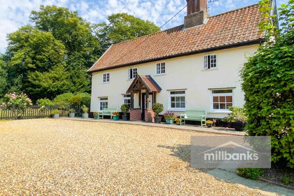
- Price
- Guide Price£700,000
- Size
- 1 acres
Southburgh Road, Cranworth, IP25, Cranworth, Norfolk IP25 England
Added on 22/03/2026Cottage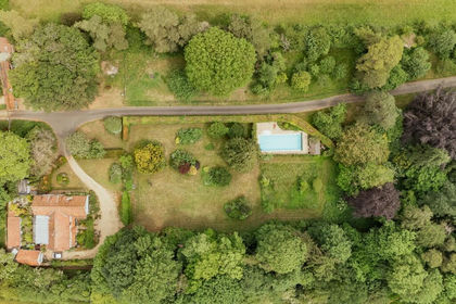
- Price
- Guide Price£700,000
- Size
- 2.2 acres
Substantial Property with Generous Accommodation in Swaffham, Swaffham, Norfolk PE37 England
Added on 28/02/2026House with Land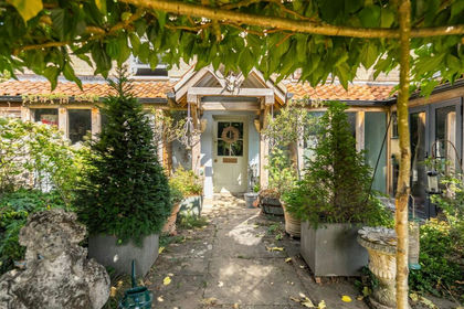
- Price
- Offers in Excess of£695,000
- Size
- 2.2 acres
Added on 08/09/2026House with Land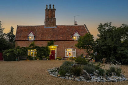
- Price
- Guide Price£700,000
- Size
- 1.7 acres
North Pickenham Road, Swaffham, Swaffham, Norfolk PE37 England
Added on 04/09/2026Farmhouse
- Price
- Guide Price£525,000
- Size
- 1.5 acres
College Road, Thompson, Thetford, Norfolk, IP24, Thompson, Norfolk IP24 England
Added on 09/09/2026Cottage
- Price
- Offers in Excess of£550,000
- Size
- 1.7 acres
Added on 04/04/2026Residential
- Price
- Offers in Excess of£625,000
- Size
- 6 acres
Drymere, Beachamwell Road, Swaffham, Beachamwell, Norfolk PE37 England
Added on 19/08/2026House with Land
- Price
- Offers in Excess of£700,000
- Size
- 1.5 acres
Great Heath Road, North Elmham, North Elmham, Norfolk NR20 England
Added on 16/06/2026Development Land
- Price
- Guide Price£625,000
- Size
- 1 acres
Attleborough Road, Great Ellingham, Attleborough, Great Ellingham, Norfolk NR17 England
Added on 25/08/2026House with Land
- Price
- Guide Price£750,000
- Size
- 1 acres
Dereham Road, Colkirk, Fakenham, Norfolk, NR21, Colkirk, Norfolk NR21 England
Added on 11/04/2026House with Land