Coed Madog, Maentwrog, near Porthmadog, Gwynedd
- Land size
- 5.44 acres
Key Features
- 5.44 acres of young mixed broadleaves
- Midway location between Porthmadog and Blaenau Ffestiniog
- Replanted native broadleaves, with self seeded conifer
- Good track access with internal hard track to woodland centre
- Please scroll down to the 'Property Brochure' for full details and maps
Description
Young mixed broadleaves with vehicular access in a beautiful location.
Coed Madog lies midway between Porthmadog and Blaenau Ffestiniog on the west side of Eryri (Snowdonia) National Park in rural Gwynedd. Portmeirion and Cardigan Bay are a 15-minute drive to the west, and the high peaks around Yr Wyddfa (Snowdon) are half an hour to the north, putting this young wood firmly in the heart of this beautiful area.
The wood occupies north-facing ground on the south side of the Ffestiniog valley and consequently enjoys remarkable panoramic views over the hills around Yr Wyddfa. The terrain within the wood is varied with the larger part being level or gently sloping, rising to steeper slopes on the upper southern boundary.
The previous stands of mature larch blew down in the storms of 2016. The wood was then replanted with a mix of native broadleaves. Birch, oak and willow have been supplemented by a variety of other species including rowan, beech, sweet chestnut, cherry and holly. A few conifers from the previous crop have also seeded in, providing an attractive mosaic of winter colour.
The young trees are now well established and clearly thriving in the benign conditions found here and the evolving habitat is proving increasingly attractive to local wildlife.
The wood is reached by a hard track that serves both the north and south boundaries – ideal for recreation and management. An overgrown internal hard track leads into the heart of the woodland from the north side. There is also approval in place for construction of a small hut, the previous one being the victim of a fallen tree. An overgrown seasonal stream runs through the wood close to the internal track.
For the last 20 years Coed Madog has provided much family enjoyment. However, children grow up and move away…hence the opportunity for the next generation of woodlanders!
Our Forester's Thoughts
Alastair says...
"There are a few tree tubes left over from the restock operation which should be removed.
My next job would be to improve access by clearing the overgrown internal track towards the middle of the wood and perhaps creating a secluded clearing there for quiet enjoyment and camping. I would also want to rebuild the small woodland hut.
The trees have grown well so I would consider respacing denser areas, favouring the retention of minor species like chestnut, cherry and oak where possible.
I would also cut and treat the occasional rhododendron bush before this invasive exotic plant establishes itself."
Please remember some management operations require approval and/or a licence.
Map Location
Property details
- Tenure
- Freehold
- Council Tax Band
- Ask Agent
- Date Posted
- 2026-10-30
Market Value Analysis
Compared with 52 Woodland listings in Wales (5+ acres).
Property Brochure
Seen the details? The full report adds the independent checks: planning activity, flood history, heritage and ground.
Utilities & Restrictions
Utilities
- Electricity
- Ask Agent
- Water
- Ask Agent
- Heating
- Ask Agent
- Broadband
- Ask Agent
- Sewerage
- Ask Agent
Rights & Restrictions
- Public Rights of Way
- Ask Agent
- Private Rights of Way
- Ask Agent
- Listed Property
- Ask Agent
- Restrictions
- Ask Agent
Listed status, conservation areas and planning constraints for this location are in the full report.
Property Features
- Accessibility
- Ask Agent
- Parking
- Ask Agent
- Garden
- Ask Agent
Beyond the particulars: planning activity, flood history, heritage and ground risks, checked for this exact spot.
Connectivity
Broadband
Fastest speed available at this postcode
17 Mbps
Standard (10-30 Mbps)
Suitable for
- Web & social
- Music streaming
- Standard video calls
Mobile signal
Predicted 4G and 5G signal; indoor signal depends on building materials.
Ofcom Connected Nations postcode-level predictions. Speeds and signal are modelled, not measured, and vary between addresses and providers.
Signal is the easy part. Planning activity, flood history and protected designations here are in the full report.
Nearest Schools
Primary
- Ysgol Edmwnd Prys0.7 miles
- Pupils
- 18
- Type
- Nursery, Infants & Juniors
- Language
- Welsh medium school / provision (including transitional)
- Ysgol Bro Cynfal1.7 miles
- Pupils
- 40
- Type
- Nursery, Infants & Juniors
- Language
- Welsh medium school / provision (including transitional)
- Ysgol Gynradd Tanygrisiau2.7 miles
- Pupils
- 32
- Type
- Nursery, Infants & Juniors
- Language
- Welsh medium school / provision (including transitional)
- Ysgol Manod3 miles
- Pupils
- 86
- Type
- Nursery, Infants & Juniors
- Language
- Welsh medium school / provision (including transitional)
- Ysgol Maenofferen3.5 miles
- Pupils
- 214
- Type
- Nursery, Infants & Juniors
- Language
- Welsh medium school / provision (including transitional)
Secondary
- Ysgol Y Moelwyn3.3 miles
- Pupils
- 355
- Type
- Secondary (ages 11-16)
- Language
- Welsh medium school / provision (including transitional)
- Ysgol Eifionydd6.8 miles
- Pupils
- 373
- Type
- Secondary (ages 11-16)
- Language
- Welsh medium school / provision (including transitional)
- Ysgol Ardudwy8.4 miles
- Pupils
- 331
- Type
- Secondary (ages 11-16)
- Language
- Welsh medium school / provision (including transitional)
- Bro Idris15 miles
- Pupils
- 541
- Type
- Middle (ages 3-16)
- Language
- Welsh medium school / provision (including transitional)
- Ysgol Dyffryn Nantlle15 miles
- Pupils
- 397
- Type
- Secondary (ages 11-19)
- Language
- Welsh medium school / provision (including transitional)
Distances are straight-line from the advertised location. Source: the national school registers (DfE, Welsh Government, Scottish Government) and Ofsted.
Schools are just the start: sold prices nearby, planning activity and any flood history are in the full report.
Amenities
Supermarket
GP surgery
Pharmacy
Straight-line distances from the advertised location. Sources: NHS records, Geolytix supermarket locations, OS Open Greenspace and the national trails registers.
The area stacks up? Now check the location itself: planning nearby, protected designations and past flooding.
Getting Around
Nearest station
Nearest bus stop
Typical drive times
Straight-line distances from the advertised location; drive times are typical free-flow times over OpenStreetMap road data, so allow more at peak. Public transport locations from DfT NaPTAN.
Easy to reach matters. So do planning activity, flood history and ground risks: all in the full report.
Flood Risk
Natural Resources Wales open data, checked around the advertised map pin for the listed acreage. Long-term risk counts flood defences; the planning map's flood zones do not. Provided by LandSale, not the listing agent, and not part of the agent's particulars. Risk varies across a holding, so verify before committing.
Rivers and the sea
Planning map: Flood Zone 1.
Surface water
These bandings are the summary. Where this location sits on the flood maps, plus planning activity, heritage and ground risks, is in the full report.
Important notice: Information, maps and tags on this page are drawn from the advertising agent's marketing materials or generated automatically. LandSale has not verified them. Relying on these details is at your own risk, always carry out independent checks before committing to a purchase.
LandSale full disclaimer
Marketing information only - not formal particulars. The details on this website are provided for general guidance and do not constitute an offer or contract. Neither LandSale nor the advertising estate/land agent accepts responsibility for any inaccuracy.
1. Source of information
- Listing content: Core description, asking price, tenure, measurements, photographs and planning history originate from the marketing materials of the advertising estate or land agent. LandSale does not author this content and cannot guarantee its accuracy.
- Automated tags & categorisation: Property type, land-use class, acreage bands and similar labels may be applied by machine-learning models. They are intended as a helpful guide only and may not reflect the property's legal status or permitted use.
- Third-party & enriched data layers: Maps, boundary outlines, planning designations, soil reports, broadband coverage and other environmental or location-based insights are licensed from external suppliers. Such data are supplied “as is", may be incomplete or out of date and are subject to change without notice.
2. Verification required
Prospective purchasers must verify critical matters, including but not limited to planning permission, title boundaries, public rights of way, environmental constraints, acreage, services, access and VAT status, through their own inspections, specialist surveys, legal advisers and the selling agent before relying on the information or entering into any contract.
3. No warranty or liability
LandSale gives no warranty, express or implied, as to the accuracy, completeness or fitness for any particular purpose of the information displayed. LandSale shall not be liable for any loss, damage, cost or expense arising directly or indirectly from any use of or reliance on such information, save where liability may not be excluded by law.
4. Updates & feedback
If you believe any detail on this listing is inaccurate, please let us know. We will investigate and, where appropriate, update the listing or notify the agent.
© LandSale | Version 1.3 - August 2026
Similar properties for sale
- Price
- Fixed Price£75,000
- Size
- 4.33 acres
Coed Y Foel, nr Penrhyndeudraeth, Gwynedd, , Gwynedd LL41 Wales
Added on 09/10/2026Woodland with Cabin
- Price
- Fixed Price£55,000
- Size
- 4.66 acres
Added on 09/10/2026Woodland
- Price
- Fixed Price£75,000
- Size
- 7.25 acres
Added on 09/10/2026Woodland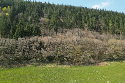
- Price
- Guide Price£67,500
- Size
- 13.5 acres
Added on 29/01/2026Woodland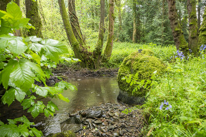
- Price
- Fixed Price£75,000
- Size
- 5.5 acres
Coed Foddhyd, Ruthin, Denbighshire, , Denbighshire LL15 Wales
Added on 09/10/2026Woodland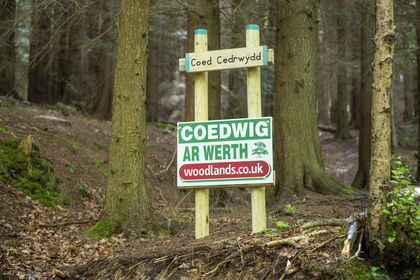
- Price
- Fixed Price£69,000
- Size
- 5 acres
Coed Cedrwydd, Ruthin, Denbighshire, , Denbighshire LL15 Wales
Added on 09/10/2026Woodland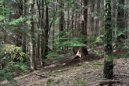
- Price
- Fixed Price£65,000
- Size
- 5 acres
Added on 31/10/2026Woodland
- Price
- Fixed Price£59,000
- Size
- 6 acres
Coed Dyfi, near Machynlleth, Ceredigion, , Ceredigion SY20 Wales
Added on 09/10/2026Woodland
- Price
- Fixed Price£89,000
- Size
- 9 acres
Coed Llyfnant, Machynlleth, Ceredigion, , Ceredigion SY20 Wales
Added on 09/10/2026Woodland
- Price
- Guide Price£60,000
- Size
- 25.75 acres
Llanddulas, Abergele, Conwy, Llanddulas and Rhyd-y-Foel, Conwy LL22 Wales
Added on 23/10/2026Woodland