Auction: Wednesday 18 November 2026 at 12 noon
Llanddulas, Abergele, Conwy
- Land size
- 25.75 acres
Key Features
- 25.75 acres of densely populated woodland
- Parking spaces with footpaths leading through part of the land
- Located close to the North Wales coastline
- For sale by online auction (subject to sale prior, reserve and conditions) auction end date 18/11/26 at 12noon
Description
A substantial plot of densely populated woodland, situated to the south of the village of Llandulas Conwy.
** For sale by online auction (subject to sale prior, reserve and conditions) *
Description
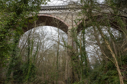
Raynes Woodland represents a substantial and highly attractive parcel of mixed broadleaf woodland, extending to approximately 25.75 acres. The woodland is characterized by a diverse range of mature specimen trees, creating a rich and varied habitat that offers both ecological and aesthetic value.
The topography of the land features gentle undulation throughout, adding visual interest and enhancing the natural character of the site. This variation in elevation contributes to a dynamic landscape, ideal for recreational use, conservation or amenity purposes.
The woodland benefits from two principal access points, each benefiting from small parking areas. From these entrances, a network of well-defined paths meanders through the woodland, intersecting at various points to provide excellent connectivity and ease of movement across the site
Conditions of Sale
Minerals
• The Vendor will retain the mines and mineral but without the right to work the same.
Development overage
• The property will be sold subject to and uplift provision which will specify that 50% of any increase in value due to development (as defined in Section 55 of the Town and Country Planning Act 1990) will be payable to the Vendor should such development occur within 25 years from the date of completion. The uplift will be payable upon the grant of a planning consent. The overage will exclude any development for agricultural and/or private equestrian use. Successive grants of permission within the terms set out above would trigger overage. Reasonable costs incurred in obtaining planning permissions can be deducted from the overage calculations.
Sale overage
• The sale will be subject to a 12-month disposal restriction whereby the purchaser covenants with the seller not to make any Disposal save for Permitted Disposals at any time during the Restricted Period without first procuring that the person to whom the Disposal is being made has executed a Deed of Covenant.
• Restricted Period: means the period of 1 year starting on the date of this transfer and ending at midnight on the day immediately preceding the first anniversary of the date of this transfer.
Situation
Raynes woodland is located to the south of the village of Llandulas, Conwy. Llanddulas is a small coastal village in Conwy County, North Wales, nestled between Old Colwyn and Abergele.
While the woodland is located within a semi-rural setting, convenient access to the North Wales Expressway A55 is available within a mile at Junction 23.
Tenure
The property is to be sold freehold with vacant possession.
Local Authority
Conwy Brough Council.
Public rights of way, wayleaves and easements
The property is sold subject to all rights of way, wayleaves and easements whether or not they are defined in this brochure.
Planning
The selling agents will not provide advice/guidance on the planning history for the property/land. Interested parties are advised to make their own investigations. It is assumed that enquiries have been satisfied, prior to an offer being made.
Anti Money Laundering Regulations (AML)
In accordance with Anti Money Laundering Regulations (AML), we are required to request forms of identification and carry out due diligence on any parties connected to a successful offer. Should an offer be made on behalf of a business/company, AML due diligence will also be necessary. Proof/source of funding must be supplied, prior to offer acceptance.
Method of sale
The property is offered for sale by online auction method however the vendor reserves the right to conclude the sale by an alternative method if required.
Plans and boundaries
The plans within these particulars are based on Ordnance Survey data and provided for reference only. They are believed to be correct but accuracy is not guaranteed. The purchaser shall be deemed to have full knowledge of all boundaries and the extent of ownership. Neither the vendor nor the vendor’s agents will be responsible for defining the boundaries or the ownership thereof.
Finance your purchase
If you require advice on how to finance a purchase through auction, please go to our trusted partners, or ask our team for further details.
Important notices
This property is available for sale by online auction. Interested buyers will need to register in advance and complete an ID verification before being able to place a bid.
There is no charge for registering. Buyers should allow sufficient time to complete this process before the time period expires. Full details can be found on Fisher German’s online auction page
Legal pack
A legal pack and any special conditions will be available on Fisher German’s online auction page and interested parties will need to register before accessing the legal documents. It is the responsibility of a prospective purchaser to make all necessary enquiries prior to the auction.
Conditions of sale
The property will, unless previously withdrawn, be sold subject to common auction conditions and special conditions of each sale may be found in the legal documents section of the Fisher German online auction page. Each purchaser shall be deemed to have notice of each condition and all the terms thereof and to bid on those terms whether they shall have inspected the said conditions or not.
Completion
Completion will take place 20 working days after exchange of contracts, unless otherwise varied and specified in the legal pack.
Fees
The winning buyer must pay £6,000 + VAT automatically at the end of the auction of which:
£4,000 + VAT is the buyer fee
£2,000 + VAT is the admin fee
The buyer is also responsible to pay the following fees, as documented within the special conditions of sale:
Legal Costs: £6,000 inc VAT
Search Costs: £995.83 inc VAT
Disbursement Costs: 85.20 inc VAT
Deposit
The balance of the 10% deposit shall be transferred by the buyer to their solicitor for onward transmission by 12 noon the following working day to the seller’s lawyer. It is therefore essential that you instruct your solicitor ahead of the auction.
Viewings
Strictly by appointment through Fisher German LLP.
Directions
Postcode – LL22 8ND
what3words – ///judges.mess.optimists
Map Location
Property details
- Tenure
- Ask Agent
- Council Tax Band
- TBC
- Date Posted
- 2026-10-23
Market Value Analysis
Compared with 13 Woodland listings in Wales (25+ acres).
Utilities & Restrictions
Utilities
- Electricity
- Ask Agent
- Water
- Ask Agent
- Heating
- Ask Agent
- Broadband
- Ask Agent
- Sewerage
- Ask Agent
Rights & Restrictions
- Public Rights of Way
- Ask Agent
- Private Rights of Way
- Ask Agent
- Listed Property
- Ask Agent
- Restrictions
- Ask Agent
Listed status, conservation areas and planning constraints for this location are in the full report.
Property Features
- Accessibility
- Ask Agent
- Parking
- Parking Available
- Garden
- Ask Agent
Beyond the particulars: planning activity, flood history, heritage and ground risks, checked for this exact spot.
Connectivity
Broadband
Fastest speed available at this postcode
1.8 Gbps
Gigabit full fibre
Suitable for
- 4K streaming on every screen
- Full-time home working
- Online gaming & big downloads
Mobile signal
Predicted 4G and 5G signal; indoor signal depends on building materials.
Ofcom Connected Nations postcode-level predictions. Speeds and signal are modelled, not measured, and vary between addresses and providers.
Signal is the easy part. Planning activity, flood history and protected designations here are in the full report.
Nearest Schools
Primary
- Ysgol Llanddulas737 metres
- Pupils
- 138
- Type
- Nursery, Infants & Juniors
- Language
- English medium school / provision
- Ysgol Cynfran0.7 miles
- Pupils
- 156
- Type
- Nursery, Infants & Juniors
- Language
- English medium school / provision
- Ysgol Swn Y Don1.7 miles
- Pupils
- 118
- Type
- Nursery, Infants & Juniors
- Language
- English medium school / provision
- Ysgol y Plas2.1 miles
- Pupils
- 74
- Type
- Nursery, Infants & Juniors
- Language
- English medium school / provision
- Ysgol Betws yn Rhos2.4 miles
- Pupils
- 74
- Type
- Nursery, Infants & Juniors
- Language
- Welsh medium school / provision (including transitional)
Secondary
- Ysgol Emrys ap Iwan2.6 miles
- Pupils
- 946
- Type
- Secondary (ages 11-19)
- Language
- English medium school / provision
- Ysgol Bryn Elian2.7 miles
- Pupils
- 981
- Type
- Secondary (ages 11-19)
- Language
- English medium school / provision
- Eirias High School3.2 miles
- Pupils
- 1,200
- Type
- Secondary (ages 11-19)
- Language
- English medium school / provision
- Ysgol Y Creuddyn6.1 miles
- Pupils
- 698
- Type
- Secondary (ages 11-19)
- Language
- Welsh medium school / provision (including transitional)
- Christ the Word7.1 miles
- Pupils
- 870
- Type
- Middle (ages 3-16)
- Language
- English medium school / provision
Distances are straight-line from the advertised location. Source: the national school registers (DfE, Welsh Government, Scottish Government) and Ofsted.
Schools are just the start: sold prices nearby, planning activity and any flood history are in the full report.
Amenities
Supermarket
GP surgery
Pharmacy
Green space
Straight-line distances from the advertised location. Sources: NHS records, Geolytix supermarket locations, OS Open Greenspace and the national trails registers.
The area stacks up? Now check the location itself: planning nearby, protected designations and past flooding.
Getting Around
Nearest station
Nearest bus stop
Typical drive times
Straight-line distances from the advertised location; drive times are typical free-flow times over OpenStreetMap road data, so allow more at peak. Public transport locations from DfT NaPTAN.
Easy to reach matters. So do planning activity, flood history and ground risks: all in the full report.
Flood Risk
Natural Resources Wales open data, checked around the advertised map pin for the listed acreage. Long-term risk counts flood defences; the planning map's flood zones do not. Provided by LandSale, not the listing agent, and not part of the agent's particulars. Risk varies across a holding, so verify before committing.
Rivers and the sea
Planning map: Flood Zone 1.
Surface water
These bandings are the summary. Where this location sits on the flood maps, plus planning activity, heritage and ground risks, is in the full report.
Important notice: Information, maps and tags on this page are drawn from the advertising agent's marketing materials or generated automatically. LandSale has not verified them. Relying on these details is at your own risk, always carry out independent checks before committing to a purchase.
LandSale full disclaimer
Marketing information only - not formal particulars. The details on this website are provided for general guidance and do not constitute an offer or contract. Neither LandSale nor the advertising estate/land agent accepts responsibility for any inaccuracy.
1. Source of information
- Listing content: Core description, asking price, tenure, measurements, photographs and planning history originate from the marketing materials of the advertising estate or land agent. LandSale does not author this content and cannot guarantee its accuracy.
- Automated tags & categorisation: Property type, land-use class, acreage bands and similar labels may be applied by machine-learning models. They are intended as a helpful guide only and may not reflect the property's legal status or permitted use.
- Third-party & enriched data layers: Maps, boundary outlines, planning designations, soil reports, broadband coverage and other environmental or location-based insights are licensed from external suppliers. Such data are supplied “as is", may be incomplete or out of date and are subject to change without notice.
2. Verification required
Prospective purchasers must verify critical matters, including but not limited to planning permission, title boundaries, public rights of way, environmental constraints, acreage, services, access and VAT status, through their own inspections, specialist surveys, legal advisers and the selling agent before relying on the information or entering into any contract.
3. No warranty or liability
LandSale gives no warranty, express or implied, as to the accuracy, completeness or fitness for any particular purpose of the information displayed. LandSale shall not be liable for any loss, damage, cost or expense arising directly or indirectly from any use of or reliance on such information, save where liability may not be excluded by law.
4. Updates & feedback
If you believe any detail on this listing is inaccurate, please let us know. We will investigate and, where appropriate, update the listing or notify the agent.
© LandSale | Version 1.3 - August 2026
Similar properties for sale
- Price
- Fixed Price£75,000
- Size
- 5.25 acres
Added on 09/10/2026Woodland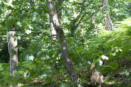
- Price
- Fixed Price£29,000
- Size
- 3.25 acres
Coed Castell (Castle Wood), Colwyn Bay, Conwy, , Conwy LL28 Wales
Added on 09/10/2026Woodland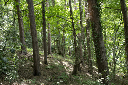
- Price
- Fixed Price£29,000
- Size
- 2.75 acres
Added on 09/10/2026Woodland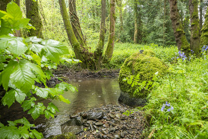
- Price
- Fixed Price£75,000
- Size
- 5.5 acres
Coed Foddhyd, Ruthin, Denbighshire, , Denbighshire LL15 Wales
Added on 09/10/2026Woodland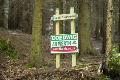
- Price
- Fixed Price£69,000
- Size
- 5 acres
Coed Cedrwydd, Ruthin, Denbighshire, , Denbighshire LL15 Wales
Added on 09/10/2026Woodland
- Price
- Fixed Price£75,000
- Size
- 6.66 acres
Added on 09/10/2026Woodland
- Price
- £45,000
- Size
- 1.5 acres
Paulsfield Drive, Wirral, CH46, Wallasey, Wirral CH46 England
Added on 29/01/2026Woodland
- Price
- £49,950
- Size
- 0.5 acres
Added on 24/07/2026Vacant Land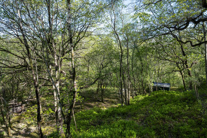
- Price
- Fixed Price£75,000
- Size
- 4.33 acres
Coed Y Foel, nr Penrhyndeudraeth, Gwynedd, , Gwynedd LL41 Wales
Added on 09/10/2026Woodland with Cabin
- Price
- Guide Price£80,000
- Size
- 24.24 acres
Glyn Ceiriog, Nr Oswestry., Llansantffraid Glyn Ceiriog, Wrexham LL20 Wales
Added on 23/10/2026Woodland