St. Marys, Chalford, Stroud, Gloucestershire, GL6
- Land size
- 3.78 acres
Key Features
- Cotswold Valley location
- Period Country House (Grade 2*), requiring renovation, approx. 4,476ft2 / 416m2
- Recently renovated adjoining Ivy Cottage (approx. 2,120ft2 / 197m2) and Wing Cottage (approx. 1,122ft2 / 104ft2) (Grade 2*)
- Characterful Mill Building (Grade 2), approx. 10,606ft2
- One-bedroom Lodge (Grade 2)
- Outbuildings
Description
A rare opportunity to purchase a substantial Grade 2* Listed Country House with two attached Cottages, an extensive former Mill building (Grade 2 Listed), adjacent workshop/stone barn, former Weavers Cottages and separate one-bedroom lodge. The property is set within approximately 3.78 acres (1.53 hectares).
Situation
St. Mary’s is situated in the Golden Valley village of Chalford, within the Parish of Minchinhampton, in the Cotswolds, an Area of Outstanding Natural Beauty. A wide range of amenities can be found in the nearby market town of Stroud, located approximately 3 miles to the north west. The property is well located providing links via A419 to M5 (8.5miles), Stroud (3 miles), Bristol, Bath and Cheltenham. Both Stroud and Kemble offer mainline train services to London (approx. 90 minutes).
Desciption - St. Marys House
The period property known as St. Mary’s House comprises a Grade 2* former Mill owners’ residence, being re-fronted in 1720 to provide a prominent and grand Country House. The main residence is attached to two cottages known as Wing Cottage and Ivy Cottage. St. Mary’s House provides the opportunity to create a truly stunning Country Manor. The rooms are well proportioned and there is an abundance of character, including sash windows with shutters, exposed beams, panel doors and signature fireplaces. There are various open fires, with single glazing, mains electricity, gas, water and drainage connected. The property sits within good-sized lawned grounds and paddock, extending to approximately 2.56 acres (1.03ha).
Wing Cottage & Ivy Cottage
The main residence is attached to two beautiful Cotswold stone cottages known as Wing Cottage and Ivy Cottage, part of the Grade 2* Listing. These have recently been renovated (circa 2020). The cottages are connected to mains water, gas, electricity and drainage, with underfloor heating to Wing Cottage. Externally, Wing Cottage benefits from an outdoor seating area and parking for two vehicles. Ivy Cottage is set within good-sized grounds and provides lawned and shrubbed gardens. A bridge over the River Frome offers a picturesque setting. There are also two garages. The property known as Latil Lodge is located to the north west of St. Mary’s House and provides a one bedroom dwelling.
Description - St. Marys Mill
St. Mary’s Mill is a Grade 2 Listed mixed use former mill building, comprising a rare Tangye steam engine, wheelhouse, storage and office space. The property has historically been occupied commercially for offices and storage. The main mill is arranged over five floors and provides predominantly open plan space, with original water wheel and steam engine on the ground floor. To the rear of the building is a large Stone Workshop and to the side a separate smaller workshop building, former Weavers Cottages and adjacent brick chimney. The assets are also Grade 2 Listed and provide opportunity for renovation and alternative uses, subject to planning.
Leases
The residential properties, with the exception of St. Mary’s House, are let on Assured Shorthold Tenancy agreements. There are two commercial Tenants to the Mill Building under commercial tenancy agreements.
Access
The site is accessed over a manned/staffed level crossing, providing a unique degree of security. The crossing gates are Grade 2 Listed and have recently been replaced. The property hatched blue on the plan and the land to the west is subject to a right of way. The access route is indicated by the green hatching on the plan.
General
Stroud District Council Wing Cottage EPC – D Ivy Cottage EPC – D Latil Lodge EPC – D
Council Tax
St. Mary’s House (E), Wing Cottage (A), Ivy Cottage (D), Latil Lodge (A)
Map Location
Property details
- Tenure
- Freehold
- Council Tax Band
- E
- Date Posted
- 2026-10-29
Market Value Analysis
Compared with 1,543 Homes with Land listings in South West England (1+ acres).
Utilities & Restrictions
Utilities
- Electricity
- Ask Agent
- Water
- Ask Agent
- Heating
- Ask Agent
- Broadband
- Ask Agent
- Sewerage
- Ask Agent
Rights & Restrictions
- Public Rights of Way
- Ask Agent
- Private Rights of Way
- Ask Agent
- Listed Property
- Ask Agent
- Restrictions
- Ask Agent
Listed status, conservation areas and planning constraints for this location are in the full report.
Property Features
- Accessibility
- Ask Agent
- Parking
- Parking Available
- Garden
- Garden
Beyond the particulars: planning activity, flood history, heritage and ground risks, checked for this exact spot.
Connectivity
Broadband
Fastest speed available at this postcode
49 Mbps
Superfast
Suitable for
- HD streaming
- Video calls
- Web & social
Mobile signal
Predicted 4G and 5G signal; indoor signal depends on building materials.
Ofcom Connected Nations postcode-level predictions. Speeds and signal are modelled, not measured, and vary between addresses and providers.
Signal is the easy part. Planning activity, flood history and protected designations here are in the full report.
Nearest Schools
Primary
- Chalford Hill Primary School0.9 milesOfsted report card · Nov 2025
- Ages
- 5 to 11
- Pupils
- 195
- Type
- Community school
- Brimscombe Church of England (VA) Primary School1 mileOfsted: Good
- Ages
- 4 to 11
- Pupils
- 115
- Type
- Voluntary aided school
- Faith
- Church of England
- Bussage Church of England Primary School1 mileNo Ofsted rating
- Ages
- 4 to 11
- Pupils
- 192
- Type
- Voluntary aided school
- Faith
- Church of England
- Minchinhampton Primary Academy1.2 milesOfsted: Good *
- Ages
- 3 to 11
- Pupils
- 260
- Type
- Academy converter
- Faith
- Church of England
- Eastcombe Primary School1.4 milesOfsted: Good
- Ages
- 4 to 11
- Pupils
- 49
- Type
- Community school
Secondary
- Thomas Keble School1.2 milesNo Ofsted rating
- Ages
- 11 to 16
- Pupils
- 718
- Type
- Academy converter
- Stroud High School3.4 milesOfsted: Outstanding
- Ages
- 11 to 18
- Pupils
- 1,144
- Type
- Academy converter
- Gender
- Girls
- Marling School3.5 milesOfsted: Good *
- Ages
- 11 to 18
- Pupils
- 1,082
- Type
- Academy converter
- Gender
- Boys
- Archway School3.8 milesOfsted report card · Apr 2026
- Ages
- 11 to 18
- Pupils
- 1,053
- Type
- Community school
- Sir William Romney's School5 milesNo Ofsted rating
- Ages
- 11 to 16
- Pupils
- 495
- Type
- Academy converter
* Latest graded judgement covers quality of education only; no overall grade was issued under the 2024-25 inspection framework.
Distances are straight-line from the advertised location. Source: the national school registers (DfE, Welsh Government, Scottish Government) and Ofsted.
Schools are just the start: sold prices nearby, planning activity and any flood history are in the full report.
Amenities
Supermarket
GP surgery
Pharmacy
Hospital
Green space
Straight-line distances from the advertised location. Sources: NHS records, Geolytix supermarket locations, OS Open Greenspace and the national trails registers.
The area stacks up? Now check the location itself: planning nearby, protected designations and past flooding.
Getting Around
Nearest station
Nearest bus stop
Typical drive times
Straight-line distances from the advertised location; drive times are typical free-flow times over OpenStreetMap road data, so allow more at peak. Public transport locations from DfT NaPTAN.
Easy to reach matters. So do planning activity, flood history and ground risks: all in the full report.
Flood Risk
Environment Agency open data, checked around the advertised map pin for the listed acreage. Long-term risk counts flood defences; the planning map's flood zones do not. Provided by LandSale, not the listing agent, and not part of the agent's particulars. Risk varies across a holding, so verify before committing.
Rivers and the sea
Not at the pin: mapped about 20 metres away.
Planning map: Flood Zone 3, about 20 metres away.
Surface water
Not at the pin: mapped about 10 metres away.
These bandings are the summary. Where this location sits on the flood maps, plus planning activity, heritage and ground risks, is in the full report.
Important notice: Information, maps and tags on this page are drawn from the advertising agent's marketing materials or generated automatically. LandSale has not verified them. Relying on these details is at your own risk, always carry out independent checks before committing to a purchase.
LandSale full disclaimer
Marketing information only - not formal particulars. The details on this website are provided for general guidance and do not constitute an offer or contract. Neither LandSale nor the advertising estate/land agent accepts responsibility for any inaccuracy.
1. Source of information
- Listing content: Core description, asking price, tenure, measurements, photographs and planning history originate from the marketing materials of the advertising estate or land agent. LandSale does not author this content and cannot guarantee its accuracy.
- Automated tags & categorisation: Property type, land-use class, acreage bands and similar labels may be applied by machine-learning models. They are intended as a helpful guide only and may not reflect the property's legal status or permitted use.
- Third-party & enriched data layers: Maps, boundary outlines, planning designations, soil reports, broadband coverage and other environmental or location-based insights are licensed from external suppliers. Such data are supplied “as is", may be incomplete or out of date and are subject to change without notice.
2. Verification required
Prospective purchasers must verify critical matters, including but not limited to planning permission, title boundaries, public rights of way, environmental constraints, acreage, services, access and VAT status, through their own inspections, specialist surveys, legal advisers and the selling agent before relying on the information or entering into any contract.
3. No warranty or liability
LandSale gives no warranty, express or implied, as to the accuracy, completeness or fitness for any particular purpose of the information displayed. LandSale shall not be liable for any loss, damage, cost or expense arising directly or indirectly from any use of or reliance on such information, save where liability may not be excluded by law.
4. Updates & feedback
If you believe any detail on this listing is inaccurate, please let us know. We will investigate and, where appropriate, update the listing or notify the agent.
© LandSale | Version 1.3 - August 2026
Contact David James, Wotton-under-Edge
Well House, The Chipping, Wotton-Under-Edge, GL12 7AD
View agent profileSimilar properties for sale
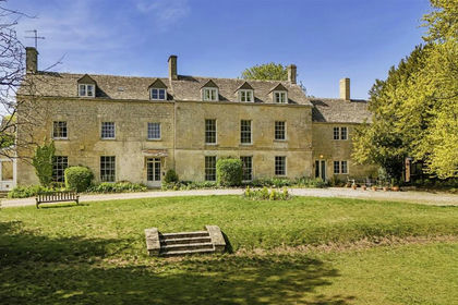
- Price
- Guide Price£2,150,000
- Size
- 4 acres
Cheltenham Road, Painswick, Stroud, Painswick, Gloucestershire GL6 England
Added on 25/05/2026Country Home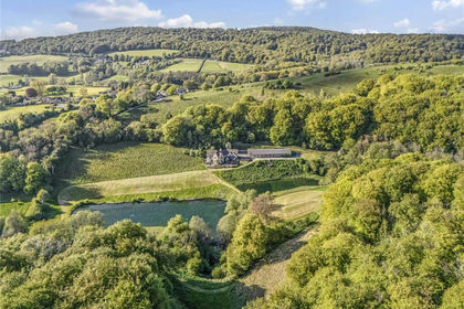
- Price
- Guide Price£2,375,000
- Size
- 10.57 acres
Cranham, Gloucester, Gloucestershire, GL4, Cranham, Gloucestershire GL4 England
Added on 25/05/2026Country Home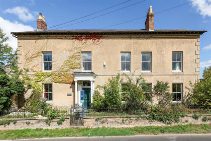
- Price
- Guide Price£1,750,000
- Size
- 5.95 acres
Birdlip Hill, Witcombe, Gloucester, Badgeworth, Gloucestershire GL3 England
Added on 17/09/2026House with Land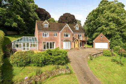
- Price
- Guide Price£1,500,000
- Size
- 1.45 acres
Coombe, Wotton-under-Edge, Gloucestershire, GL12, Wotton-under-Edge, Gloucestershire GL12 England
Added on 02/07/2026Country Home
- Price
- £1,500,000
- Size
- 1.25 acres
New Road, North Nibley, Dursley, North Nibley, Gloucestershire GL11 England
Added on 25/09/2026Country Home
- Price
- £1,650,000
- Size
- 6 acres
Harnhill, Cirencester, Gloucestershire, GL7, Driffield, Gloucestershire GL7 England
Added on 05/08/2026Country Home
- Price
- £2,500,000
- Size
- 7 acres
White Birch Manor - Awre GL14 - FOR SALE, Awre, Gloucestershire GL14 England
Added on 25/05/2026Country Home
- Price
- Guide Price£1,995,000
- Size
- 37.7 acres
West Yatton, Yatton Keynell, Chippenham, Wiltshire, SN14, Yatton Keynell, Wiltshire SN14 England
Added on 14/05/2026Country Home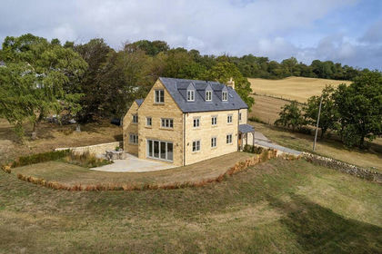
- Price
- Guide Price£2,300,000
- Size
- 2.17 acres
Winchcombe, Cheltenham, Gloucestershire, GL54, Winchcombe, Gloucestershire GL54 England
Added on 07/09/2026Country Home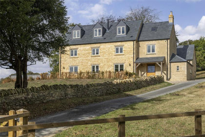
- Price
- Guide Price£2,300,000
- Size
- 2.17 acres
Winchcombe, Cheltenham, Gloucestershire, GL54, Winchcombe, Gloucestershire GL54 England
Added on 07/09/2026Country Home