Manafon, Welshpool, Powys, SY21
- Land size
- 61.82 acres
- Bedrooms
- 3
Description
Plas-Docyn is a privately located, small farm set in glorious Mid Wales countryside with good views overlooking the surrounding countryside and the Rhiew Valley. It is a well-shaped property providing privacy to the farmstead and farmhouse, which is located towards the centre of the farm. The comfortable farmhouse sits on the edge of the traditional and more modern range of buildings which are of use for agricultural, storage or equestrian purposes. The farmland lies around the house and is a mixture of flatter land with some sloping land, which provides for a variety of uses including grazing, fodder conservation and potential environmental greening and conservation purposes. Recently, parts of the land have been well fenced and blocked out with a view to using the property for equestrian purposes, and some of the buildings have been converted to suitable equestrian accommodation.
The farmhouse is a comfortable property with well-proportioned airy and light rooms and is well decorated, sitting to the side of the farmstead. The farm buildings are a mixture of storage and general-purpose buildings, some which have been converted for equestrian use, but provide a variety of storage and light industrial opportunities, subject to necessary consents. One of the brick buildings has received planning permission for a barn conversion.
The farmland lies in a number of convenient enclosures and paddocks, and recent emphasis has resulted in a number of larger fields being subdivided into equestrian paddocks, and this use could be further extended by purchasers.
It is a well laid out agricultural property with a number of flat and undulating fields with some steeper banks, with the opportunity to use these areas for grazing or environmental purposes.
PLAS-DOCYN FARMHOUSE
A well maintained and decorated farmhouse sitting on the edge of the farmstead. The farmhouse is constructed of cavity brick walls under a tiled roof with an Entrance porchway building under a cement fibre sheeted roof.
The Accommodation comprises:
Ground Floor:
From the rear, an attractive well-proportioned Utility Room with ample modern base and wall units, sink and plumbing for washing machine leading into:
Large Kitchen area with oak style base and wall units, granite breakfast bar and sink with views to countryside
Door to side pantry store
Dining Room with front window to views
A Further Sitting Room, again window to front elevation and views
From the front entrance door and hallway, stairs lead to:
First Floor:
Landing
Front Double Bedroom with storage
Front Double Bedroom with small cupboard storage
Rear Double Bedroom with storage
Family Bathroom with corner bath, WC, wash basin.
The farmhouse is currently let on a Service Agreement with vacant possession available upon completion.
OUTSIDE
The farm is accessed up a single-track road from a council-maintained road, and this provides privacy to the farmstead and land. Surrounding the house are garden grounds with parking and turning, flower beds and lawns.
AGRICULTURAL BUILDINGS
Situated to the side of the farmhouse is a range of useful farm buildings which are currently used for general storage and equestrian purposes. Formerly they were livestock housing and fodder and machinery storage and they would be useful for a number of purposes including agricultural. Subject to the necessary consents, they would be a suitable base for storage in connection with a business and are located towards the centre of the farm.
The buildings lie on a plateau adjacent to the farm buildings with long range views over the surrounding agricultural land and countryside.
Steel frame, concrete block and corrugated sheeted Range: 23.5m x 6.85m ext. and consisting of a Storeroom and Workshop together with an attached Garage: 8m x 4m ext.
4 Bay steel frame and corrugated sheeted Barn: 18.25m x 5.5m ext. with attached open fronted steel frame and corrugated sheeted Machinery Store and Lean-to: 16.9m x 10m ext.
Steel frame, concrete block and corrugated sheeted Cattle Shed: 26m x 11m ext. approx.
Located towards the centre of the farm buildings range is a 1950s built brick building with planning permission for conversion.
BARN CONVERSION
Brick and cement fibre, single storey Range being the Former Cowhouse with Loose Boxes: 23.5m x 5.9m ext. (planning consent has been given to convert to a 2-bedroom residential holiday let).
PLANNING PERMISSIONS
22/0402/HH - Approved Householder Planning Permission for 2nd floor rear extension over existing lean to roof and side extension with new chimney breast, front oak porch, removal of one chimney.
22/0523/FUL – Approved Full Planning Permission for Barn Conversion of existing unused agricultural barn into a new dwelling & installation of new package treatment plant.
THE LAND
The land is all in pasture suitable in the main for grazing or mowing or a combination of the two and extends to 61.82 Acres.
The land is set to permanent pasture and lies conveniently around the centrally located farmstead.
There are flatter areas of land currently used for equestrian purposes, and surrounding those are further areas suitable for fodder conservation. Some steeper land to the rear of the farmstead, and to the side, could be used for the grazing of livestock or other greening and environmentally interesting uses such as planting for woodland and carbon capture or other conservation purposes as required.
SUSTAINABLE FARMING SCHEME/BASIC PAYMENT SCHEME The land is registered with Rural Payment Wales
RIGHTS OF WAY, WAYLEAVES & EASEMENTS
The property is sold subject to and with the benefit of any existing rights of way, drainage, water and other rights, easements and way leaves whether by written agreement or otherwise.
MINES AND MINERALS RIGHTS
We understand that the mines and mineral rights are in hand.
SPORTING RIGHTS
We understand the sporting rights are in hand.
BOUNDARIES
Any purchaser shall be deemed to have full knowledge of all boundaries and neither the Vendor nor the Vendor’s Agents shall be responsible for defining the boundaries or ownership thereof.
INVESTMENT POTENTIAL
This is a valuable agricultural property which could be farmed, or else used as an investment vehicle for purchasers to create income whilst enjoying an outstanding lifestyle property with the associated agricultural and environmental incomes and benefits which attach to land ownership.
COUNCIL TAX Band ‘F’
EPC 49 (E) – Expires 27th August 2029
TENURE
Freehold with vacant possession on completion of the sale.
SERVICES
We understand there is mains electricity and water, septic tank drainage.
VIEWING
Accompanied by prior arrangement with the sole selling agents, Morris Marshall & Poole, 28 Broad Street, Welshpool.
NEGOTIATIONS
All interested parties are respectfully requested to negotiate directly with the Selling Agents
METHOD OF SALE
The property is being offered for sale by Private Treaty.
MONEY LAUNDERING REGULATIONS
On putting forward an offer to purchase you will be required to produce adequate identification to prove your identity and source of funding within the terms of the Money Laundering Regulations 2017. A company called ‘Coadjute’ provide reports for us, with a cost of £36 (Inc VAT) per person in order for us to complete our due diligence.
AGRICULTURAL MORTGAGE CORPORATION (AMC)
Morris Marshall & Poole are AMC Agents throughout Mid Wales and the Shropshire Borders. AMC have lent to rural business since 1928 and can now offer loans on smallholdings which create an income to the owner be it letting of grazing or buildings or for a small agricultural or equestrian business. Their loans are competitive and un-callable and may offer tax advantages over a residential mortgage. AMC are also able to lend against the value of land and buildings. For a free initial discussion please contact any office.
FLOOD RISK (PER NRW)
Flooding from rivers and sea- Very low risk - risk less than 0.1% chance each year.
Flooding from surface water and small watercourses – High risk - risk greater than 3.3% chance each year. (Houses, buildings and majority of land have not been affected by flooding).
BT & BROADBAND CHECKER
and-internet/advice-for-consumers/advice/Ofcom checker.
IMPORTANT NOTICE
These particulars are intended only as a guide and must not be relied upon as statements or representations of fact. Any prospective purchaser must satisfy themselves by inspection or otherwise as to the correctness of each statement contained within these particulars. Measurements, areas and distances are approximate only. Plans are for identification purposes only and are not to scale.
Map Location
Property details
- Tenure
- Ask Agent
- Council Tax Band
- F
- Date Posted
- 2026-10-27
Market Value Analysis
Compared with 53 Farmland & Pasture listings in Wales (50+ acres).
Utilities & Restrictions
Utilities
- Electricity
- Ask Agent
- Water
- Ask Agent
- Heating
- Ask Agent
- Broadband
- Ask Agent
- Sewerage
- Ask Agent
Rights & Restrictions
- Public Rights of Way
- Ask Agent
- Private Rights of Way
- Ask Agent
- Listed Property
- Ask Agent
- Restrictions
- Ask Agent
Listed status, conservation areas and planning constraints for this location are in the full report.
Property Features
- Accessibility
- Ask Agent
- Parking
- Parking Available
- Garden
- Garden
Beyond the particulars: planning activity, flood history, heritage and ground risks, checked for this exact spot.
Connectivity
Broadband
Fastest speed available at this postcode
5 Mbps
Under 10 Mbps here
Suitable for
- Basic browsing & email
Mobile signal
Predicted 4G and 5G signal; indoor signal depends on building materials.
Ofcom Connected Nations postcode-level predictions. Speeds and signal are modelled, not measured, and vary between addresses and providers.
Signal is the easy part. Planning activity, flood history and protected designations here are in the full report.
Nearest Schools
Primary
- Ysgol Bro Caereinion2.2 miles
- Pupils
- 494
- Type
- Middle (ages 4-19)
- Language
- Welsh medium school / provision (including transitional)
- Ysgol Rhiw Bechan3.4 miles
- Pupils
- 139
- Type
- Nursery, Infants & Juniors
- Language
- Dual language school / provision (Welsh and English) (including transitional)
- Berriew C.P. School4.3 miles
- Pupils
- 105
- Type
- Nursery, Infants & Juniors
- Language
- English medium school / provision
- Pontrobert C.P. School5.6 miles
- Pupils
- 67
- Type
- Nursery, Infants & Juniors
- Language
- Welsh medium school / provision (including transitional)
- Abermule Primary School6 miles
- Pupils
- 79
- Type
- Nursery, Infants & Juniors
- Language
- English medium school / provision
Secondary
- Ysgol Bro Caereinion2.2 miles
- Pupils
- 494
- Type
- Middle (ages 4-19)
- Language
- Welsh medium school / provision (including transitional)
- Welshpool High School7.5 miles
- Pupils
- 816
- Type
- Secondary (ages 11-19)
- Language
- English medium school / provision
- Newtown High School8.1 miles
- Pupils
- 896
- Type
- Secondary (ages 11-19)
- Language
- English medium school / provision
- Ysgol Llanfyllin9.7 miles
- Pupils
- 775
- Type
- Middle (ages 4-19)
- Language
- Dual language school / provision (Welsh and English) (including transitional)
- Llanidloes High School16 miles
- Pupils
- 703
- Type
- Secondary (ages 11-19)
- Language
- Dual language school / provision (Welsh and English) (including transitional)
Distances are straight-line from the advertised location. Source: the national school registers (DfE, Welsh Government, Scottish Government) and Ofsted.
Schools are just the start: sold prices nearby, planning activity and any flood history are in the full report.
Amenities
Supermarket
GP surgery
Pharmacy
Straight-line distances from the advertised location. Sources: NHS records, Geolytix supermarket locations, OS Open Greenspace and the national trails registers.
The area stacks up? Now check the location itself: planning nearby, protected designations and past flooding.
Getting Around
Nearest station
Nearest bus stop
Typical drive times
Straight-line distances from the advertised location; drive times are typical free-flow times over OpenStreetMap road data, so allow more at peak. Public transport locations from DfT NaPTAN.
Easy to reach matters. So do planning activity, flood history and ground risks: all in the full report.
Flood Risk
Natural Resources Wales open data, checked around the advertised map pin for the listed acreage. Long-term risk counts flood defences; the planning map's flood zones do not. Provided by LandSale, not the listing agent, and not part of the agent's particulars. Risk varies across a holding, so verify before committing.
Rivers and the sea
Planning map: Flood Zone 1.
Surface water
Not at the pin: mapped about 30 metres away.
These bandings are the summary. Where this location sits on the flood maps, plus planning activity, heritage and ground risks, is in the full report.
Important notice: Information, maps and tags on this page are drawn from the advertising agent's marketing materials or generated automatically. LandSale has not verified them. Relying on these details is at your own risk, always carry out independent checks before committing to a purchase.
LandSale full disclaimer
Marketing information only - not formal particulars. The details on this website are provided for general guidance and do not constitute an offer or contract. Neither LandSale nor the advertising estate/land agent accepts responsibility for any inaccuracy.
1. Source of information
- Listing content: Core description, asking price, tenure, measurements, photographs and planning history originate from the marketing materials of the advertising estate or land agent. LandSale does not author this content and cannot guarantee its accuracy.
- Automated tags & categorisation: Property type, land-use class, acreage bands and similar labels may be applied by machine-learning models. They are intended as a helpful guide only and may not reflect the property's legal status or permitted use.
- Third-party & enriched data layers: Maps, boundary outlines, planning designations, soil reports, broadband coverage and other environmental or location-based insights are licensed from external suppliers. Such data are supplied “as is", may be incomplete or out of date and are subject to change without notice.
2. Verification required
Prospective purchasers must verify critical matters, including but not limited to planning permission, title boundaries, public rights of way, environmental constraints, acreage, services, access and VAT status, through their own inspections, specialist surveys, legal advisers and the selling agent before relying on the information or entering into any contract.
3. No warranty or liability
LandSale gives no warranty, express or implied, as to the accuracy, completeness or fitness for any particular purpose of the information displayed. LandSale shall not be liable for any loss, damage, cost or expense arising directly or indirectly from any use of or reliance on such information, save where liability may not be excluded by law.
4. Updates & feedback
If you believe any detail on this listing is inaccurate, please let us know. We will investigate and, where appropriate, update the listing or notify the agent.
© LandSale | Version 1.3 - August 2026
Similar properties for sale
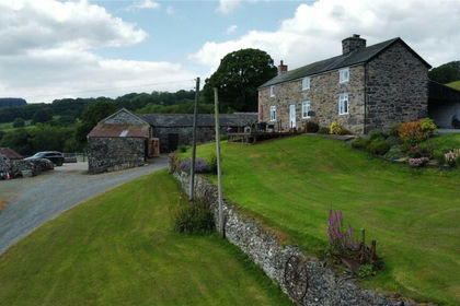
- Price
- £750,000
- Size
- 31.8 acres
Llanwddyn, Oswestry, Powys, SY10, Llanwddyn, Powys SY10 Wales
Added on 29/01/2026Small Farm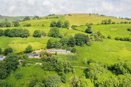
- Price
- Offers in Region of£695,000
- Size
- 53.32 acres
Hirnant, Penybontfawr, Oswestry, Pen-y-Bont-Fawr, Powys SY10 Wales
Added on 09/07/2026Farm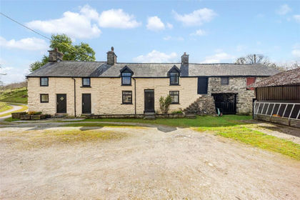
- Price
- Offers in Excess of£700,000
- Size
- 42.52 acres
Added on 29/04/2026Smallholding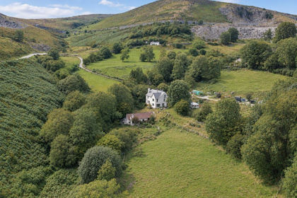
- Price
- £680,000
- Size
- 45 acres
Horseshoe Pass, Llangollen, Llantysilio, Denbighshire LL20 Wales
Added on 29/01/2026Smallholding
- Price
- Guide Price£900,000
- Size
- 50 acres
Added on 24/04/2026Farm
- Price
- Guide Price£930,000
- Size
- 34.16 acres
Added on 29/01/2026Equestrian property