Branscombe, Seaton
- Land size
- 9.02 acres
- Bedrooms
- 6
- Bathrooms
- 5
Key Features
- Elegant historic house meticulously renovated throughout
- Classical proportions, with high ceilings, large windows and grand staircase
- Elevated position with a magnificent outlook and partial sea views
- Within walking distance of the village centre and beach
- Charming southwest facing terraced gardens
- Protected by paddocks
- In all 9.02 acres (3.65 ha).
- No onward chain
Description
A beautifully presented Georgian house listed Grade II. Set in an elevated position close to the coast and overlooking Branscombe to the sea beyond. Surrounded by glorious gardens and pastureland. In all 9.02 acres (3.65 ha).
The Property - This elegant house’s origins date back to 1825 when Captain Yule, formerly a lieutenant on the Nelson’s flagship HMS Victory during the Battle of Trafalgar, retired. He built a fashionable cottage orné, Trafalgar Cottage on the site, which was then acquired and remodelled by John Tucker in 1845. The Tucker family, ran a very successful Honiton lace making business at the property, supplying London society, including the Royal family.
Today Trafalgar Barton features an attractive front façade with tall, shuttered sash windows providing wonderful views over the valley for the principal reception rooms and bedrooms. The generous accommodation is arranged over three floors and the house has classical proportions throughout. There is a successful blend of character features and the conveniences of modern living which one would hope to find in a house of this calibre. The magnificent entrance hall features a cantilevered staircase and parquet floors which continue throughout the main reception rooms. The dining room has double doors opening into the impressive drawing room, featuring an original fireplace and full height sash windows, creating an ideal space for entertaining.
At the heart of the home, the kitchen has bespoke cabinetry with large island, flagstone floors and an oil-fired AGA with an electric hob and 2 oven extension. There is room to dine and large French windows open onto a south facing terrace, ideal for outdoor dining. The generous and light filled accommodation continues on the first floor, the dual aspect master bedroom has distant sea views to the south and an ensuite shower room. There are five further bedrooms, three ensuite and a separate shower room. On the second floor the home office could provide a games room and there is an unconverted attic which offers further flexibility.
Please see floorplan for accommodation and measurements.
Outside - Trafalgar Barton is approached via a drive leading to a generous semi-walled parking and turning area. The surrounding mature, terraced gardens provide privacy and outstanding vistas, whilst gently blending into the surrounding countryside. There are lawns and herbaceous borders, as well as a number of shrubs and fine trees including a magnificent copper beech, for year-round colour and interest. Above the house is a partly walled vegetable garden. A private pathway leads through the gardens into the village and the National Trust path to the beach.
The Land - There is also an excellent block of gently sloping pastureland, divided into three paddocks, providing utility and protection for the property. There are two paddocks to the west and south of the house. Alongside the drive is a pretty, gently sloping pasture paddock with some mature trees and lovely views of the village. The adjacent gently sloping pasture paddock has access close to Bucknell Close in the centre of Branscombe Village. To the east of the house is a further pasture paddock well-sheltered by mature native trees. In all the land totals 9.02 acres (3.65 ha).
Situation - Trafalgar Barton nestles in an elevated, south-west facing position on the fringes of the picturesque, seaside village of Branscombe, on the UNESCO Jurassic Coast World Heritage site. With distant sea views, this private property is protected by the surrounding National Trust land, set in the heart of the East Devon National Landscape (formerly an AONB). Branscombe has a thriving year-round community with two popular inns, including the Masons's Arms, two cafés, village hall with tennis courts, ancient church, and primary school. There is easy access to a network of footpaths providing excellent opportunities for exploring the unspoilt Devon coastline and countryside. Branscombe beach is a 10 minute walk away, easily accessed by a footpath through the meadows.
The nearby Regency resort of Sidmouth (6 miles) with its long esplanade and wide beaches provides a good range of amenities including restaurants, independent shops, cinema, theatre, leisure centre and swimming pool as well as a Waitrose. The neighbouring fishing village of Beer offers a variety of independent shops, restaurants and pubs. Whilst surrounded by beautiful countryside , the property is easily accessible, close to the coast road, whilst the market town of Honiton (8 miles) has a mainline rail link to London Waterloo. The Cathedral City of Exeter offers a further range of cultural, recreational and shopping facilities, with access to the M5 and Exeter International Airport or at Lyme Regis with its famous Cobb and sandy beach.
Services - Main electricity. Main water. Private drainage. Oil fired central heating. Broadband: Standard and superfast fibre available. Mobile Network Coverage: There is mobile coverage in the area, please refer to Ofcom’s website for more details.
Tenure - Freehold with vacant possession upon completion.
Material Information - 1. We cannot confirm if the private drainage system complies with the current regulations.
2. Trafalgar Barton is situated in Flood Zone 1, an area with a low probability of flooding.
3. No public rights of way cross the property.
4. Neighbouring properties have a right of way over the drive.
Sporting - Racing at Taunton or Exeter. Golf at Lyme Regis or Honiton. Sailing on the coast at Lyme Regis or Topsham.
Local Authority - East Devon District Council. Tel: .
Council Tax Band: G
Education - Primary schooling at Branscombe or Beer. Good state secondary schooling at Sidmouth College, Axe Vale Academy and at the outstanding Colyton Grammar School. Independent Schools in the area include St Johns at Sidmouth, Blundells at Tiverton and the Exeter or Taunton Schools. Primary schooling at Branscombe.
Viewing - Strictly by prior appointment with sole agents Symonds and Sampson LLP. Further information, if required, is available from Ross Willmington or Angela Gillibrand on .
Directions - What3words ///recline.stands.homeward
From Branscombe village. take Lockseys Lane beside the Branoc Hall. Proceed 500 yards and the entrance driveway to Trafalgar Barton will be on the right.
Map Location
Property details
- Tenure
- Freehold
- Council Tax Band
- G
- Date Posted
- 2026-10-26
Market Value Analysis
Compared with 438 Homes with Land listings in South West England (5+ acres).
Utilities & Restrictions
Utilities
- Electricity
- Mains
- Water
- Mains
- Heating
- Oil Heating
- Broadband
- Fibre (FTTC)
- Sewerage
- Septic Tank / Private
Rights & Restrictions
- Public Rights of Way
- Ask Agent
- Private Rights of Way
- Ask Agent
- Listed Property
- Yes
- Restrictions
- Yes
Listed status, conservation areas and planning constraints for this location are in the full report.
Property Features
- Accessibility
- Ask Agent
- Parking
- Parking Available
- Garden
- Garden
Beyond the particulars: planning activity, flood history, heritage and ground risks, checked for this exact spot.
Connectivity
Broadband
Fastest speed available at this postcode
80 Mbps
Superfast
Suitable for
- HD streaming
- Video calls
- Web & social
Mobile signal
Predicted 4G and 5G signal; indoor signal depends on building materials.
Ofcom Connected Nations postcode-level predictions. Speeds and signal are modelled, not measured, and vary between addresses and providers.
Signal is the easy part. Planning activity, flood history and protected designations here are in the full report.
Nearest Schools
Primary
- Branscombe Church of England Primary School296 metresNo Ofsted rating
- Ages
- 2 to 11
- Pupils
- 6
- Type
- Academy converter
- Faith
- Church of England
- Beer Church of England Primary School1.7 milesOfsted: Good
- Ages
- 4 to 11
- Pupils
- 94
- Type
- Academy converter
- Faith
- Church of England
- Seaton Primary School3.2 milesOfsted: Good
- Ages
- 4 to 11
- Pupils
- 377
- Type
- Community school
- Sidbury Church of England Primary School3.9 milesOfsted: Good
- Ages
- 4 to 11
- Pupils
- 127
- Type
- Academy converter
- Faith
- Church of England
- Colyton Primary Academy4.3 milesOfsted: Good *
- Ages
- 4 to 11
- Pupils
- 150
- Type
- Academy sponsor led
Secondary
- Colyton Grammar School3.7 milesOfsted: Outstanding
- Ages
- 11 to 18
- Pupils
- 1,083
- Type
- Academy converter
- Sidmouth College4.1 milesOfsted report card · Mar 2026
- Ages
- 11 to 18
- Pupils
- 825
- Type
- Academy converter
- Honiton Community College7.8 milesOfsted: Good *
- Ages
- 11 to 16
- Pupils
- 637
- Type
- Academy converter
- The King's School7.8 milesOfsted: Good *
- Ages
- 11 to 18
- Pupils
- 1,097
- Type
- Academy converter
- The Woodroffe School8.7 milesOfsted: Good
- Ages
- 11 to 18
- Pupils
- 886
- Type
- Foundation school
* Latest graded judgement covers quality of education only; no overall grade was issued under the 2024-25 inspection framework.
Distances are straight-line from the advertised location. Source: the national school registers (DfE, Welsh Government, Scottish Government) and Ofsted.
Schools are just the start: sold prices nearby, planning activity and any flood history are in the full report.
Amenities
Supermarket
GP surgery
Pharmacy
Hospital
Green space
Walking trail
Straight-line distances from the advertised location. Sources: NHS records, Geolytix supermarket locations, OS Open Greenspace and the national trails registers.
The area stacks up? Now check the location itself: planning nearby, protected designations and past flooding.
Getting Around
Nearest station
Nearest bus stop
Typical drive times
Straight-line distances from the advertised location; drive times are typical free-flow times over OpenStreetMap road data, so allow more at peak. Public transport locations from DfT NaPTAN.
Easy to reach matters. So do planning activity, flood history and ground risks: all in the full report.
Flood Risk
Environment Agency open data, checked around the advertised map pin for the listed acreage. Long-term risk counts flood defences; the planning map's flood zones do not. Provided by LandSale, not the listing agent, and not part of the agent's particulars. Risk varies across a holding, so verify before committing.
Rivers and the sea
Not at the pin: mapped about 60 metres away.
Planning map: Flood Zone 3, about 60 metres away.
Surface water
These bandings are the summary. Where this location sits on the flood maps, plus planning activity, heritage and ground risks, is in the full report.
Important notice: Information, maps and tags on this page are drawn from the advertising agent's marketing materials or generated automatically. LandSale has not verified them. Relying on these details is at your own risk, always carry out independent checks before committing to a purchase.
LandSale full disclaimer
Marketing information only - not formal particulars. The details on this website are provided for general guidance and do not constitute an offer or contract. Neither LandSale nor the advertising estate/land agent accepts responsibility for any inaccuracy.
1. Source of information
- Listing content: Core description, asking price, tenure, measurements, photographs and planning history originate from the marketing materials of the advertising estate or land agent. LandSale does not author this content and cannot guarantee its accuracy.
- Automated tags & categorisation: Property type, land-use class, acreage bands and similar labels may be applied by machine-learning models. They are intended as a helpful guide only and may not reflect the property's legal status or permitted use.
- Third-party & enriched data layers: Maps, boundary outlines, planning designations, soil reports, broadband coverage and other environmental or location-based insights are licensed from external suppliers. Such data are supplied “as is", may be incomplete or out of date and are subject to change without notice.
2. Verification required
Prospective purchasers must verify critical matters, including but not limited to planning permission, title boundaries, public rights of way, environmental constraints, acreage, services, access and VAT status, through their own inspections, specialist surveys, legal advisers and the selling agent before relying on the information or entering into any contract.
3. No warranty or liability
LandSale gives no warranty, express or implied, as to the accuracy, completeness or fitness for any particular purpose of the information displayed. LandSale shall not be liable for any loss, damage, cost or expense arising directly or indirectly from any use of or reliance on such information, save where liability may not be excluded by law.
4. Updates & feedback
If you believe any detail on this listing is inaccurate, please let us know. We will investigate and, where appropriate, update the listing or notify the agent.
© LandSale | Version 1.3 - August 2026
Similar properties for sale
- Price
- Offers in Excess of£2,000,000
- Size
- 13 acres
Southleigh, Colyton, Devon, EX24, Colyton, Devon EX24 England
Added on 07/03/2026Country Home
- Price
- Guide Price£2,100,000
- Size
- 50 acres
Pound Lane, Upottery, Honiton, Devon, Upottery, Devon EX14 England
Added on 20/07/2026House with Land
- Price
- Guide Price£1,650,000
- Size
- 6.18 acres
Yarcombe, Honiton, Devon, EX14, Yarcombe, Devon EX14 England
Added on 28/03/2026Farmhouse
- Price
- Guide Price£1,500,000
- Size
- 6 acres
Added on 25/06/2026Country Home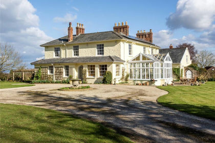
- Price
- Guide Price£1,850,000
- Size
- 10.83 acres
Over Stowey, Bridgwater, Somerset, TA5, Over Stowey, Somerset TA5 England
Added on 29/01/2026Country Estate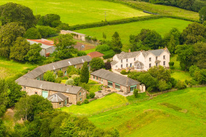
- Price
- Guide Price£2,250,000
- Size
- 24 acres
Bealy Court, Nr Chulmleigh, Devon, EX18, , Devon EX18 England
Added on 01/07/2026Country Estate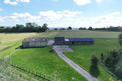
- Price
- Guide Price£1,795,000
- Size
- 42.51 acres
Fifehead Neville, Sturminster Newton, Dorset, Fifehead Neville, Dorset DT10 England
Added on 08/04/2026Country Estate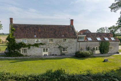
- Price
- Offers in Region of£2,250,000
- Size
- 5.5 acres
College Green, between Parbrook and East Pennard, East Pennard, Somerset BA4 England
Added on 08/10/2026Country Home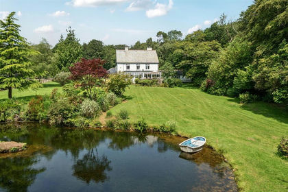
- Price
- Guide Price£1,650,000
- Size
- 4 acres
Added on 30/06/2026Country Home