Downs Lane, Stockbridge, SO20
- Land size
- 1 acres
- Bedrooms
- 4
- Bathrooms
- 3
Key Features
- Quietly positioned on the outskirts of sought-after Over Wallop
- The property is currently arranged as two separate living areas, known as Manor House and Stepping Stones
- Overall site extending to approximately one acre
- Three-bedroom Manor House built in approximately 2002
- Three-bedroom bungalow known as Stepping Stones
- Extensive integral garaging, workshop and storage
- Established planning history associated with the site
- Well placed for Stockbridge, Andover, Salisbury and Winchester
Description
Quietly tucked away on the outskirts of the ever-popular village of Over Wallop, Manor House is a rather unique opportunity, sitting within approximately one acre and surrounded by lovely open countryside.
Approached off Downs Lane and along a no-through access lane, the property feels nicely tucked away from the village whilst still being incredibly well placed for Stockbridge, Andover, Salisbury and Winchester.
The property is currently divided into two arranged living parts within the grounds – Manor House and Stepping Stones.
The part pf the property known as Manor House, was built in approximately 2002 and offers three-bedroom accommodation arranged over two floors, whilst Stepping Stones dates back to around the mid-1960s and, although previously lived in, it is now used mainly for storage.
What makes this such an interesting opportunity is not only the amount of land and its lovely rural position, but also the planning history associated with the site.
There are lots of possibilities here for somebody looking for something a little different, whether that is to make the most of the existing properties as a whole, create a fabulous individual country home or simply explore what further potential the site may have, subject of course to all the necessary consents.
THE PROPERTY
Manor House sits towards the front of the plot and was constructed in approximately 2002.
The ground floor offers a reception room, office and kitchen, together with extensive integral garaging. Upstairs there are three bedrooms served by two bath/shower rooms.
Sitting at right angles to Manor House is the wing known Stepping Stones, a detached bungalow dating from approximately the mid-1960s.
The accommodation here was originally arranged with three bedrooms, two reception rooms, a kitchen/breakfast room, bathroom and cloakroom. The bungalow has previously been occupied as a home but is now in need of modernisation and used principally for storage.
The two properties sit within a generous overall plot, and it is easy to see why the site has been explored from a planning perspective over the years.
There is an established historic planning history associated with both Manor House and Stepping Stones.
The owner has also previously explored other ideas for the site and has had conceptual plans drawn. These have not necessarily formed part of an approved planning application and are simply useful in demonstrating ideas that have previously been considered.
Anyone interested in the planning or development potential should make their own enquiries directly with Test Valley Borough Council and take their own professional advice as to the planning history, current position and what may or may not be possible in the future.
OUTSIDE
The grounds are a real feature here, with the overall site extending to approximately one acre.
The existing property/properties sit predominantly towards the front, leaving a substantial amount of garden and grounds beyond and giving the whole site a lovely feeling of space.
There is extensive parking together with integral garaging, workshop and storage areas, and the property enjoys attractive rural views across the surrounding countryside.
For somebody looking for space, privacy and a property where they can potentially put their own stamp on things, this is certainly an interesting proposition.
SITUATION & LIFESTYLE
The property sits on the rural edge of Over Wallop, one of the pretty Test Valley villages that make up the much sought-after Wallops.
It is a lovely spot for anyone wanting to feel as though they are properly in the countryside without being miles away from everything.
Over Wallop and neighbouring Middle Wallop offer useful everyday amenities, whilst Stockbridge, approximately 5.7 miles away, is one of Hampshire's prettiest small towns with its independent shops, cafés, pubs and restaurants.
Andover is approximately 6.9 miles away and provides a much wider range of shopping and leisure facilities together with a mainline railway station. Salisbury and Winchester are also within comfortable driving distance.
For anyone who loves the outdoors, this part of Hampshire is particularly special. There are some beautiful walks and cycle routes on the doorstep and miles of surrounding countryside to explore, whilst the wider Test Valley is famous for its chalk streams, pretty villages and, of course, the River Test.
There is also a good selection of schooling in the surrounding area, both state and independent.
For commuters, mainline stations can be found at Grateley and Andover with direct services towards London Waterloo, and road connections provide convenient access towards the A303 and the wider road network.
It is the sort of location that gives you the peace and space of country living whilst still keeping towns, schools and transport connections within easy reach.
SUMMARY OF ACCOMMODATION
Manor House
Ground Floor:
Reception Room | Office | Kitchen | Integral Double Garage | Integral Single Garage
First Floor:
Three Bedrooms | Two Bath/Shower Rooms
Stepping Stones
Reception Room | Dining Room | Kitchen/Breakfast Room | Three Bedrooms | Bathroom | Cloakroom
Outside
Approximately One Acre | Extensive Parking | Garaging | Workshop/Storage | Gardens & Grounds | Rural Views
SUMMARY OF FEATURES
Quietly positioned on the outskirts of sought-after Over Wallop
Overall site extending to approximately one acre
The property is currently arranged as two separate living areas, known as Manor House and Stepping Stones
Three-bedroom Manor House built in approximately 2002
Detached three-bedroom bungalow known as Stepping Stones
Extensive integral garaging, workshop and storage
Established planning history associated with the site
Lovely rural setting and countryside views
Well placed for Stockbridge, Andover, Salisbury and Winchester
DISTANCES
Stockbridge – approximately 5.7 miles
Andover – approximately 6.9 miles
Amesbury – approximately 9.8 miles
Salisbury – approximately 12.8 miles
Winchester – approximately 15.8 miles
Southampton Airport – approximately 24.3 miles
Bournemouth Airport – approximately 41 miles
Rail: Mainline services are available from Grateley and Andover with direct services towards London Waterloo.
All mileages and journey times are approximate and are intended as a guide only.
GENERAL INFORMATION
Tenure: Freehold
Local Authority: Test Valley Borough Council
Council Tax: The two existing properties are understood to be separately assessed and were previously stated as Council Tax Bands A and E. Buyers should confirm the current position directly with the Local Authority.
Services: Previous sales particulars state that the property benefits from mains electricity and water with private drainage. Buyers should satisfy themselves as to the services and their condition.
EPC: To be confirmed.
Heating: To be confirmed.
Planning: The property has an established planning history which includes historic planning.
Any reference to planning, development potential or conceptual plans within these particulars is for guidance only and should not be relied upon as confirmation that any particular development can be carried out. Buyers wishing to explore the potential of the site should make their own enquiries with Test Valley Borough Council and seek independent planning and legal advice before proceeding.
Rights of Way: Previous sales particulars state that there are no known public rights of way across the property. This should be confirmed by the buyer's solicitor.
Viewings: Strictly by appointment.
Disclaimer
Important information
These particulars have been prepared with reasonable care and are intended to provide a general description of the property. They do not form part of any offer or contract. Measurements, distances and floor plans are approximate and are provided for guidance only. Unless otherwise stated, services, heating systems and appliances have not been tested by the agent. Items shown in photographs are not necessarily included in the sale; inclusions should be confirmed through the conveyancing process.
Some images may have been enhanced using AI to help potential buyers visualise the property beyond the current furnishings. These images are illustrative and may not reflect the property’s current appearance.
Prospective buyers should arrange appropriate inspections, surveys and legal enquiries before committing to purchase. Please contact the agent if you require clarification of any information.
Map Location
Property details
- Tenure
- Freehold
- Council Tax Band
- Ask Agent
- Date Posted
- 2026-10-26
Market Value Analysis
Compared with 1,684 Homes with Land listings in South East England (1+ acres).
Energy Performance Certificate
Energy Efficiency Rating
Based on UK Energy Performance Certificate standards (EU Directive 2002/91/EC)
Running costs are one side. Planning activity, flood history and ground risks for this location are in the full report.
Utilities & Restrictions
Utilities
- Electricity
- Ask Agent
- Water
- Ask Agent
- Heating
- Ask Agent
- Broadband
- Ask Agent
- Sewerage
- Ask Agent
Rights & Restrictions
- Public Rights of Way
- Ask Agent
- Private Rights of Way
- Ask Agent
- Listed Property
- Ask Agent
- Restrictions
- Ask Agent
Listed status, conservation areas and planning constraints for this location are in the full report.
Property Features
- Accessibility
- Ask Agent
- Parking
- Parking Available
- Garden
- Garden
Beyond the particulars: planning activity, flood history, heritage and ground risks, checked for this exact spot.
Connectivity
Broadband
Fastest speed available at this postcode
48 Mbps
Superfast
Suitable for
- HD streaming
- Video calls
- Web & social
Mobile signal
Predicted 4G and 5G signal; indoor signal depends on building materials.
Ofcom Connected Nations postcode-level predictions. Speeds and signal are modelled, not measured, and vary between addresses and providers.
Signal is the easy part. Planning activity, flood history and protected designations here are in the full report.
Nearest Schools
Primary
- Wallop Primary School1.1 milesOfsted report card · Dec 2025
- Ages
- 4 to 11
- Pupils
- 88
- Type
- Community school
- Grateley Primary School1.8 milesNo Ofsted rating
- Ages
- 4 to 11
- Pupils
- 95
- Type
- Community school
- Amport Church of England Primary School3.4 milesOfsted report card · May 2026
- Ages
- 4 to 11
- Pupils
- 103
- Type
- Voluntary aided school
- Faith
- Church of England
- Abbotts Ann Church of England Primary School3.6 milesOfsted: Good *
- Ages
- 4 to 11
- Pupils
- 110
- Type
- Voluntary controlled school
- Faith
- Church of England
- Broughton Primary School3.8 milesNo Ofsted rating
- Ages
- 4 to 11
- Pupils
- 90
- Type
- Community school
Secondary
- Danebury School4.7 milesOfsted: Inadequate
- Ages
- 11 to 16
- Pupils
- 357
- Type
- Academy sponsor led
- John Hanson Community School5.5 milesNo Ofsted rating
- Ages
- 11 to 16
- Pupils
- 987
- Type
- Community school
- Harrow Way Community School6.1 milesNo Ofsted rating
- Ages
- 11 to 16
- Pupils
- 992
- Type
- Community school
- Lift Winton7 milesNo Ofsted rating
- Ages
- 11 to 16
- Pupils
- 978
- Type
- Academy sponsor led
- The Wellington Academy7.2 milesOfsted: Good
- Ages
- 11 to 19
- Pupils
- 1,121
- Type
- Academy sponsor led
* Latest graded judgement covers quality of education only; no overall grade was issued under the 2024-25 inspection framework.
Distances are straight-line from the advertised location. Source: the national school registers (DfE, Welsh Government, Scottish Government) and Ofsted.
Schools are just the start: sold prices nearby, planning activity and any flood history are in the full report.
Amenities
Supermarket
GP surgery
Pharmacy
Hospital
Green space
Straight-line distances from the advertised location. Sources: NHS records, Geolytix supermarket locations, OS Open Greenspace and the national trails registers.
The area stacks up? Now check the location itself: planning nearby, protected designations and past flooding.
Getting Around
Nearest station
Nearest bus stop
Typical drive times
Straight-line distances from the advertised location; drive times are typical free-flow times over OpenStreetMap road data, so allow more at peak. Public transport locations from DfT NaPTAN.
Easy to reach matters. So do planning activity, flood history and ground risks: all in the full report.
Flood Risk
Environment Agency open data, checked around the advertised map pin for the listed acreage. Long-term risk counts flood defences; the planning map's flood zones do not. The map pin for this listing marks the postcode area rather than the exact location, so these readings describe the surrounding area. Provided by LandSale, not the listing agent, and not part of the agent's particulars. Risk varies across a holding, so verify before committing.
Rivers and the sea
Planning map: Flood Zone 1.
Surface water
These bandings are the summary. Where this location sits on the flood maps, plus planning activity, heritage and ground risks, is in the full report.
Important notice: Information, maps and tags on this page are drawn from the advertising agent's marketing materials or generated automatically. LandSale has not verified them. Relying on these details is at your own risk, always carry out independent checks before committing to a purchase.
LandSale full disclaimer
Marketing information only - not formal particulars. The details on this website are provided for general guidance and do not constitute an offer or contract. Neither LandSale nor the advertising estate/land agent accepts responsibility for any inaccuracy.
1. Source of information
- Listing content: Core description, asking price, tenure, measurements, photographs and planning history originate from the marketing materials of the advertising estate or land agent. LandSale does not author this content and cannot guarantee its accuracy.
- Automated tags & categorisation: Property type, land-use class, acreage bands and similar labels may be applied by machine-learning models. They are intended as a helpful guide only and may not reflect the property's legal status or permitted use.
- Third-party & enriched data layers: Maps, boundary outlines, planning designations, soil reports, broadband coverage and other environmental or location-based insights are licensed from external suppliers. Such data are supplied “as is", may be incomplete or out of date and are subject to change without notice.
2. Verification required
Prospective purchasers must verify critical matters, including but not limited to planning permission, title boundaries, public rights of way, environmental constraints, acreage, services, access and VAT status, through their own inspections, specialist surveys, legal advisers and the selling agent before relying on the information or entering into any contract.
3. No warranty or liability
LandSale gives no warranty, express or implied, as to the accuracy, completeness or fitness for any particular purpose of the information displayed. LandSale shall not be liable for any loss, damage, cost or expense arising directly or indirectly from any use of or reliance on such information, save where liability may not be excluded by law.
4. Updates & feedback
If you believe any detail on this listing is inaccurate, please let us know. We will investigate and, where appropriate, update the listing or notify the agent.
© LandSale | Version 1.3 - August 2026
Similar properties for sale
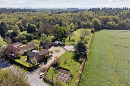
- Price
- Guide Price£975,000
- Size
- 1.5 acres
Added on 06/05/2026House with Land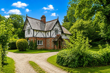
- Price
- Guide Price£700,000
- Size
- 1.75 acres
Micheldever, Winchester, SO21, Micheldever, Hampshire SO21 England
Added on 30/07/2026House with Land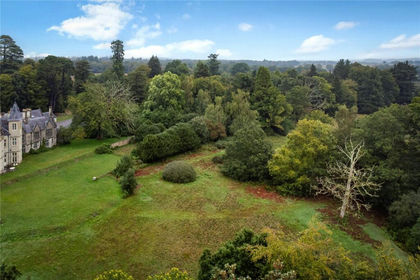
- Price
- Guide Price£895,000
- Size
- 1.97 acres
Adhurst St. Mary, Petersfield, Hampshire, GU31, Steep, Hampshire GU31 England
Added on 08/07/2026Country Home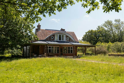
- Price
- Guide Price£849,950
- Size
- 2.93 acres
Cranmore, Isle of Wight, Shalfleet, Isle of Wight PO41 England
Added on 29/01/2026Country Home
- Price
- Guide Price£799,000
- Size
- 2.17 acres
Sleight Lane, Corfe Mullen, Wimborne, Corfe Mullen, Dorset BH21 England
Added on 18/06/2026House with Land
- Price
- Guide Price£925,000
- Size
- 30.12 acres
Gannetts, Todber, Sturminster Newton, Marnhull, Dorset DT10 England
Added on 30/09/2026Small Farm
- Price
- Guide Price£1,000,000
- Size
- 6.3 acres
Shepherd's Hill, Buckhorn Weston, Gillingham, SP8, Gillingham, Dorset SP8 England
Added on 30/09/2026Smallholding
- Price
- Guide Price£900,000
- Size
- 1.25 acres
Woodberry Lane, Emsworth, PO10, Stoughton, West Sussex PO10 England
Added on 19/04/2026Country Home