Detached Building, Ceidio
Key Features
- Detached building
- Renovation or redevelopment project
- Spectacular views
- Well located
Description
Discover this detached building, located in the heart of the rural Ll n Peninsula. Occupying a corner position, it overlooks the surrounding fields and enjoys spectacular views towards Garn Fadryn.
Comprising two rooms, a kitchenette and a cloakroom, the property has lain vacant for many years and now presents an exciting opportunity for conversion, restoration or redevelopment, subject to the necessary consents and permissions.
Dyma adeilad ar wahân, wedi’i leoli yng nghanol Penrhyn Ll n wledig. Mae mewn safle cornel, yn edrych dros y caeau cyfagos ac yn cynnig golygfeydd godidog tuag at Garn Fadryn.
Yn cynnwys dwy ystafell, cegin fach a thoiled, mae’r eiddo wedi bod yn wag ers blynyddoedd lawer ac mae bellach yn cynnig cyfle cyffrous i’w addasu, ei adfer neu ei ailddatblygu, yn amodol ar gael y caniatâd cynllunio a’r cymeradwyaethau angenrheidiol, os yw’n briodol.
Ceidio is a rural hamlet situated south of Edern, close to the northern coastline of the Ll n Peninsula. It is within easy reach of sandy beaches, scenic coastal walks and popular villages, with Nefyn and Morfa Nefyn both approximately two miles away.
Blank canvases such as this are a rarity in the current market, offering the buyer the opportunity to consider their preferred options for improving or redeveloping the property.
Internal viewings are not available due to health and safety concerns. The agents are unable to provide access, and all interest is invited on this basis.
Measurements (Refer to Floor-plan):
Entrance - 1.05m x 1.55m
Kitchenette - 2.61m x 2.64m
Cloak Room - 0.80m x 2.61m
Back Room - 2.61m x 2.64m
Front Room - 2.61m x 3.52m
Porch - 2.33m x 2.77m
The property is believed to comprise single-brick elevations beneath a fibre-sheet roof, which is likely to contain asbestos given the age of the building. No asbestos survey has been undertaken.
The property has an electricity supply, with an active utility account in place. The water supply is disconnected, and there is currently no active water utility account. All necessary infrastructure is believed to be in place, and a mains drainage connection is assumed but has not been tested or verified.
The building is currently uninhabitable and represents a renovation or redevelopment project, subject to obtaining any necessary planning permissions and consents.
Important Information:
Ratings:
EPC exempt (sub-50m2)
Council Tax: N/A
Rates: N/A
Directions:
From Pwllheli, take the A497 towards Nefyn for approximately five miles. At the roundabout beside the Bryncynan pub, signposted for Morfa Nefyn and Nefyn, turn left towards Dinas. Follow the single-track road westwards for approximately one mile. After passing the church and monument, and alongside a row of houses, you will reach the crossroads at Ceidio. Continue through the crossroads; the building is accessed via the next entrance on the left.
Tenure:
We understand that the tenure of this property is Freehold.
Services:
Not tested or warranted — as seen.
Method of Sale:
The property is offered for sale by Private Treaty.
Boundaries:
Purchaser shall be deemed to have full knowledge of all boundaries and neither the Vendor nor Vendors Agents are responsible for defining the boundaries or ownership thereof.
Planning:
The property is sold subject to any existing or other statutory notice or which may come into force in the future. Purchasers should make their own enquiries into any designations.
Easements, Wayleaves and Rights of Way:
The land is sold subject to all the benefits of all wayleaves, easements, right of way and third party rights, whether mentioned in the particulars or not.
Viewing:
Strictly by appointment only.
LWH and their clients give notice that:- They do not have the authority to make or give any representations or warranties in relation to the property. These particulars do not form part of any offer or contract and must not be relied upon as statements or representations of fact. Any areas, measurements or distances are approximate. The text and plans are for guidance only and are not necessarily comprehensive. It should not be assumed that the property has all necessary planning, building regulations or other consents and the agents have not tested any services, equipment or facilities. Purchasers must satisfy themselves by inspection or otherwise.
Map Location
Property details
- Tenure
- Ask Agent
- Council Tax Band
- Ask Agent
- Date Posted
- 2026-10-26
Utilities & Restrictions
Utilities
- Electricity
- Ask Agent
- Water
- Ask Agent
- Heating
- Ask Agent
- Broadband
- Ask Agent
- Sewerage
- Ask Agent
Rights & Restrictions
- Public Rights of Way
- Ask Agent
- Private Rights of Way
- Ask Agent
- Listed Property
- Ask Agent
- Restrictions
- Ask Agent
Listed status, conservation areas and planning constraints for this location are in the full report.
Property Features
- Accessibility
- Ask Agent
- Parking
- Ask Agent
- Garden
- Ask Agent
Beyond the particulars: planning activity, flood history, heritage and ground risks, checked for this exact spot.
Connectivity
Broadband
Fastest speed available at this postcode
5 Mbps
Under 10 Mbps here
Suitable for
- Basic browsing & email
Mobile signal
Predicted 4G and 5G signal; indoor signal depends on building materials.
Ofcom Connected Nations postcode-level predictions. Speeds and signal are modelled, not measured, and vary between addresses and providers.
Signal is the easy part. Planning activity, flood history and protected designations here are in the full report.
Nearest Schools
Primary
- Ysgol Gynradd Edern0.7 miles
- Pupils
- 78
- Type
- Nursery, Infants & Juniors
- Language
- Welsh medium school / provision (including transitional)
- Ysgol Babanod Morfa Nefyn1.1 miles
- Pupils
- 22
- Type
- Nursery, Infants & Juniors
- Language
- Welsh medium school / provision (including transitional)
- Ysgol Gynradd Nefyn1.9 miles
- Pupils
- 131
- Type
- Nursery, Infants & Juniors
- Language
- Welsh medium school / provision (including transitional)
- Ysgol Gynradd Tudweiliog3.1 miles
- Pupils
- 51
- Type
- Nursery, Infants & Juniors
- Language
- Welsh medium school / provision (including transitional)
- Ysgol Gynradd Pentreuchaf4.4 miles
- Pupils
- 93
- Type
- Nursery, Infants & Juniors
- Language
- Welsh medium school / provision (including transitional)
Secondary
- Ysgol Botwnnog4.4 miles
- Pupils
- 469
- Type
- Secondary (ages 11-16)
- Language
- Welsh medium school / provision (including transitional)
- Ysgol Glan y Mor6 miles
- Pupils
- 474
- Type
- Secondary (ages 11-16)
- Language
- Welsh medium school / provision (including transitional)
- Ysgol Dyffryn Nantlle15 miles
- Pupils
- 397
- Type
- Secondary (ages 11-19)
- Language
- Welsh medium school / provision (including transitional)
- Ysgol Eifionydd18 miles
- Pupils
- 373
- Type
- Secondary (ages 11-16)
- Language
- Welsh medium school / provision (including transitional)
- Ysgol Ardudwy19 miles
- Pupils
- 331
- Type
- Secondary (ages 11-16)
- Language
- Welsh medium school / provision (including transitional)
Distances are straight-line from the advertised location. Source: the national school registers (DfE, Welsh Government, Scottish Government) and Ofsted.
Schools are just the start: sold prices nearby, planning activity and any flood history are in the full report.
Amenities
Supermarket
GP surgery
Pharmacy
Straight-line distances from the advertised location. Sources: NHS records, Geolytix supermarket locations, OS Open Greenspace and the national trails registers.
The area stacks up? Now check the location itself: planning nearby, protected designations and past flooding.
Getting Around
Nearest station
Nearest bus stop
Typical drive times
Straight-line distances from the advertised location; drive times are typical free-flow times over OpenStreetMap road data, so allow more at peak. Public transport locations from DfT NaPTAN.
Easy to reach matters. So do planning activity, flood history and ground risks: all in the full report.
Flood Risk
Natural Resources Wales open data, checked around the advertised map pin for the listed acreage. Long-term risk counts flood defences; the planning map's flood zones do not. Provided by LandSale, not the listing agent, and not part of the agent's particulars. Risk varies across a holding, so verify before committing.
Rivers and the sea
Planning map: Flood Zone 1.
Surface water
Not at the pin: mapped about 20 metres away.
These bandings are the summary. Where this location sits on the flood maps, plus planning activity, heritage and ground risks, is in the full report.
Important notice: Information, maps and tags on this page are drawn from the advertising agent's marketing materials or generated automatically. LandSale has not verified them. Relying on these details is at your own risk, always carry out independent checks before committing to a purchase.
LandSale full disclaimer
Marketing information only - not formal particulars. The details on this website are provided for general guidance and do not constitute an offer or contract. Neither LandSale nor the advertising estate/land agent accepts responsibility for any inaccuracy.
1. Source of information
- Listing content: Core description, asking price, tenure, measurements, photographs and planning history originate from the marketing materials of the advertising estate or land agent. LandSale does not author this content and cannot guarantee its accuracy.
- Automated tags & categorisation: Property type, land-use class, acreage bands and similar labels may be applied by machine-learning models. They are intended as a helpful guide only and may not reflect the property's legal status or permitted use.
- Third-party & enriched data layers: Maps, boundary outlines, planning designations, soil reports, broadband coverage and other environmental or location-based insights are licensed from external suppliers. Such data are supplied “as is", may be incomplete or out of date and are subject to change without notice.
2. Verification required
Prospective purchasers must verify critical matters, including but not limited to planning permission, title boundaries, public rights of way, environmental constraints, acreage, services, access and VAT status, through their own inspections, specialist surveys, legal advisers and the selling agent before relying on the information or entering into any contract.
3. No warranty or liability
LandSale gives no warranty, express or implied, as to the accuracy, completeness or fitness for any particular purpose of the information displayed. LandSale shall not be liable for any loss, damage, cost or expense arising directly or indirectly from any use of or reliance on such information, save where liability may not be excluded by law.
4. Updates & feedback
If you believe any detail on this listing is inaccurate, please let us know. We will investigate and, where appropriate, update the listing or notify the agent.
© LandSale | Version 1.3 - August 2026
Contact Tir Ac Eiddo LWH Land and Property CYF, Pwllheli
27 Penlan Street, Pwllheli, LL53 5DE
View agent profileSimilar properties for sale
- Price
- Offers in Region of£65,000
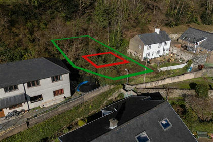
Plot @ Penlleniau, Pwllheli LL53, Pwllheli, Gwynedd LL53 Wales
Added on 28/01/2026Building Plot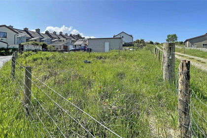
- Price
- £75,000
Land At Station Road, Station Road, Llanrug, Caernarfon, LL55, Llanrug, Gwynedd LL55 Wales
Added on 29/01/2026Building Plot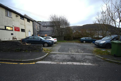 Added on 29/01/2026Building Plot
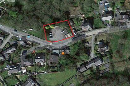 Added on 29/01/2026Building Plot
 Added on 29/01/2026Development Land
- Price
- Offers in Region of£50,000
Plots 7 & 8, Maesbrith, Dolgellau, LL40, Dolgellau, Gwynedd LL40 Wales
Added on 29/01/2026Building Plot Added on 29/01/2026Building Plot
- Price
- Offers Over£40,000
Brynmor Terrace, Penmaenmawr, Conwy, LL34, Penmaenmawr, Conwy LL34 Wales
Added on 06/02/2026Building Plot