
Pontrilas, Herefordshire, HR2
- Land size
- 1.97 acres
Key Features
- Fantastic rural development opportunity with consent for five barn conversion dwellings, but could also provide a fantastic family home (STP)
- Superb location close to thriving Herefordshire Village with views of the Black Mountains
- Prime barn complex development site
- Planning consent provides for 3 No. Four Bedroom and 2 No. Three Bedroom Dwellings but oculd easily be changed to provide one large dwelling
- No Affordable Housing Commuted Sum or Section 106 Contributions payable
- Total Site Area – 1.97 acres (0.80 ha).
- Freehold with Vacant Posession
Description
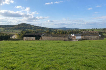
Little Pen-Y-Lan Barns, Pontrilas offers a fantastic opportunity to acquire a barn complex with a range of traditional barns with planning consent for conversion to residential use, in the heart of the Herefordshire countryside, with views over Pontrilas and the Black Mountains.
Location & Situation
The barns at Little Pen-y-Lan Farm are located approximately 1 mile east of the villages of Pontrilas & Ewyas Harold within the Golden Valley of south west Herefordshire, near the Welsh border. The villages of Pontrilas and Ewyas Harold are well connected and accessible to the city of Hereford and the principal border towns of Monmouth, Ross-on-Wye and Abergavenny, all of which are highly regarded for their range of local facilities, amenities, employment and educational establishments. The A465 at Pontrilas provides a direct connection to the city of Hereford to the north-east and the A438/A49 to the M50 and Abergavenny to the south-west and the A40/A4042 to the M4.
The Barns are well positioned in an elevated countryside location and are accessed via approximately 0.5 miles of third party track which connects to the north side of the Pontrilas to Orcop road and
enjoy far reaching views over open countryside and the Black Mountains.
The development is close to the village of Pontrilas with village shop and post office and the village of Ewyas Harold, a thriving village with Primary School, Village Hall, St Michaels and All Angels Church, Public House (The Temple Bar Inn), Fish and Chip Shop, Butchers, Village Stores and Post Office. The property is situated to the east of the Black Mountains and the Brecon Beacons National Park. The surrounding area is noted for its outstanding natural beauty and splendid countryside with a wide range of country walks nearby including Offa’s Dyke National Trail, riding and outdoor pursuits.
The larger regional centres of the Cathedral City of Hereford (12.1 miles) and Abergavenny (12.9 miles) provide access to the National Rail Network, supermarkets and a host of social, shopping and leisure facilities. The wider area is well served with schools including The Elms School, Herefordshire Cathedral, Malvern as well as the highly regarded Hereford Sixth Form College.
Description
Little Pen-y-Lan Barns comprise a range of traditional and modern agricultural buildings with planning consents for conversion to residential use.
The traditional buildings comprise a courtyard of traditional farm buildings built in the vernacular style with Herefordshire sandstone elevations. The barns, of timber frame construction and period features, lend themselves to conversion to alternative uses and have full planning permission for residential conversion.
The stone barns currently have planning permission for conversion of up to approximately 5800 square feet (539 sq. m.) and would make a fabulous, spacious and contemporary family home (subject to changes to the existing planning permissions).
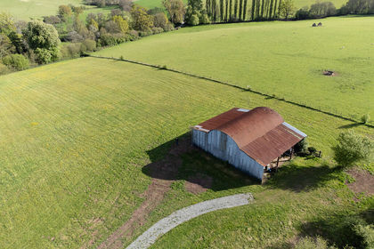
There is a further set of Dutch Barns with lean-to, and red brick barn. The buildings have Class Q permission for residential conversion but could lend themselves to conversion to ancillary uses such as pool, gym, office spaces or further living accommodation (subject to changes to planning permission).
The site extends as a whole to approximately 1.97 acres (0.80 ha).
Planning
The current approved Planning Application References for the developments are as follows
P233707/F consented on 20th March 2024, which permits for the ‘Change of use of rural buildings as well as physical alterations to the buildings and adjacent land to create three individual new dwellings’. The barns could also provide a spectacular single dwelling subject to gaining the necessary planning consent.
P231033/PA4 consented on 22nd May 2023, which permits for the ‘Prior notification for proposed change of use of an agricultural building to two larger dwelling houses (Use Class C3), and for building operations reasonably necessary for the conversion'. The consent has now been extended until 2028.
Key Information
Services: All new electric and mains water connections will be made at cost to the Purchaser and may involve significant costs in upgrading these services. Buyers are advised to make their own enquiries with the relevant service provider and to take these costs into account when making offers. If connections are required over land that is owned by the Kentchurch Estate then easements will be granted by the Kentchurch Estate to facilitate this. Whilst no charge will be made for the easement, compensation will be payable for any damage or loss of income incurred by the Estate or their agents during the process of installing these services.
Electric - Purchasers will be liable to install their own electric supplies and meter/s.
Water - The current supply provides water to both the barns and the third party owned cottage. The ownership of this supply will be transferred to the purchaser who will be liable to upgrade this supply to provide sufficient quality of supply to both the barns and the cottage. The cottage will be on a sub-supply and the cottage will be obliged to pay for their usage at a mean average of cost per unit.
Planning has been granted for the installation of a sewerage treatment plant.
Wayleaves, Easements & Rights of Way: The property is sold subject to and with benefit of all rights, including rights of way, whether public or private, light, support drainage, water and electricity supplies and any other rights and obligations, easements and proposed wayleaves for masts, pylons, stays, cables, drains and water, gas and any other pipes, whether referred to in the Conditions of Sale or not.
Local Authority: Herefordshire District Council: 01432 260000
Sporting, Timber & Mineral Rights: In so far as they are owned the sporting, timber and mineral rights are included in the sale of the property.
Title Deeds: HE44595
Tenure and Possession: The property is sold Freehold with vacant possession on completion.
Access: Kentchurch Estate will retain the freehold of the access. The purchasers of Little Pen-y-Lan Barns will be granted a right of way over the access track for all purposes at all times. A schedule of condition of the track will be made at the point of completion and Kentchurch Estate and the owners of Little Pen-y-Lan Barns will be liable for the maintenance of the track as at the condition of the schedule on a 25:75 split basis. The owner of Little Pen-y-Lan Barns will be granted the right to upgrade the surface of the access track however the Kentchurch Estate will not be liable for any of the costs of the upgrade of this track. Once the track is upgraded then the Kentchurch Estate and the owners of Little Pen-y-Lan Barns will be liable for the maintenance of the track on a 20:80 split basis.
Purchasers should understand that rights of way to all lots may have a material affect on the purchase.
Restrictive Covenant: There will be a restrictive covenant imposed on the barns preventing their use as let holiday accommodation. The restriction will be in favour of the Kentchurch Estate.
VAT: Any guide prices quoted or discussed are exclusive of VAT. In the event of a sale of the property or any part of it, or any right attached to it becoming a chargeable event for purposes of VAT, such tax would be payable in addition to the purchase price.
Method of sale: For sale as a whole by private treaty.
Directions: HR2 0BH: From the centre of Pontrilas take the road signposted towards Orcop/Garway Hill and proceed up the hill for about 1 mile and take the left-hand turn to Hill Farm. Past Hill Farm, continue on the track to the left and Pen-y-Lan barns are located at the bottom of the hill.
What3words: ///wishes.cello.minds
Health and Safety: Given the potential hazards of a farm, we would ask you be as vigilant as possible when visiting the farm for your own personal safety, in particular around the farm buildings.
Viewing: Strictly by appointment with Powells or Savills. Prior to making an appointment to view, we strongly recommend that you discuss any particular points which are likely to affect your interest in the property with a member of staff who has seen the property, in order that you do not make a wasted journey.
Disputes : Any disputes arising as to the boundaries or any point arising in the General Remarks or particulars, schedule, plan or interpretation of any questions, shall be referred to the Arbitration of the selling agents whose decision acting as experts shall be final. The Purchaser(s) shall be deemed to have full knowledge of all boundaries and neither the Vendor nor the Vendor’s agent will be responsible for defining the boundaries or ownership thereof
Map Location
Property details
- Tenure
- Ask Agent
- Council Tax Band
- Ask Agent
- Date Posted
- 2026-10-22
Market Value Analysis
Compared with 7 Conversion Land listings in West Midlands (1+ acres).
Property Brochure
Seen the details? The full report adds the independent checks: planning activity, flood history, heritage and ground.
Utilities & Restrictions
Utilities
- Electricity
- Ask Agent
- Water
- Ask Agent
- Heating
- Ask Agent
- Broadband
- Ask Agent
- Sewerage
- Ask Agent
Rights & Restrictions
- Public Rights of Way
- Ask Agent
- Private Rights of Way
- Ask Agent
- Listed Property
- Ask Agent
- Restrictions
- Ask Agent
Listed status, conservation areas and planning constraints for this location are in the full report.
Property Features
- Accessibility
- Ask Agent
- Parking
- Ask Agent
- Garden
- Ask Agent
Beyond the particulars: planning activity, flood history, heritage and ground risks, checked for this exact spot.
Connectivity
Broadband
Fastest speed available at this postcode
80 Mbps
Superfast
Suitable for
- HD streaming
- Video calls
- Web & social
Mobile signal
Predicted 4G and 5G signal; indoor signal depends on building materials.
Ofcom Connected Nations postcode-level predictions. Speeds and signal are modelled, not measured, and vary between addresses and providers.
Signal is the easy part. Planning activity, flood history and protected designations here are in the full report.
Nearest Schools
Primary
- Ewyas Harold Primary School1.2 milesOfsted: Requires improvement
- Ages
- 4 to 11
- Pupils
- 92
- Type
- Community school
- Garway Primary School4.7 milesNo Ofsted rating
- Ages
- 4 to 11
- Pupils
- 88
- Type
- Community school
- The Steiner Academy Hereford5.1 milesOfsted: Good
- Ages
- 3 to 16
- Pupils
- 345
- Type
- Academy sponsor led
- Kingstone and Thruxton Primary School5.2 milesNo Ofsted rating
- Ages
- 3 to 11
- Pupils
- 202
- Type
- Academy converter
- Longtown Community Primary School5.4 milesNo Ofsted rating
- Ages
- 4 to 11
- Pupils
- 48
- Type
- Community school
Secondary
- The Steiner Academy Hereford5.1 milesOfsted: Good
- Ages
- 3 to 16
- Pupils
- 345
- Type
- Academy sponsor led
- Kingstone High School5.3 milesNo Ofsted rating
- Ages
- 11 to 16
- Pupils
- 568
- Type
- Academy converter
- Fairfield High School7.4 milesOfsted: Outstanding
- Ages
- 11 to 16
- Pupils
- 607
- Type
- Academy converter
- The Hereford Church of England Academy8.6 milesOfsted: Requires improvement
- Ages
- 11 to 16
- Pupils
- 647
- Type
- Academy sponsor led
- Faith
- Christian
- Whitecross Hereford9.8 milesOfsted: Good
- Ages
- 11 to 16
- Pupils
- 942
- Type
- Academy converter
Distances are straight-line from the advertised location. Source: the national school registers (DfE, Welsh Government, Scottish Government) and Ofsted.
Schools are just the start: sold prices nearby, planning activity and any flood history are in the full report.
Amenities
Supermarket
GP surgery
Pharmacy
Hospital
Green space
Straight-line distances from the advertised location. Sources: NHS records, Geolytix supermarket locations, OS Open Greenspace and the national trails registers.
The area stacks up? Now check the location itself: planning nearby, protected designations and past flooding.
Getting Around
Nearest station
Nearest bus stop
Typical drive times
Straight-line distances from the advertised location; drive times are typical free-flow times over OpenStreetMap road data, so allow more at peak. Public transport locations from DfT NaPTAN.
Easy to reach matters. So do planning activity, flood history and ground risks: all in the full report.
Flood Risk
Environment Agency open data, checked around the advertised map pin for the listed acreage. Long-term risk counts flood defences; the planning map's flood zones do not. Provided by LandSale, not the listing agent, and not part of the agent's particulars. Risk varies across a holding, so verify before committing.
Rivers and the sea
Planning map: Flood Zone 1.
Surface water
These bandings are the summary. Where this location sits on the flood maps, plus planning activity, heritage and ground risks, is in the full report.
Important notice: Information, maps and tags on this page are drawn from the advertising agent's marketing materials or generated automatically. LandSale has not verified them. Relying on these details is at your own risk, always carry out independent checks before committing to a purchase.
LandSale full disclaimer
Marketing information only - not formal particulars. The details on this website are provided for general guidance and do not constitute an offer or contract. Neither LandSale nor the advertising estate/land agent accepts responsibility for any inaccuracy.
1. Source of information
- Listing content: Core description, asking price, tenure, measurements, photographs and planning history originate from the marketing materials of the advertising estate or land agent. LandSale does not author this content and cannot guarantee its accuracy.
- Automated tags & categorisation: Property type, land-use class, acreage bands and similar labels may be applied by machine-learning models. They are intended as a helpful guide only and may not reflect the property's legal status or permitted use.
- Third-party & enriched data layers: Maps, boundary outlines, planning designations, soil reports, broadband coverage and other environmental or location-based insights are licensed from external suppliers. Such data are supplied “as is", may be incomplete or out of date and are subject to change without notice.
2. Verification required
Prospective purchasers must verify critical matters, including but not limited to planning permission, title boundaries, public rights of way, environmental constraints, acreage, services, access and VAT status, through their own inspections, specialist surveys, legal advisers and the selling agent before relying on the information or entering into any contract.
3. No warranty or liability
LandSale gives no warranty, express or implied, as to the accuracy, completeness or fitness for any particular purpose of the information displayed. LandSale shall not be liable for any loss, damage, cost or expense arising directly or indirectly from any use of or reliance on such information, save where liability may not be excluded by law.
4. Updates & feedback
If you believe any detail on this listing is inaccurate, please let us know. We will investigate and, where appropriate, update the listing or notify the agent.
© LandSale | Version 1.3 - August 2026
Listing agent
Powells, MonmouthSingleton Court Business Park, Wonastow Road, Monmouth, NP25 5JA
View agent profileSimilar properties for sale
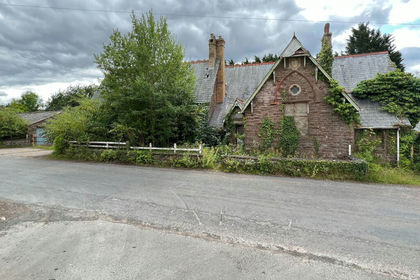
- Price
- Guide Price£450,000
- Size
- 0.5 acres
Upper Garway, Herefordshire, HR2, Garway, Herefordshire, County of HR2 England
Added on 29/01/2026Derelict property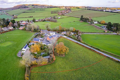
- Price
- Offers in Region of£500,000
- Size
- 1.36 acres
Wormelow, Much Dewchurch, Herefordshire, County of HR2 England
Added on 29/01/2026Development Land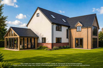
- Price
- Guide Price£350,000
Added on 31/07/2026Building Plot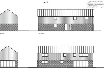 Added on 13/05/2026Development Land
- Price
- Guide Price£425,000
- Size
- 1 acres
Langstone, Llangarron, Ross-on-Wye, Llangarron, Herefordshire, County of HR9 England
Added on 29/01/2026Barn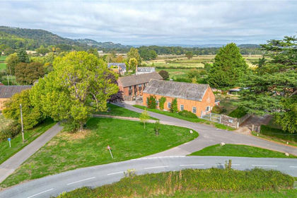
- Price
- Guide Price£360,000
- Size
- 0.25 acres
The Odd House, Blakemere, Hereford, Herefordshire, Blakemere, Herefordshire, County of HR2 England
Added on 03/10/2026Development Land
- Price
- Offers in Region of£475,000
Llangrove, Ross-on-Wye, Llangarron, Herefordshire, County of HR9 England
Added on 27/02/2026Building Plot Added on 04/11/2026Development Land
- Price
- Guide Price£399,000
- Size
- 7 acres
Upper House Farm, Wonastow, Monmouth, Monmouthshire, NP25, Mitchel Troy, Monmouthshire NP25 Wales
Added on 30/10/2026Conversion Land
- Price
- £425,000
Added on 18/06/2026Building Plot