Lower Ensden Road, Old Wives Lees, Canterbury
- Land size
- 274.05 acres
- Bedrooms
- 5
- Bathrooms
- 2
Key Features
- For sale as a whole or in two lots
- Guide Price: £3,900,000
- Lot 1: Lower Ensden Farmhouse - £1,100,000
- Lot 2: Lower Ensden Farm - £2,800,000
Description
This property offers a rare opportunity to acquire a well located farm and well proportioned house, located on the fringe of the National Landscape.
Lot 1: Lower Ensden Farmhouse -
Description - Occupying an exceptionally secluded and enviable position within the Kent Downs, Lower Ensden Farmhouse is a rare opportunity to acquire a substantial detached Grade II Listed farmhouse together with a collection of attractive outbuildings, set within grounds of approximately 3.38 acres and enjoying fantastic views across the surrounding countryside. The wonderfully peaceful setting is undoubtedly one of the property's greatest attractions. Surrounded by the rolling landscape of the Kent Downs, the house enjoys far-reaching and unspoilt views, yet remains conveniently positioned for Canterbury, Faversham and the surrounding villages. Properties in such a beautiful and secluded location are rarely available, making this an exciting opportunity for those looking to create something truly special.
The farmhouse itself is now in need of modernisation and offers considerable scope for improvement, subject to the necessary consents. With its generous proportions, period features, attractive outbuildings and exceptional setting, the property provides the opportunity to create a wonderful family home whilst retaining the character and charm of the existing Grade II Listed building.
The accommodation currently comprises an entrance hall, sitting room with a magnificent Inglenook fireplace, drawing room, dining room, kitchen/breakfast room and downstairs cloakroom. On the first floor, the landing leads to five bedrooms, with the principal bedroom benefiting from an en-suite bathroom, together with a family bathroom and separate WC. A useful cellar, with doors leading directly out to the garden completes the accommodation.
The property is approached via a gravel drive to the front providing plenty of parking. The various attractive outbuildings offer useful ancillary space and further potential, while the grounds extend to approximately 3.38 acres.
In all, Lower Ensden Farmhouse offers a rare combination of privacy, breath-taking countryside, generous accommodation and outstanding period character, together with the exciting opportunity to modernise and improve an important historic property and create a truly exceptional family home in one of Kent's most beautiful rural settings.
Location - Lower Ensden Farmhouse occupies a wonderful rural position within the Kent Downs, approximately midway between the villages of Old Wives Lees and Selling. Old Wives Lees lies on the historic Old Pilgrims Way on the Chartham Downs and is surrounded by beautiful countryside, orchards and an excellent choice of footpaths and country walks.
Despite its tranquil rural setting, the property is conveniently located for Canterbury, approximately 6 miles away. The cathedral city provides an extensive range of cultural, recreational and sporting facilities, together with a particularly strong selection of educational establishments. Canterbury has a number of highly regarded independent schools, including King's School, St Edmund's School and Kent College, alongside well-regarded state schools, grammar schools and sixth-form, making the area particularly attractive to families.
The picturesque medieval village of Chilham lies 1.5 miles away and has a magnificent castle, the village features 2 traditional pubs, village stores & railway connections to London. Faversham, approximately 5.5 miles away, and Selling, approximately 2 miles, provide rail services to London Victoria, with journey times of around 80 minutes. Chilham, approximately 1.5 miles away, also provides a rail service to London. For faster commuting, Canterbury West offers High Speed services to London St Pancras in less than an hour. Ashford International, approximately 11 miles away, provides High Speed services to London St Pancras in around 38 minutes, together with international services to the Continent. Road connections are also excellent, with access to the M2 motorway at Junction 6, approximately 4 miles away.
Council Tax - Band 'G' according to the website of the Valuation Office Agency
Lot 2: Lower Ensden Farm -
Description - In all, the land extends to approximately 270.67 acres (109.54 hectares), a large proportion of which lies within a ring fence, with only one off lying field. Access is provided from Lower Ensden Road and New Forest Lane. The land is classified Grade II and III by DEFRA with freely draining, lime rich loamy soils. The land may be suitable for alternative agricultural, horticultural or equestrian uses, subject to obtaining any necessary consents. Some of the land is also suitable for viticultural use.
Services - Mains water and electric are connected to the Farmhouse. Heating is provided via an oil central heating system and there is a private drainage system serving the property.
We are not aware of any services being connected to the land. Buyers should rely on their own investigations.
Rights Of Way And Easements - The land is sold subject to all existing covenants, wayleaves, easements and rights of way, whether public or private, specifically mentioned or not. The land is bordered to the Southeast by footpath KT|AE|8, and has bridleway KT|AE| 6 running through the Northern land parcel. A plan is available on request.
Plan - Please see the plan contained in these particulars. The boundaries on this plan are indicative only and the land will be sold in accordance with the Registered Title. Plans are reproduced from the Ordnance Survey under Licence Number ES025698. The acreages quoted are for guidance purposes only and are given without responsibility. Any intending purchaser should not rely upon the statements or representations as fact and must satisfy themselves by inspection or otherwise as to the area being sold.
Tenure And Possession - Freehold with vacant possession on completion.
Method Of Sale - The land is to be offered by private treaty as a whole or in two separate lots. The seller reserves the right to take the land to informal tender, formal tender or auction should they so desire.
Purchaser Identification - In accordance with Money Laundering Regulations, we are now required to obtain proof of identification and funds for any interested parties.
Planning - The land falls outside any settlement confines. The land is within a Nitrate Vulnerable Zone. The farmhouse is Grade II listed.
Countryside Stewardship - There is a Countryside Stewardship agreement in place for the land. Details are available from the agent on request.
Exchange Of Contracts And Completion - A 10% deposit will be payable on exchange of contracts with the balance of the purchase price payable upon completion.
Sporting Rights - In so far as they are owned, these are included in the sale.
Local Authorities - Canterbury City Council and Ashford Borough Council
Map Location
Property details
- Tenure
- Freehold
- Council Tax Band
- G
- Date Posted
- 2026-10-21
Market Value Analysis
Compared with 10 Farms & Smallholdings listings in South East England (250+ acres).
Utilities & Restrictions
Utilities
- Electricity
- Mains
- Water
- Mains
- Heating
- Oil Heating
- Broadband
- Ask Agent
- Sewerage
- Ask Agent
Rights & Restrictions
- Public Rights of Way
- Ask Agent
- Private Rights of Way
- Ask Agent
- Listed Property
- Yes
- Restrictions
- Ask Agent
Listed status, conservation areas and planning constraints for this location are in the full report.
Property Features
- Accessibility
- Ask Agent
- Parking
- Parking Available
- Garden
- Garden
Beyond the particulars: planning activity, flood history, heritage and ground risks, checked for this exact spot.
Connectivity
Broadband
Fastest speed available at this postcode
47 Mbps
Superfast
Suitable for
- HD streaming
- Video calls
- Web & social
Fixed wireless access may also be an option here.
Mobile signal
Predicted 4G and 5G signal; indoor signal depends on building materials.
Ofcom Connected Nations postcode-level predictions. Speeds and signal are modelled, not measured, and vary between addresses and providers.
Signal is the easy part. Planning activity, flood history and protected designations here are in the full report.
Nearest Schools
Primary
- Chilham, St Mary's Church of England Primary School1.4 milesNo Ofsted rating
- Ages
- 4 to 11
- Pupils
- 81
- Type
- Voluntary controlled school
- Faith
- Church of England
- Chartham Primary School1.7 milesNo Ofsted rating
- Ages
- 5 to 11
- Pupils
- 380
- Type
- Academy converter
- Selling Church of England Primary School2.4 milesOfsted report card · Jan 2026
- Ages
- 4 to 11
- Pupils
- 86
- Type
- Academy converter
- Faith
- Church of England
- Boughton-under-Blean and Dunkirk Primary School2.7 milesNo Ofsted rating
- Ages
- 5 to 11
- Pupils
- 209
- Type
- Voluntary controlled school
- Faith
- Methodist
- Hernhill Church of England Primary School3.7 milesNo Ofsted rating
- Ages
- 5 to 11
- Pupils
- 210
- Type
- Voluntary controlled school
- Faith
- Church of England
Secondary
- The Canterbury Academy4 milesOfsted report card · Jan 2026
- Ages
- 11 to 19
- Pupils
- 1,984
- Type
- Academy converter
- Simon Langton Grammar School for Boys4.8 milesOfsted: Outstanding *
- Ages
- 11 to 18
- Pupils
- 1,226
- Type
- Foundation school
- Gender
- Boys
- The Archbishop's School4.9 milesOfsted: Good
- Ages
- 11 to 18
- Pupils
- 770
- Type
- Foundation school
- Faith
- Church of England
- The Abbey School4.9 milesOfsted report card · Jan 2026
- Ages
- 11 to 19
- Pupils
- 1,061
- Type
- Academy converter
- Queen Elizabeth's Grammar School5.1 milesOfsted: Good
- Ages
- 11 to 18
- Pupils
- 1,156
- Type
- Academy converter
* Latest graded judgement covers quality of education only; no overall grade was issued under the 2024-25 inspection framework.
Distances are straight-line from the advertised location. Source: the national school registers (DfE, Welsh Government, Scottish Government) and Ofsted.
Schools are just the start: sold prices nearby, planning activity and any flood history are in the full report.
Amenities
Supermarket
GP surgery
Pharmacy
Hospital
Green space
Walking trail
Straight-line distances from the advertised location. Sources: NHS records, Geolytix supermarket locations, OS Open Greenspace and the national trails registers.
The area stacks up? Now check the location itself: planning nearby, protected designations and past flooding.
Getting Around
Nearest station
Nearest bus stop
Typical drive times
Straight-line distances from the advertised location; drive times are typical free-flow times over OpenStreetMap road data, so allow more at peak. Public transport locations from DfT NaPTAN.
Easy to reach matters. So do planning activity, flood history and ground risks: all in the full report.
Flood Risk
Environment Agency open data, checked around the advertised map pin for the listed acreage. Long-term risk counts flood defences; the planning map's flood zones do not. Provided by LandSale, not the listing agent, and not part of the agent's particulars. Risk varies across a holding, so verify before committing.
Rivers and the sea
Planning map: Flood Zone 1.
Surface water
Not at the pin: mapped about 180 metres away.
These bandings are the summary. Where this location sits on the flood maps, plus planning activity, heritage and ground risks, is in the full report.
Important notice: Information, maps and tags on this page are drawn from the advertising agent's marketing materials or generated automatically. LandSale has not verified them. Relying on these details is at your own risk, always carry out independent checks before committing to a purchase.
LandSale full disclaimer
Marketing information only - not formal particulars. The details on this website are provided for general guidance and do not constitute an offer or contract. Neither LandSale nor the advertising estate/land agent accepts responsibility for any inaccuracy.
1. Source of information
- Listing content: Core description, asking price, tenure, measurements, photographs and planning history originate from the marketing materials of the advertising estate or land agent. LandSale does not author this content and cannot guarantee its accuracy.
- Automated tags & categorisation: Property type, land-use class, acreage bands and similar labels may be applied by machine-learning models. They are intended as a helpful guide only and may not reflect the property's legal status or permitted use.
- Third-party & enriched data layers: Maps, boundary outlines, planning designations, soil reports, broadband coverage and other environmental or location-based insights are licensed from external suppliers. Such data are supplied “as is", may be incomplete or out of date and are subject to change without notice.
2. Verification required
Prospective purchasers must verify critical matters, including but not limited to planning permission, title boundaries, public rights of way, environmental constraints, acreage, services, access and VAT status, through their own inspections, specialist surveys, legal advisers and the selling agent before relying on the information or entering into any contract.
3. No warranty or liability
LandSale gives no warranty, express or implied, as to the accuracy, completeness or fitness for any particular purpose of the information displayed. LandSale shall not be liable for any loss, damage, cost or expense arising directly or indirectly from any use of or reliance on such information, save where liability may not be excluded by law.
4. Updates & feedback
If you believe any detail on this listing is inaccurate, please let us know. We will investigate and, where appropriate, update the listing or notify the agent.
© LandSale | Version 1.3 - August 2026
Similar properties for sale
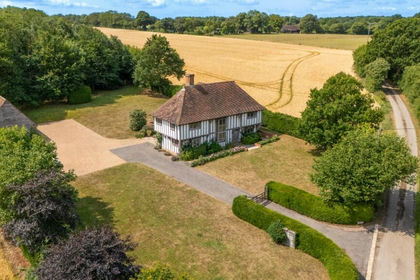
- Price
- £2,550,000
- Size
- 2.16 acres
Added on 29/01/2026House with Land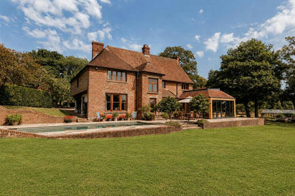
- Price
- £3,500,000
- Size
- 46.6 acres
The Manor House, Longage Manor, Lyminge, Folkestone, Lyminge, Kent CT18 England
Added on 15/08/2026Country Estate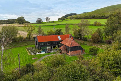
- Price
- £2,500,000
- Size
- 4.66 acres
Blue House, Annex And Plot/Land, Bluehouse Lane, Saltwood, Saltwood, Kent CT21 England
Added on 13/10/2026Country Home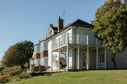
- Price
- £2,400,000
- Size
- 25.5 acres
Added on 09/10/2026House with Land
- Price
- Guide Price£2,750,000
- Size
- 27.44 acres
Chalksole Manor House, Vineyard & Cottages, Dover, CT15, Alkham, Kent CT15 England
Added on 29/01/2026Country Estate
- Price
- £4,950,000
Added on 29/01/2026Development Land
- Price
- Guide Price£3,650,000
- Size
- 8.5 acres
Smarden Road, Biddenden, Kent, TN27, Biddenden, Kent TN27 England
Added on 18/06/2026House with Land
- Price
- Guide Price£4,250,000
- Size
- 211 acres
Lower Farm Road, Boughton Monchelsea, Boughton Monchelsea, Kent ME17 England
Added on 28/05/2026Farm
- Price
- Guide Price£2,500,000
Added on 29/01/2026Development Land
- Price
- £2,500,000
- Size
- 3 acres
Added on 28/01/2026Development Land