Auction: Wednesday 28 October 2026 at 2pm
Development Site 2 Birkmyre Avenue, Port Glasgow, Inverclyde
- Land size
- 0.71 acres
Key Features
- Development opportunity
- Planning permission for 10 residential houses
- Site area approximately 0.71 acres
- Located within a residential area of Port Glasgow
- Planning reference IC/06/237R
Description
THIS PROPERTY IS BEING SOLD BY LIVESTREAM AUCTION AT 2PM ON WEDNESDAY 28th OCTOBER.
You can bid online, by telephone or by proxy. You must register to bid before 12.00 noon on Wednesday 28th October.
How to register: Visit auctionhouse.co,uk/Scotland. Scroll down and click “Register to bid”. This will take you to Passport by EIG, which is where we livestream our auctions. To create an account, click “sign up” and fill in all required details. You will receive an email once your registration is approved. If you need help registering to bid, please call the office.
To bid online on auction day: Log back in before 2pm on auction day, navigate to the lot you are interested in and click “bid now”.
Development site
The site at Birkmyre Avenue is an elevated residential development opportunity, offering views northwards towards the Firth of Clyde. The site was previously occupied by commercial buildings, which have since been demolished. The site extends to approximately 0.71 acres (0.29 hectares).
Planning permission was previously granted for the development of ten houses and six flats. The section of the site intended for the flats, which is situated towards the southern part of the site, has since been sold. The remaining planning consent provides for one detached four-bedroom house, together with nine terraced houses arranged across two blocks. These comprise seven three-bedroom homes and two two-bedroom homes. Full planning permission can be reviewed on Inverclyde Council website under planning reference: IC/06/237R.
The site is situated on the eastern side of Birkmyre Avenue, a short distance from its junction with Lilybank Road and to the south of Port Glasgow town centre. The surrounding area is predominantly residential, with Port Glasgow Bowling Club located next to the site. Port Glasgow is located within the Inverclyde area of Scotland, approximately 23 miles west of Glasgow and 5 miles southeast of Greenock. The town is well connected to Glasgow via the A/M8 motorway network. With a population of approximately 14,000, Port Glasgow provides a range of shopping, leisure and community facilities. A number of primary and secondary schools, as well as further education facilities, are also available within the surrounding area.
PURCHASERS NOTES
Please note that these particulars have been prepared by us on the basis of information provided by our client. If there is any aspect of these particulars that you wish clarified or that you find misleading please contact the office where further information will be made available.
• No tests have been made of services, equipment or fittings.
• No warranty is given or implied as to the condition of buildings, services, fixtures, fittings etc.
• All measurements, distances and acres are approximate.
• Fixtures, fittings and other items are not included unless specified in these details.
This material is protected by the laws of copyright. The owner of the copyright is Auction House Scotland. The property sheet forms part of our database and is protected by the database rights and copyright laws. No unauthorised copying or distribution without permission. Auction House Scotland is revolutionising the sale of property in Scotland.
Remember, if you are buying a property which is being sold by Auction House Scotland you will normally be responsible for payment of a Buyer's Premium or Auction Fee of 3.6% of the purchase price subject to a minimum of £3600 inclusive of VAT. More details can be obtained on application.
Cybercrime Warning:
Please be aware that there is a significant risk posed by cyber fraud, specifically affecting email accounts and bank account details. PLEASE NOTE THAT OUR BANK ACCOUNT DETAILS WILL NOT CHANGE DURING THE COURSE OF A TRANSACTION AND WE WILL NOT CHANGE OUR BANK DETAILS VIA EMAIL. Please be careful to check account details with us in person if in any doubt. We will not accept responsibility if you transfer money into an incorrect account.
Map Location
Property details
- Tenure
- Freehold
- Council Tax Band
- Ask Agent
- Date Posted
- 2026-10-15
Utilities & Restrictions
Utilities
- Electricity
- Ask Agent
- Water
- Ask Agent
- Heating
- Ask Agent
- Broadband
- Ask Agent
- Sewerage
- Ask Agent
Rights & Restrictions
- Public Rights of Way
- Ask Agent
- Private Rights of Way
- Ask Agent
- Listed Property
- Ask Agent
- Restrictions
- Ask Agent
Listed status, conservation areas and planning constraints for this location are in the full report.
Property Features
- Accessibility
- No Wheelchair Access
- Parking
- Ask Agent
- Garden
- Ask Agent
Beyond the particulars: planning activity, flood history, heritage and ground risks, checked for this exact spot.
Connectivity
Broadband
Fastest speed available at this postcode
80 Mbps
Superfast
Suitable for
- HD streaming
- Video calls
- Web & social
Mobile signal
Predicted 4G and 5G signal; indoor signal depends on building materials.
Ofcom Connected Nations postcode-level predictions. Speeds and signal are modelled, not measured, and vary between addresses and providers.
Signal is the easy part. Planning activity, flood history and protected designations here are in the full report.
Nearest Schools
Primary
- St John's Primary School200 metres
- Pupils
- 291
- Type
- Roman Catholic
- King's Oak Primary School1.1 miles
- Pupils
- 256
- Type
- Non-denominational
- All Saints Primary School1.3 miles
- Pupils
- 372
- Type
- Roman Catholic
- St Michael's Primary School1.5 miles
- Pupils
- 149
- Type
- Roman Catholic
- Newark Primary School1.6 miles
- Pupils
- 430
- Type
- Non-denominational
Secondary
- Port Glasgow High School2.2 miles
- Pupils
- 540
- Type
- Non-denominational
- St Stephen's High School2.2 miles
- Pupils
- 542
- Type
- Roman Catholic
- Notre Dame High School2.8 miles
- Pupils
- 879
- Type
- Roman Catholic
- Clydeview Academy4 miles
- Pupils
- 984
- Type
- Non-denominational
- Inverclyde Academy4.2 miles
- Pupils
- 773
- Type
- Non-denominational
Distances are straight-line from the advertised location. Source: the national school registers (DfE, Welsh Government, Scottish Government) and Ofsted.
Schools are just the start: planning activity, heritage and any flood history here are in the full report.
Amenities
Supermarket
GP surgery
Pharmacy
Green space
Walking trail
Straight-line distances from the advertised location. Sources: NHS records, Geolytix supermarket locations, OS Open Greenspace and the national trails registers.
The area stacks up? Now check the location itself: planning nearby, protected designations and past flooding.
Getting Around
Nearest station
Nearest bus stop
Typical drive times
Straight-line distances from the advertised location; drive times are typical free-flow times over OpenStreetMap road data, so allow more at peak. Public transport locations from DfT NaPTAN.
Easy to reach matters. So do planning activity, flood history and ground risks: all in the full report.
Flood Risk
SEPA open data, checked around the advertised map pin for the listed acreage. Provided by LandSale, not the listing agent, and not part of the agent's particulars. Risk varies across a holding, so verify before committing.
Rivers and the sea
Surface water
Not at the pin: mapped about 10 metres away.
These bandings are the summary. Where this location sits on the flood maps, plus planning activity, heritage and ground risks, is in the full report.
Important notice: Information, maps and tags on this page are drawn from the advertising agent's marketing materials or generated automatically. LandSale has not verified them. Relying on these details is at your own risk, always carry out independent checks before committing to a purchase.
LandSale full disclaimer
Marketing information only - not formal particulars. The details on this website are provided for general guidance and do not constitute an offer or contract. Neither LandSale nor the advertising estate/land agent accepts responsibility for any inaccuracy.
1. Source of information
- Listing content: Core description, asking price, tenure, measurements, photographs and planning history originate from the marketing materials of the advertising estate or land agent. LandSale does not author this content and cannot guarantee its accuracy.
- Automated tags & categorisation: Property type, land-use class, acreage bands and similar labels may be applied by machine-learning models. They are intended as a helpful guide only and may not reflect the property's legal status or permitted use.
- Third-party & enriched data layers: Maps, boundary outlines, planning designations, soil reports, broadband coverage and other environmental or location-based insights are licensed from external suppliers. Such data are supplied “as is", may be incomplete or out of date and are subject to change without notice.
2. Verification required
Prospective purchasers must verify critical matters, including but not limited to planning permission, title boundaries, public rights of way, environmental constraints, acreage, services, access and VAT status, through their own inspections, specialist surveys, legal advisers and the selling agent before relying on the information or entering into any contract.
3. No warranty or liability
LandSale gives no warranty, express or implied, as to the accuracy, completeness or fitness for any particular purpose of the information displayed. LandSale shall not be liable for any loss, damage, cost or expense arising directly or indirectly from any use of or reliance on such information, save where liability may not be excluded by law.
4. Updates & feedback
If you believe any detail on this listing is inaccurate, please let us know. We will investigate and, where appropriate, update the listing or notify the agent.
© LandSale | Version 1.3 - August 2026
Listing agent
Auction House Scotland, Glasgow
Building 3, 46 Munro Place, Anniesland, Glasgow G13 2UP
Contact Auction House Scotland, Glasgow
Building 3, 46 Munro Place, Anniesland, Glasgow G13 2UP
View agent profileSimilar properties for sale
 Added on 17/07/2026Development Land
- Price
- Offers in Excess of£79,000
Added on 11/08/2026Development Land
- Price
- Guide Price£90,000
- Size
- 1.21 acres
Added on 06/06/2026Development Land
- Price
- £125,000
- Size
- 1.9 acres
Added on 17/07/2026Development Land- Price
- Guide Price£115,000
- Size
- 1.9 acres
Added on 10/06/2026Development Land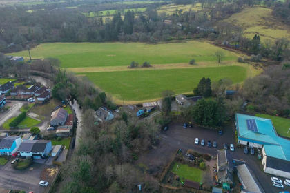
- Price
- Offers in Region of£89,000
Burnfoot Road, Lochwinnoch, Paisley and Renfrewshire South, Renfrewshire PA12 Scotland
Added on 29/01/2026Building Plot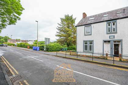
- Price
- Guide Price£75,000
Land at 12 Stirling Road, Drymen, G63, Stirling and Strathallan, Stirling G63 Scotland
Added on 17/07/2026Development Land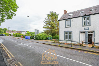
- Price
- Guide Price£75,000
Land at 12 Stirling Road, Drymen, G63, Stirling and Strathallan, Stirling G63 Scotland
Added on 29/01/2026Development Land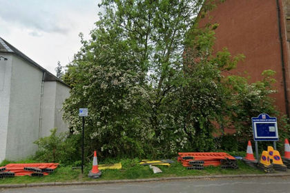
- Price
- Offers Over£112,500
- Size
- 1 acres
PLOT Buchanan Street, Balfron, Glasgow, Stirling and Strathallan, Stirling G63 Scotland
Added on 26/08/2026Building Plot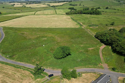
- Price
- Offers Over£125,000
- Size
- 1.2 acres
Added on 25/07/2026Building Plot