Haverthwaite, Ulverston, Cumbria, LA12
- Bedrooms
- 2
- Bathrooms
- 2
Key Features
- Retained Character Beams and Thickset Walls
- Feature Staircase with Velux Rooflights
- Hardwood Double Glazed Windows
- Oil Fired Central Heating & PV Solar Panels
- Full Fibre Broadband
- Mezzanine Gallery Looking Down Onto Living Area
- Off Road Parking Plus Large Garage & Workshop
- Excellent Location for A590, Ulverston, Barrow and Kendal along with Wider Lake District
- Local Occupancy Applies
Description
Unique bank barn conversion with impressive features, open plan living and large garage/workshop. Countryside views and good size plot.
OVERVIEW
With open countryside views and a pretty village location within the Lake District National Park, this three storey barn conversion must be viewed to be fully appreciated. A former Cumbrian bank barn, converted by the current owner, the property has a unique layout - the generous open plan living dining and kitchen space extends to 28' 8" x 27' 1" (8.74m x 8.24m) max making it ideal for entertaining and has impressive features and a woodburner. The garden room at the rear offers privacy for work or hobbies - a real bonus. The first floor has two double bedrooms, one of which is ensuite and there is a versatile mezzanine/gallery. The surprises continue on the lower ground floor with a large workshop and garage, perfect for tinkering, woodworking or hobbies plus a utility room and external store. The garden slopes away from the house on the banked up east elevation, blending into the surrounding fields yet still retaining space for play and relaxation close to the house.
ACCOMMODATION
Stone steps lead from the parking area up to the characterful wooden double doors and into the entrance vestibule. A handy cloakroom and WC lead to one side and glazed doors into the open plan living/dining and kitchen space. An impressive room with part vaulted ceiling, feature central staircase and wooden flooring running throughout. Light streams in from the tall French doors, windows front and rear and the two large Velux rooflights on the galleried landing above. A multi fuel stove provides a focal point to the living area.
-
The kitchen area has a range of freestanding units and a central island. For serious cooks, the commercial style gas (LPG) cooker with electric oven is a great addition and has a substantial stainless steel extractor above. Completing this level of the house is a garden room - another generous space with a Moroccan feel and exposed beams. French doors lead to the garden and there are pleasant views across open fields. Internal stairs lead down to the garage, workshop and utility.
-
The open stairs lead up onto the galleried landing with two large Velux rooflights providing natural light. The exposed beams and frame of the original building are a lovely feature and care and attention was used in retaining their character during conversion. The generous vaulted mezzanine is the perfect spot for hobbies or a statement chair or sofa bed. A platform has been created within the roof space above the mezzanine for storage and there is an additional galleried store above the wardrobe of the front bedroom - a quirky feature both visible and accessible from the landing.
-
Full of character, the larger of the two bedrooms has exposed beams, a vaulted ceiling and a lovely view over fields and the Lakeland landscape toward Bigland Heights. Adjacent to the ensuite bathroom is a built-in cupboard. Fitted with a three piece suite, the ensuite has a bath with shower above, hand basin and WC. The second double bedroom is at the front with pleasant outlook towards trees and a built-in double wardrobe. The shower room has natural light from a Velux rooflight, a WC and hand basin. The shower enclosure is a good size with both a fixed head and hand held spray plus a radiator.
-
The lower ground floor is particularly of interest to buyers with lots of outdoor gear, a classic car, motorbikes or woodworking hobbies. There is ample space for a number of vehicles whilst still retaining areas for storage. The garage houses the solar panel controls and there are two windows and fully tracked doors at the front. The utility room has a Belfast sink, plumbing for a washing machine and space for a tumble dryer. The hot water cylinder/thermal store can use any excess solar gain and there is an oil fired Worcester boiler.
-
The plot extends to approximately a third of an acre – there is plenty of off road parking within the gravelled yard at the front and access at the side leads into the rear garden. Adjacent to the house is a level lawn, perfect for play and there are two gravelled seating area connected by a couple of steps - ideal for admiring the views. The plot is larger than expected, sloping away from the property and blending with the green fields and nature that surround it. Mature trees and shrubs offer children the prospect of adventure and hide and seek and the garden is bounded with walling on three sides.
DIMENSIONS
Open Plan Living/Dining and Kitchen 28' 8" x 27' 1" (8.74m x 8.24m) max Garden Room 10' 11" x 22' 10" (3.32m x 6.96m) Mezzanine/Gallery 10' 4" x 17' 9" (3.15m x 5.41m) Bedroom 11' 0" x 12' 9" (3.36m x 3.88m) Ensuite 6' 2" x 8' 6" (1.88m x 2.60m) Bedroom 8' 6" x 10' 0" (2.60m x 3.05m) Shower Room 8' 9" x 5' 0" (2.66m x 1.52m) Garage and Workshop 28' 2" x 27' 0" (8.58m x 8.22m) max Utility Room 10' 9" x 10' 8" (3.27m x 3.25m) Store 10' 8" x 10' 10" (3.25m x 3.30m)
DIRECTIONS
Heading west on A590, proceed through Newby Bridge and Backbarrow. Pass the first turning to Haverthwaite (opposite the Lakeside and Haverthwaite Railway), then take the next left signposted Cark and Haverthwaite. Continue towards the village - as the road bends round to the left the property is set back from the road on the inside of the bend on the left-hand side. what3words///blurs.jump.enjoy
ESSENTIAL INFORMATION
Services: Mains Water, Electric and Drainage. Oil fired central heating and LPG for cooking/hob. PV solar panels and superfast full fibre broadband. Hard wired speaker points. Burglar alarm system Tenure: Freehold. The property owns a proportion of the yard to the front with a right of access for neighbouring properties both on foot and with a vehicle. There are two oil tanks at the side of the house - one belongs to the attached property. There is a flying freehold at the front of the house beneath the cloakroom and WC. Subject to a Local Occupancy Clause. The property must be used as a Private Dwelling House. The dwelling house shall not be occupied otherwise than by a person employed or to be employed or last employed locally or has throughout the period of three years immediately preceding the commencement of such occupation of the dwelling house had his only or principal home locally together with the dependents of such a person living with him or her and (truncated)
Map Location
Property details
- Tenure
- Ask Agent
- Council Tax Band
- E
- Date Posted
- 2026-10-14
Energy Performance Certificate
Energy Efficiency Rating
Based on UK Energy Performance Certificate standards (EU Directive 2002/91/EC)
Running costs are one side. Planning activity, flood history and ground risks for this location are in the full report.
Utilities & Restrictions
Utilities
- Electricity
- Ask Agent
- Water
- Ask Agent
- Heating
- Ask Agent
- Broadband
- Ask Agent
- Sewerage
- Ask Agent
Rights & Restrictions
- Public Rights of Way
- Ask Agent
- Private Rights of Way
- Ask Agent
- Listed Property
- Ask Agent
- Restrictions
- Ask Agent
Listed status, conservation areas and planning constraints for this location are in the full report.
Property Features
- Accessibility
- Ask Agent
- Parking
- Parking Available
- Garden
- Garden
Beyond the particulars: planning activity, flood history, heritage and ground risks, checked for this exact spot.
Connectivity
Broadband
Fastest speed available at this postcode
80 Mbps
Superfast
Suitable for
- HD streaming
- Video calls
- Web & social
Mobile signal
Predicted 4G and 5G signal; indoor signal depends on building materials.
Ofcom Connected Nations postcode-level predictions. Speeds and signal are modelled, not measured, and vary between addresses and providers.
Signal is the easy part. Planning activity, flood history and protected designations here are in the full report.
Nearest Schools
Primary
- Leven Valley CofE Primary School0.9 milesOfsted: Good *
- Ages
- 4 to 11
- Pupils
- 68
- Type
- Voluntary aided school
- Faith
- Church of England
- Penny Bridge CofE School1.9 milesOfsted: Good
- Ages
- 4 to 11
- Pupils
- 123
- Type
- Academy converter
- Faith
- Church of England
- Cartmel CofE Primary School4 milesOfsted: Good
- Ages
- 4 to 11
- Pupils
- 47
- Type
- Voluntary controlled school
- Faith
- Church of England
- Church Walk CofE Primary School4.6 milesOfsted report card · Mar 2026
- Ages
- 4 to 11
- Pupils
- 88
- Type
- Voluntary aided school
- Faith
- Church of England
- Sir John Barrow School4.8 milesOfsted: Outstanding
- Ages
- 3 to 11
- Pupils
- 235
- Type
- Community school
Secondary
- Cartmel Priory CofE School4.2 milesOfsted report card · May 2026
- Ages
- 11 to 16
- Pupils
- 371
- Type
- Academy converter
- Faith
- Church of England
- Ulverston Victoria High School5.2 milesOfsted: Good *
- Ages
- 11 to 18
- Pupils
- 1,319
- Type
- Community school
- John Ruskin School8.8 milesOfsted: Good
- Ages
- 11 to 16
- Pupils
- 247
- Type
- Community school
- Dowdales School9.2 milesNo Ofsted rating
- Ages
- 11 to 16
- Pupils
- 877
- Type
- Community school
- Dallam School10 milesOfsted report card · Apr 2026
- Ages
- 11 to 18
- Pupils
- 761
- Type
- Academy converter
* Latest graded judgement covers quality of education only; no overall grade was issued under the 2024-25 inspection framework.
Distances are straight-line from the advertised location. Source: the national school registers (DfE, Welsh Government, Scottish Government) and Ofsted.
Schools are just the start: sold prices nearby, planning activity and any flood history are in the full report.
Amenities
Supermarket
GP surgery
Pharmacy
Hospital
Green space
Straight-line distances from the advertised location. Sources: NHS records, Geolytix supermarket locations, OS Open Greenspace and the national trails registers.
The area stacks up? Now check the location itself: planning nearby, protected designations and past flooding.
Getting Around
Nearest station
Nearest bus stop
Typical drive times
Straight-line distances from the advertised location; drive times are typical free-flow times over OpenStreetMap road data, so allow more at peak. Public transport locations from DfT NaPTAN.
Easy to reach matters. So do planning activity, flood history and ground risks: all in the full report.
Flood Risk
Environment Agency open data, checked around the advertised map pin for the listed acreage. Long-term risk counts flood defences; the planning map's flood zones do not. Provided by LandSale, not the listing agent, and not part of the agent's particulars. Risk varies across a holding, so verify before committing.
Rivers and the sea
Planning map: Flood Zone 1.
Surface water
These bandings are the summary. Where this location sits on the flood maps, plus planning activity, heritage and ground risks, is in the full report.
Important notice: Information, maps and tags on this page are drawn from the advertising agent's marketing materials or generated automatically. LandSale has not verified them. Relying on these details is at your own risk, always carry out independent checks before committing to a purchase.
LandSale full disclaimer
Marketing information only - not formal particulars. The details on this website are provided for general guidance and do not constitute an offer or contract. Neither LandSale nor the advertising estate/land agent accepts responsibility for any inaccuracy.
1. Source of information
- Listing content: Core description, asking price, tenure, measurements, photographs and planning history originate from the marketing materials of the advertising estate or land agent. LandSale does not author this content and cannot guarantee its accuracy.
- Automated tags & categorisation: Property type, land-use class, acreage bands and similar labels may be applied by machine-learning models. They are intended as a helpful guide only and may not reflect the property's legal status or permitted use.
- Third-party & enriched data layers: Maps, boundary outlines, planning designations, soil reports, broadband coverage and other environmental or location-based insights are licensed from external suppliers. Such data are supplied “as is", may be incomplete or out of date and are subject to change without notice.
2. Verification required
Prospective purchasers must verify critical matters, including but not limited to planning permission, title boundaries, public rights of way, environmental constraints, acreage, services, access and VAT status, through their own inspections, specialist surveys, legal advisers and the selling agent before relying on the information or entering into any contract.
3. No warranty or liability
LandSale gives no warranty, express or implied, as to the accuracy, completeness or fitness for any particular purpose of the information displayed. LandSale shall not be liable for any loss, damage, cost or expense arising directly or indirectly from any use of or reliance on such information, save where liability may not be excluded by law.
4. Updates & feedback
If you believe any detail on this listing is inaccurate, please let us know. We will investigate and, where appropriate, update the listing or notify the agent.
© LandSale | Version 1.3 - August 2026
Listing agent
Milne Moser, Milnthorpe
Westmorland House, The Square, Milnthorpe, LA7 7QJ
Similar properties for sale
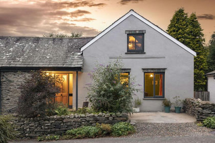
- Price
- Offers Over£475,000
Low House Barn, Ayside, Nr Cartmel, LA11, Staveley-in-Cartmel, Westmorland and Furness LA11 England
Added on 29/01/2026Barn Conversion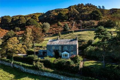
- Price
- Offers Over£625,000
- Size
- 2.12 acres
Ayside, Grange-Over-Sands, Cumbria, Staveley-in-Cartmel, Westmorland and Furness LA11 England
Added on 09/09/2026House with Land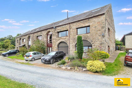
- Price
- Offers in Region of£425,000
Plumpton, Ulverston, Egton with Newland, Westmorland and Furness LA12 England
Added on 11/08/2026Barn Conversion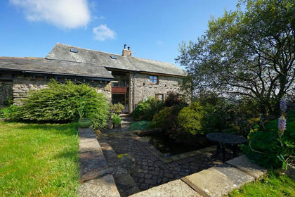
- Price
- Offers in Region of£475,000
Added on 21/07/2026Barn Conversion
- Price
- £475,000
- Size
- 6 acres
Added on 24/09/2026Cottage
- Price
- £525,000
No.2 The Byres, Cartmel Fell, Windermere, LA23, Cartmel Fell, Westmorland and Furness LA23 England
Added on 30/07/2026Barn Conversion Added on 23/07/2026Barn Conversion
- Price
- Guide Price£500,000
Added on 22/06/2026Development Land
- Price
- Guide Price£500,000
Added on 17/07/2026Lakefront property
- Price
- Offers Over£650,000
- Size
- 2 acres
Added on 29/01/2026House with Land