Of Rosieburn, Banff, AB45
- Land size
- 7 acres
- Bedrooms
- 3
- Bathrooms
- 2
Key Features
- Rural Powerhouse
- Architect Crafted
- Seven Acres
- Barn Potential
- Rosieburn Retreat
- Equestrian Ready
Description
Big land, bold views, beautiful living.
A brand new home wrapped in rural tranquillity.
Seven acres of pure countryside freedom.
Low and Partners is excited to showcase Upper Mains of Rosieburn, Alvah, Banff — an exceptional opportunity comprising approximately seven acres, nine agricultural buildings and a brand new architect designed three bedroom, two bathroom home. This remarkable property offers a rare blend of rural privacy, modern efficiency and outstanding potential for future development, business use or lifestyle expansion. Fully consented Planning Approval and Building Warrant are in place, with the build inspected and signed off at each stage by the architect. A final completion certificate will be provided, ensuring full compliance for mortgage purposes and Local Authority requirements.
The newly built home meets the latest energy efficiency standards, incorporating solar PV panels, an Air Source Heat Pump, underfloor heating throughout the ground floor and appropriately sized ASHP radiators upstairs. A modern wood burning stove sits beautifully between the open plan lounge, dining and kitchen area, adding warmth and character. An EV charge point is installed, and extensive parking is available around the stead, both within and outside the buildings.
The entrance is bright and welcoming, with stairs leading to the upper level and partially glazed pocket doors opening into the impressive L shaped lounge, dining and kitchen space. A cupboard houses the underfloor heating manifolds. The open plan living area is flooded with natural light from dual aspect windows and two sets of patio sliding doors that open onto the surrounding patio areas. Every window and door frames wonderful views across the land. The stove creates a cosy focal point, while the kitchen offers stylish wall and base cabinetry with grey work surfaces, integrated dishwasher, oven, hob and extractor fan. Grey flooring and modern lighting complete the space.
The utility room is generously sized, with space for appliances, a window overlooking the front and a deep double cupboard housing the solar unit, heat store for the ASHP . A great sized downstairs bedroom features two windows allowing ample light, along with modern flooring and lighting. The shower room includes a wash hand basin, toilet, shower, heated radiator, tiled floor and panelled wet wall.
Upstairs, the hallway is a bright and versatile space, ideal as an office or reading area. A Velux window, radiator, lighting and storage cupboard enhance the area. The main bedroom is exceptionally large, with a double wardrobe, dual aspect Velux windows and two additional windows, creating a beautifully light and airy room. Bedroom three mirrors the size and feel of bedroom two, offering another spacious and comfortable room with lighting and radiators. The upstairs bathroom includes a bath with shower mixer, walk in shower, toilet, wash hand basin, heated towel rail, radiator, flooring and a large Velux window.
Beyond the house, the property’s outbuildings offer extraordinary potential. The nine structures include original stone and slate buildings that, with vision and appropriate consents, could be transformed into further accommodation, business premises, storage, offices or recreational spaces. A very large covered barn has previously been used as a horse arena and for dog agility training, lending itself to multiple uses. Additional stock sheds and stabling sit adjacent to the paddock, with land extending towards the Rosieburn riverbank. The Braes, running along the burn, provide useful grazing and a pleasant natural area.
The appeal of Upper Mains of Rosieburn is further enhanced by its privacy, accessed via a quiet minor road and a private 200 metre track. There are no public footpaths or bridleways crossing the land. Full access rights are in place, with only a limited right to pass and repass for the neighbouring farmer — this does not extend into the main house or farm building areas.
The property benefits from mains electricity with a smart meter, a private spring fed water supply with filtration system meeting all consent requirements, and new underground drainage and wastewater treatment.
Upper Mains of Rosieburn is a standout rural holding offering modern living, extensive land, huge potential and complete privacy — a rare opportunity in the Banff area for those seeking a lifestyle property with scope to grow, develop or simply enjoy the peace of the countryside.
Notes - Owners have confirmed the house will come with a 6 year Build Guarantee.
Location
Upper Mains of Rosieburn sits within the peaceful rural parish of Alvah, just a short distance from Banff, offering a truly idyllic countryside setting with outstanding privacy and panoramic views. This part of Aberdeenshire is known for its rolling farmland, wooded riverbanks and quiet minor roads, creating a calm and secluded environment ideal for those seeking space, nature and a slower pace of life. Despite its rural feel, the property remains conveniently positioned for access to Banff and Macduff, where you’ll find supermarkets, shops, cafés, schools, leisure facilities and essential services.
The surrounding area is rich in outdoor opportunities, with scenic walking routes, cycling trails and wildlife right on the doorstep. The Rosieburn itself runs alongside part of the land, adding to the natural charm and providing a beautiful backdrop for grazing, recreation or simply enjoying the tranquillity. The coastline is also within easy reach, offering beaches, harbours and coastal paths stretching from Banff to Gardenstown and beyond.
Transport links from Alvah connect easily to Turriff, Huntly, Keith and Aberdeen, making the location practical for commuting while still offering the privacy and freedom of a countryside estate. With no public footpaths or bridleways crossing the land and access via a quiet minor road and private track, Upper Mains of Rosieburn enjoys a rare level of seclusion.
This location offers the perfect blend of rural serenity, practical accessibility and lifestyle potential — an exceptional setting for those looking to embrace countryside living with room to grow, create or simply enjoy the peace of Aberdeenshire’s landscape.
Disclaimer
These particulars do not constitute any part of an offer or contract. All statements contained therein, while believed to be correct, are not guaranteed. All measurements are approximate. Intending purchasers must satisfy themselves by inspection or otherwise, as to the accuracy of each of the statements contained in these particulars.
Map Location
Property details
- Tenure
- Freehold
- Council Tax Band
- TBC
- Date Posted
- 2026-10-12
Market Value Analysis
Compared with 137 Homes with Land listings in Scotland (5+ acres).
Utilities & Restrictions
Utilities
- Electricity
- Mains
- Water
- Private Supply
- Heating
- Solar PVT (Hybrid), Double Glazing, Air Source Heat Pump, Wood Burner
- Broadband
- Ask Agent
- Sewerage
- Septic Tank / Private
Rights & Restrictions
- Public Rights of Way
- Ask Agent
- Private Rights of Way
- Ask Agent
- Listed Property
- Ask Agent
- Restrictions
- Ask Agent
Listed status, conservation areas and planning constraints for this location are in the full report.
Property Features
- Accessibility
- Level Access Shower
- Parking
- Driveway
- Garden
- Garden
Beyond the particulars: planning activity, flood history, heritage and ground risks, checked for this exact spot.
Connectivity
Broadband
Fastest speed available at this postcode
1.8 Gbps
Gigabit full fibre · available to 25% of premises
Suitable for
- 4K streaming on every screen
- Full-time home working
- Online gaming & big downloads
Mobile signal
Predicted 4G and 5G signal; indoor signal depends on building materials.
Ofcom Connected Nations postcode-level predictions. Speeds and signal are modelled, not measured, and vary between addresses and providers.
Signal is the easy part. Planning activity, flood history and protected designations here are in the full report.
Nearest Schools
Primary
- Aberchirder School2.7 miles
- Pupils
- 110
- Type
- Non-denominational
- King Edward School3.8 miles
- Pupils
- 24
- Type
- Non-denominational
- Turriff Primary School5 miles
- Pupils
- 406
- Type
- Non-denominational
- Banff Primary School5.4 miles
- Pupils
- 296
- Type
- Non-denominational
- Ordiquhill School5.8 miles
- Pupils
- 58
- Type
- Non-denominational
Secondary
- Banff Academy5.2 miles
- Pupils
- 970
- Type
- Non-denominational
- Turriff Academy5.5 miles
- Pupils
- 623
- Type
- Non-denominational
- The Gordon Schools12 miles
- Pupils
- 665
- Type
- Non-denominational
- Keith Grammar School14 miles
- Pupils
- 370
- Type
- Non-denominational
- Buckie High School16 miles
- Pupils
- 826
- Type
- Non-denominational
Distances are straight-line from the advertised location. Source: the national school registers (DfE, Welsh Government, Scottish Government) and Ofsted.
Schools are just the start: planning activity, heritage and any flood history here are in the full report.
Amenities
Supermarket
GP surgery
Pharmacy
Straight-line distances from the advertised location. Sources: NHS records, Geolytix supermarket locations, OS Open Greenspace and the national trails registers.
The area stacks up? Now check the location itself: planning nearby, protected designations and past flooding.
Getting Around
Nearest station
Nearest bus stop
Typical drive times
Straight-line distances from the advertised location; drive times are typical free-flow times over OpenStreetMap road data, so allow more at peak. Public transport locations from DfT NaPTAN.
Easy to reach matters. So do planning activity, flood history and ground risks: all in the full report.
Flood Risk
SEPA open data, checked around the advertised map pin for the listed acreage. Provided by LandSale, not the listing agent, and not part of the agent's particulars. Risk varies across a holding, so verify before committing.
Rivers and the sea
Surface water
Not at the pin: mapped about 20 metres away.
These bandings are the summary. Where this location sits on the flood maps, plus planning activity, heritage and ground risks, is in the full report.
Important notice: Information, maps and tags on this page are drawn from the advertising agent's marketing materials or generated automatically. LandSale has not verified them. Relying on these details is at your own risk, always carry out independent checks before committing to a purchase.
LandSale full disclaimer
Marketing information only - not formal particulars. The details on this website are provided for general guidance and do not constitute an offer or contract. Neither LandSale nor the advertising estate/land agent accepts responsibility for any inaccuracy.
1. Source of information
- Listing content: Core description, asking price, tenure, measurements, photographs and planning history originate from the marketing materials of the advertising estate or land agent. LandSale does not author this content and cannot guarantee its accuracy.
- Automated tags & categorisation: Property type, land-use class, acreage bands and similar labels may be applied by machine-learning models. They are intended as a helpful guide only and may not reflect the property's legal status or permitted use.
- Third-party & enriched data layers: Maps, boundary outlines, planning designations, soil reports, broadband coverage and other environmental or location-based insights are licensed from external suppliers. Such data are supplied “as is", may be incomplete or out of date and are subject to change without notice.
2. Verification required
Prospective purchasers must verify critical matters, including but not limited to planning permission, title boundaries, public rights of way, environmental constraints, acreage, services, access and VAT status, through their own inspections, specialist surveys, legal advisers and the selling agent before relying on the information or entering into any contract.
3. No warranty or liability
LandSale gives no warranty, express or implied, as to the accuracy, completeness or fitness for any particular purpose of the information displayed. LandSale shall not be liable for any loss, damage, cost or expense arising directly or indirectly from any use of or reliance on such information, save where liability may not be excluded by law.
4. Updates & feedback
If you believe any detail on this listing is inaccurate, please let us know. We will investigate and, where appropriate, update the listing or notify the agent.
© LandSale | Version 1.3 - August 2026
Listing agent
Low & Partners, Aberdeen
Holmlea Fyvie Turriff Aberdeenshire AB53 8JP
Similar properties for sale
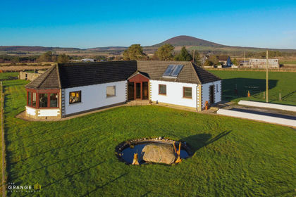
- Price
- Offers Over£450,000
- Size
- 19 acres
Knock, Huntly, AB54, Aberdeenshire North and Moray East, Moray AB54 Scotland
Added on 22/05/2026House with Land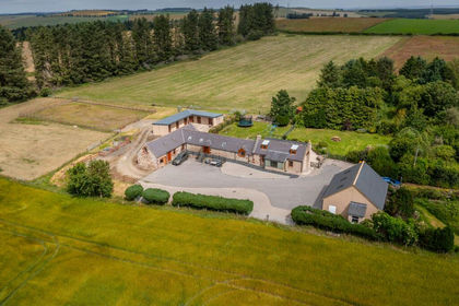
- Price
- Offers Over£440,000
- Size
- 9 acres
Ythanwells, Huntly, AB54, Gordon and Buchan, Aberdeenshire AB54 Scotland
Added on 08/08/2026Equestrian property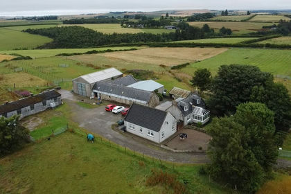
- Price
- Offers Over£380,000
- Size
- 10 acres
Cottown Croft, Gight, Methlick, AB41, Gordon and Buchan, Aberdeenshire AB41 Scotland
Added on 10/08/2026House with Land
- Price
- Offers Over£445,000
- Size
- 25.75 acres
Added on 19/02/2026Farmland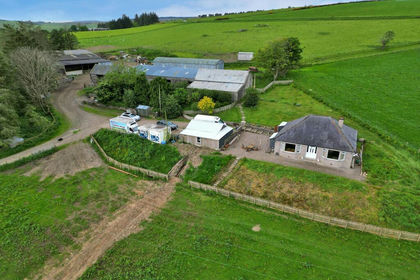
- Price
- Offers in Excess of£445,000
- Size
- 25.75 acres
Upper Lynemore, Keith, AB55, Moray West, Nairn and Strathspey, Moray AB55 Scotland
Added on 19/02/2026Smallholding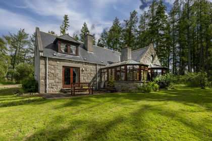
- Price
- Offers Over£450,000
- Size
- 7 acres
Logie Woodlands, Pitcaple, Inverurie, AB51, Gordon and Buchan, Aberdeenshire AB51 Scotland
Added on 29/01/2026Country Home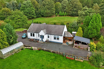
- Price
- Offers Over£365,000
- Size
- 3 acres
Added on 15/09/2026House with Land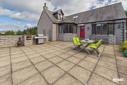
- Price
- Offers Over£390,000
- Size
- 4 acres
Clatt, Huntly, AB54, Gordon and Buchan, Aberdeenshire AB54 Scotland
Added on 29/09/2026House with Land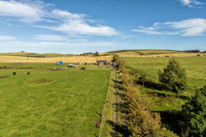
- Price
- Offers Over£390,000
- Size
- 33.3 acres
2 Hayhillock Cottage, Ellon, Aberdeenshire, AB41, Gordon and Buchan, Aberdeenshire AB41 Scotland
Added on 13/10/2026Smallholding
- Price
- Offers Over£450,000
- Size
- 4.45 acres
Added on 14/10/2026Smallholding