Grange Cottages, Croxton, Ulceby, DN396YD
- Land size
- 3 acres
- Bedrooms
- 5
- Bathrooms
- 2
Key Features
- Pair of refurbished cottages and 3 acres
- Total of 5 bedrooms
- Ideal for two family occupation
- Semi Rural location.
- Potential to become a single dwelling
Description
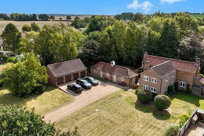
Presenting a unique opportunity to acquire a charming pair of refurbished cottages, set in a semi rural location. This versatile property comprises a three bedroom semi detached house and an adjacent two bedroom cottage, offering a total of five bedrooms across both dwellings. The cottages have been thoughtfully modernised, blending character features with contemporary finishes to create comfortable and inviting living spaces. With flexible accommodation, this property is ideally suited for two family occupation, multi-generational living or as a home with income potential. Subject to the necessary consents, there is also scope to combine the cottages into a single, substantial dwelling, allowing for further customisation to suit individual requirements.
The property also includes a 3 acre ( approximately) fenced paddock ideal for those with equestrian interests. Whilst located to the side of a working farm the property is well screened and enjoys private, enclosed gardens to each cottage.
There is generous parking for several vehicles and potential to create further outbuildings or recreational areas, subject to planning. With its blend of rural tranquillity and convenient access to local amenities, this property presents a rare opportunity to acquire a flexible home with an adjacent 3 acre paddock.
EPC Rating: E
Entrance
Side entrance with tiled floor and utility store housing the oil fired boiler.
Breakfast room
Enjoying views to the rear garden.
Kitchen
Newly refurbished with an excellent range of high gloss finished units with contrasting tops and including an inset electric hob with extractor over, fitted oven and microwave, breakfast bar and space for an upright fridge/freezer.
Bathroom
A fully tiled, split level indulgence appointed with a freestanding roll topped bath, walk-in glazed shower enclosure, close coupled wc, pedestal wash hand basin and spot lighting.
Inner Hall
Radiator, window and stair.
Lounge
A relaxing rear facing room centred on the cast iron stove in beamed recess and with views to the enclosed garden.
Study
A flexible space ideal for use as either a study, hobby room or play room.
Bedroom 1
A generous double room overlooking the garden.
Bedroom 2
Part sloping ceiling and views to open farmland.
Rear Landing
A flexible area which could easily become further accommodation if required and steps up to a further landing.
Bedroom 3
A further double room with garden rooms.
NOTE
The inner landing continues to a further bedroom which is included in Cottage 1 and a ,currently closed, door opens into Cottage 1.
Rear Entrance
Pvcu door and laminated flooring.
Bathroom
To include a 3 piece suite and tiled walls.
Open Plan Living Area and Kitchen
A generous, contemporary, triple aspect L shaped living space suited to modern family life and including a brick built fire recess with inset cast iron stove, French doors to enclosed garden and a generous kitchen area newly appointed with a good range of high gloss finished units with integrated oven, hob and extractor fan, plumbing for a washing machine and space for an upright fridge/freezer. ( maximum measurements.)
Landing
Potential access back to Cottage 2.
Bedroom 1
A double room with views to open farmland and part sloping ceiling.
Bedroom 2
A door from the landing opens to the inner landing of Cottage 2 and leads to the second, dual aspect double bedroom
Garden
Each cottage has its own, enclosed gardens and there is a common parking area to the side. The fenced paddock lies to the east of the cottage immediately adjacent to the parking area.
Disclaimer
ANTI MONEY LAUNDERING.
Intending purchasers will be asked to produce identification documentation at the offer stage sale.
This will be requested digitally via our partner company HIPLA who will request a fee of £20 + VAT per purchaser.
REFERRALS.
Newton Fallowell and our partners provide a range of services to buyers, although you are free to use an alternative provider. We can refer you on to Mortgage Advice Bureau for help with finance. We may receive a fee of £200, if you take out a mortgage through them. If you require a solicitor to handle your purchase we can refer you on to our in house solicitors. We may receive a fee of upto £200 if you use their services.
Map Location
Property details
- Tenure
- Freehold
- Council Tax Band
- A
- Date Posted
- 2026-10-09
Market Value Analysis
Compared with 675 Homes with Land listings in Yorkshire and The Humber (1+ acres).
Energy Performance Certificate
Energy Efficiency Rating
Based on UK Energy Performance Certificate standards (EU Directive 2002/91/EC)
Running costs are one side. Planning activity, flood history and ground risks for this location are in the full report.
Utilities & Restrictions
Utilities
- Electricity
- Mains
- Water
- Mains
- Heating
- Oil Heating
- Broadband
- No Internet Connection
- Sewerage
- Septic Tank / Private
Rights & Restrictions
- Public Rights of Way
- Ask Agent
- Private Rights of Way
- Ask Agent
- Listed Property
- Ask Agent
- Restrictions
- Ask Agent
Listed status, conservation areas and planning constraints for this location are in the full report.
Property Features
- Accessibility
- Ask Agent
- Parking
- Parking Available
- Garden
- Private Garden
Beyond the particulars: planning activity, flood history, heritage and ground risks, checked for this exact spot.
Connectivity
Broadband
Fastest speed available at this postcode
34 Mbps
Superfast · available to 22% of premises
Suitable for
- HD streaming
- Video calls
- Web & social
Mobile signal
Predicted 4G and 5G signal; indoor signal depends on building materials.
Ofcom Connected Nations postcode-level predictions. Speeds and signal are modelled, not measured, and vary between addresses and providers.
Signal is the easy part. Planning activity, flood history and protected designations here are in the full report.
Nearest Schools
Primary
- Ulceby St Nicholas Church of England Primary School1.1 milesOfsted: Good
- Ages
- 4 to 11
- Pupils
- 94
- Type
- Academy sponsor led
- Faith
- Church of England
- Kirmington CofE Primary School1.5 milesNo Ofsted rating
- Ages
- 3 to 11
- Pupils
- 38
- Type
- Voluntary controlled school
- Faith
- Church of England
- Wootton St Andrew's CofE Primary School1.7 milesNo Ofsted rating
- Ages
- 4 to 11
- Pupils
- 58
- Type
- Voluntary aided school
- Faith
- Church of England
- St Barnabas CofE Primary School, Barnetby3.1 milesOfsted report card · Feb 2026
- Ages
- 5 to 11
- Pupils
- 127
- Type
- Voluntary controlled school
- Faith
- Church of England
- Killingholme Primary School3.9 milesNo Ofsted rating
- Ages
- 3 to 11
- Pupils
- 105
- Type
- Community school
Secondary
- Oasis Academy Immingham5.7 milesOfsted report card · Mar 2026
- Ages
- 11 to 16
- Pupils
- 568
- Type
- Academy sponsor led
- Baysgarth School6.2 milesNo Ofsted rating
- Ages
- 11 to 16
- Pupils
- 1,014
- Type
- Community school
- The Vale Academy6.6 milesNo Ofsted rating
- Ages
- 11 to 18
- Pupils
- 627
- Type
- Academy converter
- Sir John Nelthorpe School6.7 milesNo Ofsted rating
- Ages
- 11 to 19
- Pupils
- 878
- Type
- Voluntary controlled school
- Caistor Grammar School7.6 milesOfsted: Good
- Ages
- 11 to 18
- Pupils
- 690
- Type
- Academy converter
Distances are straight-line from the advertised location. Source: the national school registers (DfE, Welsh Government, Scottish Government) and Ofsted.
Schools are just the start: sold prices nearby, planning activity and any flood history are in the full report.
Amenities
Supermarket
GP surgery
Pharmacy
Hospital
Straight-line distances from the advertised location. Sources: NHS records, Geolytix supermarket locations, OS Open Greenspace and the national trails registers.
The area stacks up? Now check the location itself: planning nearby, protected designations and past flooding.
Getting Around
Nearest station
Nearest bus stop
Typical drive times
Straight-line distances from the advertised location; drive times are typical free-flow times over OpenStreetMap road data, so allow more at peak. Public transport locations from DfT NaPTAN.
Easy to reach matters. So do planning activity, flood history and ground risks: all in the full report.
Flood Risk
Environment Agency open data, checked around the advertised map pin for the listed acreage. Long-term risk counts flood defences; the planning map's flood zones do not. Provided by LandSale, not the listing agent, and not part of the agent's particulars. Risk varies across a holding, so verify before committing.
Rivers and the sea
Planning map: Flood Zone 1.
Surface water
Not at the pin: mapped about 40 metres away.
These bandings are the summary. Where this location sits on the flood maps, plus planning activity, heritage and ground risks, is in the full report.
Important notice: Information, maps and tags on this page are drawn from the advertising agent's marketing materials or generated automatically. LandSale has not verified them. Relying on these details is at your own risk, always carry out independent checks before committing to a purchase.
LandSale full disclaimer
Marketing information only - not formal particulars. The details on this website are provided for general guidance and do not constitute an offer or contract. Neither LandSale nor the advertising estate/land agent accepts responsibility for any inaccuracy.
1. Source of information
- Listing content: Core description, asking price, tenure, measurements, photographs and planning history originate from the marketing materials of the advertising estate or land agent. LandSale does not author this content and cannot guarantee its accuracy.
- Automated tags & categorisation: Property type, land-use class, acreage bands and similar labels may be applied by machine-learning models. They are intended as a helpful guide only and may not reflect the property's legal status or permitted use.
- Third-party & enriched data layers: Maps, boundary outlines, planning designations, soil reports, broadband coverage and other environmental or location-based insights are licensed from external suppliers. Such data are supplied “as is", may be incomplete or out of date and are subject to change without notice.
2. Verification required
Prospective purchasers must verify critical matters, including but not limited to planning permission, title boundaries, public rights of way, environmental constraints, acreage, services, access and VAT status, through their own inspections, specialist surveys, legal advisers and the selling agent before relying on the information or entering into any contract.
3. No warranty or liability
LandSale gives no warranty, express or implied, as to the accuracy, completeness or fitness for any particular purpose of the information displayed. LandSale shall not be liable for any loss, damage, cost or expense arising directly or indirectly from any use of or reliance on such information, save where liability may not be excluded by law.
4. Updates & feedback
If you believe any detail on this listing is inaccurate, please let us know. We will investigate and, where appropriate, update the listing or notify the agent.
© LandSale | Version 1.3 - August 2026
Listing agent
Newton Fallowell, Brigg
Unit 1, 2 Wrawby Street, Brigg, DN20 8JH
Similar properties for sale
- Price
- £675,000
- Size
- 1.5 acres
Allisons Cottage, Barnetby, Melton Ross, North Lincolnshire DN38 England
Added on 25/08/2026House with Land
- Price
- £695,000
- Size
- 1 acres
Horsegate Field Road, Goxhill, DN19, Goxhill, North Lincolnshire DN19 England
Added on 16/07/2026House with Land
- Price
- £500,000
- Size
- 1 acres
Owmby Lane, North Kelsey Moor, LN7, North Kelsey, Lincolnshire LN7 England
Added on 30/05/2026Cottage
- Price
- £650,000
- Size
- 4.5 acres
Added on 05/10/2026House with Land
- Price
- £700,000
- Size
- 1.12 acres
Moortown Road, Nettleton, LN7, Caistor, Lincolnshire LN7 England
Added on 19/09/2026House with Land
- Price
- Offers in Excess of£600,000
- Size
- 1 acres
Holme Lane, Holme, Scunthorpe, Lincolnshire, DN16, Messingham, North Lincolnshire DN16 England
Added on 25/07/2026Country Home
- Price
- £580,000
- Size
- 1 acres
Added on 29/01/2026House with Land
- Price
- £560,000
- Size
- 1 acres
Endyke Lane, Cottingham, Cottingham, East Riding of Yorkshire HU16 England
Added on 31/07/2026House with Land
- Price
- £550,000
- Size
- 1.3 acres
High Street, Snitterby, Gainsborough, Lincolnshire, DN21, Snitterby, Lincolnshire DN21 England
Added on 09/08/2026House with Land
- Price
- Guide Price£650,000
- Size
- 5.46 acres
5.46 Acres - Catskin Lane, Walesby, Market Rasen, Walesby, Lincolnshire LN8 England
Added on 01/08/2026Multiple Dwelling Property