Corfton Bache, Craven Arms
- Land size
- 1 acres
- Bedrooms
- 2
- Bathrooms
- 2
Key Features
- Detached two-bedroom country cottage
- Approximately 1 acre of gardens and orchard
- Elevated position with stunning countryside views
- Mature orchard with apple, plum, greengage and walnut trees
- Principal bedroom with en-suite shower room
- Recently renovated family bathroom
- Conservatory overlooking the gardens
- Cosy sitting room with wood-burning stove
- Large timber workshop and ample parking
- Potential for extension or further improvement (STPP)
Description
Located on an elevated hillside position and surrounded by beautiful countryside, 15 Corfton Bache offers a rare opportunity to embrace a peaceful rural lifestyle. Set within approximately one acre of mature gardens and productive orchard, this delightful detached cottage is a haven for nature lovers, keen gardeners, and those seeking an escape from the hustle and bustle of everyday life.
Enjoy breath-taking far-reaching views from the patio and gardens, where red kites can often be seen soaring overhead. The orchard is home to a wonderful variety of fruit trees including apple, plum, greengage and walnut, while the surrounding land offers exciting potential for grazing small animals, creating wildlife habitats, or establishing colourful wildflower meadows.
The accommodation is both welcoming and characterful. A spacious entrance hall sets the tone, leading to the principal bedroom, complete with its own en-suite shower room. A recently renovated family bathroom provides a relaxing retreat with contemporary fittings and a bath ideal for unwinding after a day spent outdoors.
At the heart of the home lies the kitchen breakfast room, complemented by a practical utility lean-to, perfect for muddy boots, gardening equipment and pets. The formal dining room enjoys a lovely outlook towards the conservatory, which in turn provides delightful views across the gardens and surrounding countryside.
The cosy sitting room is a wonderful space to relax, featuring a charming fireplace with gas fired stove, creating a warm and inviting atmosphere throughout the cooler months. Patio doors open directly onto a terrace, seamlessly connecting indoor and outdoor living, while a useful catio offers a secure outdoor space for feline companions.
A space saving staircase from the sitting room leads to the impressive second bedroom, a spacious vaulted room full of character and charm. Benefiting from its own WC and wash hand basin, this versatile space could equally serve as guest accommodation, a hobby room or a peaceful home office.
Outside, the property continues to impress with ample parking and a substantial timber workshop/garden store. In addition to its existing charm, the cottage offers exciting potential for further enhancement or extension, subject to the necessary planning permissions.
This is a truly special home offering tranquillity, nature, privacy and scope for the future, all set within a picturesque countryside setting. Early viewing is highly recommended to fully appreciate everything this wonderful property has to offer.
Services: We understand that the property has LPG fired central heating, mains electric, mains water and private drainage. EPC E.
Broadband Speed: Basic 15 Mbps, Ultrafast 1800 Mbps
Flood Risk: Very Low.
Tenure: Freehold
Local Authority: Shropshire Council, The Shirehall, Abbey Foregate, Shrewsbury, Shropshire SY2 6ND. Tel
Council Tax Band: D
Mortgage Services: We offer a no obligation mortgage service through Hilltop Mortgage Solutions. Please ask a member of our team for further details.
Referral Services: Samuel Wood routinely refers vendors and purchasers to providers of conveyancing and financial services. We may receive fees from them as declared in our Referral Fees Disclosure Form.
Anti-Money Laundering: To comply with these regulations, we are required to complete Anti-Money Laundering (AML) checks for all purchasers. We use Movebutler, a secure HMRC-approved platform by Credas, to make this process quick and easy on any device. A charge of £25pp will be collected by Movebutler, a link will be emailed to you when your offer has been accepted.
Viewings: Strictly by appointment only, please contact the Craven Arms office on or email . For out of hours enquiries please contact Vicki Oldhams on .
Map Location
Property details
- Tenure
- Freehold
- Council Tax Band
- D
- Date Posted
- 2026-10-09
Market Value Analysis
Compared with 1,040 Homes with Land listings in West Midlands (1+ acres).
Energy Performance Certificate
Energy Efficiency Rating
Based on UK Energy Performance Certificate standards (EU Directive 2002/91/EC)
Running costs are one side. Planning activity, flood history and ground risks for this location are in the full report.
Utilities & Restrictions
Utilities
- Electricity
- Mains
- Water
- Mains
- Heating
- Gas Heating
- Broadband
- Ask Agent
- Sewerage
- Septic Tank / Private
Rights & Restrictions
- Public Rights of Way
- Ask Agent
- Private Rights of Way
- Ask Agent
- Listed Property
- Ask Agent
- Restrictions
- Ask Agent
Listed status, conservation areas and planning constraints for this location are in the full report.
Property Features
- Accessibility
- Ask Agent
- Parking
- Garage, Driveway
- Garden
- Garden
Beyond the particulars: planning activity, flood history, heritage and ground risks, checked for this exact spot.
Connectivity
Broadband
Fastest speed available at this postcode
1.8 Gbps
Gigabit full fibre
Suitable for
- 4K streaming on every screen
- Full-time home working
- Online gaming & big downloads
Fixed wireless access may also be an option here.
Mobile signal
Predicted 4G and 5G signal; indoor signal depends on building materials.
Ofcom Connected Nations postcode-level predictions. Speeds and signal are modelled, not measured, and vary between addresses and providers.
Signal is the easy part. Planning activity, flood history and protected designations here are in the full report.
Nearest Schools
Primary
- Corvedale CofE Primary School1 mileOfsted: Good
- Ages
- 2 to 11
- Pupils
- 83
- Type
- Voluntary aided school
- Faith
- Church of England
- Wistanstow CofE Primary School3.7 milesOfsted: Requires improvement *
- Ages
- 4 to 11
- Pupils
- 51
- Type
- Voluntary controlled school
- Faith
- Church of England
- Stokesay Primary School4 milesOfsted report card · Apr 2026
- Ages
- 3 to 11
- Pupils
- 150
- Type
- Academy sponsor led
- Rushbury CofE Primary School4.2 milesOfsted: Good
- Ages
- 4 to 11
- Pupils
- 64
- Type
- Voluntary controlled school
- Faith
- Church of England
- Onny CofE (A) Primary School4.5 milesOfsted: Good
- Ages
- 2 to 11
- Pupils
- 87
- Type
- Academy converter
- Faith
- Church of England
Secondary
- Church Stretton School6 milesNo Ofsted rating
- Ages
- 11 to 16
- Pupils
- 539
- Type
- Academy converter
- Ludlow Church of England School6.1 milesOfsted: Requires improvement *
- Ages
- 11 to 16
- Pupils
- 626
- Type
- Academy converter
- Faith
- Church of England
- The Community College, Bishop's Castle11 milesNo Ofsted rating
- Ages
- 11 to 16
- Pupils
- 507
- Type
- Foundation school
- Wigmore School11 milesNo Ofsted rating
- Ages
- 11 to 19
- Pupils
- 467
- Type
- Academy converter
- William Brookes School13 milesOfsted: Requires improvement
- Ages
- 11 to 16
- Pupils
- 748
- Type
- Academy converter
* Latest graded judgement covers quality of education only; no overall grade was issued under the 2024-25 inspection framework.
Distances are straight-line from the advertised location. Source: the national school registers (DfE, Welsh Government, Scottish Government) and Ofsted.
Schools are just the start: sold prices nearby, planning activity and any flood history are in the full report.
Amenities
Supermarket
GP surgery
Pharmacy
Hospital
Straight-line distances from the advertised location. Sources: NHS records, Geolytix supermarket locations, OS Open Greenspace and the national trails registers.
The area stacks up? Now check the location itself: planning nearby, protected designations and past flooding.
Getting Around
Nearest station
Nearest bus stop
Typical drive times
Straight-line distances from the advertised location; drive times are typical free-flow times over OpenStreetMap road data, so allow more at peak. Public transport locations from DfT NaPTAN.
Easy to reach matters. So do planning activity, flood history and ground risks: all in the full report.
Flood Risk
Environment Agency open data, checked around the advertised map pin for the listed acreage. Long-term risk counts flood defences; the planning map's flood zones do not. The map pin for this listing is approximate, so these readings describe the surrounding area. Provided by LandSale, not the listing agent, and not part of the agent's particulars. Risk varies across a holding, so verify before committing.
Rivers and the sea
Planning map: Flood Zone 1.
Surface water
Not at the pin: mapped about 10 metres away.
These bandings are the summary. Where this location sits on the flood maps, plus planning activity, heritage and ground risks, is in the full report.
Important notice: Information, maps and tags on this page are drawn from the advertising agent's marketing materials or generated automatically. LandSale has not verified them. Relying on these details is at your own risk, always carry out independent checks before committing to a purchase.
LandSale full disclaimer
Marketing information only - not formal particulars. The details on this website are provided for general guidance and do not constitute an offer or contract. Neither LandSale nor the advertising estate/land agent accepts responsibility for any inaccuracy.
1. Source of information
- Listing content: Core description, asking price, tenure, measurements, photographs and planning history originate from the marketing materials of the advertising estate or land agent. LandSale does not author this content and cannot guarantee its accuracy.
- Automated tags & categorisation: Property type, land-use class, acreage bands and similar labels may be applied by machine-learning models. They are intended as a helpful guide only and may not reflect the property's legal status or permitted use.
- Third-party & enriched data layers: Maps, boundary outlines, planning designations, soil reports, broadband coverage and other environmental or location-based insights are licensed from external suppliers. Such data are supplied “as is", may be incomplete or out of date and are subject to change without notice.
2. Verification required
Prospective purchasers must verify critical matters, including but not limited to planning permission, title boundaries, public rights of way, environmental constraints, acreage, services, access and VAT status, through their own inspections, specialist surveys, legal advisers and the selling agent before relying on the information or entering into any contract.
3. No warranty or liability
LandSale gives no warranty, express or implied, as to the accuracy, completeness or fitness for any particular purpose of the information displayed. LandSale shall not be liable for any loss, damage, cost or expense arising directly or indirectly from any use of or reliance on such information, save where liability may not be excluded by law.
4. Updates & feedback
If you believe any detail on this listing is inaccurate, please let us know. We will investigate and, where appropriate, update the listing or notify the agent.
© LandSale | Version 1.3 - August 2026
Listing agent
Samuel Wood, Craven Arms
10 Corvedale Road, Craven Arms, SY7 9ND
Similar properties for sale
- Price
- Offers in Region of£395,000
- Size
- 1.37 acres
Added on 29/01/2026Mill Conversion
- Price
- Offers Over£550,000
- Size
- 5 acres
Haytons Bent, Ludlow, SY8, Stanton Lacy, Shropshire SY8 England
Added on 28/05/2026Cottage
- Price
- Offers Over£350,000
Woolston, Church Stretton, Wistanstow, Shropshire SY6 England
Added on 25/08/2026Barn Conversion
- Price
- Offers in Region of£400,000
- Size
- 2.2 acres
Copperville, Hope Bowdler, Church Stretton, Shropshire, Hope Bowdler, Shropshire SY6 England
Added on 13/08/2026House with Land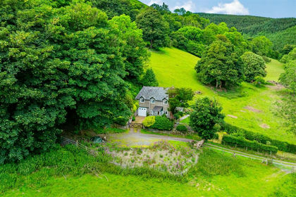
- Price
- Offers in Region of£495,000
- Size
- 1 acres
Birds Nest Cottage, Minton, Church Stretton, SY6, Church Stretton, Shropshire SY6 England
Added on 02/07/2026Cottage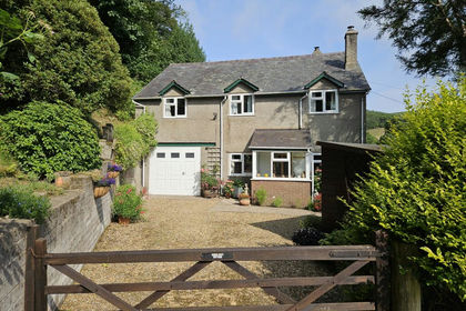
- Price
- Offers in Region of£495,000
- Size
- 1 acres
Birds Nest Cottage, Minton, Shropshire, Church Stretton, Shropshire SY6 England
Added on 16/07/2026Cottage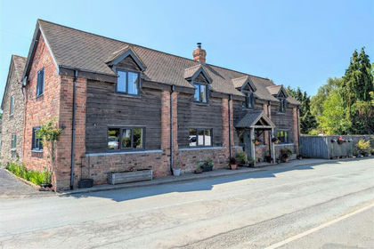
- Price
- Offers in Region of£445,000
The Old Barn, Longville, Much Wenlock, TF13, Rushbury, Shropshire TF13 England
Added on 29/01/2026Barn Conversion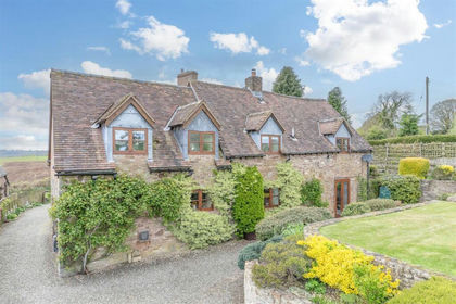
- Price
- Offers Over£475,000
Cleedownton, Ludlow, Stoke St. Milborough, Shropshire SY8 England
Added on 28/05/2026Barn Conversion
- Price
- Offers in Excess of£475,000
Aston-On-Clun, Craven Arms, SY7, Hopesay, Shropshire SY7 England
Added on 05/10/2026Barn Conversion
- Price
- Offers in Region of£365,000
Barn 3, Holt Preen Manor Barns, Plaish, Church Stretton, SY6, Cardington, Shropshire SY6 England
Added on 08/07/2026Barn Conversion