Willey Presteigne LD8
- Land size
- 215.91 acres
- Bedrooms
- 4
Key Features
- A Rare Opportunity to Acquire a Substantial Upland Farm
- Attractive recently renovated Grade II Listed Four-Bedroom Farmhouse
- Grassland and Woodland extending to 215.91 acres
- Duck Flight Pond
- Range of Farm Buildings inc. Outlying Barn
- Quiet, Private Location
- For Sale by Private Treaty
- 3 miles from the historic border town of Presteigne
Description
OLD HALL FARM, NORTH WEST HEREFORDSHIRE
A SUBSTANTIAL 215.91-ACRE COUNTRY PROPERTY WITH GRADE II LISTED FARMHOUSE, FARM BUILDINGS & DEVELOPMENT POTENTIAL
Old Hall Farm presents a rare opportunity to acquire an attractive and highly private rural holding extending to approximately 215.91 acres, comprising a recently renovated four-bedroom Grade II Listed farmhouse, a substantial range of agricultural buildings, productive grassland, woodland and a traditional farmstead with potential for alternative uses, subject to the necessary planning and listed building consents.
Occupying a scenic position in North West Herefordshire close to the Welsh Border, the property enjoys far-reaching views across the surrounding countryside and is situated approximately 3 miles from the historic market town of Presteigne.
The farm is approached via a private drive and the central farmstead is surrounded by approximately 215.91 acres of predominantly permanent pasture, together with woodland, mature hedgerows, watercourses and areas of natural regeneration.
OLD HALL FARMHOUSE
At the heart of the holding is the attractive Grade II Listed Old Hall Farmhouse, a 17th-century brick and timber-framed country house which has recently been renovated to a high standard.
The detached farmhouse provides approximately four bedrooms and retains a wealth of character features, including exposed timber beams, an open fireplace and traditional flagstone flooring. The property enjoys an idyllic rural setting with unspoilt, far-reaching views over the Herefordshire countryside.
The accommodation briefly comprises:
Ground Floor
Kitchen
A characterful farmhouse kitchen with exposed timber beams, laminate flooring, a range of fitted units, electric range cooker set within an alcove, dishwasher, space for a large fridge/freezer and inset lighting. Open access leads through to the breakfast room.
Breakfast Room
A bright room with windows to three elevations and laminate flooring.
Dining Room
With windows to the front and side elevations, together with glazed double doors providing far-reaching countryside views.
Sitting Room
With side-facing window, open fireplace and stone hearth.
Boot Room
With traditional flagstone flooring, sink, worktop and storage beneath, with space for washing machine and other appliances. The boot room provides access to the guest WC and useful understairs storage.
Cellar
Accessed from the dining room and incorporating a strip window to the front elevation.
First Floor
Bedroom One
A double bedroom with exposed timber beams to the eaves, front-facing windows and en-suite bathroom.
Undereaves Storage Room
Bedroom Two
A double bedroom with side-facing window, exposed timber beams and en-suite bathroom, together with a large storage cupboard.
Bedroom Three
With side-facing window and en-suite shower room.
Bedroom Four
With side-facing window and en-suite shower room.
Attic
Stairs rise from the first-floor landing to a useful attic space with windows to both front and rear elevations, providing valuable additional storage.
OUTSIDE
The farmhouse is approached via a path descending from the upper level to the dwelling.
The gardens and immediate surroundings occupy a particularly attractive and secluded position, with extensive views across the surrounding Herefordshire countryside. The grounds offer considerable scope for further landscaping and enhancement.
The farmhouse is served by mains electricity, private water from a borehole, private drainage via septic tank and oil-fired central heating.
THE FARMSTEAD & BUILDINGS
The farmyard occupies a central position within the holding and is approached by a private drive from the council-maintained road.
The property includes a useful range of traditional and modern agricultural buildings, providing accommodation for livestock, machinery, fodder storage and general agricultural purposes.
The buildings include:
45ft x 20ft stone and timber-framed former cart building, beneath a corrugated iron roof, with part stone and concrete block elevations.
12ft x 8ft concrete lean-to, adjoining the former cart building.
60ft x 37ft open-fronted steel-framed Dutch barn, with corrugated iron side and rear elevations.
60ft x 20.8ft open-sided four-bay steel-framed barn, with profile roof.
105ft x 27.5ft open-sided seven-bay steel-framed barn, with profile roof.
45ft x 20.8ft open-sided three-bay steel-framed barn, with profile roof.
30ft x 18ft open-fronted outlying Dutch barn, with corrugated iron side and rear elevations.
The traditional buildings may offer potential for conversion or alternative uses, subject to planning and, where applicable, listed building consent.
THE LAND
The farm extends to approximately 215.91 acres in total, predominantly comprising permanent grassland together with areas of woodland and other natural features.
The land surrounds the central farmstead and provides a varied combination of rolling pasture and woodland, with some steeper grazing areas. Fields are conveniently divided and are considered suitable for livestock grazing and general agricultural purposes.
The land benefits from roadside access onto the council-maintained road, together with good internal access from the private drive and farmstead.
Lime Brook runs through the property, providing an attractive natural water feature. The land is enclosed by a combination of mature mixed-species hedgerows and post-and-netting fencing, with additional internal hedgerows and fencing.
The land is classified by DEFRA as Grade 3 and Grade 4 agricultural land and lies at approximately 190m to 280m above sea level.
The combination of pasture, woodland, mature trees, hedgerows and watercourses creates a varied rural landscape with significant biodiversity interest and potential for future environmental enhancement.
DEVELOPMENT & ALTERNATIVE USE POTENTIAL
Old Hall Farm offers prospective purchasers the opportunity to acquire a substantial and private farmstead with a range of traditional buildings which may have potential for conversion or redevelopment, subject to planning.
The combination of the farmhouse, traditional buildings, substantial acreage and secluded setting may lend itself to a variety of future uses, potentially including residential, tourism or other rural enterprise uses, subject to the necessary planning and listed building consents.
Purchasers are advised to make their own enquiries with Herefordshire Council regarding the potential for any proposed development or change of use.
SPORTING & ENVIRONMENTAL INTEREST
Sporting rights are understood to be in hand.
The vendor has excavated a duck flight pond.
The land is currently entered into the Sustainable Farming Incentive (2026) and Mid Tier Stewardship schemes. Further information is available from the vendor.
LOCATION
Old Hall Farm occupies a private and scenic rural position in North West Herefordshire, close to the Welsh Border.
The historic market town of Presteigne is approximately 3 miles away, providing a range of everyday amenities including independent shops, cafés, restaurants, greengrocers and family butchers.
Further facilities can be found in the surrounding market towns:
Knighton – approximately 5 miles
Kington – approximately 10 miles
Ludlow – approximately 15 miles
Hereford – approximately 26 miles
The surrounding countryside is characterised by attractive rolling landscapes and forms part of the distinctive Welsh Marches, providing an appealing setting for country living, farming and a wide range of outdoor pursuits.
TENURE
We are informed that the property is freehold.
SERVICES
Mains electricity
Private borehole water supply
Private drainage tank
Oil-fired central heating
LOCAL AUTHORITY
Herefordshire Council
Council Tax Band: D
RIGHTS OF WAY, EASEMENTS & WAYLEAVES
The property is sold subject to and with the benefit of all easements, quasi-easements, wayleaves and rights of way, whether declared or otherwise.
We understand that a footpath and bridlepath cross the property, providing access for walking, riding and cycling.
ADDITIONAL INFORMATION
Entitlements are available by separate negotiation.
The agent has not tested any apparatus, equipment, fixtures, fittings or services and therefore cannot verify that they are in working order or fit for purpose. Prospective purchasers are advised to obtain appropriate verification from their solicitor or surveyor.
A RARE RURAL OPPORTUNITY
Old Hall Farm offers an exceptional combination of a characterful Grade II Listed farmhouse, substantial acreage, a private central farmstead, extensive agricultural buildings and potential for future alternative uses, all set within the beautiful Herefordshire countryside close to the Welsh Border.
Viewing is strongly recommended to appreciate the setting, scale and potential of this unique rural holding.
Viewing Arrangements, Negotiations & Any Further Information
Through DAVID PARRY & COMPANY
email: .
Presteigne Office Tel:
Map Location
Property details
- Tenure
- Ask Agent
- Council Tax Band
- Ask Agent
- Date Posted
- 2026-10-02
Market Value Analysis
Compared with 19 Farms & Smallholdings listings in West Midlands (100+ acres).
Utilities & Restrictions
Utilities
- Electricity
- Ask Agent
- Water
- Ask Agent
- Heating
- Ask Agent
- Broadband
- Ask Agent
- Sewerage
- Ask Agent
Rights & Restrictions
- Public Rights of Way
- Ask Agent
- Private Rights of Way
- Ask Agent
- Listed Property
- Ask Agent
- Restrictions
- Ask Agent
Listed status, conservation areas and planning constraints for this location are in the full report.
Property Features
- Accessibility
- Ask Agent
- Parking
- Parking Available
- Garden
- Garden
Beyond the particulars: planning activity, flood history, heritage and ground risks, checked for this exact spot.
Connectivity
Broadband
Fastest speed available at this postcode
6 Mbps
Under 10 Mbps here
Suitable for
- Basic browsing & email
Mobile signal
Predicted 4G and 5G signal; indoor signal depends on building materials.
Ofcom Connected Nations postcode-level predictions. Speeds and signal are modelled, not measured, and vary between addresses and providers.
Signal is the easy part. Planning activity, flood history and protected designations here are in the full report.
Nearest Schools
Primary
- St Mary's CofE Primary School3.7 milesOfsted: Good *
- Ages
- 2 to 11
- Pupils
- 55
- Type
- Voluntary aided school
- Faith
- Church of England
- Wigmore Primary School5.3 milesNo Ofsted rating
- Ages
- 2 to 11
- Pupils
- 169
- Type
- Academy converter
- Shobdon Primary School5.8 milesOfsted: Good
- Ages
- 5 to 11
- Pupils
- 74
- Type
- Community school
- Leintwardine Endowed CE Primary School6 milesOfsted: Good
- Ages
- 4 to 11
- Pupils
- 75
- Type
- Voluntary aided school
- Faith
- Church of England
- Pembridge CofE Primary School7.3 milesOfsted: Good *
- Ages
- 3 to 11
- Pupils
- 80
- Type
- Academy converter
- Faith
- Church of England
Secondary
- Wigmore School5.4 milesNo Ofsted rating
- Ages
- 11 to 19
- Pupils
- 467
- Type
- Academy converter
- Lady Hawkins' School7.7 milesOfsted: Good *
- Ages
- 11 to 16
- Pupils
- 281
- Type
- Academy converter
- Weobley High School12 milesNo Ofsted rating
- Ages
- 11 to 16
- Pupils
- 533
- Type
- Community school
- Ludlow Church of England School12 milesOfsted: Requires improvement *
- Ages
- 11 to 16
- Pupils
- 626
- Type
- Academy converter
- Faith
- Church of England
- Earl Mortimer College12 milesOfsted: Good
- Ages
- 11 to 16
- Pupils
- 502
- Type
- Community school
* Latest graded judgement covers quality of education only; no overall grade was issued under the 2024-25 inspection framework.
Distances are straight-line from the advertised location. Source: the national school registers (DfE, Welsh Government, Scottish Government) and Ofsted.
Schools are just the start: sold prices nearby, planning activity and any flood history are in the full report.
Amenities
Supermarket
GP surgery
Pharmacy
Hospital
Straight-line distances from the advertised location. Sources: NHS records, Geolytix supermarket locations, OS Open Greenspace and the national trails registers.
The area stacks up? Now check the location itself: planning nearby, protected designations and past flooding.
Getting Around
Nearest station
Nearest bus stop
Typical drive times
Straight-line distances from the advertised location; drive times are typical free-flow times over OpenStreetMap road data, so allow more at peak. Public transport locations from DfT NaPTAN.
Easy to reach matters. So do planning activity, flood history and ground risks: all in the full report.
Flood Risk
Environment Agency open data, checked around the advertised map pin for the listed acreage. Long-term risk counts flood defences; the planning map's flood zones do not. Provided by LandSale, not the listing agent, and not part of the agent's particulars. Risk varies across a holding, so verify before committing.
Rivers and the sea
Planning map: Flood Zone 1.
Surface water
Not at the pin: mapped about 20 metres away.
These bandings are the summary. Where this location sits on the flood maps, plus planning activity, heritage and ground risks, is in the full report.
Important notice: Information, maps and tags on this page are drawn from the advertising agent's marketing materials or generated automatically. LandSale has not verified them. Relying on these details is at your own risk, always carry out independent checks before committing to a purchase.
LandSale full disclaimer
Marketing information only - not formal particulars. The details on this website are provided for general guidance and do not constitute an offer or contract. Neither LandSale nor the advertising estate/land agent accepts responsibility for any inaccuracy.
1. Source of information
- Listing content: Core description, asking price, tenure, measurements, photographs and planning history originate from the marketing materials of the advertising estate or land agent. LandSale does not author this content and cannot guarantee its accuracy.
- Automated tags & categorisation: Property type, land-use class, acreage bands and similar labels may be applied by machine-learning models. They are intended as a helpful guide only and may not reflect the property's legal status or permitted use.
- Third-party & enriched data layers: Maps, boundary outlines, planning designations, soil reports, broadband coverage and other environmental or location-based insights are licensed from external suppliers. Such data are supplied “as is", may be incomplete or out of date and are subject to change without notice.
2. Verification required
Prospective purchasers must verify critical matters, including but not limited to planning permission, title boundaries, public rights of way, environmental constraints, acreage, services, access and VAT status, through their own inspections, specialist surveys, legal advisers and the selling agent before relying on the information or entering into any contract.
3. No warranty or liability
LandSale gives no warranty, express or implied, as to the accuracy, completeness or fitness for any particular purpose of the information displayed. LandSale shall not be liable for any loss, damage, cost or expense arising directly or indirectly from any use of or reliance on such information, save where liability may not be excluded by law.
4. Updates & feedback
If you believe any detail on this listing is inaccurate, please let us know. We will investigate and, where appropriate, update the listing or notify the agent.
© LandSale | Version 1.3 - August 2026
Listing agent
David Parry & Co, Presteigne
8 High Street, Presteigne, LD8 2BA
Similar properties for sale
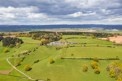
- Price
- Guide Price£3,700,000
- Size
- 286.32 acres
Pervin Farm, Hope under Dinmore, Leominster, Leominster, Herefordshire, County of HR6 England
Added on 29/01/2026Farm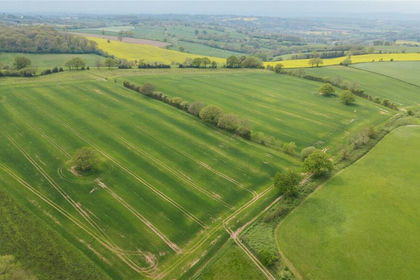
- Price
- £3,145,000
- Size
- 241.52 acres
Parsonage Farm, Kyre, Tenbury Wells, Worcestershire, Kyre, Worcestershire WR15 England
Added on 14/05/2026Farm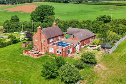
- Price
- Guide Price£3,000,000
- Size
- 144.5 acres
Sinton Green, Hallow, WR2, Grimley, Worcestershire WR2 England
Added on 16/06/2026Farm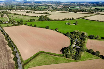
- Price
- Guide Price£2,500,000
- Size
- 214.23 acres
Yatton, Ross on Wye, Yatton, Herefordshire, County of HR9 England
Added on 14/10/2026Farm
- Price
- Guide Price£2,900,000
- Size
- 190.39 acres
Talybont-On-Usk, Brecon, Powys, LD3, Talybont-on-Usk, Powys LD3 Wales
Added on 29/01/2026Farm
- Price
- £2,900,000
- Size
- 190.39 acres
Maesmawr Farm Talybont-on-usk, Talybont-on-Usk, Powys LD3 Wales
Added on 29/01/2026Farm
- Price
- Guide Price£3,500,000
- Size
- 395 acres
Pontrhydfendigaid, Ystrad Meurig, Ystrad Fflur, Ceredigion SY25 Wales
Added on 28/01/2026Livestock Farm