Ferry Road, Surlingham, Norwich, Norfolk, NR14
- Land size
- 0.5 acres
- Bedrooms
- 6
- Bathrooms
- 5
Key Features
- Impressive Detached Barn Conversion In A Sought-After Village Location
- Five Bedrooms In The Main Barn, Offering Generous And Versatile Accommodation
- Two Established Holiday Lets Generating Impressive Income
- Wraparound Grounds Extending To Approximately Half An Acre
- Far-Reaching Countryside Views Towards The River Yare
- 37 Solar Panels And An Air Source Heat Pump
- Beautifully Presented Interiors With Character Throughout
- Extensive Shingle Driveway, Ample Parking And A Double Garage
- Easy Access To Two Popular Public Houses & Village School
- Easy Reach Of Norwich's City Centre
Description
Set within approximately half an acre (stms) in the sought-after riverside village of Surlingham, Pottles Barn offers an exceptional amount of space and flexibility. The detached barn conversion provides six bedrooms in the principal home, while Pottles Cottage and Pottles Retreat are currently run as self-contained holiday lets. Together, they create an appealing opportunity to enjoy a substantial countryside home alongside an established source of income.
A five-bar gate opens onto an extensive shingle driveway, with ample parking and access to a double garage. The gardens give the property a wonderful sense of privacy and space, with broad lawns, mature trees, established planting and places to sit and take in the surroundings. Beyond the grounds, the outlook stretches across farmland towards the River Yare. Despite its peaceful position, Pottles Barn is around seven miles south-east of Norwich, with the Norfolk Broads and wider road network within easy reach.
The principal barn offers over 2500 sq ft of accommodation, arranged to suit a large family while retaining the versatility to adapt as needs change. The sitting room is an inviting place to gather, with a bay window and feature fireplace, while a separate dining room provides space for more formal occasions. The kitchen/breakfast room is well equipped for everyday life and has room for the household to come together around the table.
Four bedrooms are situated on the ground floor, including two with en-suite facilities, alongside a family bathroom with a walk-in shower room. A further bedroom occupies the first floor, benefitting from built-in storage. This arrangement offers considerable choice for family members, visiting guests or those looking for space to work from home.
The two holiday lets add another dimension to the property. Pottles Cottage has its own open-plan sitting, dining and kitchen area, a double bedroom, a mezzanine bedroom and a shower room. Pottles Retreat is a charming open-plan log cabin offering cosy accommodation for two within the grounds. Both are currently operated as holiday lets, giving a purchaser the opportunity to continue an established venture, subject to their own plans and any necessary consents.
The current owners have also invested in solar panels, an air source heat pump and a water softener. These additions enhance the appeal of a property that already stands out for the scale of its accommodation, the breadth of its grounds and the possibilities offered by its two independent lets.
Surlingham is a particularly attractive base for enjoying this part of Norfolk. Riverside walks, the Wherryman’s Way and National Cycle Route 1 are close at hand, while the village has a primary school, farm shop, café, patisserie and two riverside pubs. Norwich is within easy reach, as are the Broads and the Norfolk coastline.
Pottles Barn brings together a sizeable family home, approximately half an acre of gardens, a beautiful rural outlook and two existing holiday lets in one of the area’s most desirable villages. Viewing is essential to appreciate the full extent of what is on offer.
Discover Surlingham;
Set on the edge of the Norfolk Broads and approximately six miles south-east of Norwich, Surlingham is widely regarded as one of South Norfolk's most desirable villages. Surrounded by open countryside and riverside walks, it offers an exceptional lifestyle for those seeking peace and tranquillity without compromising on convenience.
Pottles Barn enjoys a particularly enviable position, being just a pleasant five-minute stroll from the banks of the River Yare, the village sailing club and one of the area's popular riverside public houses. Whether you're launching a boat, walking the dog along the riverbank or enjoying a leisurely lunch overlooking the water, these wonderful amenities are all within easy reach.
The village enjoys a thriving community centred around its parish church, village hall and highly regarded primary school. Residents also benefit from two popular riverside public houses, an award-winning vineyard, farm shop, artisan patisserie and an abundance of walking and cycling routes through the Broads National Park.
Excellent road links provide straightforward access into Norwich, where a comprehensive range of shopping, leisure and rail services are available, making Surlingham an ideal location for commuters and families alike. Whether enjoying an afternoon on the River Yare, exploring the surrounding countryside or simply relaxing within this welcoming village community, Surlingham offers an enviable balance of rural charm and everyday convenience.
Additional Information:
Council Tax Band - G
Local Authority - South Norfolk Council
We have been advised that the property has the following services; mains water, mains drainage, electricity and heating is via an air source heat pump. We have been advised that the 37 Solar Panels are owned outright and are included within the sale.
Winkworth wishes to inform prospective buyers and tenants that these particulars are a guide and act as information only. All our details are given in good faith and believed to be correct at the time of printing but they don’t form part of an offer or contract. No Winkworth employee has authority to make or give any representation or warranty in relation to this property. All fixtures and fittings, whether fitted or not are deemed removable by the vendor unless stated otherwise and room sizes are measured between internal wall surfaces, including furnishings. The services, systems and appliances have not been tested, and no guarantee as to their operability or efficiency can be given.
Map Location
Property details
- Tenure
- Freehold
- Council Tax Band
- G
- Date Posted
- 2026-09-30
Utilities & Restrictions
Utilities
- Electricity
- Ask Agent
- Water
- Ask Agent
- Heating
- Ask Agent
- Broadband
- Ask Agent
- Sewerage
- Ask Agent
Rights & Restrictions
- Public Rights of Way
- Ask Agent
- Private Rights of Way
- Ask Agent
- Listed Property
- Ask Agent
- Restrictions
- Ask Agent
Listed status, conservation areas and planning constraints for this location are in the full report.
Property Features
- Accessibility
- Ask Agent
- Parking
- Parking Available
- Garden
- Garden
Beyond the particulars: planning activity, flood history, heritage and ground risks, checked for this exact spot.
Connectivity
Broadband
Fastest speed available at this postcode
5.5 Gbps
Superfast · available to 83% of premises
Suitable for
- 4K streaming on every screen
- Full-time home working
- Online gaming & big downloads
Mobile signal
Predicted 4G and 5G signal; indoor signal depends on building materials.
Ofcom Connected Nations postcode-level predictions. Speeds and signal are modelled, not measured, and vary between addresses and providers.
Signal is the easy part. Planning activity, flood history and protected designations here are in the full report.
Nearest Schools
Primary
- Surlingham Primary School645 metresOfsted: Good
- Ages
- 4 to 11
- Pupils
- 65
- Type
- Academy sponsor led
- Brundall Primary School1.2 milesNo Ofsted rating
- Ages
- 4 to 11
- Pupils
- 277
- Type
- Community school
- Rockland St Mary Primary School1.9 milesOfsted: Good
- Ages
- 2 to 11
- Pupils
- 78
- Type
- Academy sponsor led
- Little Plumstead Church of England Primary Academy2.3 milesNo Ofsted rating
- Ages
- 4 to 11
- Pupils
- 192
- Type
- Academy converter
- Faith
- Church of England
- Blofield Primary School2.3 milesNo Ofsted rating
- Ages
- 4 to 11
- Pupils
- 220
- Type
- Community school
Secondary
- Thorpe St Andrew School and Sixth Form3 milesOfsted: Good *
- Ages
- 11 to 18
- Pupils
- 1,830
- Type
- Academy converter
- Framingham Earl High School3.9 milesNo Ofsted rating
- Ages
- 11 to 16
- Pupils
- 791
- Type
- Academy converter
- The Open Academy4.3 milesOfsted: Good
- Ages
- 11 to 19
- Pupils
- 529
- Type
- Academy sponsor led
- Faith
- Church of England
- Sprowston Community Academy4.7 milesOfsted report card · May 2026
- Ages
- 11 to 18
- Pupils
- 1,702
- Type
- Academy sponsor led
- Notre Dame High School, Norwich5 milesOfsted: Good
- Ages
- 11 to 18
- Pupils
- 1,613
- Type
- Academy converter
- Faith
- Roman Catholic
* Latest graded judgement covers quality of education only; no overall grade was issued under the 2024-25 inspection framework.
Distances are straight-line from the advertised location. Source: the national school registers (DfE, Welsh Government, Scottish Government) and Ofsted.
Schools are just the start: sold prices nearby, planning activity and any flood history are in the full report.
Amenities
Supermarket
GP surgery
Pharmacy
Hospital
Green space
Straight-line distances from the advertised location. Sources: NHS records, Geolytix supermarket locations, OS Open Greenspace and the national trails registers.
The area stacks up? Now check the location itself: planning nearby, protected designations and past flooding.
Getting Around
Nearest station
Nearest bus stop
Typical drive times
Straight-line distances from the advertised location; drive times are typical free-flow times over OpenStreetMap road data, so allow more at peak. Public transport locations from DfT NaPTAN.
Easy to reach matters. So do planning activity, flood history and ground risks: all in the full report.
Flood Risk
Environment Agency open data, checked around the advertised map pin for the listed acreage. Long-term risk counts flood defences; the planning map's flood zones do not. Provided by LandSale, not the listing agent, and not part of the agent's particulars. Risk varies across a holding, so verify before committing.
Rivers and the sea
Planning map: Flood Zone 1.
Surface water
Not at the pin: mapped about 20 metres away.
These bandings are the summary. Where this location sits on the flood maps, plus planning activity, heritage and ground risks, is in the full report.
Important notice: Information, maps and tags on this page are drawn from the advertising agent's marketing materials or generated automatically. LandSale has not verified them. Relying on these details is at your own risk, always carry out independent checks before committing to a purchase.
LandSale full disclaimer
Marketing information only - not formal particulars. The details on this website are provided for general guidance and do not constitute an offer or contract. Neither LandSale nor the advertising estate/land agent accepts responsibility for any inaccuracy.
1. Source of information
- Listing content: Core description, asking price, tenure, measurements, photographs and planning history originate from the marketing materials of the advertising estate or land agent. LandSale does not author this content and cannot guarantee its accuracy.
- Automated tags & categorisation: Property type, land-use class, acreage bands and similar labels may be applied by machine-learning models. They are intended as a helpful guide only and may not reflect the property's legal status or permitted use.
- Third-party & enriched data layers: Maps, boundary outlines, planning designations, soil reports, broadband coverage and other environmental or location-based insights are licensed from external suppliers. Such data are supplied “as is", may be incomplete or out of date and are subject to change without notice.
2. Verification required
Prospective purchasers must verify critical matters, including but not limited to planning permission, title boundaries, public rights of way, environmental constraints, acreage, services, access and VAT status, through their own inspections, specialist surveys, legal advisers and the selling agent before relying on the information or entering into any contract.
3. No warranty or liability
LandSale gives no warranty, express or implied, as to the accuracy, completeness or fitness for any particular purpose of the information displayed. LandSale shall not be liable for any loss, damage, cost or expense arising directly or indirectly from any use of or reliance on such information, save where liability may not be excluded by law.
4. Updates & feedback
If you believe any detail on this listing is inaccurate, please let us know. We will investigate and, where appropriate, update the listing or notify the agent.
© LandSale | Version 1.3 - August 2026
Listing agent
Winkworth, Poringland
Unit 2 Overtons Way, Poringland, NR14 7WB
Similar properties for sale
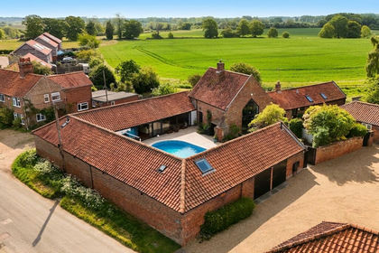
- Price
- Guide Price£930,000
The Street, Rockland St. Mary, Norwich, Rockland St. Mary, Norfolk NR14 England
Added on 25/09/2026Barn Conversion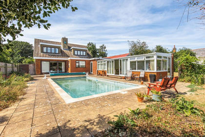
- Price
- Guide Price£650,000
- Size
- 1 acres
Award Winning Detached Family Home in Rockland St Mary, Rockland St. Mary, Norfolk NR14 England
Added on 15/09/2026House with Land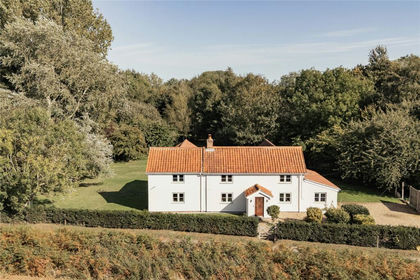
- Price
- Offers in Excess of£900,000
- Size
- 1.89 acres
Lower Road, Rockland St. Mary, Norwich, Norfolk, NR14, Claxton, Norfolk NR14 England
Added on 11/05/2026House with Land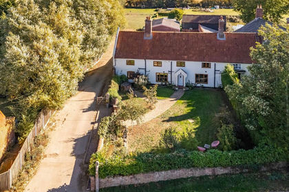
- Price
- Offers in Region of£750,000
- Size
- 1.17 acres
Lingwood, Norwich, Lingwood and Burlingham, Norfolk NR13 England
Added on 06/10/2026House with Land
- Price
- Guide Price£600,000
- Size
- 1 acres
Added on 08/08/2026House with Land
- Price
- Guide Price£850,000
- Size
- 4 acres
South Walsham Road, Panxworth, Norwich, Norfolk, NR13, Woodbastwick, Norfolk NR13 England
Added on 27/08/2026Cottage
- Price
- Offers in Excess of£650,000
Added on 13/08/2026Barn Conversion
- Price
- Offers Over£800,000
Panxworth Road, South Walsham, South Walsham, Norfolk NR13 England
Added on 26/06/2026Barn Conversion
- Price
- Guide Price£1,000,000
- Size
- 28 acres
Wroxham Road, Rackheath, Norfolk, NR13, Rackheath, Norfolk NR13 England
Added on 12/08/2026House with Land
- Price
- Guide Price£750,000
- Size
- 0.32 acres
Moulton Barns, Moulton St. Mary, Norwich, Beighton, Norfolk NR13 England
Added on 25/09/2026Barn Conversion