Sulgrave Road, Greatworth, Banbury
- Land size
- 11 acres
- Bedrooms
- 3
- Bathrooms
- 2
Key Features
- 3 bedroom detached bungalow extending to 2,323 sq. ft with integrated garage
- Separate detached outbuilding/workshop
- 36,600 sq. ft of nursery and glass buildings with potential for alternative uses (subject to planning)
- Set within 11 acres of agricultural land
Description
A rare opportunity to acquire a unique rural lifestyle property featuring a individual professionally built stone bungalow, together with extensive versatile infrastructure suitable for alternative uses subject to planning, set within 11 acres.
Situation - Home Nurseries is located to the north of the Northamptonshire village of Greatworth. The local market town of Brackley is approximately 5.5 miles to the southeast, with the market town of Banbury approximately 7.5 miles west, and the town of Northampton approximately 21 miles east, with both providing a range of local and amenity services, with vast education and employment opportunities.
The property is located off the B4525, with Junction 11 of the M40 approximately 6.5 miles west, as well as the A422 providing access to Brackley and major trunk roads such s the A5 and A43. The property benefits from good connectivity to the Midland’s road network, with Banbury and Northampton providing mainline railway stations to London Euston and Birmingham New Street.
The property is shown on the location plan.
Description - Home Nurseries is a unique rural lifestyle property, with potential for alternative uses subject to planning. Commanding a prominent position within the 11 acre plot is an individual professionally built stone detached bungalow which was built in 1990, providing excellent accommodation throughout. Situated within its own plot with landscaped gardens to the south and west, complete with an ornamental pond to the rear, the bungalow is approached directly from the public highway via a block paved driveway providing extensive parking.
The bungalow is a contemporary rural property providing generous accommodation throughout, arranged over one floor with scope for extension (subject to planning) and sympathetic modernisation throughout. It should be noted that the oil fired viler is approximately 4 years old which was replaced together with all the radiators in necessary pipework at the same time. Externally, the property is of stone construction under a tile roof, with an integrated double garage complete with remote control electric up and over doors, an outdoor office space and a detached outbuilding/workshop.
The accommodation is shown on the floorplan and comprises:
Reception Hall
Sitting Room
Conservatory
Kitchen/Diner
Utility Room
Bedroom 1 with ensuite
Bedroom 2
Bedroom 3
Family Bathroom
Outside - Externally, the property benefits approximately 36,600 sq. ft of glasshouses which have previously been used for horticultural purposes until circa 2010. In addition, there are further outbuildings on the property which have been used for varying purposes. It is understood that the buildings benefit from a 3-phase electricity supply and water supplied via a borehole.
The land extends to approximately 5.5 acres (2.23 hectares) and comprises a single enclosure of permanent pasture which has bee used for livestock grazing purposes historically. The external boundaries are made up of post and stock wire fencing as well as mature hedgerow and tree boundaries. It is understood that the land does not benefit from any services.
Services - Home Nurseries benefits from mains electricity, water supplied from a borehole which is located to the rear of the property which is pumped via a compression tank, private drainage via a septic tank which is located in the lawn to the front of the bungalow and oil fired central heating. The outbuildings are understood to benefit from a three-phase electric supply and a natural water supply.
It is understood that the property benefits from solar panel heating, which generates approximately £3,000 of income per annum.
Planning - Historically the property has been used as part of a horticultural business, which ceased trading in 2010. A pre-application was submitted in September 2025 on behalf of the vendor for the proposed redevelopment of a commercial agricultural/horticultural site to low key commercial units. The summary of advice from the planning officer confirmed that the principle of development is capable of being acceptable, however it would need to be demonstrated that the proposed development would result in acceptable impact on the wider neighbouring settlement confine and would need to provide a justification for the sustainability of the scheme without the need for a private car. For further details, please contact the vendor’s Agent.
The property was previously subject to the agricultural occupancy condition, however, this was successfully removed in July 2026.
It is the responsibility of the purchaser to make their own enquiries as to the planning history of the property.
Plan, Area & Description - The property is currently registered under title numbers NN362878 and NN164291.
Please note field numbers quoted may not match the RPA field numbers and a plan is for identification purposes only.
The plan, area and description are believed to be correct in every way, but no claim will be entertained by the vendor or the agent in respect of any error, omissions and misdescriptions.
Tenure & Possession - The property will be sold freehold with vacant possession given upon completion.
Rights Of Way Etc. - The property can be accessed directly off the public highway known as Sulgrave Road, with a block paved driveway giving access to the front of the property.
It is understood that a public footpath crosses through the agricultural land from north to south.
Council Tax - Home Nurseries is within Council Tax Band F and the amount payable for 2026/27 is £3,647.37.
Development Overage - The vendor will impose a development overage on any non-agricultural or non-private equestrian development over the entirety of the property for a period of 30 years at 30% which will be triggered on the earlier of either implementation of planning permission or disposal where the land that is disposed of includes the whole or any part (s) of the property with the benefit of that planning permission.
For clarity, it excludes any agricultural or equestrian development.
Local Authority & Utilities - West Northamptonshire Council Tel.
Western Power Tel.
Sporting, Timber And Mineral Rights - All rights are believed to be held with the freehold owner and will be included within the sale.
Method Of Sale - The property is offered for sale by private treaty and any interested party should submit their unconditional offers to the Agent’s Towcester Office for the attention of Tayla Cave.
Lotting - The vendor reserves the right to offer the property for sale in any other order than that described in these particulars, subdivide, amalgamate or withdraw the property from sale without prior notice.
What3words - ///trickster.resources.polka
Epc Rating - Home Nurseries has a rating of C (72) with potential for C (78).
Viewing - Viewing is strictly but appointment by contacting Tayla Cave on or email Tayla. . Please note, this is a working property and therefore appropriate health and safety advice, and bio-security measures must be taken.
Anti Money Laundering Regulations - We are required under due diligence, as set up under HMRC, to take a full identification (e.g. photo ID and recent utility bill as proof of address) of a potential purchaser prior to accepting an offer on a property.
To enable us to comply with the Money Laundering Regulations we need to verify the buyer’s identity before proceeding with a sale. We charge a small administration fee for conducting an electronic AML verification check via our online provider, MoveButler.
Amc - If you would like to discuss financing a purchase of agricultural land, please speak to our recommended AMC agents (Tayla Cave or Andrew Pinny) who will be happy to discuss this with you and make an introduction to AMC on your behalf.
Map Location
Property details
- Tenure
- Ask Agent
- Council Tax Band
- Ask Agent
- Date Posted
- 2026-09-25
Market Value Analysis
Compared with 77 Homes with Land listings in East Midlands (10+ acres).
Utilities & Restrictions
Utilities
- Electricity
- Mains
- Water
- Mains
- Heating
- Electric Heating
- Broadband
- Ask Agent
- Sewerage
- Septic Tank / Private
Rights & Restrictions
- Public Rights of Way
- Ask Agent
- Private Rights of Way
- Ask Agent
- Listed Property
- Ask Agent
- Restrictions
- Ask Agent
Listed status, conservation areas and planning constraints for this location are in the full report.
Property Features
- Accessibility
- Ask Agent
- Parking
- Parking Available
- Garden
- Garden
Beyond the particulars: planning activity, flood history, heritage and ground risks, checked for this exact spot.
Connectivity
Broadband
Fastest speed available at this postcode
1 Gbps
Gigabit full fibre
Suitable for
- 4K streaming on every screen
- Full-time home working
- Online gaming & big downloads
Mobile signal
Predicted 4G and 5G signal; indoor signal depends on building materials.
Ofcom Connected Nations postcode-level predictions. Speeds and signal are modelled, not measured, and vary between addresses and providers.
Signal is the easy part. Planning activity, flood history and protected designations here are in the full report.
Nearest Schools
Primary
- Greatworth Primary School644 metresOfsted: Good *
- Ages
- 4 to 11
- Pupils
- 86
- Type
- Community school
- Farthinghoe Primary School2.2 milesOfsted: Good *
- Ages
- 4 to 11
- Pupils
- 16
- Type
- Academy converter
- Helmdon Primary School2.3 milesOfsted: Good
- Ages
- 4 to 11
- Pupils
- 126
- Type
- Community school
- Culworth Church of England Primary Academy2.4 milesOfsted: Good *
- Ages
- 2 to 11
- Pupils
- 109
- Type
- Academy converter
- Faith
- Church of England
- Middleton Cheney Primary Academy3.2 milesOfsted report card · Mar 2026
- Ages
- 4 to 11
- Pupils
- 322
- Type
- Academy converter
Secondary
- Chenderit School2.9 milesOfsted: Good
- Ages
- 11 to 18
- Pupils
- 1,104
- Type
- Academy converter
- Blessed George Napier Catholic School and Sixth Form6.5 milesOfsted: Good
- Ages
- 11 to 18
- Pupils
- 943
- Type
- Academy converter
- Faith
- Roman Catholic
- Futures Institute Banbury6.5 milesNo Ofsted rating
- Ages
- 14 to 18
- Pupils
- 116
- Type
- Studio schools
- Wykham Park6.6 milesNo Ofsted rating
- Ages
- 11 to 18
- Pupils
- 800
- Type
- Academy sponsor led
- North Oxfordshire Academy7.2 milesNo Ofsted rating
- Ages
- 11 to 19
- Pupils
- 1,004
- Type
- Academy sponsor led
* Latest graded judgement covers quality of education only; no overall grade was issued under the 2024-25 inspection framework.
Distances are straight-line from the advertised location. Source: the national school registers (DfE, Welsh Government, Scottish Government) and Ofsted.
Schools are just the start: sold prices nearby, planning activity and any flood history are in the full report.
Amenities
Supermarket
GP surgery
Pharmacy
Hospital
Green space
Straight-line distances from the advertised location. Sources: NHS records, Geolytix supermarket locations, OS Open Greenspace and the national trails registers.
The area stacks up? Now check the location itself: planning nearby, protected designations and past flooding.
Getting Around
Nearest station
Nearest bus stop
Typical drive times
Straight-line distances from the advertised location; drive times are typical free-flow times over OpenStreetMap road data, so allow more at peak. Public transport locations from DfT NaPTAN.
Easy to reach matters. So do planning activity, flood history and ground risks: all in the full report.
Flood Risk
Environment Agency open data, checked around the advertised map pin for the listed acreage. Long-term risk counts flood defences; the planning map's flood zones do not. Provided by LandSale, not the listing agent, and not part of the agent's particulars. Risk varies across a holding, so verify before committing.
Rivers and the sea
Planning map: Flood Zone 1.
Surface water
Not at the pin: mapped about 50 metres away.
These bandings are the summary. Where this location sits on the flood maps, plus planning activity, heritage and ground risks, is in the full report.
Important notice: Information, maps and tags on this page are drawn from the advertising agent's marketing materials or generated automatically. LandSale has not verified them. Relying on these details is at your own risk, always carry out independent checks before committing to a purchase.
LandSale full disclaimer
Marketing information only - not formal particulars. The details on this website are provided for general guidance and do not constitute an offer or contract. Neither LandSale nor the advertising estate/land agent accepts responsibility for any inaccuracy.
1. Source of information
- Listing content: Core description, asking price, tenure, measurements, photographs and planning history originate from the marketing materials of the advertising estate or land agent. LandSale does not author this content and cannot guarantee its accuracy.
- Automated tags & categorisation: Property type, land-use class, acreage bands and similar labels may be applied by machine-learning models. They are intended as a helpful guide only and may not reflect the property's legal status or permitted use.
- Third-party & enriched data layers: Maps, boundary outlines, planning designations, soil reports, broadband coverage and other environmental or location-based insights are licensed from external suppliers. Such data are supplied “as is", may be incomplete or out of date and are subject to change without notice.
2. Verification required
Prospective purchasers must verify critical matters, including but not limited to planning permission, title boundaries, public rights of way, environmental constraints, acreage, services, access and VAT status, through their own inspections, specialist surveys, legal advisers and the selling agent before relying on the information or entering into any contract.
3. No warranty or liability
LandSale gives no warranty, express or implied, as to the accuracy, completeness or fitness for any particular purpose of the information displayed. LandSale shall not be liable for any loss, damage, cost or expense arising directly or indirectly from any use of or reliance on such information, save where liability may not be excluded by law.
4. Updates & feedback
If you believe any detail on this listing is inaccurate, please let us know. We will investigate and, where appropriate, update the listing or notify the agent.
© LandSale | Version 1.3 - August 2026
Listing agent
Howkins & Harrison LLP, Towcester
98A Watling Street East, Towcester, NN12 6BT
Contact Howkins & Harrison LLP, Towcester
98A Watling Street East, Towcester, NN12 6BT
View agent profileSimilar properties for sale
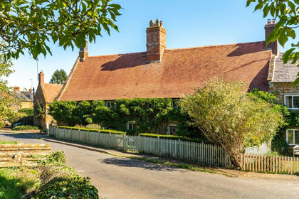
- Price
- Guide Price£1,600,000
- Size
- 5.21 acres
Wardington, Oxfordshire, Wardington, Oxfordshire OX17 England
Added on 18/09/2026House with Land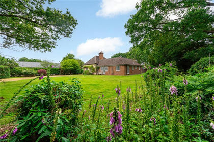
- Price
- £1,150,000
- Size
- 6 acres
Akeley Wood, Akeley, Buckingham, Buckinghamshire, MK18, Akeley, Buckinghamshire MK18 England
Added on 12/04/2026House with Land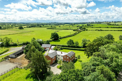
- Price
- Guide Price£1,500,000
- Size
- 12.81 acres
Added on 04/09/2026Equestrian property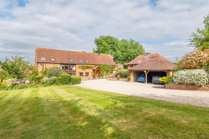
- Price
- £1,450,000
- Size
- 7.5 acres
The Barn, Fir Tree Farm, Bascote, Southam, Long Itchington, Warwickshire CV47 England
Added on 30/04/2026Barn Conversion
- Price
- £1,425,000
- Size
- 9.3 acres
Added on 28/08/2026Equestrian property
- Price
- Guide Price£1,300,000
- Size
- 14 acres
Thame Road, Piddington, Oxfordshire., Piddington, Oxfordshire OX25 England
Added on 10/05/2026Barn Conversion
- Price
- £1,400,000
- Size
- 5 acres
Added on 07/09/2026Equestrian property
- Price
- £1,350,000
- Size
- 6.87 acres
Dry Leys Farm, Quainton, Buckinghamshire, HP22, Quainton, Buckinghamshire HP22 England
Added on 18/04/2026Farmhouse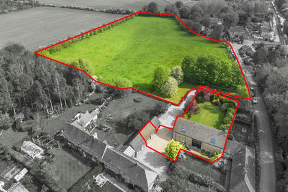
- Price
- Guide Price£1,250,000
- Size
- 5.29 acres
Canal Road, Thrupp, OX5, Shipton-on-Cherwell and Thrupp, Oxfordshire OX5 England
Added on 08/08/2026Barn Conversion
- Price
- Guide Price£1,000,000
- Size
- 5 acres
Added on 15/07/2026Farmhouse