Britwell Salome, Watlington
- Land size
- 9 acres
- Bedrooms
- 8
- Bathrooms
- 4
Key Features
- Lovely country house with a handsome Georgian frontage and exceptional period character
- Eight double bedrooms with generous, beautifully proportioned reception rooms
- Excellent secondary accommodation, stables and extensive period outbuildings with considerable potential
- Glorious gardens and grounds with a swimming pool, tennis court, orchard and nine-acre field
- Peaceful Chilterns setting close to Watlington, Wallingford, Henley-on-Thames and Oxford
- Excellent London connections via the M40 and fast rail services to Paddington and Marylebone
Description
There has been a house on this spot since the fifteenth century, and you can feel it. What greets you to day is a handsome Georgian front in a quiet corner of Britwell Salome, below the Chiltern escarpment — a house that has grown gently over five hundred years and is all the better for it.
Why We Love The Priory - There has been a house on this spot since the fifteenth century, and you can feel it. What greets you to day is a handsome Georgian front in a quiet corner of Britwell Salome, below the Chiltern escarpment — a house that has grown gently over five hundred years and is all the better for it. Wide oak boards worn smooth underfoot, fireplaces built for real fires, and floor-to - ceiling sash windows that pull the light deep into the rooms: the character here was earned, not applied.’
The front door opens into a proper reception hall, the kind that sets the tone for a house, with three fine reception rooms leading off it. The drawing room runs to 34 feet, with windows on three sides, so it is bright from breakfast until the light goes; the dining room has an inglenook that comes into its own on winter evenings; and there is a smaller, cosier sitting room for everything in between.
The kitchen is where the house really lives. Timber beams overhead, an Aga at its heart, Shaker cabinetry around a generous island, and room for a table where most of family life will inevitably happen — with a walk-in pantry, a boot room for muddy dogs and wellies, and a quiet study close by.
Upstairs are eight bedrooms, every one a double — a rare thing, and a house party waiting to happen. The principal room looks out on two sides and has its own dressing room and bathroom; two more bedrooms are en suite, and a large family bathroom serves the rest.
The Courtyard and Outbuildings
The drive sweeps past the front door to a courtyard flanked by period barns and outbuildings, and it is here that the Priory - once home to The Priory Vintage Car Company for 22 years since 2000 - reveals its ambitions. One outbuilding holds an office beneath a magnificent double- height vaulted ceiling — a place to work that no commute could rival — with a self- contained two-bedroom flat above the stables, complete with its own reception room, kitchen and bathroom, ready for guests, grandparents or a housekeeper. The great barn offers garaging and storage on a scale that invites ideas: studio, party barn, collection of cars. The potential is considerable.
Glorious Gardens and Grounds
The gardens unfold in a series of rooms of their own. A walled garden hides a folly; a walled kitchen garden with its glasshouse keeps the table supplied through the seasons; and an orchard, immaculate lawns, clipped hedges and fine mature trees do the rest. There is a tennis court, a swimming pool with its own pavilion, and beyond it all a nine-acre field — the full country life, in other words, arranged around a house that has been practising it since the fifteenth century.
Chapters Past - The Priory marked on Ordnance Survey maps — was the manor farmhouse of Britwell Prior, an ancient estate whose story begins with a queen’s gift and runs through medieval Canterbury, a lost royal castle and one of Oxfordshire’s great recusant families.
Britwell Salome lies on the spring line at the foot of the Chiltern Hills, where the prehistoric Icknield Way — the oldest road in Britain — cuts through the parish. The village appears in The Domesday Book: held before the Conquest by the Saxon thegn Wulfstan, by 1086 it had passed to Miles Crispin, fi rst castellan of Wallingford Castle, and became part of the great honour of Wallingford. Its curious second name is a corruption of de Sulham, the family who held the manor in the Middle Ages. The parish church of St Nicholas, in part Norman work, has stood since the twelfth century.
Rising behind the house is Castle Hill, site of a small royal castle raised in the early twelfth century. Commanding the road between Watlington and the great fortress at Wallingford, it played its part in the civil war between King Stephen and the Empress Matilda — “the Anarchy” — before Henry II ordered it razed after 1154. Tradition holds that its stones were carried down the hill and built into the chapel that once stood beside The Priory.
In the eleventh century Queen Emma — wife of both King Æthelred the Unready and King Cnut — granted part of Britwell to Christ Church Priory, Canterbury. The priory’s lands, tenants and chapel became known as Britwell Prior, a manor and parish in its own right, so thoroughly entangled with its neighbour that in 1685 the vicar despaired of “the greatest intricacy and confusion imaginable” over their boundaries: one little village, he wrote, “made up of two little parishes”, its two churches standing “not above a bow’s shoot from one another”. The Priory was the principal farmhouse of this Canterbury manor — the very heart of Britwell Prior — and its name preserves the connection to this day.
The Setting - Britwell Salome sits on the rolling chalk country of the Chilterns National Landscape and it is the sort of village that keeps things simple: a good pub, a farm shop, and hills in every direction.
Everything else is a mile up the road in Watlington, a market town that punches well above its size — a proper butcher, a delicatessen, a library, a Co-op, an antique shop, tennis and bowls clubs, and both an Outstanding-rated primary school and a well- regarded secondary. Seven miles away, the Saxon town of Wallingford earns its keep on the Thames: a Waitrose, antique shops and boutiques, a traditional market in the square every Friday, its own cinema and theatre, and a sports park where the cricket, rugby, football, hockey and rowing clubs are all long established. When more is wanted, Henley-on- Thames is ten miles to the southeast and Oxford fourteen to the northeast.
For all its seclusion, The Priory is easily reached: the M40 is four miles away, putting London, the M25 and the Midlands within comfortable range, while trains run from Didcot Parkway (about 12 miles) to Paddington in around 40 minutes, and from Princes Risborough (about 11 miles) to Marylebone in much the same time.
Schools
Schooling is a particular strength of this Schooling is a particular strength of this corner of Oxfordshire. The prep schools at Moulsford on the Thames — Moulsford Prep and Cranford School — are within twenty minutes, with Rupert House at Henley and The Oratory Prep at Goring Heath close behind. Senior options run from The Oratory at Woodcote and Shiplake College near Henley to Abingdon, St Helen & St Katharine and Radley, while Oxford brings Magdalen College School, the Dragon, Summer Fields, Headington and Oxford High within reach; Wycombe Abbey, Pangbourne College and Eton College complete the picture.
Map Location
Property details
- Tenure
- Freehold
- Council Tax Band
- H
- Date Posted
- 2026-09-22
Market Value Analysis
Compared with 471 Homes with Land listings in South East England (5+ acres).
Energy Performance Certificate
Energy Efficiency Rating
Based on UK Energy Performance Certificate standards (EU Directive 2002/91/EC)
Running costs are one side. Planning activity, flood history and ground risks for this location are in the full report.
Utilities & Restrictions
Utilities
- Electricity
- Ask Agent
- Water
- Ask Agent
- Heating
- Ask Agent
- Broadband
- Ask Agent
- Sewerage
- Ask Agent
Rights & Restrictions
- Public Rights of Way
- Ask Agent
- Private Rights of Way
- Ask Agent
- Listed Property
- Ask Agent
- Restrictions
- Ask Agent
Listed status, conservation areas and planning constraints for this location are in the full report.
Property Features
- Accessibility
- Ask Agent
- Parking
- Parking Available
- Garden
- Garden
Beyond the particulars: planning activity, flood history, heritage and ground risks, checked for this exact spot.
Connectivity
Broadband
Fastest speed available at this postcode
80 Mbps
Superfast
Suitable for
- HD streaming
- Video calls
- Web & social
Mobile signal
Predicted 4G and 5G signal; indoor signal depends on building materials.
Ofcom Connected Nations postcode-level predictions. Speeds and signal are modelled, not measured, and vary between addresses and providers.
Signal is the easy part. Planning activity, flood history and protected designations here are in the full report.
Nearest Schools
Primary
- Watlington Primary School1.3 milesOfsted: Good *
- Ages
- 3 to 11
- Pupils
- 227
- Type
- Academy converter
- Ewelme CofE Primary School2.2 milesNo Ofsted rating
- Ages
- 4 to 11
- Pupils
- 92
- Type
- Voluntary aided school
- Faith
- Church of England
- RAF Benson Community Primary School2.7 milesOfsted: Good
- Ages
- 4 to 11
- Pupils
- 123
- Type
- Community school
- Chalgrove Community Primary School3.1 milesNo Ofsted rating
- Ages
- 3 to 11
- Pupils
- 220
- Type
- Academy converter
- Lewknor Church of England Primary School3.7 milesOfsted: Good *
- Ages
- 4 to 11
- Pupils
- 74
- Type
- Voluntary controlled school
- Faith
- Church of England
Secondary
- Icknield Community College1.3 milesNo Ofsted rating
- Ages
- 11 to 16
- Pupils
- 804
- Type
- Academy converter
- Wallingford School4.7 milesNo Ofsted rating
- Ages
- 11 to 18
- Pupils
- 1,507
- Type
- Academy converter
- Langtree School7.3 milesOfsted: Good
- Ages
- 11 to 16
- Pupils
- 626
- Type
- Academy converter
- Lord Williams's School7.8 milesOfsted: Good
- Ages
- 11 to 18
- Pupils
- 2,259
- Type
- Academy converter
- Maiden Erlegh Chiltern Edge8.6 milesOfsted: Good
- Ages
- 11 to 16
- Pupils
- 374
- Type
- Academy sponsor led
* Latest graded judgement covers quality of education only; no overall grade was issued under the 2024-25 inspection framework.
Distances are straight-line from the advertised location. Source: the national school registers (DfE, Welsh Government, Scottish Government) and Ofsted.
Schools are just the start: sold prices nearby, planning activity and any flood history are in the full report.
Amenities
Supermarket
GP surgery
Pharmacy
Hospital
Green space
Walking trail
Straight-line distances from the advertised location. Sources: NHS records, Geolytix supermarket locations, OS Open Greenspace and the national trails registers.
The area stacks up? Now check the location itself: planning nearby, protected designations and past flooding.
Getting Around
Nearest station
Nearest bus stop
Typical drive times
Straight-line distances from the advertised location; drive times are typical free-flow times over OpenStreetMap road data, so allow more at peak. Public transport locations from DfT NaPTAN.
Easy to reach matters. So do planning activity, flood history and ground risks: all in the full report.
Flood Risk
From Environment Agency flood map open data, checked around the advertised map pin and allowing for the listed acreage where known. This summary comes from LandSale, the advertising platform, not from the listing agent, and is not part of the agent's particulars. Risk can vary across a single holding, so verify anything critical through your own searches before committing.
Rivers and the sea
Surface water
Also mapped within the area searched, about 110 metres around the pin: a 1 in 30 or greater chance each year from about 20 metres and a 1 in 100 to 1 in 1000 chance each year from about 10 metres.
Higher risk nearbyThese bandings are the summary. Where this location sits on the flood maps, plus planning activity, heritage and ground risks, is in the full report.
Important notice: Information, maps and tags on this page are drawn from the advertising agent's marketing materials or generated automatically. LandSale has not verified them. Relying on these details is at your own risk, always carry out independent checks before committing to a purchase.
LandSale full disclaimer
Marketing information only - not formal particulars. The details on this website are provided for general guidance and do not constitute an offer or contract. Neither LandSale nor the advertising estate/land agent accepts responsibility for any inaccuracy.
1. Source of information
- Listing content: Core description, asking price, tenure, measurements, photographs and planning history originate from the marketing materials of the advertising estate or land agent. LandSale does not author this content and cannot guarantee its accuracy.
- Automated tags & categorisation: Property type, land-use class, acreage bands and similar labels may be applied by machine-learning models. They are intended as a helpful guide only and may not reflect the property's legal status or permitted use.
- Third-party & enriched data layers: Maps, boundary outlines, planning designations, soil reports, broadband coverage and other environmental or location-based insights are licensed from external suppliers. Such data are supplied “as is", may be incomplete or out of date and are subject to change without notice.
2. Verification required
Prospective purchasers must verify critical matters, including but not limited to planning permission, title boundaries, public rights of way, environmental constraints, acreage, services, access and VAT status, through their own inspections, specialist surveys, legal advisers and the selling agent before relying on the information or entering into any contract.
3. No warranty or liability
LandSale gives no warranty, express or implied, as to the accuracy, completeness or fitness for any particular purpose of the information displayed. LandSale shall not be liable for any loss, damage, cost or expense arising directly or indirectly from any use of or reliance on such information, save where liability may not be excluded by law.
4. Updates & feedback
If you believe any detail on this listing is inaccurate, please let us know. We will investigate and, where appropriate, update the listing or notify the agent.
© LandSale | Version 1.3 - August 2026
Listing agent
Blue Book, Covering the Country and London
Covering London
Similar properties for sale
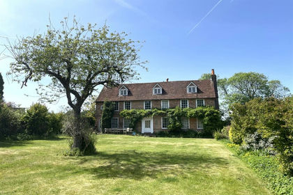
- Price
- Guide Price£2,750,000
- Size
- 11.59 acres
Old Farm House, Stoke Row, Henley-on-Thames, Stoke Row, Oxfordshire RG9 England
Added on 29/01/2026House with Land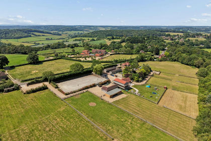
- Price
- Guide Price£2,000,000
- Size
- 6.5 acres
The Haven, Marlow Rd, Cadmore End, Buckinghamshire, Lane End, Buckinghamshire HP14 England
Added on 11/08/2026Equestrian property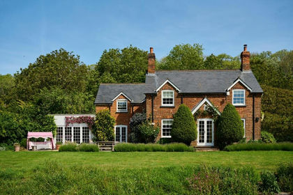
- Price
- £2,500,000
- Size
- 5.5 acres
Bledlow Ridge, High Wycombe, Bledlow-cum-Saunderton, Buckinghamshire HP14 England
Added on 18/06/2026Country Home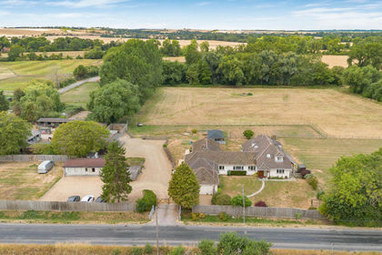
- Price
- £1,975,000
- Size
- 5 acres
Bessels Way, Blewbury, OX11, Blewbury, Oxfordshire OX11 England
Added on 10/08/2026House with Land
- Price
- £2,600,000
- Size
- 16 acres
Harley Wood Farm, Reading, Berkshire, Basildon, West Berkshire RG8 England
Added on 21/08/2026House with Land
- Price
- Guide Price£2,850,000
- Size
- 6.5 acres
Added on 27/02/2026Country Home
- Price
- Guide Price£2,250,000
- Size
- 34.82 acres
Added on 29/01/2026Farm
- Price
- Guide Price£2,600,000
- Size
- 4 acres
Spring Lane, Maidenhead, SL6, Cookham, Windsor and Maidenhead SL6 England
Added on 24/06/2026House with Land
- Price
- Guide Price£2,250,000
- Size
- 8 acres
Terrick, Buckinghamshire, Ellesborough, Buckinghamshire HP17 England
Added on 16/04/2026House with Land
- Price
- Guide Price£2,200,000
- Size
- 6 acres
Added on 09/09/2026House with Land