Detached Bungalow with 1.25 Acres in the Peaceful Village of High Kelling
- Land size
- 1.25 acres
- Bedrooms
- 3
- Bathrooms
- 1
Key Features
- Guide Price £650,000 - £700,00
- Substantial Detached Bungalow in Highly Peaceful Village Setting
- Almost 1.25 Acres (STMS)
- Three Generous Bedrooms
- Large Dual-Aspect Sitting Room
- French Doors Opening onto the Garden
- Kitchen/Breakfast Room
- Integral Garage
- Mature Gardens and Partially Wooded Grounds
- Potential for Further Development (STPP)
Description
Guide Price £650,000 - £700,00.
Set amongst mature gardens, woodland and an abundance of nature, this spacious three-bedroom bungalow offers generous accommodation together with an unusually large and private plot.
The accommodation comprises three good-sized bedrooms, a family bathroom, a large dual-aspect sitting room with French doors opening onto the garden, and a kitchen/breakfast room. The property also benefits from an integral garage.
The grounds are undoubtedly one of the property’s standout features, extending to approximately 1.25 acres. Formal gardens surround the bungalow before giving way to areas of mature planting and woodland, creating a wonderfully private and tranquil environment. There has previously been exploration into the potential for additional dwellings within the grounds, subject to planning permission.
Having been in the same ownership for almost 50 years, the bungalow was originally built by the current owners with their later years in mind. The peace and quiet, together with the surrounding wildlife and countryside, have been a much-loved feature of living here.
The property also enjoys excellent access to the surrounding countryside, with a footpath from the rear leading across the fields and into Bodham Woods, whilst a further route from the road leads towards Selbrigg Pond.
HIGH KELLING
Driving through the pine forest-lined road as you arrive at High Kelling on a sunny day, you instinctively know you are close to the coast and there’s a timelessness to this area that has been entertaining day-trippers and holidaymakers for decades. Less than two miles from Holt, the North Norfolk Railway steam train stops here and the 40s weekend sees the area come to life with visitors dressed in World War II outfits and vintage cars, as if the years have been rolled back.
The school has strong connections with Holt Rugby Club which sits on nine acres at High Kelling’s Bridge Road, and a young players programme has nurtured local talent, most notably Ben Youngs, England’s most-capped scrum-half of all time. Nearby, Voewood is an incredible Grade II listed, Arts and Crafts style house designed and built in the early 20th century in a unique ‘butterfly’ style with a central three-storey portion flanked by two, two-storey ‘wings’. Restored by rare books dealer Simon Finch in 1998, the country house hosts weddings and events in its 11 acres, along with providing a base for his arts business.
Discover more of the area’s history with a visit to nearby Felbrigg Hall, a Tudor estate and now a National Trust property, or further inland to Blickling Hall, a Jacobean estate which is believed to be the birthplace of Anne Boleyn. Past and present, High Kelling is a wonderful spot in this fascinating part of Norfolk.
SERVICES CONNECTED
Mains electricity, water and drainage. Oil fired central heating.
COUNCIL TAX
Band D.
ENERGY EFFICIENCY RATING
E. Ref: - 0883-3066-2201-7356-1200
To retrieve the Energy Performance Certificate for this property please visit and enter in the reference number above. Alternatively, the full certificate can be obtained through Sowerbys.
TENURE
Freehold.
LOCATION
What3words: ///mediate.dwarf.vented
WEBSITE TAGS
work-and-grow
project-homes
cosy-cottages
EPC Rating: E
Parking - Driveway
Disclaimer
These particulars are provided as a guide only and do not form part of any offer or contract. Sowerbys and its representatives have no authority to make or give representations or warranties. All descriptions, measurements, photographs and plans are for guidance only and should not be relied upon as statements of fact. Buyers should satisfy themselves as to the accuracy of the information through inspection or professional advice. Services, appliances and equipment have not been tested and no warranty can be given as to their condition. Planning permissions, building regulations and other consents should be verified by the buyer’s legal adviser. In accordance with Anti-Money Laundering regulations, proceeding buyers must complete a digital ID check through our compliance partner. A charge of £48 including VAT per sale or purchase applies. Leasehold buyers should confirm ground rent, service charges and lease details with their legal adviser.
Map Location
Property details
- Tenure
- Freehold
- Council Tax Band
- D
- Date Posted
- 2026-09-17
Market Value Analysis
Compared with 1,222 Homes with Land listings in East Anglia (1+ acres).
Energy Performance Certificate
Energy Efficiency Rating
Based on UK Energy Performance Certificate standards (EU Directive 2002/91/EC)
Running costs are one side. Planning activity, flood history and ground risks for this location are in the full report.
Utilities & Restrictions
Utilities
- Electricity
- Mains
- Water
- Mains
- Heating
- Oil Heating
- Broadband
- Fibre (FTTC)
- Sewerage
- Mains
Rights & Restrictions
- Public Rights of Way
- Ask Agent
- Private Rights of Way
- Ask Agent
- Listed Property
- Ask Agent
- Restrictions
- Ask Agent
Listed status, conservation areas and planning constraints for this location are in the full report.
Property Features
- Accessibility
- Ask Agent
- Parking
- Driveway
- Garden
- Private Garden
Beyond the particulars: planning activity, flood history, heritage and ground risks, checked for this exact spot.
Connectivity
Broadband
Fastest speed available at this postcode
80 Mbps
Superfast
Suitable for
- HD streaming
- Video calls
- Web & social
Mobile signal
Outdoor predictions; indoor signal depends on building materials.
Ofcom Connected Nations postcode-level predictions. Speeds and signal are modelled, not measured, and vary between addresses and providers.
Signal is the easy part. Planning activity, flood history and protected designations here are in the full report.
Nearest Schools
Primary
- Kelling CE Primary School1.8 milesNo Ofsted rating
- Ages
- 4 to 11
- Pupils
- 56
- Type
- Voluntary aided school
- Faith
- Church of England
- Holt Community Primary School2 milesNo Ofsted rating
- Ages
- 4 to 11
- Pupils
- 176
- Type
- Community school
- Sheringham Community Primary School3.3 milesNo Ofsted rating
- Ages
- 3 to 11
- Pupils
- 398
- Type
- Community school
- Gresham Village School and Nursery4.4 milesNo Ofsted rating
- Ages
- 3 to 11
- Pupils
- 138
- Type
- Academy converter
- Blakeney Church of England Voluntary Aided Primary School4.9 milesNo Ofsted rating
- Ages
- 4 to 11
- Pupils
- 31
- Type
- Voluntary aided school
- Faith
- Church of England
Secondary
- Sheringham High School3.2 milesOfsted: Good
- Ages
- 11 to 18
- Pupils
- 630
- Type
- Academy converter
- Cromer Academy7.4 milesNo Ofsted rating
- Ages
- 11 to 16
- Pupils
- 665
- Type
- Academy converter
- Aylsham High School10 milesNo Ofsted rating
- Ages
- 11 to 16
- Pupils
- 1,138
- Type
- Foundation school
- Reepham High School and College11 milesOfsted: Good *
- Ages
- 11 to 18
- Pupils
- 959
- Type
- Academy converter
- Alderman Peel High School12 milesOfsted: Good
- Ages
- 11 to 16
- Pupils
- 606
- Type
- Academy converter
* Latest graded judgement covers quality of education only; no overall grade was issued under the 2024-25 inspection framework.
Distances are straight-line from the advertised location. Source: the national school registers (DfE, Welsh Government, Scottish Government) and Ofsted.
Schools are just the start: sold prices nearby, planning activity and any flood history are in the full report.
Amenities
Supermarket
GP surgery
Pharmacy
Hospital
Green space
Straight-line distances from the advertised location. Sources: NHS records, Geolytix supermarket locations, OS Open Greenspace and the national trails registers.
The area stacks up? Now check the location itself: planning nearby, protected designations and past flooding.
Getting Around
Nearest station
Nearest bus stop
Typical drive times
Straight-line distances from the advertised location; drive times are typical free-flow times over OpenStreetMap road data, so allow more at peak. Public transport locations from DfT NaPTAN.
Easy to reach matters. So do planning activity, flood history and ground risks: all in the full report.
Flood Risk
From Environment Agency flood map open data, checked around the advertised map pin and allowing for the listed acreage where known. This summary comes from LandSale, the advertising platform, not from the listing agent, and is not part of the agent's particulars. Risk can vary across a single holding, so verify anything critical through your own searches before committing.
Rivers and the sea
Surface water
These bandings are the summary. Where this location sits on the flood maps, plus planning activity, heritage and ground risks, is in the full report.
Important notice: Information, maps and tags on this page are drawn from the advertising agent's marketing materials or generated automatically. LandSale has not verified them. Relying on these details is at your own risk, always carry out independent checks before committing to a purchase.
LandSale full disclaimer
Marketing information only - not formal particulars. The details on this website are provided for general guidance and do not constitute an offer or contract. Neither LandSale nor the advertising estate/land agent accepts responsibility for any inaccuracy.
1. Source of information
- Listing content: Core description, asking price, tenure, measurements, photographs and planning history originate from the marketing materials of the advertising estate or land agent. LandSale does not author this content and cannot guarantee its accuracy.
- Automated tags & categorisation: Property type, land-use class, acreage bands and similar labels may be applied by machine-learning models. They are intended as a helpful guide only and may not reflect the property's legal status or permitted use.
- Third-party & enriched data layers: Maps, boundary outlines, planning designations, soil reports, broadband coverage and other environmental or location-based insights are licensed from external suppliers. Such data are supplied “as is", may be incomplete or out of date and are subject to change without notice.
2. Verification required
Prospective purchasers must verify critical matters, including but not limited to planning permission, title boundaries, public rights of way, environmental constraints, acreage, services, access and VAT status, through their own inspections, specialist surveys, legal advisers and the selling agent before relying on the information or entering into any contract.
3. No warranty or liability
LandSale gives no warranty, express or implied, as to the accuracy, completeness or fitness for any particular purpose of the information displayed. LandSale shall not be liable for any loss, damage, cost or expense arising directly or indirectly from any use of or reliance on such information, save where liability may not be excluded by law.
4. Updates & feedback
If you believe any detail on this listing is inaccurate, please let us know. We will investigate and, where appropriate, update the listing or notify the agent.
© LandSale | Version 1.3 - August 2026
Listing agent
Sowerbys, Holt
1 Market Place Holt NR25 6BE
Similar properties for sale
- Price
- Guide Price£500,000
Added on 26/02/2026Barn Conversion
- Price
- Guide Price£675,000
- Size
- 0.75 acres
Baconsthorpe Road, Hempstead, Holt, Hempstead, Norfolk NR25 England
Added on 09/07/2026Multiple Dwelling Property
- Price
- Guide Price£595,000
- Size
- 2 acres
Added on 09/09/2026Development Land
- Price
- Guide Price£595,000
Exceptional Semi-Detached Barn Conversion in Sharrington, Brinton, Norfolk NR24 England
Added on 28/07/2026Barn Conversion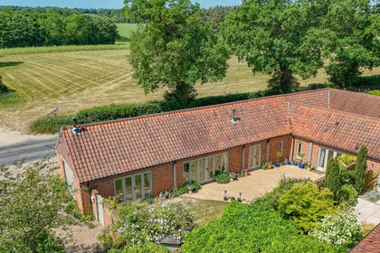
- Price
- Guide Price£500,000
Dereham Road, Briningham, Norfolk, NR24, Briningham, Norfolk NR24 England
Added on 22/06/2026Barn Conversion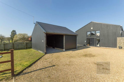
- Price
- Guide Price£650,000
Heath Road, Corpusty, Corpusty and Saxthorpe, Norfolk NR11 England
Added on 28/03/2026Barn Conversion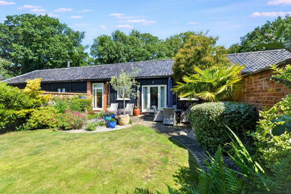
- Price
- Guide Price£525,000
Melton Park, Melton Constable, Melton Constable, Norfolk NR24 England
Added on 02/07/2026Barn Conversion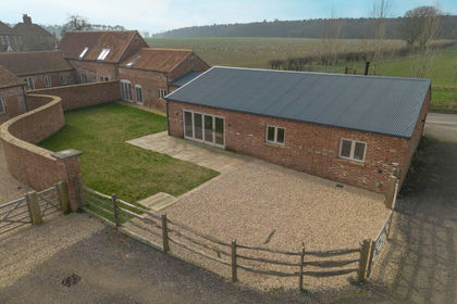
- Price
- Guide Price£750,000
Green Farm Barns, Hindolveston Road, Melton Constable, NR24, Melton Constable, Norfolk NR24 England
Added on 24/03/2026Barn Conversion
- Price
- Guide Price£795,000
Green Farm Barns, Hindolveston Road, Melton Constable, NR24, Melton Constable, Norfolk NR24 England
Added on 24/03/2026Barn Conversion
- Price
- Offers in Region of£550,000
Characterful Detached Barn Conversion in Roughton, Roughton, Norfolk NR11 England
Added on 11/08/2026Barn Conversion