Butts Green, Clavering
- Bedrooms
- 4
- Bathrooms
- 3
Key Features
- Peaceful setting at the end of Butts Green between Clavering and Langley
- Approx. 2,400 sq. ft. of versatile, high-spec living space plus outbuildings
- Stunning open-plan kitchen/dining/living area with garden access
- Electric gates
- Separate utility room and walk-in pantry
- Four double bedrooms, two with en suite facilities
- Detached cart lodge with studio above – ideal for guests or home office
- Sweeping Cotsworld stone driveway and landscaped gardens
- High specification throughout
- 10 year structural warranty
Description
The Accomodation
This exceptional barn conversion seamlessly combines grand double-height living spaces, a bespoke hand-crafted kitchen, and four generous bedrooms with a self-contained one-bedroom annex above a double cart lodge which could make an ideal home study. Set within beautifully landscaped grounds featuring a sweeping shingle driveway, black weatherboarded elevations, and expansive rear stone terraces overlooking countryside views, the estate delivers luxurious contemporary living infused with timeless character.
The main dwelling seamlessly blends immense character, impressive double-height timber framing, and luxurious contemporary finishes. Stepping inside, the vast principal living space is anchored by a magnificent double-height sitting and dining hall, characterized by exposed wall and ceiling timbers, flagstone flooring, and broad glazed doors that flood the room with natural light while providing views of the grounds. Flowing naturally from this spectacular reception area, the bespoke kitchen features an expansive oak-finished central island topped with premium stone, integrated high-end appliances, and ample workspace framed by original oak post-and-beam construction. A walk-in pantry and a separate, well-appointed utility room provide excellent supplementary storage and practical domestic functionality.
Continuing down the central hallway, the accommodation offers four generously proportioned bedrooms, designed with comfort and privacy in mind. The principal bedroom suite serves as a serene retreat, complete with a dedicated walk-in wardrobe featuring custom illuminated open shelving and bespoke cabinetry. This suite further benefits from a luxurious, fully tiled en-suite shower room fitted with a floating double vanity, matte black fixtures, and a glass-enclosed walk-in shower. Additional bedrooms enjoy high ceilings, neutral decor, and fitted storage, served by another sleek en-suite shower room as well as a main family bathroom complete with a deep soaking tub, overhead rain shower, and traditional latch oak doors. Each room throughout this wing benefits from underfloor heating, clean design accents, and carefully preserved architectural details.
Complementing the main residence is a separate annexe that provides exceptional flexibility for guest accommodation, multi-generational living, or home working.
The ground floor houses a spacious double cart lodge alongside an enclosed entrance hall, guest WC, and a dedicated storeroom. Integrated within this footprint is the annexe's private entrance and kitchen, with stairs leading directly to the upper level. First Floor Annexe arranged across the entire upper level, the accommodation opens into a bright sitting room. Directly off this central space is a comfortable bedroom complete with its own dedicated en-suite shower room, offering ideal private quarters for long-term guests or extended family. This versatile two-story structure seamlessly combines practical storage and utility space with a complete, highly customizable living area designed to adapt effortlessly to modern living needs.
Outside
Approached via a sweeping Cotswold stone driveway providing generous off-street parking, the property makes an immediate impression with its attractive black weatherboarded elevations set beneath a combination of pantiles and slate roofing. Flanking the front aspect, neat expansive lawns and the detached double cart lodge frame a paved central pathway, bordered by manicured low-level hedging and symmetrical topiary that lead directly to the oak-framed main entrance porch. Moving toward the rear grounds, wide paved stone terraces extend seamlessly from the principal reception spaces, providing an idyllic private area for alfresco dining and entertaining surrounded by pristine lawns and mature tree-lined borders overlooking open countryside.
Services
Mains electric and water, drainage is served by a treatment plant and underground LPG gas – There are ducting’s in the road for the purchaser to choose their internet provider.
Map Location
Property details
- Tenure
- Freehold
- Council Tax Band
- Ask Agent
- Date Posted
- 2026-09-16
Utilities & Restrictions
Utilities
- Electricity
- Mains
- Water
- Mains
- Heating
- Gas Heating
- Broadband
- Ask Agent
- Sewerage
- Septic Tank / Private
Rights & Restrictions
- Public Rights of Way
- Ask Agent
- Private Rights of Way
- Ask Agent
- Listed Property
- Ask Agent
- Restrictions
- Ask Agent
Listed status, conservation areas and planning constraints for this location are in the full report.
Property Features
- Accessibility
- Ask Agent
- Parking
- Driveway
- Garden
- Private Garden
Beyond the particulars: planning activity, flood history, heritage and ground risks, checked for this exact spot.
Connectivity
Broadband
Fastest speed available at this postcode
68 Mbps
Superfast · available to 44% of premises
Suitable for
- HD streaming
- Video calls
- Web & social
Mobile signal
Outdoor predictions; indoor signal depends on building materials.
Ofcom Connected Nations postcode-level predictions. Speeds and signal are modelled, not measured, and vary between addresses and providers.
Signal is the easy part. Planning activity, flood history and protected designations here are in the full report.
Nearest Schools
Primary
- Clavering Primary School1.9 milesOfsted: Good
- Ages
- 5 to 11
- Pupils
- 179
- Type
- Community school
- Anstey First School3.1 milesOfsted report card · Apr 2026
- Ages
- 2 to 9
- Pupils
- 39
- Type
- Community school
- Chrishall Holy Trinity and St Nicholas CofE (Aided) Primary School and Pre-School3.5 milesNo Ofsted rating
- Ages
- 2 to 11
- Pupils
- 124
- Type
- Voluntary aided school
- Faith
- Church of England
- Furneux Pelham Church of England School3.9 milesOfsted: Good
- Ages
- 3 to 11
- Pupils
- 107
- Type
- Voluntary controlled school
- Faith
- Church of England
- Newport Primary School4 milesOfsted: Good
- Ages
- 4 to 11
- Pupils
- 155
- Type
- Community school
Secondary
- Joyce Frankland Academy, Newport4.2 milesOfsted: Good
- Ages
- 11 to 18
- Pupils
- 865
- Type
- Academy converter
- Saffron Walden County High School5.5 milesOfsted: Outstanding
- Ages
- 11 to 18
- Pupils
- 2,157
- Type
- Academy converter
- Edwinstree Church of England Middle School6.4 milesNo Ofsted rating
- Ages
- 9 to 13
- Pupils
- 486
- Type
- Voluntary controlled school
- Faith
- Church of England
- Freman College6.5 milesNo Ofsted rating
- Ages
- 13 to 18
- Pupils
- 1,049
- Type
- Academy converter
- Avanti Grange Secondary School7.1 milesOfsted: Outstanding *
- Ages
- 11 to 18
- Pupils
- 660
- Type
- Free schools
* Latest graded judgement covers quality of education only; no overall grade was issued under the 2024-25 inspection framework.
Distances are straight-line from the advertised location. Source: the national school registers (DfE, Welsh Government, Scottish Government) and Ofsted.
Schools are just the start: sold prices nearby, planning activity and any flood history are in the full report.
Amenities
Supermarket
GP surgery
Pharmacy
Hospital
Green space
Straight-line distances from the advertised location. Sources: NHS records, Geolytix supermarket locations, OS Open Greenspace and the national trails registers.
The area stacks up? Now check the location itself: planning nearby, protected designations and past flooding.
Getting Around
Nearest station
Nearest bus stop
Typical drive times
Straight-line distances from the advertised location; drive times are typical free-flow times over OpenStreetMap road data, so allow more at peak. Public transport locations from DfT NaPTAN.
Easy to reach matters. So do planning activity, flood history and ground risks: all in the full report.
Flood Risk
From Environment Agency flood map open data, checked around the advertised map pin and allowing for the listed acreage where known. This summary comes from LandSale, the advertising platform, not from the listing agent, and is not part of the agent's particulars. Risk can vary across a single holding, so verify anything critical through your own searches before committing.
Rivers and the sea
Surface water
These bandings are the summary. Where this location sits on the flood maps, plus planning activity, heritage and ground risks, is in the full report.
Important notice: Information, maps and tags on this page are drawn from the advertising agent's marketing materials or generated automatically. LandSale has not verified them. Relying on these details is at your own risk, always carry out independent checks before committing to a purchase.
LandSale full disclaimer
Marketing information only - not formal particulars. The details on this website are provided for general guidance and do not constitute an offer or contract. Neither LandSale nor the advertising estate/land agent accepts responsibility for any inaccuracy.
1. Source of information
- Listing content: Core description, asking price, tenure, measurements, photographs and planning history originate from the marketing materials of the advertising estate or land agent. LandSale does not author this content and cannot guarantee its accuracy.
- Automated tags & categorisation: Property type, land-use class, acreage bands and similar labels may be applied by machine-learning models. They are intended as a helpful guide only and may not reflect the property's legal status or permitted use.
- Third-party & enriched data layers: Maps, boundary outlines, planning designations, soil reports, broadband coverage and other environmental or location-based insights are licensed from external suppliers. Such data are supplied “as is", may be incomplete or out of date and are subject to change without notice.
2. Verification required
Prospective purchasers must verify critical matters, including but not limited to planning permission, title boundaries, public rights of way, environmental constraints, acreage, services, access and VAT status, through their own inspections, specialist surveys, legal advisers and the selling agent before relying on the information or entering into any contract.
3. No warranty or liability
LandSale gives no warranty, express or implied, as to the accuracy, completeness or fitness for any particular purpose of the information displayed. LandSale shall not be liable for any loss, damage, cost or expense arising directly or indirectly from any use of or reliance on such information, save where liability may not be excluded by law.
4. Updates & feedback
If you believe any detail on this listing is inaccurate, please let us know. We will investigate and, where appropriate, update the listing or notify the agent.
© LandSale | Version 1.3 - August 2026
Listing agent
Arkwright & Co, Saffron Walden
51 High Street, Saffron Walden, CB10 1AR
Similar properties for sale
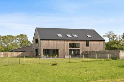
- Price
- Guide Price£1,500,000
Added on 16/06/2026Barn Conversion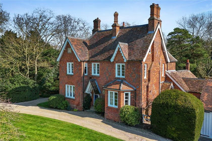
- Price
- £1,500,000
- Size
- 1.5 acres
Wicken Road, Wicken Bonhunt, Saffron Walden, Essex, CB11, Wicken Bonhunt, Essex CB11 England
Added on 03/04/2026House with Land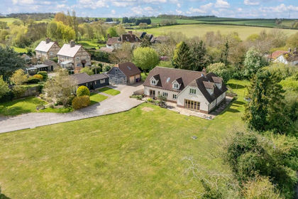
- Price
- Offers in Excess of£1,500,000
- Size
- 1 acres
Shaftenhoe End, Barley, SG8, Barley, Hertfordshire SG8 England
Added on 24/04/2026House with Land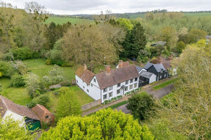
- Price
- Guide Price£1,500,000
- Size
- 1.3 acres
Added on 16/04/2026House with Land
- Price
- Guide Price£1,100,000
Added on 02/06/2026Barn Conversion
- Price
- Guide Price£1,600,000
Added on 09/09/2026Barn Conversion
- Price
- Guide Price£1,250,000
- Size
- 3 acres
Frogge Street, Ickleton, Ickleton, Cambridgeshire CB10 England
Added on 27/02/2026Equestrian property
- Price
- Offers Over£1,100,000
Burton End, Burton Barns, CM24, Stansted Mountfitchet, Essex CM24 England
Added on 03/02/2026Barn Conversion
- Price
- Offers Over£1,500,000
- Size
- 3 acres
Mill End, Standon, SG11, Standon, Hertfordshire SG11 England
Added on 11/06/2026House with Land
- Price
- Guide Price£1,495,000
- Size
- 1 acres
Glebe Court, Bishop's Stortford, Hertfordshire, CM23, Bishop's Stortford, Hertfordshire CM23 England
Added on 15/06/2026House with Land