Saron, Llandysul, SA44
- Land size
- 6.5 acres
- Bedrooms
- 3
- Bathrooms
- 1
Key Features
- Council Tax Band - E
- 6.5 Acres of Land with Various Outbuildings
- Cottage style home full of character
- Location - Saron, Llandysul
- Far Reaching Countryside Views
- Early viewing recommended
- EPC Rating - E
Description
6.5 Acre versatile smallholding suitable for various uses including equestrian, keeping a few sheep or just running the dogs on your own land. 2/3 Bedroom cottage/ bungalow style property with far reaching rural views. Wood burners for the cosy nights in, feature beamed ceilings, sun room to enjoy the views and a rural location with no near neighbours. The property could be split to offer multi occupancy or offer a lovely family home. The cottage is set in 2 acres of land being level to gently sloping with field shelter or pony stable and garden sheds. The remaining 4 acres is a level field situated opposite the cottage on a quiet country road. A rural but convenient location 2 miles from Saron & Drefach/ Felindre with public house, garage and shop. Between the Ceredigion coastline and Carmarthen Town.
Directions : From Carmarthen take the A 484 north towards Newcastle Emlyn. Travel through Bronwydd, Conwyl Elfed, Cwmduad up the hill to Rhos and onto Saron. Pass the garage and football field. Pass the Llwyndafydd public House and the Bus stop on the left and turn left towards Drefach Felindre and the woolen mills. After 250 yards Turn 3rd left and carry on the country road To the T junction which is some 2 miles, the property will be found immediately in front. Turn left and the entrance is on the right hand side.
Mobile Signal
Yes
Construction Type
Traditional
Location,
Situated in a rural but convenient location. Within a couple of miles are a cluster of villages that include Drefelin, Drefach Felindre, Saron, Rhos and Llangeler. Offering between them shops, garage, junior schools and eateries. The towns of Llandysul are 5 miles, Newcastle Emlyn 6 miles, New Quay on the beautiful Ceredigion coastline is 20 miles with wonderful beaches and views of the coastline and the county town of Carmarthen is 13 miles approx. offering excellent facilities and M4 dual carriageway connection.
Sun Room
4.6m x 2.7m (15' 1" x 8' 10")
Double aspect to rear to enjoy the views with French doors to side. Tiled flooring and patio doors to.
Kitchen / Dining Room
5.3m x 4.2m (17' 5" x 13' 9")
Housing the oil boiler which runs the hot water and central heating system. Range of base units with worktops over and matching wall units. One and a half bowl sink unit with single drainer. Space for fridge, freezer, cooker and washing machine. Plate rack, featured overhead beams, tiled flooring, double aspect to front and side providing floods of natural light. Radiator and door to front garden.
Sitting Room
4.7m x 4.04m (15' 5" x 13' 3")
Log burner with brick surround with stone mantle and stone hearth. Featured over head beams, wood style flooring, double glazed window to front with window seat, radiator and plate rack. Door to
Bedroom 1
2.46m x 4.1m (8' 1" x 13' 5")
Double glazed window to front with seat area, radiator, featured overhead beams, wooden flooring and door to
Sitting / Bedroom
4.6m x 4.6m (15' 1" x 15' 1")
Log burner inset with brick surround enhancing the character and charm. Double glazed dual aspect to front and rear. Door to rear garden and vaulted ceiling with overhead beams.
Rear Hallway
Door to
Bedroom 2
3.9m x 3m (12' 10" x 9' 10")
Patio doors to rear, double glazed window to side, wooden flooring and radiator. Practical fitted wardrobe approximately a meter deep in size with 2 sliding doors and mirrored fronts. Featured over head beams.
Bathroom
2.5m x 3m (8' 2" x 9' 10")
Double glazed window to rear, radiator and tiled flooring. Shower cubicle approximately 1.3 meter long, W/C, vanity wash hand basin with storage below and mirror light above. The bathroom is fitted with localised wall tiles, an airing cupboard with lagged tank and featured over head beams.
Outbuildings
- Garden shed and adjoining workshop 4.4m x 5m
- Car Port / Log Store
- Field Shelter or Pony Stable 4.2m X 9.1m
- Corrugated Iron store shed 2.6m x 4.2
Land
The property is surrounded by its own land amounting to approximately 2 acres. The land is level to very gently sloping away from the house, the 2 acres includes the garden and pony paddock. Across the quiet country road is a 4.5 acre paddock with gated entrance. This section of land is level and bounded by mature hedgerows. Great quality land suitable for various uses.
Services
We have been informed by the current vendor that the property benefits from mains water, mains electric, private septic tank drainage and oil central heating.
Tenure and Possession
We are informed the property is of Freehold Tenure and will be vacant on completion.
Council Tax
The property is listed under the Local Authority of Carmarthenshire County Council and has the following charges. Council Tax Band: E
Anti Money Laundering
To comply with Government anti-money laundering legislation, we are legally required to carry out identity and verification checks on all buyers and sellers. We work with our trusted and industry-recognised partner, Coadjute, who will send you a secure link to complete these biometric checks electronically once your offer has been accepted (subject to contract). A non-refundable fee of £45 + VAT per person is payable directly to Coadjute for this service. These checks must be completed before we can issue the memorandum of sale to the solicitors and progress the transaction.
If you have any questions or need any assistance, please don’t hesitate to contact the office – we’re always happy to help.
Land Transaction Tax
The purchase of this property may be subject to Land Transaction Tax (LTT). The amount payable will depend upon the purchase price and the purchaser’s individual circumstances. Buyers are advised to use the Welsh Revenue Authority Land Transaction Tax calculator and/or seek advice from their solicitor or financial adviser.
Map Location
Property details
- Tenure
- Freehold
- Council Tax Band
- E
- Date Posted
- 2026-09-16
Market Value Analysis
Compared with 266 Farms & Smallholdings listings in Wales (5+ acres).
Energy Performance Certificate
Energy Efficiency Rating
Based on UK Energy Performance Certificate standards (EU Directive 2002/91/EC)
Running costs are one side. Planning activity, flood history and ground risks for this location are in the full report.
Utilities & Restrictions
Utilities
- Electricity
- Mains
- Water
- Mains
- Heating
- Oil Heating
- Broadband
- Full Fibre (FTTP)
- Sewerage
- Septic Tank / Private
Rights & Restrictions
- Public Rights of Way
- Ask Agent
- Private Rights of Way
- Ask Agent
- Listed Property
- Ask Agent
- Restrictions
- Ask Agent
Listed status, conservation areas and planning constraints for this location are in the full report.
Property Features
- Accessibility
- Level Access
- Parking
- Garage, Driveway
- Garden
- Garden
Beyond the particulars: planning activity, flood history, heritage and ground risks, checked for this exact spot.
Connectivity
Broadband
Fastest speed available at this postcode
1.8 Gbps
Gigabit full fibre
Suitable for
- 4K streaming on every screen
- Full-time home working
- Online gaming & big downloads
Fixed wireless access may also be an option here.
Mobile signal
Outdoor predictions; indoor signal depends on building materials.
Ofcom Connected Nations postcode-level predictions. Speeds and signal are modelled, not measured, and vary between addresses and providers.
Signal is the easy part. Planning activity, flood history and protected designations here are in the full report.
Nearest Schools
Primary
- Brynsaron924 metres
- Pupils
- 51
- Type
- Infants & Juniors
- Language
- Welsh medium school / provision (including transitional)
- Penboyr1.4 miles
- Pupils
- 77
- Type
- Infants & Juniors
- Language
- Welsh medium school / provision (including transitional)
- Ysgol Bro Teifi3.9 miles
- Pupils
- 861
- Type
- Middle (ages 3-19)
- Language
- Welsh medium school / provision (including transitional)
- Y Ddwylan4.7 miles
- Pupils
- 253
- Type
- Infants & Juniors
- Language
- Dual language school / provision (Welsh and English) (including transitional)
- Cae'R Felin4.8 miles
- Pupils
- 104
- Type
- Nursery, Infants & Juniors
- Language
- Welsh medium school / provision (including transitional)
Secondary
- Ysgol Bro Teifi3.9 miles
- Pupils
- 861
- Type
- Middle (ages 3-19)
- Language
- Welsh medium school / provision (including transitional)
- Ysgol Gyfun Emlyn4.5 miles
- Pupils
- 502
- Type
- Secondary (ages 11-19)
- Language
- Dual language school / provision (Welsh and English) (including transitional)
- Queen Elizabeth High School11 miles
- Pupils
- 1,289
- Type
- Secondary (ages 11-19)
- Language
- English medium school / provision
- Ysgol Bro Preseli12 miles
- Pupils
- 932
- Type
- Middle (ages 3-19)
- Language
- Welsh medium school / provision (including transitional)
- Ysgol Gyfun Gymraeg Bro Myrddin12 miles
- Pupils
- 929
- Type
- Secondary (ages 11-19)
- Language
- Welsh medium school / provision (including transitional)
Distances are straight-line from the advertised location. Source: the national school registers (DfE, Welsh Government, Scottish Government) and Ofsted.
Schools are just the start: sold prices nearby, planning activity and any flood history are in the full report.
Amenities
Supermarket
GP surgery
Pharmacy
Green space
Straight-line distances from the advertised location. Sources: NHS records, Geolytix supermarket locations, OS Open Greenspace and the national trails registers.
The area stacks up? Now check the location itself: planning nearby, protected designations and past flooding.
Getting Around
Nearest station
Nearest bus stop
Typical drive times
Straight-line distances from the advertised location; drive times are typical free-flow times over OpenStreetMap road data, so allow more at peak. Public transport locations from DfT NaPTAN.
Easy to reach matters. So do planning activity, flood history and ground risks: all in the full report.
Flood Risk
From Natural Resources Wales flood map open data, checked around the advertised map pin and allowing for the listed acreage where known. This summary comes from LandSale, the advertising platform, not from the listing agent, and is not part of the agent's particulars. Risk can vary across a single holding, so verify anything critical through your own searches before committing.
Rivers and the sea
Surface water
These bandings are the summary. Where this location sits on the flood maps, plus planning activity, heritage and ground risks, is in the full report.
Important notice: Information, maps and tags on this page are drawn from the advertising agent's marketing materials or generated automatically. LandSale has not verified them. Relying on these details is at your own risk, always carry out independent checks before committing to a purchase.
LandSale full disclaimer
Marketing information only - not formal particulars. The details on this website are provided for general guidance and do not constitute an offer or contract. Neither LandSale nor the advertising estate/land agent accepts responsibility for any inaccuracy.
1. Source of information
- Listing content: Core description, asking price, tenure, measurements, photographs and planning history originate from the marketing materials of the advertising estate or land agent. LandSale does not author this content and cannot guarantee its accuracy.
- Automated tags & categorisation: Property type, land-use class, acreage bands and similar labels may be applied by machine-learning models. They are intended as a helpful guide only and may not reflect the property's legal status or permitted use.
- Third-party & enriched data layers: Maps, boundary outlines, planning designations, soil reports, broadband coverage and other environmental or location-based insights are licensed from external suppliers. Such data are supplied “as is", may be incomplete or out of date and are subject to change without notice.
2. Verification required
Prospective purchasers must verify critical matters, including but not limited to planning permission, title boundaries, public rights of way, environmental constraints, acreage, services, access and VAT status, through their own inspections, specialist surveys, legal advisers and the selling agent before relying on the information or entering into any contract.
3. No warranty or liability
LandSale gives no warranty, express or implied, as to the accuracy, completeness or fitness for any particular purpose of the information displayed. LandSale shall not be liable for any loss, damage, cost or expense arising directly or indirectly from any use of or reliance on such information, save where liability may not be excluded by law.
4. Updates & feedback
If you believe any detail on this listing is inaccurate, please let us know. We will investigate and, where appropriate, update the listing or notify the agent.
© LandSale | Version 1.3 - August 2026
Listing agent
Morgan & Davies, Carmarthen
11 Lammas Street, Carmarthen, SA31 3AD
Similar properties for sale
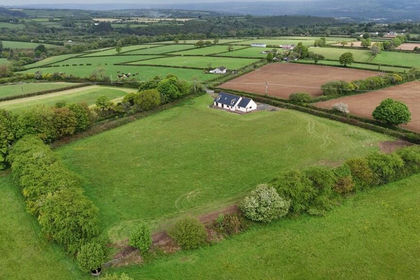
- Price
- Offers in Region of£525,000
- Size
- 3.5 acres
Penboyr, Llandysul, Carmarthenshire. SA44, Llangeler, Carmarthenshire SA44 Wales
Added on 12/05/2026Smallholding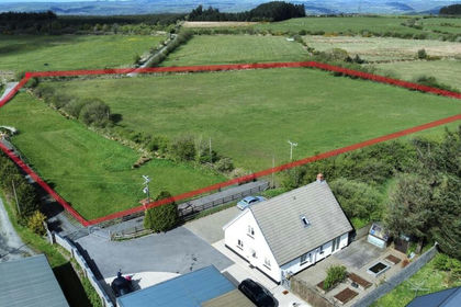
- Price
- Offers in Region of£498,000
- Size
- 5.3 acres
Cwmduad, Carmarthen, Carmarthenshire., Cynwyl Elfed, Carmarthenshire SA33 Wales
Added on 29/05/2026Equestrian property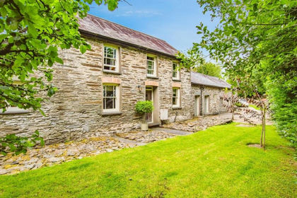
- Price
- Guide Price£575,000
- Size
- 7 acres
Felindre CARMARTHENSHIRE, Llangeler, Carmarthenshire SA44 Wales
Added on 27/05/2026House with Land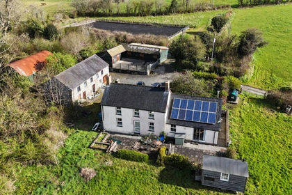
- Price
- Offers in Region of£550,000
- Size
- 18 acres
Penrhiwllan, Llandysul, Ceredigion. SA44, Llandyfriog, Ceredigion SA44 Wales
Added on 30/04/2026Smallholding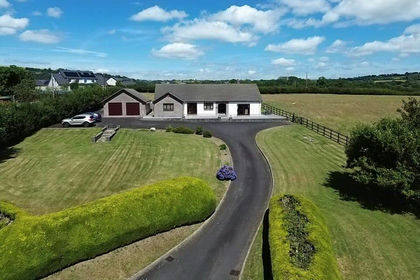
- Price
- £595,000
- Size
- 6.5 acres
Aberbanc, Henllan, Llandysul, SA44, Llandyfriog, Ceredigion SA44 Wales
Added on 22/07/2026Smallholding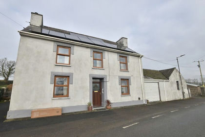
- Price
- Offers in Region of£560,000
- Size
- 23.5 acres
Llandysul, Ceredigion, SA44, Llandyfriog, Ceredigion SA44 Wales
Added on 28/01/2026Smallholding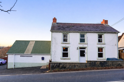
- Price
- £399,000
- Size
- 3.3 acres
Penrhiwllan, Llandysul, SA44, Llandyfriog, Ceredigion SA44 Wales
Added on 18/06/2026Smallholding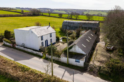
- Price
- £515,000
- Size
- 8 acres
Tanglwst, Capel Iwan, SA38, Newcastle Emlyn, Carmarthenshire SA38 Wales
Added on 16/04/2026Residential
- Price
- £450,000
- Size
- 14.7 acres
Added on 02/06/2026Smallholding
- Price
- £550,000
- Size
- 7.5 acres
Capel Iwan Road, Newcastle Emlyn, SA38, Newcastle Emlyn, Carmarthenshire SA38 Wales
Added on 28/04/2026Smallholding