Low Road, Wortwell, Harleston
- Bedrooms
- 4
- Bathrooms
- 4
Key Features
- Secure Gated Parking for several cars
- Landscaped gardens
- Abundance of character
- Three ensuites
- Rural setting
- Paddock
- Superb vaulted first floor reception room
- Head of a long driveway
- Convenient for Harleston
- Formerly a successful B&B so offers income potential
Description
GUIDE PRICE £750,000 - £775,000. A superbly presented and characterful Grade II Listed detached barn conversion in an idyllic rural position with a delightful landscaped garden.
Property - Approached via a long shared private drive, this exceptional Grade II Listed thatched barn conversion occupies a wonderfully private position amidst the beautiful countryside of the Waveney Valley. With its original thatched roof, traditional weatherboarding, brickwork and wealth of exposed timbers, the property retains an impressive sense of its agricultural heritage, whilst offering spacious and highly versatile accommodation suited equally to family life, entertaining or a range of alternative uses.
The house is approached over the private driveway, which culminates in a generous courtyard providing parking for several vehicles and five traditional cart lodges. A low wall and gated entrance lead into the principal gardens and towards the front door.
A welcoming entrance lobby opens into the spectacular dining hall, which forms the heart of the home and extends almost the full depth of the barn. Vaulted proportions, exposed timbers and an abundance of natural light create an impressive space for both everyday family life and entertaining, whilst providing a fitting introduction to the character and scale found throughout the property.
To the front are two generous bedroom suites, one enjoying the additional benefit of a dressing area, while a study to the rear provides a quiet and adaptable space for home working, hobbies or family use.
The dining hall leads through to a delightful family room, creating a more relaxed reception space with a natural connection to the garden. This in turn opens into the comprehensively fitted kitchen/breakfast room, thoughtfully arranged around a substantial central island and providing a sociable setting for family gatherings and informal entertaining. A useful utility room lies beyond, while a short inner passage leads to a further bedroom and shower room.
The accommodation on the ground floor is particularly versatile and, for many years, the vendors successfully operated the property as a bed and breakfast. The arrangement therefore offers considerable flexibility for those seeking guest accommodation, multigenerational living or the opportunity to work from home without compromising the principal living spaces.
An oak staircase rises from the dining hall to the first floor, where the scale and character of the original barn become particularly apparent. A stunning vaulted drawing room provides an impressive principal reception space, with exposed beams, dramatic roof timbers and a charming galleried area currently arranged as a music space. The principal bedroom is equally impressive, enjoying generous proportions, a vaulted ceiling and a superb en suite, creating a peaceful private retreat above the main accommodation.
Outside, the gardens are a particular feature of the property. Beautifully landscaped by the vendors, they have been designed to create a series of distinct areas and pockets of interest, with established planting, mature trees and sweeping lawns providing a wonderfully established setting. Terraces immediately adjoining the house provide natural areas for outdoor dining and entertaining, while the wider gardens open onto uninterrupted rural views.
Beyond the principal gardens lies a useful paddock, providing an additional area of land with considerable versatility and the opportunity to enjoy the surrounding countryside and abundant wildlife. The combination of the formal gardens, open land and rural outlook creates a rare sense of space and seclusion.
With its striking period architecture, beautifully preserved character, versatile accommodation and exceptional rural setting, this is a particularly special country home. The property successfully combines the romance and individuality of a traditional thatched barn with the scale and flexibility required for modern family living, while the established gardens and surrounding countryside provide a truly peaceful backdrop.
Location - Wortwell is situated just off the A143 between Harleston and Bungay, this quiet little village is right next to the River Waveney providing some popular, well stocked, fishing lakes. Within the village is a community centre which is used by various clubs for events, a village pub and motor garage. Harleston is the nearest town and has an excellent range of independently owned shops along with a supermarket, doctors, dentists and veterinary surgery, schools to G.C.S.E. level, 2 hotels, a number of cafes, restaurants and pubs. Diss is approximately 11 miles and has a mainline rail link to London, Liverpool Street in 90 minutes.
Services - Oil fired central heating. Drainage via private treatment plant. Mains water and electric. (Durrants have not tested any apparatus, equipment, fittings or services and so cannot verify they are in working order)
Local Authority - South Norfolk Council and Tax Band F
Viewing - Viewing is strictly by arrangement with the vendors' agent Durrants, please call .
Aml Disclaimer - To comply with HMRC's regulations on Anti-Money Laundering (AML), we are legally required to conduct AML checks on every purchaser once a sale is agreed. We use a government-approved electronic identity verification service to ensure compliance, accuracy, and security. This is approved by the Government as part of the Digital Identity and Attributes Trust Framework (DIATF). This helps us to protect all our client's interests by using the most advanced verification process to help prevent the impacts of money laundering alongside our internal manual policies and procedures while staying compliant with HMRC. The cost of anti-money laundering (AML) checks are £30 including VAT per person, payable in advance after an offer has been accepted. This fee is mandatory to comply with the regulations and must be paid before a memorandum of sale can be issued. Please note that the fee is non-refundable.
Map Location
Property details
- Tenure
- Freehold
- Council Tax Band
- F
- Date Posted
- 2026-09-16
Utilities & Restrictions
Utilities
- Electricity
- Mains
- Water
- Mains
- Heating
- Oil Heating
- Broadband
- Ask Agent
- Sewerage
- Septic Tank / Private
Rights & Restrictions
- Public Rights of Way
- Ask Agent
- Private Rights of Way
- Ask Agent
- Listed Property
- Yes
- Restrictions
- Ask Agent
Listed status, conservation areas and planning constraints for this location are in the full report.
Property Features
- Accessibility
- Ask Agent
- Parking
- Covered Parking
- Garden
- Garden
Beyond the particulars: planning activity, flood history, heritage and ground risks, checked for this exact spot.
Connectivity
Broadband
Fastest speed available at this postcode
1.8 Gbps
Gigabit full fibre
Suitable for
- 4K streaming on every screen
- Full-time home working
- Online gaming & big downloads
Mobile signal
Outdoor predictions; indoor signal depends on building materials.
Ofcom Connected Nations postcode-level predictions. Speeds and signal are modelled, not measured, and vary between addresses and providers.
Signal is the easy part. Planning activity, flood history and protected designations here are in the full report.
Nearest Schools
Primary
- Mendham Primary School1.2 milesNo Ofsted rating
- Ages
- 3 to 11
- Pupils
- 57
- Type
- Academy converter
- Alburgh With Denton Church of England Primary Academy1.5 milesNo Ofsted rating
- Ages
- 4 to 11
- Pupils
- 99
- Type
- Academy converter
- Faith
- Church of England
- The Harleston Sancroft Academy (a 3-16 Church of England School)2.6 milesOfsted: Good *
- Ages
- 3 to 16
- Pupils
- 824
- Type
- Academy converter
- Faith
- Church of England
- Earsham Church of England Primary Academy3.9 milesNo Ofsted rating
- Ages
- 5 to 11
- Pupils
- 65
- Type
- Academy converter
- Faith
- Church of England
- St Edmund's Catholic Primary School4.6 milesOfsted: Good
- Ages
- 4 to 11
- Pupils
- 60
- Type
- Academy sponsor led
- Faith
- Roman Catholic
Secondary
- The Harleston Sancroft Academy (a 3-16 Church of England School)2.6 milesOfsted: Good *
- Ages
- 3 to 16
- Pupils
- 824
- Type
- Academy converter
- Faith
- Church of England
- Bungay High School4.4 milesOfsted report card · Mar 2026
- Ages
- 11 to 18
- Pupils
- 922
- Type
- Academy converter
- Long Stratton High School7.5 milesOfsted report card · Feb 2026
- Ages
- 11 to 16
- Pupils
- 679
- Type
- Academy sponsor led
- Stradbroke High School7.5 milesNo Ofsted rating
- Ages
- 11 to 16
- Pupils
- 353
- Type
- Academy converter
- Sir John Leman High School9 milesOfsted report card · Apr 2026
- Ages
- 11 to 18
- Pupils
- 1,404
- Type
- Academy converter
* Latest graded judgement covers quality of education only; no overall grade was issued under the 2024-25 inspection framework.
Distances are straight-line from the advertised location. Source: the national school registers (DfE, Welsh Government, Scottish Government) and Ofsted.
Schools are just the start: sold prices nearby, planning activity and any flood history are in the full report.
Amenities
Supermarket
GP surgery
Pharmacy
Hospital
Green space
Straight-line distances from the advertised location. Sources: NHS records, Geolytix supermarket locations, OS Open Greenspace and the national trails registers.
The area stacks up? Now check the location itself: planning nearby, protected designations and past flooding.
Getting Around
Nearest station
Nearest bus stop
Typical drive times
Straight-line distances from the advertised location; drive times are typical free-flow times over OpenStreetMap road data, so allow more at peak. Public transport locations from DfT NaPTAN.
Easy to reach matters. So do planning activity, flood history and ground risks: all in the full report.
Flood Risk
From Environment Agency flood map open data, checked around the advertised map pin and allowing for the listed acreage where known. This summary comes from LandSale, the advertising platform, not from the listing agent, and is not part of the agent's particulars. Risk can vary across a single holding, so verify anything critical through your own searches before committing.
Rivers and the sea
Surface water
These bandings are the summary. Where this location sits on the flood maps, plus planning activity, heritage and ground risks, is in the full report.
Important notice: Information, maps and tags on this page are drawn from the advertising agent's marketing materials or generated automatically. LandSale has not verified them. Relying on these details is at your own risk, always carry out independent checks before committing to a purchase.
LandSale full disclaimer
Marketing information only - not formal particulars. The details on this website are provided for general guidance and do not constitute an offer or contract. Neither LandSale nor the advertising estate/land agent accepts responsibility for any inaccuracy.
1. Source of information
- Listing content: Core description, asking price, tenure, measurements, photographs and planning history originate from the marketing materials of the advertising estate or land agent. LandSale does not author this content and cannot guarantee its accuracy.
- Automated tags & categorisation: Property type, land-use class, acreage bands and similar labels may be applied by machine-learning models. They are intended as a helpful guide only and may not reflect the property's legal status or permitted use.
- Third-party & enriched data layers: Maps, boundary outlines, planning designations, soil reports, broadband coverage and other environmental or location-based insights are licensed from external suppliers. Such data are supplied “as is", may be incomplete or out of date and are subject to change without notice.
2. Verification required
Prospective purchasers must verify critical matters, including but not limited to planning permission, title boundaries, public rights of way, environmental constraints, acreage, services, access and VAT status, through their own inspections, specialist surveys, legal advisers and the selling agent before relying on the information or entering into any contract.
3. No warranty or liability
LandSale gives no warranty, express or implied, as to the accuracy, completeness or fitness for any particular purpose of the information displayed. LandSale shall not be liable for any loss, damage, cost or expense arising directly or indirectly from any use of or reliance on such information, save where liability may not be excluded by law.
4. Updates & feedback
If you believe any detail on this listing is inaccurate, please let us know. We will investigate and, where appropriate, update the listing or notify the agent.
© LandSale | Version 1.3 - August 2026
Listing agent
Durrants, Harleston
32-34 The Thoroughfare, Harleston, IP20 9AU
Similar properties for sale
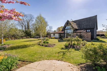
- Price
- Guide Price£750,000
- Size
- 0.9 acres
Added on 12/03/2026Barn Conversion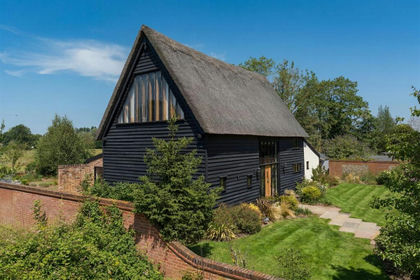
- Price
- Guide Price£750,000
- Size
- 0.9 acres
A striking barn in a peaceful countryside setting, Wortwell, Norfolk IP20 England
Added on 01/08/2026Barn Conversion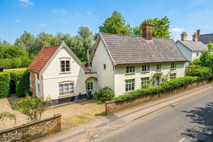
- Price
- Offers Over£635,000
- Size
- 1 acres
Redenhall, Harleston, Redenhall with Harleston, Norfolk IP20 England
Added on 13/03/2026House with Land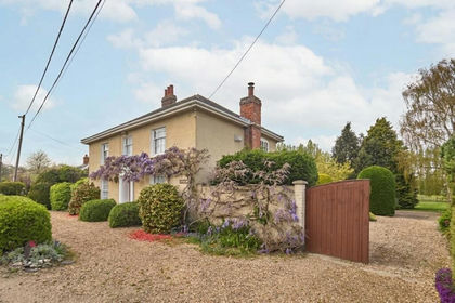
- Price
- Guide Price£700,000
- Size
- 3.16 acres
Withersdale Street, Mendham, Harleston, Mendham, Suffolk IP20 England
Added on 03/05/2026House with Land
- Price
- Guide Price£675,000
Abbey Road, Flixton, Bungay, Suffolk, NR35, Flixton (Bungay & Wainford Ward), Suffolk NR35 England
Added on 04/08/2026Barn Conversion
- Price
- Guide Price£675,000
Abbey Road, Flixton, Bungay, Suffolk, NR35, Flixton (Bungay & Wainford Ward), Suffolk NR35 England
Added on 04/08/2026Barn Conversion
- Price
- Guide Price£900,000
- Size
- 3.5 acres
Added on 15/07/2026House with Land
- Price
- Guide Price£700,000
- Size
- 1 acres
Added on 26/08/2026House with Land
- Price
- Guide Price£725,000
- Size
- 0.34 acres
Added on 01/05/2026Barn Conversion
- Price
- Guide Price£615,000
- Size
- 1.1 acres
Added on 22/02/2026House with Land